Stouffville, Ontario
| Stouffville | |
|---|---|
| Community | |
 Location within York | |
| Coordinates: 43°58′N 79°15′W / 43.967°N 79.250°WCoordinates: 43°58′N 79°15′W / 43.967°N 79.250°W | |
| Country |
|
| Province |
|
| Regional municipality | York Region |
| Town | Whitchurch–Stouffville |
| Incorporated | Village of Stouffville 1877 |
| Amalgamation (with Whitchurch Township) | January 1, 1971 |
| Government | |
| • Type | Municipality |
| • Mayor | Justin Altmann |
| • Councillors |
[1] Rick Upton (Ward 4) Iain Lovatt (Ward 5) Rob Hargrave (Ward 6) |
| • MPP | Helena Jaczek |
| • MP | Jane Philpott |
| Area[2] | |
| • Land | 14.87 km2 (5.74 sq mi) |
| Elevation | 266 m (873 ft) |
| Population (2011)[2] | |
| • Total | 24,886 |
| • Density | 1,673.3/km2 (4,334/sq mi) |
| Time zone | Eastern Standard Time (EST) (UTC-5) |
| • Summer (DST) | Eastern Daylight Time (EDT) (UTC-4) |
| Forward sortation area | L4A |
| Area code(s) | 905 and 289 |
| NTS Map | 030M14 |
| GNBC Code | FCSZB |
| Website |
www |
Stouffville (/ˈstoʊvɪl/) is the primary urban area within the town of Whitchurch–Stouffville, Ontario, Canada. It is centred at the intersection of Main Street, Mill Street and Market Street. Between 2006 and 2011, the population of the Community of Stouffville grew 100.5% from 12,411 to 24,886, or from 51% to 66% of the total population of the larger Town of Whitchurch–Stouffville.[3]
History
Founded in 1804 by Abraham Stouffer, the hamlet was originally named Stoufferville.[4] Stouffer built a sawmill and grist-mill[5] on the banks of Duffin's Creek in the 1820s.[6] The community name was shortened to Stouffville when its first post office opened in 1832.[7]
In 1877, Stouffville became an incorporated village.[8] On January 1, 1971, the Village of Stouffville amalgamated with Whitchurch Township and was designated a community within the larger town of Whitchurch–Stouffville; with amalgamation, the boundary of the town was also moved four farm lots south of the original boundary of Main Street (the land was formerly a part of Markham Township). The population of urban Stouffville in 1971 was 5,036.[9]
In 2003, a large 16th-century Huron village was discovered in Stouffville during land development; approximately 2000 people once inhabited the site (Mantle Site), which included a palisade and more than 80 longhouses, yielding tens of thousands of artifacts.[10]
Geography
Urban Stouffville is approximately 4.5 km long, stretching from the York-Durham Line to Highway 48, and approximately 2.7 km wide with development north and south of Main Street. Stouffville is bounded by farmland and a golf course. The community is located on the Oak Ridges Moraine and the Rouge River watershed.
Transportation
GO Transit's Stouffville line passes through the community with commuter trains stopping at the Stouffville GO Station in the downtown core and terminating at Lincolnville GO Station. When no trains are scheduled a bus service from Toronto serves the town with some runs continuing to Uxbridge.[11]
York Region Transit's bus#15 travels around the community of Stouffville and along the Stouffville Road to Yonge Street in Richmond Hill,[12] and their bus#9 (9th line) travels from the town to Markham Stouffville Hospital and thence to Box Grove Plaza.[13]
Demographics
In 2006, urban Stouffville had a population of 8,000 to 10,000 people, or about one-third of the population of the larger Town of Whitchurch–Stouffville.[14] The Town of Whitchurch–Stouffville estimates that the population grew more than 58% between 2006 and 2011; most of that growth was limited to the Community of Stouffville or the Community of Ballantrae.[15] By 2021, the town’s total population forecast is projected to be approximately 55,800 persons, with an estimated 41,000 persons residing within the Community of Stouffville proper.[16]
Growth
With connection to a massive new sewage system (also known as the Big Pipe) and a water pipe from Lake Ontario, urban Stouffville began to grow rapidly after 2005. The first of the new subdivisions were south of Main Street along Hoover Park Drive (Wheler's Mill and Wheler's on Main subdivisions), and north of Main Street along Millard Street west of Ninth Line.
In 2008, construction began to widen Stouffville Road / Main Street from two lanes to four lanes, from Ninth Line to the edge of urban Stouffville at Highway 48 (the community of Ringwood), and further to McCowan Road. Construction was completed in June 2010. Stouffville Road has since been widened up to Highway 404.
Notable residents
- Keith Acton, former NHL player and Edmonton Oilers associate coach
- Capt. Arthur Roy Brown DSC and Bar, RNAS (23 December 1893 – 9 March 1944), World War I flying ace who spent the latter years of his life running a farm in Stouffville.
- Michael Del Zotto, Philadelphia Flyers defenceman
- Jeff Marek, NHL and CHL analyst for Sportsnet
- Brad May, Stanley Cup winner with the Anaheim Ducks
- Jane Philpott, Minister of Health (Canada) and MP of the Liberal Party of Canada
- (See also Notable residents, Whitchurch–Stouffville)
Nearest communities
Urban Stouffville is situated in the southeast corner of the town of Whitchurch–Stouffville. Neighbouring communities within the town include Ringwood and Gormley to the east, and Bloomington to the north. Claremont, Uxbridge, and the ghost town of Altona (part of Pickering) lie to the east. Stouffville is bordered on the south by the city of Markham.
References
- "(Code 1020) Census Profile". 2011 census. Statistics Canada. 2012. Retrieved 2012-03-01.
Notes
- ↑ http://www.townofws.com/members_council.asp
- 1 2 Statistics Canada: 2012
- ↑ Statistics Canada, 2011 Census Profile: Stouffville, Ontario; Town of Whitchurch-Stouffville, Council in Committee Report; Status Report No. 1, Attachment 2, #3.0, Sept. 18, 2012.
- ↑ Guillet, Edwin Clarence (1963). Early life in Upper Canada. University of Toronto Press.
- ↑ Schrauwers, Albert (2009). Union is strength: W.L. Mackenzie, the Children of Peace and the emergence of joint stock democracy in Upper Canada. University of Toronto Press. p. 107. ISBN 0-8020-9927-0.
- ↑ http://www.heritagefdn.on.ca/userfiles/HTML/nts_1_5626_1.html Ontario Heritage Trust Founding of Stouffville
- ↑ For a complete history of the community of Stouffville, see Jean Barkey, Stouffville, 1877-1977 A Pictorial History of a Prosperous Ontario Community (Stouffville, ON: Stouffville Historical Committee, 1977); also Jean Barkey et al., "Stouffville," Whitchurch Township, 95-99; also Isabel Champion, ed., "Stouffville," Markham: 1793-1900 (Markham, ON: Markham Historical Society, 1979), 289-296.
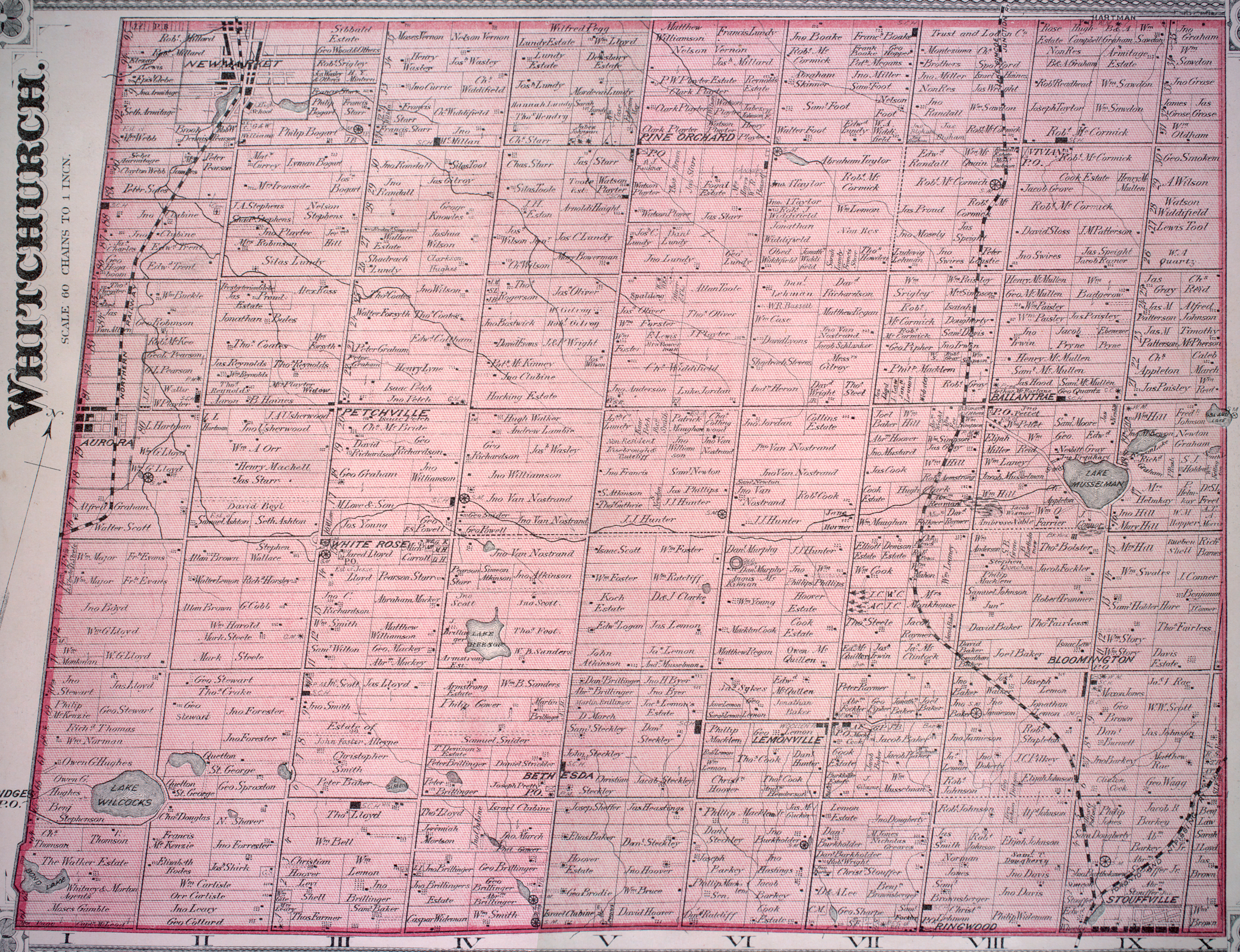
- ↑ Cf. the detailed 1878 maps, Township of Markham; Township of Whitchurch, Illustrated historical atlas of the county of York and the township of West Gwillimbury & town of Bradford in the county of Simcoe, Ont. (Toronto : Miles & Co., 1878); also Stouffville Map (1880).
- ↑ Barkey et al., Whitchurch Township, 99.
- ↑ Archeological Services, Inc., Mantle Site; Toronto Museum Project, Dunsmere Pipe; also Minutes, Town of Whitchurch-Stouffville Council, Huron Ancestral Village Resolution (C10-C0 & R00), June 17, 2007.
- ↑ "GO Transit Stouffville Line". GO Transit.
- ↑ "YRT Route 15" (PDF). York Region Transit. Retrieved 24 October 2015.
- ↑ "YRT Route 9" (PDF). York Region Transit. Retrieved 24 October 2015.
- ↑ "2006 Community Profiles, Whitchurch-Stouffville". Statistics Canada. Retrieved 2007-12-04.
- ↑ Town of Whitchurch-Stouffville, Memorial and Bethesda Park Plans.
- ↑ Town of Whitchurch-Stouffville, "Council in Committee Report: Growth Management Status: Community of Stouffville 2010 Year End Assessment," 3.3 (February 15, 2011).
External links
- Town of Whitchurch-Stouffville
- Ontario Plaques - Founding of Stouffville
- Stouffville.com Stouffville's Online News and Events, Tourism and Business Directory
- Stouffville Connects