Ontario Highway 16
| ||||
|---|---|---|---|---|
| Route information | ||||
| Length: | 3.8 km[1] (2.4 mi) | |||
| Major junctions | ||||
| South end: |
| |||
| North end: |
| |||
| Location | ||||
| Counties: | Simcoe County, Muskoka Region, Parry Sound District, Timiskaming District, Cochrane District, Rainy River District | |||
| Highway system | ||||
| ||||

King's Highway 16, commonly referred to as Highway 16 and historically as the Prescott Highway, is a provincially maintained highway in the Canadian province of Ontario. The highway once travelled from near Prescott to Ottawa. However, its length was truncated significantly when most of the route was "twinned" with a second roadway, and renumbered as Highway 416. However, a short stub remains through Johnstown, crossing the St. Lawrence River on the Ogdensburg-Prescott International Bridge to Ogdensburg, New York, where it becomes New York State Route 812.
The Ottawa–Prescott Road was one of the first highways designated in Ontario; it was one of four designated in 1918. The highway was numbered in August 1925.
History
The Prescott Highway was established as a provincial highway in 1918, shortly after the Provincial Highway (Highway 2). It remained named until the summer of 1925, when route numbering was introduced and it became Provincial Highway 16. A new route was constructed throughout the 1970s to provide a controlled-access right-of-way for the highway. During the 1990s, this new route was "twinned", whereby a new road was constructed parallel to the existing one, and redesignated as Highway 416. A short section through downtown Ottawa was not incorporated into Highway 416, instead being redesigned as Ottawa Regional Road 73 (Prince of Wales Drive). This left a short stub through Johnstown, which remains designated as Highway 16.
Highway 16 New
In 1966 the Eastern Ontario Highway Planning Study was published the Department of Highways (DHO), the predecessor to today's Ministry of Transportation of Ontario (MTO), identifying the need for a controlled-access highway between Ottawa and Highway 401.[2] Highway 16, which crosses the geologically subdued St. Lawrence Lowlands, was selected over Highway 15, which crosses the undulating Canadian Shield to the west, as the ideal route for the new link.[3] To overcome the issue of abutting properties established along the Highway 16 corridor, the DHO began purchasing a new right-of-way between Highway 401 and Century Road by late 1967, and constructed a two lane bypass of the original alignment, avoiding all the built up areas that the original Highway 16 encountered. This route was designed to easily accommodate the eventual upgrade to a freeway when traffic volumes necessitated.[4]
Construction of the Super two, dubbed Highway 16 New,[5] took place between 1969 and 1983.[2] The Spencerville Bypass opened by 1971, connecting with the old highway in the south near Crowder Road and in the north near Ventnor Road.[6] By the end of 1973 the new highway was completed from immediately north of Highway 401 through Leeds and Grenville United Counties and into Ottawa–Carleton. This included a bypass around Kemptville and a new structure over the Rideau River.[6] The new highway ended at Dilworth Road (Regional Road 13).
For nearly a decade, no new construction took place. Then, during the summer of 1982, the MTO awarded a contract to begin constructing the route north from Dilworth Road towards Manotick, bypassing North Gower. Following the completion of this first contract, which extended the route as far north as Roger Stevens Drive (Regional Road 6) and included a structure over Stevens Creek, a second contract was awarded for the remaining distance north to Century Road (Regional Road 8).[5] The project was completed in 1983,[2] merging into the original route of Highway 16 northeast of the present Prince of Wales Drive overpass.[7]
With the completion of Highway 16 New, the MTO need only construct interchanges and the southbound lanes in order to create a full freeway corridor. The upgrade to Highway 416 took place between 1989 and 1999 and was created by the twinning of 57 km (35 mi) of Highway 16 New and the construction of an interchange at Highway 401.
Route description
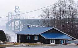
Highway 16 is now a very brief route, though it was much longer before the construction of Highway 416 truncated it. The highway begins near the shores of the St. Lawrence River in Johnstown at the former Highway 2, now Leeds and Grenville County Road 2.[8] From there the route travels northwest adjacent to the Ogdensburg-Prescott International Bridge, which lies to the southwest. A customs plaza lies at the end of the bridge, north of which the road to the bridge meets the highway. To the northeast is single-detached housing. The highway continues, exiting Johnstown and curving slightly towards the north.[9]
Immediately after crossing over a Canadian National track, the route encounters an interchange with Highway 401, Exit 721B. This parclo interchange features full access to Highway 401, including movements not possible at the Highway 416 interchange to the west.[8] North of the interchange, the road curves gently to the northwest, intersecting Cedar Grove Road. After this, the opposing directions of travel diverge and become ramps to northbound and from southbound Highway 416.[9]
Major intersections
The following table lists the major junctions along Highway 16, as noted by the Ministry of Transportation of Ontario.[1] The entire route is located in Leeds and Grenville United Counties.[8]
| Location | km[1] | mi | Destinations | Notes | |
|---|---|---|---|---|---|
| Johnstown | 0.0 | 0.0 | County Road 2 – Prescott, Cardinal | Access to Ogdensburg-Prescott International Bridge | |
| Edwardsburgh/Cardinal | 1.5 | 0.93 | Exit 721B[8] | ||
| 2.2 | 1.4 | County Road 44 north Cedar Grove Road | Old Highway 16 alignment | ||
| 3.8 | 2.4 | Northbound access to and southbound access from Highway 416[8] | |||
| 1.000 mi = 1.609 km; 1.000 km = 0.621 mi | |||||
References
- 1 2 3 Ministry of Transportation of Ontario (2008). "Annual Average Daily Traffic (AADT) counts". Retrieved February 9, 2012.
- 1 2 3 Ministry of Transportation of Ontario (June 17, 2010). "History of Highway 416". Government of Ontario. Retrieved September 30, 2011.
- ↑ Environmental Assessment Board (July 31, 1987). EA-86-01 (PDF) (Report). Environmental Review Tribunal. p. 9. Retrieved September 30, 2011.
- ↑ "New 45-Mile Highway to Link Ottawa with 401". The Globe and Mail. 124 (36,795). Toronto. November 14, 1967. p. 4.
- 1 2 Ministry of Transportation and Communications (April 1982). Provincial Highways Construction Projects 1982–83 (Report). Transportation Capital Branch, Ministry of Transportation of Ontario. p. XXVII.
- 1 2 Ontario Road Map (Map). Cartography by Photogrammetry Office. Ontario Department of Transportation and Communications. 1971. § G–H30.
- ↑ Google (September 30, 2011). "Site of merger between Highway 16 and old Highway 16 before the construction of Highway 416" (Map). Google Maps. Google. Retrieved September 30, 2011.
- 1 2 3 4 5 Ontario Back Road Atlas (Map). Cartography by MapArt. Peter Heiler. 2010. p. 50. § X–Y64. ISBN 978-1-55198-226-7.
- 1 2 Google (September 7, 2014). "Highway 16 length and route" (Map). Google Maps. Google. Retrieved September 7, 2014.