North East Hampshire (UK Parliament constituency)
| North East Hampshire | |
|---|---|
|
County constituency for the House of Commons | |
|
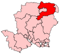
Boundary of North East Hampshire in Hampshire. | |
|
Location of Hampshire within England. | |
| County | Hampshire |
| Electorate | 72,548 (December 2010)[1] |
| Major settlements | Fleet, Church Crookham, Hook and Yateley |
| Current constituency | |
| Created | 1997 |
| Member of parliament | Ranil Jayawardena (Conservative) |
| Number of members | One |
| Created from | East Hampshire, Aldershot |
| Overlaps | |
| European Parliament constituency | South East England |

North East Hampshire is a constituency[n 1] represented in the House of Commons of the UK Parliament since 2015 by Ranil Jayawardena, a Conservative.[n 2]
History
The constituency was created in 1997 from parts of the seats of Aldershot and East Hampshire since which it has only seen one member serving it in Westminster. In terms of majority size, it is the safest Conservative seat in the UK.
Boundaries
1997-2010: The District of Hart wards of Church Crookham, Crondall, Eversley, Fleet Courtmoor, Fleet Pondtail, Fleet West, Hartley Wintney, Hook, Long Sutton, Odiham, and Whitewater, and the District of East Hampshire wards of Binsted, Bramshott and Liphook, Froyle and Bentley, Grayshott, Headley, Selborne, Whitehill Bordon and Whitehill, and Whitehill Lindford.
2010-present: The District of Hart wards of Church Crookham East, Church Crookham West, Crondall, Eversley, Fleet Central, Fleet Courtmoor, Fleet North, Fleet Pondtail, Fleet West, Hartley Wintney, Hook, Long Sutton, Odiham, Yateley East, Yateley North, and Yateley West, and the Borough of Basingstoke and Deane wards of Calleva, Pamber, Sherborne St John, and Upton Grey and The Candovers.
Towns and villages in the constituency include Elvetham Heath, Eversley, Fleet, Hartley Wintney, Headley, Herriard, Hook, Odiham, Sherfield on Loddon, Silchester and Yateley.
This constituency was slightly altered for the 2010 general election - the seat's southernmost part was transferred to East Hampshire while it gained some wards from Basingstoke and Hart wards from Aldershot.
Constituency profile
The seat includes significant software, hardware and military sectors and a significant proportion of Basingstoke, Bracknell and City of London commuters, particularly the latter towards Hook railway station on the South West Main Line; the average income level is higher than the national average.[2] This area also has low unemployment[3] and a high proportion of semi-detached and detached properties.[4]
Members of Parliament
| Election | Member[5] | Party | Notes | |
|---|---|---|---|---|
| 1997 | James Arbuthnot | Conservative | Previously MP for Wanstead and Woodford 1987-97; Opposition Chief Whip 1997-2001; Chairman of the Defence Select Committee 2005-14; retired 2015 | |
| 2015 | Ranil Jayawardena | Conservative | ||
Elections
Elections in the 2010s
| Party | Candidate | Votes | % | ± | |
|---|---|---|---|---|---|
| Conservative | Ranil Jayawardena | 35,573 | 65.9 | +5.3 | |
| Liberal Democrat | Graham Cockarill | 5,657 | 10.5 | −15.0 | |
| Labour | Amran Justin Matheo Hussain | 5,290 | 9.8 | 0.0 | |
| UKIP | Robert John Charles Blay1 | 4,732 | 8.8 | +4.6 | |
| Green | Andrew Graham Johnston | 2,364 | 4.4 | +4.4 | |
| Monster Raving Loony | Mad Max Bobetsky | 384 | 0.7 | +0.7 | |
| Majority | 29,916 | 55.4 | |||
| Turnout | 54,000 | 72.9 | −0.4 | ||
| Conservative hold | Swing | ||||
1: After nominations were closed, Blay was suspended from UKIP after threatening to shoot his Conservative opponent.[7][8] His name still appeared on ballot papers as it was too late to remove him.[9]
| Party | Candidate | Votes | % | ± | |
|---|---|---|---|---|---|
| Conservative | James Arbuthnot | 32,075 | 60.6 | +7.5 | |
| Liberal Democrat | Denzil Coulson | 13,478 | 25.5 | −1.6 | |
| Labour | Barry Jones | 5,173 | 9.8 | −6.8 | |
| UKIP | Ruth Duffin | 2,213 | 4.2 | +0.9 | |
| Majority | 18,597 | 35.1 | |||
| Turnout | 52,939 | 73.3 | +10.7 | ||
| Conservative hold | Swing | ||||
Elections in the 2000s
| Party | Candidate | Votes | % | ± | |
|---|---|---|---|---|---|
| Conservative | James Arbuthnot | 25,407 | 53.7 | +0.5 | |
| Liberal Democrat | Adam Carew | 12,858 | 27.2 | +4.2 | |
| Labour | Kevin McGrath | 7,630 | 16.1 | −3.8 | |
| UKIP | Paul Birch | 1,392 | 2.9 | −1.0 | |
| Majority | 12,549 | 26.5 | |||
| Turnout | 47,287 | 64.8 | +3.2 | ||
| Conservative hold | Swing | −1.8 | |||
| Party | Candidate | Votes | % | ± | |
|---|---|---|---|---|---|
| Conservative | James Arbuthnot | 23,379 | 53.2 | +2.3 | |
| Liberal Democrat | Michael Ian Plummer | 10,122 | 23.0 | +0.3 | |
| Labour | Barry Jones | 8,744 | 19.9 | +3.8 | |
| UKIP | Graham Frederick Charles Mellstrom | 1,702 | 3.9 | +3.0 | |
| Majority | 13,257 | 30.2 | |||
| Turnout | 43,947 | 61.6 | −12.0 | ||
| Conservative hold | Swing | ||||
Elections in the 1990s
| Party | Candidate | Votes | % | ± | |
|---|---|---|---|---|---|
| Conservative | James Arbuthnot | 26,017 | 50.9 | N/A | |
| Liberal Democrat | Ian Henderson Mann | 11,619 | 22.7 | N/A | |
| Labour | Peter Roy Dare | 8,203 | 16.0 | N/A | |
| Referendum | Winston David Rees | 2,420 | 4.7 | N/A | |
| Independent | Keki Pirosha Jessavala | 2,400 | 4.7 | N/A | |
| UKIP | Christopher William Berry | 452 | 0.9 | N/A | |
| Majority | 14,398 | 28.2 | N/A | ||
| Turnout | 51,111 | 73.6 | N/A | ||
| Conservative win (new seat) | |||||
See also
Notes
- ↑ A county constituency (for the purposes of election expenses and type of returning officer)
- ↑ As with all constituencies, the constituency elects one Member of Parliament (MP) by the first past the post system of election at least every five years.
References
- ↑ "Electorate Figures - Boundary Commission for England". 2011 Electorate Figures. Boundary Commission for England. 4 March 2011. Retrieved 13 March 2011.
- ↑ "2001 Census". Neighbourhood.statistics.gov.uk. Retrieved 2013-02-04.
- ↑ Unemployment claimants by constituency The Guardian
- ↑ "2011 census interactive maps". Ons.gov.uk. Retrieved 2013-02-04.
- ↑ Leigh Rayment's Historical List of MPs – Constituencies beginning with "H" (part 1)
- ↑ "Election Data 2015". Electoral Calculus. Archived from the original on 17 October 2015. Retrieved 17 October 2015.
- ↑ UKIP candidate Robert Blay suspended over shooting threat - BBC News, 5 May 2015
- ↑ Ukip candidate suspended for threatening to 'put a bullet in' Tory rival - The Guardian, 5 May 2015
- ↑ Robert Blay: UKIP suspends parliamentary candidate - Mirror, 5 May 2015
- ↑ "Election Data 2010". Electoral Calculus. Archived from the original on 17 October 2015. Retrieved 17 October 2015.
- ↑ "Election Data 2005". Electoral Calculus. Archived from the original on 15 October 2011. Retrieved 18 October 2015.
- ↑ "Election Data 2001". Electoral Calculus. Archived from the original on 15 October 2011. Retrieved 18 October 2015.
- ↑ "Election Data 1997". Electoral Calculus. Archived from the original on 15 October 2011. Retrieved 18 October 2015.
Sources
- Election result, 2005 (BBC)
- Election results, 1997 - 2001 (BBC)
- Election results, 1997 - 2001 (Election Demon)
- Election results, 1997 - 2005 (Guardian)
Coordinates: 51°12′N 0°55′W / 51.20°N 0.91°W