Silchester
| Silchester | |
 The village sign in front of Silchester Village Hall |
|
 Silchester |
|
| Population | 918 (2001 census)[1] |
|---|---|
| OS grid reference | SU6262 |
| Civil parish | Silchester |
| District | Basingstoke and Deane |
| Shire county | Hampshire |
| Region | South East |
| Country | England |
| Sovereign state | United Kingdom |
| Post town | Reading |
| Postcode district | RG7 |
| Dialling code | 0118 |
| Police | Hampshire |
| Fire | Hampshire |
| Ambulance | South Central |
| EU Parliament | South East England |
| UK Parliament | North East Hampshire |
| Website | Silchester Parish Council |
Coordinates: 51°21′11″N 1°06′04″W / 51.353°N 1.101°W
Silchester is a village and civil parish about 5 miles (8 km) north of Basingstoke in Hampshire. It is adjacent to the county boundary with Berkshire and about 9 miles (14 km) south-west of Reading.
Silchester is most notable for the archaeological site and Roman town of Calleva Atrebatum, which was first occupied by the Romans in about AD 45 and includes what is considered the best-preserved Roman wall in Great Britain.
Location
The present village is centred on Silchester Common. It is about 1 mile (1.6 km) west of the Church of England parish church and former manor house (now Manor Farm), which are in the eastern part of the former Roman town.
Local government
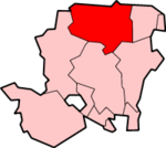
Silchester is a civil parish with an elected parish council. Silchester parish is in the ward of Pamber and Sichester,[2] part of Basingstoke and Deane District Council and of Hampshire County Council and all three councils are responsible for different aspects of local government. The ward returns two councillors to the borough council.[3] The 2001 census recorded a parish population of 918.[1]
Transport
There is a village link minibus service which serves Pamber Heath, Silchester and Mortimer West End. It is necessary to pre-book this service by contacting Hampshire County Council.[4]
Manor
Silcester was recorded in the 11th century, when one Alestan held a manor here with King Edward the Confessor as his overlord and one Cheping held another manor with Earl Harold Godwinson as his overlord.[5] The Domesday Book of 1086 recorded that the Normans William De Ow and Ralph de Mortimer possessed Alestan's and Cheping's manors respectively.[5] The book assessed Alestan's manor at five hides and Mortimer's at three hides.[5] De Mortimer's tenant was another Norman, Ralph Bluet.[5] In 1204 he or a later Ralph Bluet gave a palfrey horse in exchange for a licence to enclose an area of land south-east of the former Roman town as a deer park.[5] Today parts of the earthwork park pale survive and parts of the former park remain wooded.[5]
Forms of the toponym included Ciltestere and Cilcestre in the 13th century, Scilchestre in the 14th century and Sylkchester in the 18th century before it reached its current spelling.[5]
The Irish peer Murrough Boyle, 1st Viscount Blesington (1685–1718) bought the manor in 1704 and it remained with his hereditary heirs until the death of William Stewart, 1st Earl of Blessington in 1769.[5] In 1778 it was inherited jointly by Thomas, 1st Viscount de Vesci and Edward Pakenham, 2nd Baron Longford.[5] In 1806 Baron Longford's daughter The Hon. Catherine Pakenham married Arthur Wellesley, who in 1814 was created Duke of Wellington. In 1828 John, 2nd Viscount de Vesci and Catherine's brother Thomas Pakenham, 2nd Earl of Longford sold the manor of Silchester to the Duke.[5] In the first decade of the 20th century Arthur Wellesley, 4th Duke of Wellington still owned the manor of Silchester.[5]
Church and chapel

The Church of England parish church of St Mary the Virgin is just within the walls of the former Roman town, possibly on the site of a Roman temple.[6][7] The building may contain some re-used Roman materials.[8] The building dates from the late 12th[5] or early 13th century.[9] It has a north and south aisle, each of two bays.[5] There is no chancel arch, and the chancel is longer than the nave.[5] The wall of the south aisle was rebuilt in about 1325–50, incorporating an ogee-arched tomb recess containing the effigy of a lady wearing a wimple.[9] Two new windows were added to the church the 14th century and two more including the Perpendicular Gothic[9] east window of the chancel in the 15th century.[5]
The church has a Perpendicular Gothic[9] rood screen.[5] The pulpit was made early in the 18th century but its tester is dated 1639.[9] There is also a carved memorial cartouche to the Irish peer Viscount Ikerrin (died 1712).[9] The bell-turret has a ring of five bells. Four were cast by John Stares of Aldbourne,[10] Wiltshire in 1744.[11] The other was cast by William Taylor of Oxford[10] in 1848.[11]
There is a Primitive Methodist chapel on Silchester Common.[5]
Roman town

Calleva Atrebatum was an Iron Age oppidum and subsequently a town in the Roman province of Britannia and the civitas capital of the Atrebates tribe. Its ruins are beneath and to the west of the parish church, which is itself just within the town wall and about 1 mile (1.6 km) to the east of the modern village.
The site covers an area of over 107 acres (43 ha) within a polygonal earthwork. The earthworks and extensive ruined walls are still visible. The remains of the amphitheatre,[12] added about AD 70–80 and situated outside the city walls, can also be clearly seen. The area inside the walls is now largely farmland with no visible distinguishing features, other than the enclosing earthworks and walls, with the church and old manor house in one corner.
During excavations carried out in 1893, the Silchester Ogham stone was located. Dated c. 400 AD, it is one of very few found in England so far.
Amenities
Silchester's sole public house is the Calleva Arms,[13] named after the former Roman town of Calleva Atrebatum that lies within the village boundary. It was known as The Crown prior to being renamed.
The parish has regular events and village activities through the year including a beer festival, fun run, church fete, and music festival.[14] The village has an amateur dramatic society[15] and a village association.[16]
Silchester Cricket Club[17] compete in Regional Division Three North East in the Hampshire Cricket League.[18]
School
Silchester has a Church of England primary school.[19] Most Silchester children of secondary school age attend The Hurst Community College in Baughurst.
Awards
Silchester was voted "Hampshire Village of the Year" (2008) and "South England Village of the Year" (2009) in the Calor Village of the Year competition.[20]
References
- 1 2 "Area selected: Basingstoke and Deane (Non-Metropolitan District)". Neighbourhood Statistics: Full Dataset View. Office for National Statistics. Retrieved 30 January 2011.
- ↑ "HCC Ward Boundaries" (PDF). 2008. Retrieved 15 May 2010.
- ↑ "Basingstoke and Deane Wards Information Councillors for Pamber & Silchester". Retrieved 15 May 2010.
- ↑ http://www3.hants.gov.uk/travel_information_guide_for_mortimer_west_end__pamber_and_silchester.pdf
- 1 2 3 4 5 6 7 8 9 10 11 12 13 14 15 16 17 Page, 1911, pages 51–56
- ↑ "The Parish Church: The Silchester Trail" (PDF). Hampshire County Council. Retrieved 8 February 2013.
- ↑ Johnson, Walter J. (1912). Byways in British Archeology. Cambridge : The University Press. p. 24.
- ↑ Aston & Bond, 1976, page 53
- 1 2 3 4 5 6 Pevsner & Lloyd, 1967, page 505
- 1 2 "Bell Founders". Dove's Guide for Church Bell Ringers. Retrieved 30 January 2011.
- 1 2 "Silchester S Mary". Dove's Guide for Church Bell Ringers. Retrieved 30 January 2011.
- ↑ Silchester amphitheatre
- ↑ Calleva Arms
- ↑ Pete's Silchester Pages
- ↑ Silchester Players
- ↑ Silchester Association
- ↑ Silchester Cricket Club
- ↑ Hampshire Cricket League
- ↑ Silchester Church of England Primary School
- ↑ "Calor Village of the Year competition". 2009. Retrieved 16 March 2010.
Sources and further reading
- Aston, Michael; Bond, James (1976). The Landscape of Towns. Archaeology in the Field Series. London: J.M. Dent & Sons Ltd. p. 53. ISBN 0-460-04194-0.
- Page, W.H., ed. (1911). A History of the County of Hampshire, Volume 4. Victoria County History. pp. 51–56.
- Pevsner, Nikolaus; Lloyd, David (1967). Hampshire and the Isle of Wight. The Buildings of England. Harmondsworth: Penguin Books. pp. 503–505.
External links
| Wikimedia Commons has media related to Silchester. |
- grid reference SU627620
- Excavations of Roman remains by Reading university
- Reading Museum web site on Silchester Roman Town
- Silchester Primary School
- British History victorian account of the village