Laurel micropolitan area
| Laurel USA | |
|---|---|
| Micropolitan area | |
| Laurel micropolitan statistical area | |
 | |
| Country | United States |
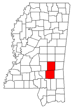
| State | Mississippi |
| Counties | Jasper, Jones |
| Area | |
| • Total | 1,377 sq mi (3,570 km2) |
| • Land | 1,370 sq mi (3,500 km2) |
| • Water | 7 sq mi (20 km2) |
| Population (2009) | |
| • Total | 85,716 |
| • Density | 61.9/sq mi (23.9/km2) |
| Time zone | CST (UTC-6) |
| • Summer (DST) | CDT (UTC-5) |
The Laurel Micropolitan Statistical Area is a micropolitan area in the southeastern Mississippi that covers two counties - Jasper and Jones. As of the 2000 census, the USA had a population of 83,107 (though July 1, 2009 estimate placed the population at 85,716).[1]
Counties
Communities
Incorporated places
- Bay Springs
- Ellisville
- Heidelberg
- Laurel (Principal City)
- Louin
- Montrose
- Sandersville
- Soso
Unincorporated places
Demographics
As of the census[2] of 2000, there were 83,107 people, 30,983 households, and 22,507 families residing within the USA. The racial makeup of the USA was 65.73% White, 32.13% African American, 0.32% Native American, 0.22% Asian, 0.01% Pacific Islander, 1.12% from other races, and 0.47% from two or more races. Hispanic or Latino of any race were 1.67% of the population.
The median income for a household in the USA was $26,614, and the median income for a family was $32,208. Males had a median income of $27,728 versus $18,333 for females. The per capita income for the USA was $13,855.
See also
- List of metropolitan areas in Mississippi
- List of micropolitan areas in Mississippi
- List of cities in Mississippi
- List of towns and villages in Mississippi
- List of census-designated places in Mississippi
- List of United States metropolitan areas
References
- ↑ "Table 1. Annual Estimates of the Population of Metropolitan and Micropolitan Statistical Areas: April 1, 2000 to July 1, 2009 (CBSA-EST2009-01)" (CSV). 2009 Population Estimates. United States Census Bureau, Population Division. 2010-03-23. Retrieved 2010-03-25.
- ↑ "American FactFinder". United States Census Bureau. Retrieved 2008-01-31.
.svg.png)