Granada, Colorado
| Granada, Colorado | |
|---|---|
| Statutory Town | |
 Location within Prowers County (left) and Colorado (right) | |
| Coordinates: 38°3′53″N 102°18′40″W / 38.06472°N 102.31111°WCoordinates: 38°3′53″N 102°18′40″W / 38.06472°N 102.31111°W | |
| Country |
|
| State |
|
| County[1] | Prowers |
| Incorporated (town) | July 25, 1887[2] |
| Government | |
| • Type | Statutory Town[1] |
| Area | |
| • Total | 0.7 sq mi (1.9 km2) |
| • Land | 0.7 sq mi (1.9 km2) |
| • Water | 0 sq mi (0 km2) |
| Elevation | 3,484 ft (1,062 m) |
| Population (2010) | |
| • Total | 517 |
| • Density | 914.3/sq mi (336.8/km2) |
| Time zone | MST (UTC-7) |
| • Summer (DST) | MDT (UTC-6) |
| ZIP code[3] | 81041 |
| Area code(s) | 719 |
| FIPS code | 08-31550 |
| GNIS feature ID | 0195594 |

Granada is a Statutory Town in Prowers County, Colorado, United States. The population was 640 at the 2000 census.
History
A post office called Granada has been in operation since 1873.[4] The community most likely takes its name from nearby Granada Creek.[5]
During World War II, the Granada War Relocation Center was located west of Granada as a Japanese American internment camp. It opened in August 1942 and housed a maximum population of 7,318 citizens.
Geography
Granada is located at 38°3′53″N 102°18′40″W / 38.06472°N 102.31111°W (38.064603, -102.311052).[6] According to the United States Census Bureau, the town has a total area of 0.7 square miles (1.8 km2), all land.
Demographics
| Historical population | |||
|---|---|---|---|
| Census | Pop. | %± | |
| 1880 | 121 | — | |
| 1890 | 163 | 34.7% | |
| 1900 | 204 | 25.2% | |
| 1910 | 359 | 76.0% | |
| 1920 | 308 | −14.2% | |
| 1930 | 352 | 14.3% | |
| 1940 | 342 | −2.8% | |
| 1950 | 551 | 61.1% | |
| 1960 | 593 | 7.6% | |
| 1970 | 551 | −7.1% | |
| 1980 | 557 | 1.1% | |
| 1990 | 513 | −7.9% | |
| 2000 | 640 | 24.8% | |
| 2010 | 517 | −19.2% | |
| Est. 2015 | 486 | [7] | −6.0% |
As of the census[9] of 2000, there were 640 people, 198 households, and 151 families residing in the town. The population density was 889.6 people per square mile (343.2/km²). There were 233 housing units at an average density of 323.9 per square mile (124.9/km²). The racial makeup of the town was 64.69% White, 0.16% Native American, 33.75% from other races, and 1.41% from two or more races. Hispanic or Latino of any race were 62.50% of the population.
There were 198 households out of which 48.5% had children under the age of 18 living with them, 61.1% were married couples living together, 9.6% had a female householder with no husband present, and 23.7% were non-families. 18.2% of all households were made up of individuals and 11.6% had someone living alone who was 65 years of age or older. The average household size was 3.23 and the average family size was 3.77.
In the town the population was spread out with 37.7% under the age of 18, 9.1% from 18 to 24, 25.3% from 25 to 44, 18.3% from 45 to 64, and 9.7% who were 65 years of age or older. The median age was 28 years. For every 100 females there were 95.1 males. For every 100 females age 18 and over, there were 100.5 males.
The median income for a household in the town was $26,042, and the median income for a family was $31,750. Males had a median income of $22,167 versus $18,750 for females. The per capita income for the town was $10,561. About 25.2% of families and 27.8% of the population were below the poverty line, including 34.4% of those under age 18 and 17.5% of those age 65 or over.
Education
Students are served by Granada Undivided High School whose mascot are the Bobcats.
Transportation
Bus service is provided daily eastward towards Wichita, Kansas and westward towards Pueblo, Colorado by BeeLine Express (subcontractor of Greyhound Lines).[10][11]
See also
References
- 1 2 "Active Colorado Municipalities". State of Colorado, Department of Local Affairs. Retrieved 2007-09-01.
- ↑ "Colorado Municipal Incorporations". State of Colorado, Department of Personnel & Administration, Colorado State Archives. 2004-12-01. Retrieved 2007-09-02.
- ↑ "ZIP Code Lookup" (JavaScript/HTML). United States Postal Service. Retrieved September 24, 2007.
- ↑ "Post offices". Jim Forte Postal History. Retrieved 25 June 2016.
- ↑ Dawson, John Frank. Place names in Colorado: why 700 communities were so named, 150 of Spanish or Indian origin. Denver, CO: The J. Frank Dawson Publishing Co. p. 24.
- ↑ "US Gazetteer files: 2010, 2000, and 1990". United States Census Bureau. 2011-02-12. Retrieved 2011-04-23.
- ↑ "Annual Estimates of the Resident Population for Incorporated Places: April 1, 2010 to July 1, 2015". Retrieved July 2, 2016.
- ↑ "Census of Population and Housing". Census.gov. Retrieved June 4, 2015.
- ↑ "American FactFinder". United States Census Bureau. Retrieved 2008-01-31.
- ↑ BeeLine Express
- ↑ Greyhound Lines
External links
Municipalities and communities of Prowers County, Colorado, United States | ||
|---|---|---|
| City | 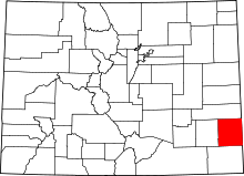 | |
| Towns | ||
| Unincorporated communities | ||
