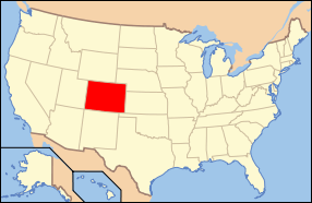
Castle Rock, Colorado
| Castle Rock, Colorado | |
|---|---|
| Home Rule Municipality | |
 Location within Douglas County and Colorado | |
 Location of Castle Rock in the State of Colorado | |
| Coordinates: 39°22′34″N 104°51′13″W / 39.376089°N 104.853487°WCoordinates: 39°22′34″N 104°51′13″W / 39.376089°N 104.853487°W[1] | |
| Country | United States |
| State | Colorado |
| County | Douglas[2] |
| Founded | 1874 |
| Incorporated (town) | May 17, 1881[3] |
| Government | |
| • Type | Home Rule Municipality[2] |
| • Town Manager | Dave Corliss |
| Area | |
| • Total | 33.79 sq mi (87.5 km2) |
| • Land | 33.79 sq mi (87.5 km2) |
| • Water | 0.0 sq mi (0 km2) |
| Elevation | 6,224 ft (1,897 m) |
| Population (2010)[4] | |
| • Total | 48,231 |
| • Estimate (2014) | 55,747 |
| • Density | 1,400/sq mi (550/km2) |
| Time zone | MST (UTC-7) |
| • Summer (DST) | MDT (UTC-6) |
| ZIP Codes | 80104, 80108, 80109[5] |
| Area code(s) | 303 & 720 |
| INCITS place code | 0812415 |
| GNIS feature ID | 0169449 |
| Website |
www |
Castle Rock is a home rule municipality that is the county seat of Douglas County, Colorado, United States.[6] The most populous municipality of the county, the community's population was 48,231 at the 2010 United States Census,[4] with an estimated population of 55,747 as of 2014.[7] It is named for the prominent, castle tower-shaped butte near the center of town.[8] Located midway between Denver and Colorado Springs, Castle Rock is part of the Front Range Urban Corridor.
History

The region in and around Castle Rock was originally home to the Arapaho and Cheyenne people. They occupied the land between the Arkansas and South Platte Rivers.
White settlers were drawn to the area by rumors of gold and by land opened through the Homestead Act of 1862. However, it was the discovery of rhyolite stone, not gold, that ultimately led to the settlement of Castle Rock.
Castle Rock was founded in 1874 when the eastern Douglas County border was redrawn to its present location. Castle Rock was chosen as the county seat because of its central location.
One of the first homesteaders in the area near today's Castle Rock was Jeremiah Gould. He owned about 160 acres (0.65 km2) to the south of "The (Castle) Rock." At that time, the settlement consisted of just a few buildings for prospectors, workers, and cowboys. In 1874, Jeremiah Gould donated 120 acres (0.49 km2) to the new town that was also now home to the Douglas County government. For the beginning the six streets named Elbert, Jerry, Wilcox, Perry, Castle and Front were laid out to build the actual town of Castle Rock. The Courthouse Square was defined and about 77 lots, each 50 by 112 feet (34 m), were auctioned off for a total profit of US$3,400.
A new train depot brought the Denver and Rio Grande Railway to the area.
During the late 1800s and early 1900s, Castle Rock had a very active Rhyolite quarrying industry. Many Swedish immigrants arrived in the area to work in the quarries.
Castle Rock currently encompasses about 35 square miles (91 km2), with a population of more than 42,000[9] in town and 70,000 in the surrounding area.
Geography

Castle Rock is located at 39°22′20″N 104°51′22″W / 39.37222°N 104.85611°W (39.372212, -104.856090) at an elevation of 6,224 feet (1,897 m).[10] Located in central Colorado at the junction of Interstate 25 and State Highway 86, Castle Rock is 28 mi (45 km) south of downtown Denver and 37 mi (60 km) north of Colorado Springs.[11]
The town lies a few miles east of the Rampart Range of the Rocky Mountains on the western edge of the Great Plains.[12][13] Castle Rock, the butte that is the town's namesake, sits just north of the town center.[14] Other prominent landforms visible from Castle Rock include Dawson Butte, Devils Head, Mount Evans and Pikes Peak.
East Plum Creek, a stream within the South Platte River watershed, flows generally north through Castle Rock. Hangman's Gulch, which runs northwest then west around the north side of the town center, drains into East Plum Creek as do multiple unnamed gulches in the southern and western areas of town. McMurdo Gulch and Mitchell Gulch run north then northeast through eastern Castle Rock and drain into Cherry Creek east of town.[15]
Castle Rock is within the Colorado Foothills Life Zone.[16] The hillsides are covered with large meadows of grass, small plants, scattered juniper trees and open ponderosa pine woodlands. Other trees common in the area include Gambel oak (scrub oak or oak brush) and pinyon pine. Local wildlife includes the American badger, American black bear, bobcat, coyote, Colorado chipmunk, gray fox, mountain cottontail rabbit, mountain lion, mule deer, pocket gopher, porcupine, and skunk. Birds that can be found in the area include the golden eagle, peregrine falcon, sharp-shinned hawk, black-billed magpie, red-tailed hawk, pinyon jay and western tanager.[17]
According to the United States Census Bureau, Castle Rock has a total area of 33.79 square miles (87.5 km2), all of it land.[4]
Lying within the Front Range Urban Corridor, the town is part of the greater Denver metropolitan area.[18] Castle Rock borders three communities, all to its north; from west to east, these are Castle Pines Village, the city of Castle Pines, and The Pinery.[19][20] Other nearby communities include Franktown to the east, Larkspur to the south, Perry Park to the southwest, and Sedalia to the northwest.[19]
Climate
Castle Rock experiences a semi-arid climate (Köppen BSk) with cold, dry, snowy winters and hot, wetter summers. On average, the town receives 18.79 inches (477 mm) of precipitation annually. Snowfall averages 61.8 inches (157 cm) per year.[21] On average, January is the coldest month, July is the hottest month, and August is the month with the most precipitation.[22] The hottest temperature recorded in Castle Rock was 99 °F (37 °C) in July 1973; the coldest temperature recorded was −35 °F (−37 °C) in January 1963.[23]
| Climate data for Castle Rock, Colorado | |||||||||||||
|---|---|---|---|---|---|---|---|---|---|---|---|---|---|
| Month | Jan | Feb | Mar | Apr | May | Jun | Jul | Aug | Sep | Oct | Nov | Dec | Year |
| Record high °F (°C) | 73 (23) |
75 (24) |
80 (27) |
91 (33) |
94 (34) |
98 (37) |
99 (37) |
98 (37) |
94 (34) |
91 (33) |
78 (26) |
71 (22) |
99 (37) |
| Average high °F (°C) | 45.5 (7.5) |
46.4 (8) |
52.6 (11.4) |
59.2 (15.1) |
69.0 (20.6) |
79.0 (26.1) |
85.2 (29.6) |
82.7 (28.2) |
75.6 (24.2) |
64.6 (18.1) |
53.2 (11.8) |
44.7 (7.1) |
63.14 (17.31) |
| Daily mean °F (°C) | 31.7 (−0.2) |
33.0 (0.6) |
39.4 (4.1) |
46.0 (7.8) |
55.5 (13.1) |
64.6 (18.1) |
70.4 (21.3) |
68.6 (20.3) |
60.7 (15.9) |
49.6 (9.8) |
39.1 (3.9) |
31.2 (−0.4) |
49.15 (9.53) |
| Average low °F (°C) | 17.8 (−7.9) |
19.7 (−6.8) |
26.2 (−3.2) |
32.7 (0.4) |
42.0 (5.6) |
50.3 (10.2) |
55.7 (13.2) |
54.4 (12.4) |
45.8 (7.7) |
34.6 (1.4) |
24.9 (−3.9) |
17.6 (−8) |
35.14 (1.76) |
| Record low °F (°C) | −35 (−37) |
−29 (−34) |
−14 (−26) |
−7 (−22) |
18 (−8) |
28 (−2) |
39 (4) |
35 (2) |
15 (−9) |
−3 (−19) |
−18 (−28) |
−26 (−32) |
−35 (−37) |
| Average precipitation inches (mm) | 0.62 (15.7) |
0.65 (16.5) |
1.83 (46.5) |
2.20 (55.9) |
2.18 (55.4) |
2.05 (52.1) |
2.46 (62.5) |
2.71 (68.8) |
1.24 (31.5) |
1.11 (28.2) |
1.00 (25.4) |
0.74 (18.8) |
18.79 (477.3) |
| Average snowfall inches (cm) | 8.2 (20.8) |
7.2 (18.3) |
14.7 (37.3) |
9.2 (23.4) |
0.7 (1.8) |
0 (0) |
0 (0) |
0 (0) |
0.3 (0.8) |
3.5 (8.9) |
7.0 (17.8) |
11.0 (27.9) |
61.8 (157) |
| Average precipitation days (≥ 0.01 in) | 3.5 | 3.8 | 5.3 | 5.7 | 7.9 | 7.6 | 7.4 | 9.4 | 5.8 | 3.8 | 3.8 | 3.9 | 67.8 |
| Average snowy days (≥ 0.1 in) | 3.1 | 3.5 | 3.9 | 3.1 | 0.4 | 0 | 0 | 0 | 0.3 | 1.1 | 2.9 | 3.7 | 21.9 |
| Source: National Weather Service;[21] The Weather Channel[22] | |||||||||||||
Neighborhoods
Castle Rock's postal codes include many neighborhoods:
Meadows, Founders and Crystal Valley Ranch
Map of Neighborhoods in the Meadows Castle Rock
|
North of Downtown / West of I-25
South of Downtown / West of I-25
|
North of Downtown / East of I-25
South of Downtown / East of I-25 |
Link to a Map of the Neighborhoods in Castle Rock, Colorado
Demographics
| Historical population | |||
|---|---|---|---|
| Census | Pop. | %± | |
| 1880 | 88 | — | |
| 1890 | 315 | 258.0% | |
| 1900 | 304 | −3.5% | |
| 1910 | 365 | 20.1% | |
| 1920 | 461 | 26.3% | |
| 1930 | 478 | 3.7% | |
| 1940 | 580 | 21.3% | |
| 1950 | 741 | 27.8% | |
| 1960 | 1,152 | 55.5% | |
| 1970 | 1,531 | 32.9% | |
| 1980 | 3,921 | 156.1% | |
| 1990 | 8,708 | 122.1% | |
| 2000 | 20,224 | 132.2% | |
| 2010 | 48,231 | 138.5% | |
| Est. 2015 | 55,591 | [24] | 15.3% |
As of the 2010 census, there were 48,231 people, 16,688 households, and 12,974 families residing in the town. The population density was 1,526.3 people per square mile (589.3/km²). There were 17,626 housing units at an average density of 557.8 per square mile (215.2/km²). The racial makeup of the town was 90.7% White, 1.7% Asian, 1.1% African American, 0.6% American Indian, 0.1% Pacific Islander, 2.9% from other races, and 2.8% from two or more races. Hispanics and Latinos of any race were 10.0% of the population.[4]
There were 16,688 households out of which 48.4% had children under the age of 18 living with them, 65.4% were married couples living together, 3.9% had a male householder with no wife present, 8.5% had a female householder with no husband present, and 22.3% were non-families. 17.7% of all households were made up of individuals, and 4.0% had someone living alone who was 65 years of age or older. The average household size was 2.86, and the average family size was 3.27.[4]
In the town, the population was spread out with 32.4% under the age of 18, 5.8% from 18 to 24, 33.0% from 25 to 44, 22.6% from 45 to 64, and 6.2% who were 65 years of age or older. The median age was 33.8 years. For every 100 females, there were 98.5 males. For every 100 females age 18 and over, there were 95.5 males age 18 and over.[4]
The median income for a household in the town was $85,461, and the median income for a family was $95,973. Males had a median income of $66,993 versus $47,087 for females. The per capita income for the town was $34,089. About 4.0% of families and 6.2% of the population were below the poverty line, including 8.2% of those under age 18 and 6.2% of those age 65 or over.[4]
Castle Rock is the 17th most populous municipality in Colorado and is the center of the burgeoning urbanization of the county.
Economy
Many of Castle Rock’s residents work in the Denver Technological Center, better known as "The Denver Tech Center" (DTC), which is an 18-mile drive north on I-25, with Downtown Denver roughly 30 miles north, and Denver International Airport about 45 miles north.
As of 2011, 78.2% of the population over the age of 16 was in the labor force. 0.4% was in the armed forces, and 77.7% was in the civilian labor force with 72.6% employed and 5.1% unemployed. The composition, by occupation, of the employed civilian labor force was: 48.0% in management, business, science, and arts; 25.8% in sales and office occupations; 14.7% in service occupations; 6.4% in natural resources, construction, and maintenance; 5.2% in production, transportation, and material moving. The three industries employing the largest percentages of the working civilian labor force were: educational services, health care, and social assistance (15.5%); professional, scientific, and management, and administrative and waste management services (13.2%); and finance and insurance, and real estate and rental and leasing (12.6%).[4]
The cost of living in Castle Rock is above average; compared to a U.S. average of 100, the cost of living index for the town is 106.3.[26] As of 2011, the median home value in the town was $278,000, the median selected monthly owner cost was $2,067 for housing units with a mortgage and $492 for those without, and the median gross rent was $1,069.[4]
Government

Castle Rock is a Home Rule Municipality with a council-manager form of government. The town council consists of seven members, each representing an election district, elected to four-year terms. One member, appointed by the council, serves as mayor, presiding over council meetings, and another member serves as mayor pro tem. The mayor presides over council meetings and casts one vote, like other council members. The council sets policy for the town, adopts ordinances, approves the town budget, makes major land-use decisions, and appoints key town government staff including the town manager, town attorney, municipal judge, and members of town boards and commissions.[27] The town manager, David Corliss, supervises all departments, prepares and implements the town budget, and works with the council to develop policies and propose new plans.[28]
Tax revenues are used to provide general government, fire, police, parks maintenance and programs, street maintenance and operations, support for recreation, and planning and code enforcement services. The town also provides development services, golf, water and sewer services to residents through self-supporting enterprise funds.
As the county seat, Castle Rock is the administrative center of Douglas County. The county courthouse, the Douglas County Justice Center, is located north of downtown, and most departments of the county government base their operations in the town.[29][30]
As of 2013, Castle Rock lies within Colorado's 4th U.S. Congressional District.[31] For the purposes of representation in the Colorado General Assembly, the town is located in the 4th district of the Colorado Senate and the 45th district of the Colorado House of Representatives.[32]
Education
Primary and secondary education
Douglas County School District is based in Castle Rock and operates 18 public schools in the town. These include ten elementary schools, two middle schools, two charter schools, one magnet school, one alternative high school, and two high schools: Castle View High School and Douglas County High School.[33] In addition, there are three private primary schools located in Castle Rock: The Rock Academy (Grades PK-3), School of the Rock (PK-8), and Woodlands Academy (1-8).[34]
Libraries
The Douglas County Libraries public library system is based in Castle Rock, co-located with the local branch library, the Philip S. Miller Library, south of downtown. The Miller Library includes the Douglas County History Research Center and offers several educational and recreational programs to the public.[35]
Infrastructure
Transportation
Interstate 25 and U.S. Route 87 run concurrently north-south through Castle Rock. U.S. Route 85, also a north-south route, enters the town from the northwest, meeting I-25 at Exit 184; south of the exit, it runs concurrently with I-25 and U.S. 87. Colorado State Highway 86, an east-west route, enters Castle Rock from the east, then turns north and west as Founders Parkway, terminating at its junction with I-25 at Exit 184.[36]
For local transportation within Castle Rock, the town government sponsors a voucher program for reduced-fare taxi service. This service is available to town residents who are disabled or who do not have access to a vehicle. In addition, the Castle Rock Senior Center offers a shuttle service for resident senior citizens.[37]
BNSF Railway and Union Pacific Railroad each have a freight rail line that runs through Castle Rock.[38] Both lines run parallel to U.S. 85.[15]
Utilities
The Intermountain Rural Electric Association, based in nearby Sedalia, provides electric power. Black Hills Energy provides natural gas service. Waste Management and other businesses provide trash removal.[39] The town government's Utilities Department oversees water provision, distribution, and infrastructure maintenance.[40]
Health care
Within town there are several medical offices, an urgent care and an emergency room. Castle Rock Adventist Hospital, a full service hospital, opened on August 1, 2013. The 50 bed hospital offers comprehensive health care to the Douglas County area, with labor and delivery suites, NICU, orthopedic surgery, ICU and medical imaging.[41]
Media
Castle Rock has a weekly newspaper, The Douglas County News-Press.[42]
Castle Rock is part of the Denver radio and television market. Radio station KJMN is licensed to Castle Rock, but broadcasts from Denver playing a Spanish Adult Hits format on 92.1 FM.[43][44] Denver radio station 850 KOA, which broadcasts a news/talk and sports format, operates its 50,000 watt transmitter from a site 10 miles northeast of downtown Castle Rock, in the town of Parker. Another Denver station, KEZW "Studio 1430", a CNN affiliate with a nostalgia music format, operates its transmitter from Highlands Ranch, 13 miles north of downtown Castle Rock.
NPR programming can be heard on Colorado Public Radio's KCFR-FM. Castle Rock is also served by the AM signal of KGNU, a non-commercial affiliate of PRI, Pacifica, and the BBC World Service, and which also provides diverse music programming.
Television station KETD, an affiliate of the LeSEA network, broadcasts on digital channel 46. Licensed to Castle Rock, the station is located near Centennial, Colorado.[45]
Parks and recreation
Castle Rock's open space and parks comprise 27% the town’s total land area (5,415 acres (21.91 km2) of parks and open space / 20,224 acres (81.84 km2) total land area). Additionally, there are 56 miles (90 km) of soft-surface and paved trails.[46]
- Parks - Baldwin Park, Bison Park, Butterfield Park, Castle Highlands Park, Castle North Park, Castlewood Canyon State Park, Centennial Park, Festival Park, Founders Park, Gemstone Park, Glovers Tot Lot, Matney Park, Metzler Ranch Park, Mitchell Gulch Park, Paintbrush Park, Plum Creek Park, Rhyolite Regional Park, Rosecrown Park.
- Trails & Open Space - East Plum Creek Trail, Gateway Mesa Open Space, Hidden Mesa Open Space, Memmen Ridge Open Space, Mitchell Creek Canyon Trail, Mitchell Creek Trail System, Native Legend Open Space, Quarry Mesa Open Space, Ridgeline Open Space, Rock Park, The Bowl.
Culture

Points of interest
The Castle Rock Historical Museum is located in the former Denver and Rio Grande Railway depot building on Elbert Street. This building is purported to have been built in 1875. It is made of rhyolite taken from local quarries. In this museum visitors can see history of how Castle Rock changed over the years.
The Sri Venkateswara Temple's 8 acre complex located on Ridge Road is a significant landmark for the Hindu community of Colorado, attracting regular worshipers from as far away as Colorado Springs and Denver. The Temple also invites Swami's to lecture, offers classes, and undertakes outreach and service programs in the community.
Sports
From 1986 through 2006, a professional golf tournament was held in Castle Pines Village. The International, a PGA Tour event, was held in August at the Castle Pines Golf Club.
In the media
In the 2000s, Castle Rock developed a positive reputation in American media as an affordable and family-friendly community:
- In 2014, Money magazine ranked Castle Rock No. 4 in the nation in its list of the “Best Places to Live 2014".[47] "Our reporters then visit 35 of the top ranking places to choose a top 10 that not only look good on paper, but also have happy residents, manageable traffic, attractive parks and gathering places, plus intangibles like community spirit.[48] "[47]
- Money magazine ranked Castle Rock No. 19 in the nation in 2011 and No. 16 in 2012 its list of the “100 Best Places to Live in America".[49] Ranking methodology was based on job growth, home affordability, safety, school quality, health care, arts and leisure, diversity and several ease-of-living criteria.[47]
- Family Circle magazine ranked Castle Rock No. 1 in the nation in its list of the “10 Best Towns for Families," August 2010.[50] The article shares the results of the magazine’s quest to identify "the best communities across the country that combine big-city opportunities with suburban charm" and "an ideal blend of affordable houses, good jobs, top-rated schools, wide-open spaces and a lot less stress."[51] This is Castle Rock's second time making Family Circle's top ten list. In the August 2007 issue Castle Rock was ranked No. 9.[52]
- Forbes magazine named Castle Rock No. 5 of “America's 25 Best Places To Move,” 7 July 2009[53]
- Money magazine ranked Douglas County No. 5 in the United States for “Job Growth over the Last Eight Years”. (Towns include Castle Rock, Parker, Stonegate, Lone Tree, and Highlands Ranch), 18 August 2009[54]
- American City Business Journals (ACBJ) ranked Douglas County No. 4 in the nation for “Quality of Life,” May 2004
- Denver Business Journal reported that Castle Rock was ranked No. 6 on Gadberry Group’s list of "2008 High-Growth Areas in the United States". 9 January 2009[55]
- SchoolDigger.com ranked Douglas County School District No.1 in the Denver Metropolitan Area and No.12 in Colorado based on 2009 test scores. (School district rankings were determined by averaging the rankings of individual schools within each of the 122 districts evaluated). Source: National Center for Education Statistics, U.S. Dept of Education, and Colorado Department of Education.[56]
Notable people
Notable individuals who were born in and/or have lived in Castle Rock include:
- Amy Adams (1974- ), actress[57]
- Kirsten Bomblies (1973- ), biologist[58]
- Jim Cottrell (1983- ), NFL linebacker[59][60]
- John Lewis Dyer (1812-1901), Methodist circuit riding missionary; resided part of his life in Castle Rock; buried in Cedar Hill Cemetery[61]
- Gary Hallberg (1958- ), professional golfer[62]
- Tom Hamilton (1951- ), Aerosmith bassist
- Beth Malone (1969- ), actress[63]
- Nelson Rangell (1960- ), jazz musician[64]
- Edward Seidensticker (1921-2007), Japanologist[65]
- Ann Strother (1983- ), WNBA player, coach[66]
Gallery
 View of Pikes Peak from Rock Park in Castle Rock.
 View of Devil's Head Lookout from Ridgeline Open Space in Castle Rock.
 View of Mount Evans from Rock Park in Castle Rock.
 View from Rock Park Lookout Area in Castle Rock.
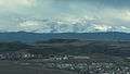 View of Pikes Peak from I-25 in Castle Rock.
 View of The Meadows neighborhood taken from Daniels Park.
 Castle Rock as seen from I-25.
 Hiking trail at Rock Park in Castle Rock.
See also
- Outline of Colorado
- State of Colorado
- Castle Rock v. Gonzales (2005), a U.S. Supreme Court case
References
- ↑ "2014 U.S. Gazetteer Files: Places". United States Census Bureau. July 1, 2014. Retrieved January 5, 2015.
- 1 2 "Active Colorado Municipalities". State of Colorado, Department of Local Affairs. Archived from the original on 2010-11-23. Retrieved 2007-09-01.
- ↑ "Colorado Municipal Incorporations". State of Colorado, Department of Personnel & Administration, Colorado State Archives. 2004-12-01. Retrieved 2007-08-15.
- 1 2 3 4 5 6 7 8 9 "American FactFinder 2". United States Census Bureau. Retrieved 2011-07-21.
- ↑ "ZIP Code Lookup". United States Postal Service. Archived from the original (JavaScript/HTML) on September 3, 2007. Retrieved September 4, 2007.
- ↑ "Find a County". National Association of Counties. Archived from the original on 2011-05-31. Retrieved 2011-06-07.
- ↑ "Annual Estimates of the Resident Population for Incorporated Places: April 1, 2010 to July 1, 2014". Retrieved June 4, 2015.
- ↑ Dawson, John Frank (1954). Place names in Colorado: why 700 communities were so named, 150 of Spanish or Indian origin. Denver, CO: The J. Frank Dawson Publishing Co. p. 13.
- ↑ "Castle Rock, CO - Official Website". crgov.com.
- ↑ "US Board on Geographic Names". United States Geological Survey. 2007-10-25. Retrieved 2008-01-31.
- ↑ "City Distance Tool". Geobytes. Retrieved 2013-10-03.
- ↑ "Physiographic provinces of Colorado". Colorado Geological Survey. Retrieved 2013-10-03.
- ↑ "Map of Major Topographic Features in Colorado". Colorado Geological Survey. Retrieved 2013-10-03.
- ↑ "History of Castle Rock". Town of Castle Rock, Colorado. Retrieved 2013-10-03.
- 1 2 "Castle Rock (map)" (PDF). Colorado Department of Transportation. 2012-09-11. Retrieved 2013-10-03.
- ↑ Life Zones Interactive Diagram
- ↑ Foothills Life Zones General Information
- ↑ "OMB Bulletin No. 13-01" (PDF). Office of Management and Budget. 2013-02-28. Retrieved 2013-10-17.
- 1 2 "Colorado: 2010 - Population and Housing Unit Counts" (PDF). United States Census Bureau. Aug 2012. Retrieved 2013-10-17.
- ↑ "Douglas County [Map]" (PDF). Colorado Department of Transportation. 2012-07-30. Retrieved 2013-10-17.
- 1 2 "NOWData - NOAA Online Weather Data". National Weather Service Forecast Office - Denver-Boulder, CO. Retrieved 2013-10-17.
- 1 2 "Average Weather for Castle Rock, CO". The Weather Channel. Archived from the original on December 10, 2012. Retrieved 2013-10-17.
- ↑ "Climatography of the United States No. 20" (PDF). NOAA. Retrieved 2011-02-21.
- ↑ "Annual Estimates of the Resident Population for Incorporated Places: April 1, 2010 to July 1, 2015". Retrieved July 2, 2016.
- ↑ "Census of Population and Housing". Census.gov. Archived from the original on April 22, 2013. Retrieved June 4, 2015.
- ↑ "Castle Rock, Colorado". City-Data.com. Retrieved 2013-10-19.
- ↑ "Town Government". Town of Castle Rock. Retrieved 2016-04-13.
- ↑ "Town Manager's Office". Town of Castle Rock. Retrieved 2016-04-13.
- ↑ "Our Locations". Douglas County Government. Retrieved 2013-10-25.
- ↑ "Departments". Douglas County Government. Retrieved 2013-10-25.
- ↑ "Colorado - Congressional Districts" (PDF). The National Atlas of the United States of America. U.S. Geological Survey. Retrieved 2013-10-25.
- ↑ "Colorado Webmaps - My Neighborhood". Government of Colorado. Retrieved 2013-10-25.
- ↑ "School Choice Selector". Douglas County School District. Retrieved 2013-10-19.
- ↑ "Private Schools in Castle Rock". Greatschools. Retrieved 2013-10-19.
- ↑ "Philip S. Miller Library". Douglas County Libraries. Retrieved 2013-10-25.
- ↑ "Castle Rock, CO". Google Maps. Retrieved 2013-11-20.
- ↑ "Local Transportation". Town of Castle Rock. Retrieved 2013-11-20.
- ↑ "Colorado Statewide Rail System 2012 [Map]" (PDF). Colorado Department of Transportation. Retrieved 2013-11-20.
- ↑ "Utilities/Services". Town of Castle Rock. Retrieved 2013-11-20.
- ↑ "Utilities/Castle Rock Water". Town of Castle Rock. Retrieved 2013-11-20.
- ↑ "Castle Rock Adventist Hospital". Retrieved May 20, 2013.
- ↑ "Advertise with Us". Colorado Community Newspapers. Archived from the original on August 17, 2009. Retrieved 2009-10-07.
- ↑ "Station Information Profile". Arbitron. Retrieved 2009-10-07.
- ↑ "Contacto". Entravision Communications Corporation. Archived from the original on April 24, 2009. Retrieved 2010-04-05.
- ↑ "TVQ TV Database Query". Federal Communications Commission. Retrieved 2009-10-07.
- ↑ Castle Rock, CO - Official Website - Parks, Open Space and Trails
- 1 2 3 "Best Places to Live 2014: 4. Castle Rock, Colo.". Money. September 17, 2014.
- ↑ How MONEY Ranks the Best Places - TIME
- ↑ "http://money.cnn.com/magazines/moneymag/bplive/2011/snapshots/PL0812415.html". CNN. Archived from the original on February 22, 2014. External link in
|title=(help) - ↑ 10 Best Towns for Families
- ↑ "Castle Rock among '10 best' for families in U.S.". Castle Rock Chamber of Commerce. Archived from the original on July 13, 2010.
- ↑ Archived October 4, 2011, at the Wayback Machine.
- ↑ Kilborn, Peter T. "http://www.forbes.com/2009/07/07/relocate-relocation-cities-lifestyle-real-estate-affordable-moving_slide_6.html". Forbes. External link in
|title=(help) - ↑ "http://money.cnn.com/magazines/moneymag/bplive/2009/top25s/financial/jobgrowth.html". CNN. Archived from the original on March 28, 2014. External link in
|title=(help) - ↑ "http://denver.bizjournals.com/denver/stories/2009/01/05/daily49.html". 2009-01-09. External link in
|title=(help) - ↑ Best School Districts in Colorado - CO District Rankings
- ↑ "Biography for Amy Adams". IMDb. Retrieved 2011-09-29.
- ↑ "Biography of Artist Kirsten Bomblies". Artists for Conservation. Retrieved 2011-09-29.
- ↑ "Jimmy Cottrell Profile". Scout.com. Retrieved 2011-09-29.
- ↑ "Jimmy Cottrell, LB". National Football League. Retrieved 2011-09-29.
- ↑ "Father John Lewis Dyer". oakdene.org. Archived from the original on February 1, 2014. Retrieved January 19, 2014.
- ↑ Hanley, Reid (1992-06-21). "Sports Psychologist Helps Hallberg Stay Focused On Task At Hand". Chicago Tribune. Retrieved 2011-09-29.
- ↑ "bio - beth malone". Weebly. Retrieved 2015-06-24.
- ↑ Miller, Ken. (2007). Nelson Rangell - Interview Cafe (Video-recording), Time: 4:13
- ↑ Fox, Margalit (2007-08-31). "Edward Seidensticker, Translator, Is Dead at 86". New York Times. Retrieved 2011-09-29.
- ↑ "Ann Strother". UConn Hoop Legends. University of Connecticut. Retrieved 2011-09-29.
External links
| Wikimedia Commons has media related to Castle Rock, Colorado. |
Municipalities and communities of Douglas County, Colorado, United States | ||
|---|---|---|
| Cities | 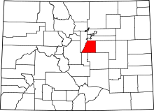 | |
| Towns | ||
| CDPs | ||
| Unincorporated communities | ||
| Footnotes | ‡This populated place also has portions in an adjacent county or counties | |
