Kit Carson County, Colorado
| Kit Carson County, Colorado | |
|---|---|
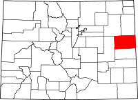 Location in the U.S. state of Colorado | |
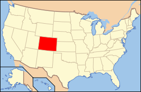 Colorado's location in the U.S. | |
| Founded | April 11, 1889 |
| Named for | Kit Carson |
| Seat | Burlington |
| Largest city | Burlington |
| Area | |
| • Total | 2,162 sq mi (5,600 km2) |
| • Land | 2,161 sq mi (5,597 km2) |
| • Water | 0.9 sq mi (2 km2), 0.04% |
| Population (est.) | |
| • (2015) | 7,758 |
| • Density | 3.8/sq mi (1/km²) |
| Congressional district | 4th |
| Time zone | Mountain: UTC-7/-6 |
| Website |
www |
Kit Carson County is one of the 64 counties in the U.S. state of Colorado. As of the 2010 census, the population was 8,270.[1] The county seat is Burlington.[2] The county was established in 1889 and named for American frontiersman and Indian fighter Kit Carson.[3][4]
Geography
According to the U.S. Census Bureau, the county has a total area of 2,162 square miles (5,600 km2), of which 2,161 square miles (5,600 km2) is land and 0.9 square miles (2.3 km2) (0.04%) is water.[5]
Adjacent counties
- Yuma County - north
- Cheyenne County, Kansas - northeast
- Sherman County, Kansas - east
- Wallace County, Kansas - southeast
- Cheyenne County - south
- Lincoln County - west
- Washington County - northwest
Major highways
Demographics
| Historical population | |||
|---|---|---|---|
| Census | Pop. | %± | |
| 1890 | 2,472 | — | |
| 1900 | 1,580 | −36.1% | |
| 1910 | 7,483 | 373.6% | |
| 1920 | 8,915 | 19.1% | |
| 1930 | 9,725 | 9.1% | |
| 1940 | 7,512 | −22.8% | |
| 1950 | 8,600 | 14.5% | |
| 1960 | 6,957 | −19.1% | |
| 1970 | 7,530 | 8.2% | |
| 1980 | 7,599 | 0.9% | |
| 1990 | 7,140 | −6.0% | |
| 2000 | 8,011 | 12.2% | |
| 2010 | 8,270 | 3.2% | |
| Est. 2015 | 7,758 | [6] | −6.2% |
| U.S. Decennial Census[7] 1790-1960[8] 1900-1990[9] 1990-2000[10] 2010-2015[1] | |||
As of the census[11] of 2000, there were 8,011 people, 2,990 households, and 2,081 families residing in the county. The population density was 4 people per square mile (1/km²). There were 3,430 housing units at an average density of 2 per square mile (1/km²). The racial makeup of the county was 87.28% White, 1.74% Black or African American, 0.51% Native American, 0.32% Asian, 0.04% Pacific Islander, 9.20% from other races, and 0.91% from two or more races. 13.67% of the population were Hispanic or Latino of any race.
There were 2,990 households out of which 33.60% had children under the age of 18 living with them, 59.40% were married couples living together, 6.30% had a female householder with no husband present, and 30.40% were non-families. 27.20% of all households were made up of individuals and 12.50% had someone living alone who was 65 years of age or older. The average household size was 2.50 and the average family size was 3.07.
In the county the population was spread out with 26.70% under the age of 18, 7.50% from 18 to 24, 29.00% from 25 to 44, 22.20% from 45 to 64, and 14.60% who were 65 years of age or older. The median age was 37 years. For every 100 females there were 112.20 males. For every 100 females age 18 and over, there were 112.10 males.
The median income for a household in the county was $33,152, and the median income for a family was $41,867. Males had a median income of $28,700 versus $19,978 for females. The per capita income for the county was $16,964. About 9.40% of families and 12.10% of the population were below the poverty line, including 16.60% of those under age 18 and 11.10% of those age 65 or over.
Recreation
National historic landmark
Historic trail
Communities
See also
- Outline of Colorado
- Index of Colorado-related articles
- National Register of Historic Places listings in Kit Carson County, Colorado
References
- 1 2 "State & County QuickFacts". United States Census Bureau. Retrieved February 10, 2014.
- ↑ "Find a County". National Association of Counties. Retrieved 2011-06-07.
- ↑ Columbia-Lippincott Gazeteer, p. 957
- ↑ Gannett, Henry (1905). The Origin of Certain Place Names in the United States. Govt. Print. Off. p. 176.
- ↑ "US Gazetteer files: 2010, 2000, and 1990". United States Census Bureau. 2011-02-12. Retrieved 2011-04-23.
- ↑ "County Totals Dataset: Population, Population Change and Estimated Components of Population Change: April 1, 2010 to July 1, 2015". Retrieved July 2, 2016.
- ↑ "U.S. Decennial Census". United States Census Bureau. Retrieved June 8, 2014.
- ↑ "Historical Census Browser". University of Virginia Library. Retrieved June 8, 2014.
- ↑ "Population of Counties by Decennial Census: 1900 to 1990". United States Census Bureau. Retrieved June 8, 2014.
- ↑ "Census 2000 PHC-T-4. Ranking Tables for Counties: 1990 and 2000" (PDF). United States Census Bureau. Retrieved June 8, 2014.
- ↑ "American FactFinder". United States Census Bureau. Retrieved 2011-05-14.
External links
| Wikimedia Commons has media related to Kit Carson County, Colorado. |
- Kit Carson County Government website
- Colorado County Evolution by Don Stanwyck
- Colorado Historical Society
 |
Washington County | Yuma County | Cheyenne County, Kansas | |
| Lincoln County | |
Sherman County, Kansas | ||
| ||||
| | ||||
| Cheyenne County | Wallace County, Kansas |
Municipalities and communities of Kit Carson County, Colorado, United States | ||
|---|---|---|
| City | | |
| Towns | ||

Coordinates: 39°19′N 102°36′W / 39.31°N 102.60°W