Superior, Colorado
| Superior, Colorado | |
|---|---|
| Town | |
|
Rock Creek Ranch subdivision in Superior | |
 Location in Boulder County and the state of Colorado | |
| Coordinates: 39°56′N 105°10′W / 39.933°N 105.167°WCoordinates: 39°56′N 105°10′W / 39.933°N 105.167°W | |
| Country |
|
| State |
|
| Counties[1] | Boulder County, Jefferson County |
| Founded | 1896 |
| Incorporated | June 10, 1904[2] |
| Government | |
| • Type | Statutory Town[1] |
| Area | |
| • Total | 4 sq mi (10.2 km2) |
| • Land | 4 sq mi (10.2 km2) |
| • Water | 0 sq mi (0 km2) |
| Elevation[3] | 5,495 ft (1,675 m) |
| Population (2010) | |
| • Total | 12,483 |
| • Density | 3,120.8/sq mi (1,223.8/km2) |
| Time zone | MST (UTC-7) |
| • Summer (DST) | MDT (UTC-6) |
| ZIP code[4] | 80027 |
| Area code(s) | Both 303 and 720 |
| FIPS code | 08-75640 |
| GNIS feature ID | 0203891 |
| Highways | US 36, SH 128, SH 170 |
| Website | Town Website |

Superior is a Statutory Town in Boulder County in the U.S. state of Colorado, with a small, uninhabited segment of land area extending into Jefferson County . According to the 2010 census, the population of the city was 12,483.
History
Superior's history is one of coal mining. The first mines in the area were developed in the late 19th century. Coal was discovered on the Hake family farm in 1894, and recollections of members of pioneer families in Superior, including the Hakes and Autreys, are preserved as part of the Maria Rogers Oral History Program at the Carnegie Library for Local History in Boulder, Colorado.[5] The town was reportedly named after Superior, Wisconsin.[6]
Mining was the major force in Superior's history until the Industrial Mine closed in 1945. Subsequently, many people moved out of the area and the Town evolved into a quiet ranching and farming community. The Town's population hovered around 250 until the late 1990s.
Geography
Superior is located at 39°56′N 105°10′W / 39.933°N 105.167°W (39.931190, -105.159085).[7]
According to the United States Census Bureau, the town has a total area of 4.0 square miles (10.3 km²), of which, 4.0 square miles (10.2 km²) of it is land and 0.04 square miles (0.1 km²) of it (0.50%) is water.
As of 2013 there were 27 miles (43.45 km) of trails and 594 acres (2.40 km²)[8] of parks, green space, and open space, which is about 23.2% of the land area.
Demographics
| Historical population | |||
|---|---|---|---|
| Census | Pop. | %± | |
| 1910 | 349 | — | |
| 1920 | 233 | −33.2% | |
| 1930 | 160 | −31.3% | |
| 1940 | 205 | 28.1% | |
| 1950 | 134 | −34.6% | |
| 1960 | 173 | 29.1% | |
| 1970 | 171 | −1.2% | |
| 1980 | 208 | 21.6% | |
| 1990 | 255 | 22.6% | |
| 2000 | 9,011 | 3,433.7% | |
| 2010 | 12,483 | 38.5% | |
| Est. 2015 | 12,980 | [9] | 4.0% |
As of the census[11] of 2010, there were 12,483 people, 4,484 households (for 2007-2011), and 3,159 families residing in the town. The population density was 3,120.8 people per square mile (1,223.8/km²). There were 4,698 housing units at an average density of 1,186.4 per square mile (458.1/km²). The racial makeup of the town was 80.4% White, 0.9% African American, 0.2% Native American, 13.8% Asian, less than 0.1% Pacific Islander, 1.00% from other races, and 3.7% from two or more races. Hispanic or Latino of any race were 6.6% of the population.
Of all households, 46.6% had children under the age of 18 living with them, 57.9% were married couples living together, 8.1% had a female householder with no husband present, and 29.7% were non-families. 20.0% of all households were individuals living alone and 1.6% had someone living alone who was 65 years of age or older. The average household size was 2.71 and the average family size was 3.31.
In the town the population was spread out with 31.5% under the age of 18, 12.9% from 18 to 24, 33.4% from 25 to 44, 24.1% from 45 to 64, and 3.1% who were 65 years of age or older. The median age was 32.5 years. For every 100 females there were 103.0 males. For every 100 females age 18 and over, there were 101.1 males.
The median income for a household in the town was $100,194, and the median income for a family was $119,115. The per capita income for the town was $44,318 (for 2007-2011). About 1.4% of families and 4.3% of the population were below the poverty line, including 3.1% of those under age 18 and none of those age 65 or over.
Of residents 25 years and over, 97.5% were high school graduates and 71.8% held a bachelor's degree or higher, with 26.8% holding graduate or professional degrees.
Education
Superior has three public schools, run by the Boulder Valley School District, Superior Elementary,[12] Eldorado K-8 and Monarch K-8. The home public high school is Monarch High School in nearby Louisville, Colorado.
In popular culture
Sections of the 1985 movie American Flyers were filmed in Superior.
Notable people
- Marcelo Balboa - soccer star
- Hiro Branson - World Video Game Tournament champion (2001, 2002)
- Alexander Puldy - University of Colorado Lacrosse Captain (2009-2013)
- Taylor James - University of Colorado Ralphie Handler (2010, 2011, 2012)
- Mason Crosby- University of Colorado/NFL Kicker (Green Bay Packers)
See also
- Outline of Colorado
- State of Colorado
- Jefferson Parkway
- Rocky Flats National Wildlife Refuge
References
- 1 2 "Active Colorado Municipalities". State of Colorado, Department of Local Affairs. Retrieved 2007-09-01.
- ↑ "Colorado Municipal Incorporations". State of Colorado, Department of Personnel & Administration, Colorado State Archives. 2004-12-01. Retrieved 2007-09-02.
- ↑ "US Board on Geographic Names". United States Geological Survey. 2007-10-25. Retrieved 2008-01-31.
- ↑ "ZIP Code Lookup" (JavaScript/HTML). United States Postal Service. Retrieved 2008-01-06.
- ↑ Steele, Shirley S. (2008). "Autrey, Raymond, 1921-". Maria Rogers Oral History Program. Boulder Public Library.
- ↑ Dawson, John Frank. Place names in Colorado: why 700 communities were so named, 150 of Spanish or Indian origin. Denver, CO: The J. Frank Dawson Publishing Co. p. 48.
- ↑ "US Gazetteer files: 2010, 2000, and 1990". United States Census Bureau. 2011-02-12. Retrieved 2011-04-23.
- ↑ "Town of Superior website". Retrieved 17 November 2013.
- ↑ "Annual Estimates of the Resident Population for Incorporated Places: April 1, 2010 to July 1, 2015". Retrieved July 2, 2016.
- ↑ "Census of Population and Housing". Census.gov. Retrieved June 4, 2015.
- ↑ "American FactFinder". United States Census Bureau. Retrieved 2008-01-31.
- ↑ Great Schools, Superior Elementary School Accessed 4-8-2011
External links
- Town of Superior
- Superior Observer (Superior's Weekly Newspaper)
- Superior Elementary School
Municipalities and communities of Boulder County, Colorado, United States | ||
|---|---|---|
| Cities |  | |
| Towns | ||
| CDPs | ||
| Unincorporated communities | ||
| Ghost town | ||
| Footnotes | ‡This populated place also has portions in an adjacent county or counties | |
Municipalities and communities of Jefferson County, Colorado, United States | ||
|---|---|---|
| Cities | 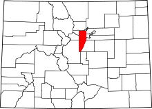 | |
| Towns | ||
| CDPs | ||
| Unincorporated communities | ||
| Ghost town | ||
| Footnotes | ‡This populated place also has portions in an adjacent county or counties | |
