Cherry Valley, Pennsylvania
| Cherry Valley, Pennsylvania | |
|---|---|
| Borough | |
|
Countryside along Pennsylvania Route 38 | |
 Cherry Valley | |
| Coordinates: 41°09′26″N 79°47′53″W / 41.15722°N 79.79806°WCoordinates: 41°09′26″N 79°47′53″W / 41.15722°N 79.79806°W | |
| Country | United States |
| State | Pennsylvania |
| County | Butler |
| Incorporated | 1909 |
| Government | |
| • Type | Borough Council |
| • Mayor | Ron Lockwood |
| Area | |
| • Total | 2.8 sq mi (7.3 km2) |
| • Land | 2.8 sq mi (7.3 km2) |
| • Water | 0.0 sq mi (0.0 km2) |
| Elevation | 1,322 ft (403 m) |
| Population (2010) | |
| • Total | 66 |
| • Density | 23/sq mi (9.0/km2) |
| Time zone | Eastern (EST) (UTC-5) |
| • Summer (DST) | EDT (UTC-4) |

Cherry Valley is a borough in Butler County, Pennsylvania, United States. The population was 66 at the 2010 census.[1]
Geography
Cherry Valley is located in northern Butler County at 41°09′26″N 79°47′53″W / 41.157204°N 79.798127°W,[2] along the Venango County border.
Pennsylvania Route 38 passes through the borough, leading east 3 miles (5 km) to Interstate 80 Exit 42 and 5 miles (8 km) to Emlenton, and to the south 1.5 miles (2.4 km) to Eau Claire.
According to the United States Census Bureau, the borough has a total area of 2.8 square miles (7.3 km2), all of it land.[1]
Demographics
| Historical population | |||
|---|---|---|---|
| Census | Pop. | %± | |
| 1910 | 113 | — | |
| 1920 | 83 | −26.5% | |
| 1930 | 80 | −3.6% | |
| 1940 | 97 | 21.3% | |
| 1950 | 94 | −3.1% | |
| 1960 | 82 | −12.8% | |
| 1970 | 73 | −11.0% | |
| 1980 | 91 | 24.7% | |
| 1990 | 96 | 5.5% | |
| 2000 | 72 | −25.0% | |
| 2010 | 66 | −8.3% | |
| Est. 2015 | 65 | [3] | −1.5% |
| Sources:[4][5][6] | |||
As of the census[5] of 2000, there were 72 people, 27 households, and 18 families residing in the borough. The population density was 25.1 people per square mile (9.7/km2). There were 31 housing units at an average density of 10.8 per square mile (4.2/km2). The racial makeup of the borough was 100.00% White.
There were 27 households, out of which 18.5% had children under the age of 18 living with them, 66.7% were married couples living together, and 33.3% were non-families. 22.2% of all households were made up of individuals, and 11.1% had someone living alone who was 65 years of age or older. The average household size was 2.67 and the average family size was 3.22.
In the borough the population was spread out, with 22.2% under the age of 18, 6.9% from 18 to 24, 25.0% from 25 to 44, 33.3% from 45 to 64, and 12.5% who were 65 years of age or older. The median age was 43 years. For every 100 females there were 132.3 males. For every 100 females age 18 and over, there were 124.0 males.
The median income for a household in the borough was $51,250, and the median income for a family was $41,250. Males had a median income of $21,875 versus $21,875 for females. The per capita income for the borough was $14,915. There were 25.0% of families and 18.8% of the population living below the poverty line, including 37.5% of under eighteens and none of those over 64.
References
- 1 2 "Geographic Identifiers: 2010 Demographic Profile Data (G001): Cherry Valley borough, Pennsylvania". U.S. Census Bureau, American Factfinder. Retrieved March 24, 2014.
- ↑ "US Gazetteer files: 2010, 2000, and 1990". United States Census Bureau. 2011-02-12. Retrieved 2011-04-23.
- ↑ "Annual Estimates of the Resident Population for Incorporated Places: April 1, 2010 to July 1, 2015". Retrieved July 2, 2016.
- ↑ "Census of Population and Housing". U.S. Census Bureau. Archived from the original on 11 May 2015. Retrieved 11 December 2013.
- 1 2 "American FactFinder". United States Census Bureau. Archived from the original on 2013-09-11. Retrieved 2008-01-31.
- ↑ "Incorporated Places and Minor Civil Divisions Datasets: Subcounty Resident Population Estimates: April 1, 2010 to July 1, 2012". Population Estimates. U.S. Census Bureau. Archived from the original on 17 June 2013. Retrieved 11 December 2013.
| Counties |  Map of the Pittsburgh Tri-State with green counties in the metropolitan area and yellow counties in the combined area. | |
|---|---|---|
| Major cities | ||
| Cities and towns 15k-50k (in 2010) | ||
| Airports | ||
| Topics | ||
| ||
Municipalities and communities of Butler County, Pennsylvania, United States | ||
|---|---|---|
| City | 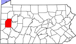 | |
| Boroughs | ||
| Townships | ||
| CDPs | ||
| Unincorporated communities | ||
| Footnotes | ‡This populated place also has portions in an adjacent county or counties | |