Interstate 80
| |
|---|---|
 | |
| Route information | |
| Length: | 2,899.54 mi[1] (4,666.36 km) |
| Existed: | 1956 – present |
| History: | Completed in 1986 |
| Major junctions | |
| West end: |
|
| |
| East end: |
|
| Location | |
| States: | California, Nevada, Utah, Wyoming, Nebraska, Iowa, Illinois, Indiana, Ohio, Pennsylvania, New Jersey |
| Highway system | |

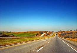
Interstate 80 (I-80) is a transcontinental limited-access highway in the United States that runs from downtown San Francisco, California, to Teaneck, New Jersey, in the New York City Metropolitan Area. The highway was designated in 1956 as one of the original routes of the Interstate Highway System. Its final segment was opened to traffic in 1986. It is the second-longest Interstate Highway in the United States, following I-90. The Interstate runs through many major cities including Oakland, California, Sacramento, California, Salt Lake City, Utah, Omaha, Nebraska, Des Moines, Iowa, and Toledo, Ohio, and passes within 10 miles (16 km) of Chicago, Illinois, Cleveland, Ohio and New York City, New York.
I-80 is the Interstate Highway that most closely approximates the route of the historic Lincoln Highway, the first road across the United States. The highway roughly traces other historically significant travel routes in the Western United States: the Oregon Trail across Wyoming and Nebraska, the California Trail across most of Nevada and California, the first transcontinental airmail route, and except in the Great Salt Lake area, the entire route of the First Transcontinental Railroad. From near Chicago east to near Youngstown, Ohio, I-80 is a toll road, containing the majority of both the Indiana Toll Road and the Ohio Turnpike. I-80 runs concurrently with I-90 from near Portage, Indiana, to Elyria, Ohio. In Pennsylvania, I-80 is known as the Keystone Shortway, a non-tolled freeway that crosses rural north-central portions of the state on the way to New Jersey and New York City.
Route description
| mi[1] | km | |
|---|---|---|
| CA | 199.24 | 320.65 |
| NV | 410.67 | 660.91 |
| UT | 196.34 | 315.98 |
| WY | 402.76 | 648.18 |
| NE | 455.32 | 732.77 |
| IA | 303.23 | 488.00 |
| IL | 163.52 | 263.16 |
| IN | 151.56 | 243.91 |
| OH | 237.48 | 382.19 |
| PA | 311.07 | 500.62 |
| NJ | 68.35 | 110.00 |
| Total | 2,902.51 | 4,671.14 |


California
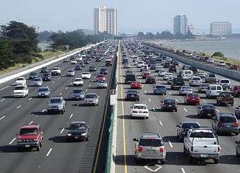
I-80 begins at an interchange with U.S. Route 101 (US 101) in San Francisco, and then crosses the San Francisco–Oakland Bay Bridge into Oakland. It then heads northeast through Vallejo, Sacramento, and the Sierra Nevada mountains before crossing into Nevada.
A portion of the route through Pinole involved the experimental transplantation of the rare species Santa Cruz tarweed in the right-of-way.
Nevada
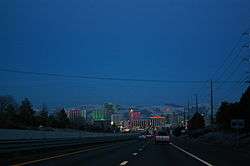
In Nevada, I-80 traverses the northern portion of the state. The freeway serves the Reno–Sparks metropolitan area, and it also goes through the towns of Fernley, Lovelock, Winnemucca, Battle Mountain, Elko, Wells, and West Wendover on its way through the state.
The Nevada portion of I-80 follows the paths of the Truckee and Humboldt rivers, which have been used as a transportation corridor since the California Gold Rush of the 1840s. The Interstate also follows the historical routes of the California Trail, First Transcontinental Railroad, and Feather River Route throughout portions of the state. I-80 in Nevada closely follows, and at many points directly overlaps, the original route of the Victory Highway, State Route 1, and US 40.
Utah
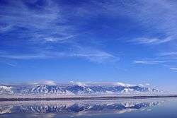
After crossing Utah's western border in Wendover, I-80 crosses the desolate Bonneville Salt Flats west of the Great Salt Lake. The longest stretch between exits on an Interstate Highway is located between Wendover and Knolls, with 37 miles (60 km) between those exits. This portion of I-80, crossing the Great Salt Lake Desert, is extremely flat and straight, dotted with large warning signs about driver fatigue and drowsiness.
East of the salt flats, I-80 passes the southern edge of Great Salt Lake and continues on through Salt Lake City, where it merges with I-15 for three miles (4.8 km) before entering the Wasatch Mountains east of the city. It ascends Parley's Canyon and passes within a few miles of Park City as it follows a route through the mountains towards the junction with the eastern terminus of the western section of I-84. From the junction it continues up Echo Canyon and on towards the border with Wyoming, near Evanston.
The route of the Utah section of I-80 is defined in Utah Code Annotated § 72-4-113(10).[2]
Wyoming
In Wyoming, I-80 reaches its maximum elevation of 8,640 feet (2,630 m) above sea level[3] at Sherman Summit, near Buford, which at 8,000 feet (2,400 m) is the highest community on I-80. Farther west in Wyoming, the Interstate passes through the dry Red Desert and over the Continental Divide. In a way, the highway crosses the Divide twice, since two ridges of the Rocky Mountains split in Wyoming, forming the Great Divide Basin, from which surface water cannot drain, but can only evaporate.
Nebraska
I-80 enters Nebraska west of Bushnell. The western portion of I-80 in Nebraska runs very close to the state of Colorado, without entering the state. The intersection of I-76 and I-80 is visible from the Colorado–Nebraska state line. From its intersection with I-76 to Grand Island, I-80 lies in the valley of the South Platte River and the Platte River.
The longest straight stretch of Interstate anywhere in the Interstate Highway System is the approximately 72 miles (116 km) of I-80 occurring between exit 318 in the Grand Island area and mile marker 390 near Lincoln. Along this length, the road does not vary from an ideally straight line by more than a few yards. After Lincoln, I-80 turns northeast towards Omaha. It then crosses the Missouri River in Omaha to enter the state of Iowa. Part of I-80 in Nebraska is marked as a Blue Star Memorial Highway.
Iowa
I-80 is the longest Interstate Highway in Iowa. It extends from west to east across the central portion of the state through the population centers of Council Bluffs, Des Moines and the Quad Cities.[4] It enters the state at the Missouri River in Council Bluffs and heads east through the southern Iowa drift plain. In the Des Moines area, I-80 meets up with I-35 and the two routes bypass Des Moines together. In Ankeny, the Interstates split and I-80 continues east. In eastern Iowa, it provides access to the University of Iowa in Iowa City. Northwest of the Quad Cities in Walcott is Iowa 80, the World's Largest Truckstop. I-80 passes along the northern edge of Davenport and Bettendorf and leaves Iowa via the Fred Schwengel Memorial Bridge over the Mississippi River into Illinois. The majority of the highway runs through farmland,[4] yet roughly one-third of Iowa's population live along the I-80 corridor.[5]
Illinois
In Illinois, I-80 runs from the Fred Schwengel Memorial Bridge across the Mississippi River south to an intersection with I-74. It then runs east across north-central Illinois just north of the Illinois River to Joliet. I-80 continues east and joins I-94 just before entering Indiana.
Indiana
In Indiana, I-80 runs concurrently with another Interstate Highway for its entire length. It runs with I-94 on the Borman Expressway from the Illinois state line to Lake Station, Indiana, and the Indiana Toll Road with I-90 from Lake Station to the Ohio state line.
Between LaPorte and the Greater Toledo, Ohio, area, I-80/I-90 is located within 10 miles (16 km) of the Michigan state line, but does not enter that state. From the State Road 9 (SR 9) and I-80/I-90 interchange, the sign marking the Indiana–Michigan state line is visible. I-80/I-90 passes through the South Bend metropolitan area intersecting with the St. Joseph Valley Parkway. At another point in northern Indiana, I-80/I-90 comes within about 200 yards (180 m) from the Michigan border.[6]
Ohio
In Ohio, I-80 enters with I-90 from the Indiana Toll Road and immediately becomes the Ohio Turnpike. The two Interstates cross rural northwest Ohio and run just south of the metropolitan area of Toledo. In Rossford, the turnpike intersects I-75 in an area known as the Crossroads of America. This intersection is one of the largest intersections of three Interstate Highways in the United States.
In Elyria Township, just west of Cleveland, I-90 splits from I-80, leaving the turnpike and running northeast as a freeway. I-80 runs east-southeast through the southern suburbs of Cleveland. Just northwest of Youngstown, the Ohio Turnpike continues southeast as I-76, while I-80 exits the turnpike and runs east to the north of Youngstown, entering Pennsylvania south of Sharon, Pennsylvania.
Pennsylvania
In Pennsylvania, I-80 is the main east–west Interstate-standard highway through central Pennsylvania. It runs from the Ohio state line near Sharon to the Delaware Water Gap Toll Bridge over the Delaware River and is called the "Confair Memorial Highway".
It traverses the extreme northern section of the Pittsburgh metropolitan area. A spur from I-80 (I-180) runs to Williamsport, while another (I-380) runs to Scranton. I-80 intersects I-476 in the Pocono Mountains which connects with Scranton, Wilkes-Barre, Allentown and Philadelphia. I-80 intersects I-79 in Western Pennsylvania which connects with Erie (about 75 miles [121 km] to the north) and Pittsburgh (about 55 miles [89 km] to the south). Additional intersections include I-81 connecting Syracuse, New York, and Harrisburg while I-99 connects with State College and Altoona. Also in Western Pennsylvania I-80 serves as the western terminus for I-376 which connects it to the Pittsburgh International Airport and on to downtown and suburban Pittsburgh.
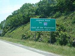
In Clearfield County, I-80 reaches its highest elevation east of the Mississippi River, 2,250 feet (686 m), although other Interstate Highways east of the Mississippi, including I-26 in North Carolina and Tennessee, reach higher elevations.
In 2007, the Pennsylvania Turnpike Commission, combined with state legislature Act No. 44, initiated plans to enact a tolling system on the entire span of I-80 throughout the Commonwealth of Pennsylvania. On October 15, 2007, the Pennsylvania Department of Transportation (PennDOT and the PTC] signed a 50-year lease agreement, which would allow the PTC to maintain and, eventually, toll I-80.[7] However, the application for a toll was rejected by the Federal Highway Administration.[8]
New Jersey
A portion of I-80 that goes through New Jersey is called the Bergen–Passaic Expressway.[9]
I-80 does not enter New York City. Once the I-95/New Jersey Turnpike was extended in 1971 from its former terminus at US 46 in Ridgefield to I-80 in Teaneck the section from Teaneck to Fort Lee was resigned as I-95, and it is the latter roadway that enters New York City via the George Washington Bridge. I-80's designated end (as per signage and New Jersey Department of Transportation documents) is four miles (6.4 km)[10] short of New York City in Teaneck, before the Degraw Avenue overpass. There, signs designate the end of I-80 and the beginning of I-95/New Jersey Turnpike northbound.
Therefore, the fact that mileage markers beyond the end of I-80 appear to follow as if they were part of I-80 is a coincidence. They match what would have been the correct mileage markers of I-95 had the Somerset Freeway been built.
One section of I-80 running from Netcong to Denville was constructed in 1958. It is one of the oldest sections of Interstate Highway in the United States.
History
I-80 was included in the original plan for the Interstate Highway System as approved in 1956. The highway was built in segments. The final piece of I-80 was completed in 1986 on the western edge of Salt Lake City. This piece was coincidentally dedicated close to the 30th birthday of the Interstate Highway System, which was noted at the dedication and considered to be a milestone in the history of highway construction in the United States.[11] It was also noted at the dedication that this was only 50 miles (80 km) south of Promontory Summit, where the golden spike of the United States First Transcontinental Railroad was laid.[12]
John McPhee described the geology revealed by the building of Interstate 80 in a series of books on the formation of the continent of North America, books that were published between 1981 and 1993 and collected in a one-volume edition in 1998. In ‘’Basin and Range’’ (1981), he described how the idea emerged in a conversation with Princeton geologist Kenneth S. Deffeyes: “What about Interstate 80, I asked him. It goes the distance. How would it be? ‘Absorbing,’ he said. And he mused aloud: After 80 crosses the Border Fault, it pussyfoots along on morainal till that levelled up the fingers of the foldbelt hills. It does a similar dance with glacial debris in parts of Pennsylvania. It needs no assistance on the craton. It climbs a ramp to the Rockies and a fault-block staircase up the front of the Sierra. It is geologically shrewd. It was the route of animal migrations, and of human history that followed. It avoids melodrama, avoids the Grand Canyons, the Jackson Holes, the geologic operas of the country, but it would surely be a sound experience of the big picture, of the history, the construction, the components of the continent.”[13]
Junction list
- California
-
 US 101 in San Francisco
 -
 I‑880 in Oakland
 -
 I‑580 on the Oakland–Emeryville city line. The highways travel concurrently to Albany
 -
 I‑780 in Vallejo
 -
 I‑680 in Fairfield
 -
 I‑505 in Vacaville
 -
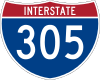
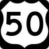 I‑305 / US 50 in West Sacramento
 -
 I‑5 in Sacramento
 - Nevada
-
 I‑580 / US 395 in Reno
 -
 US 95 south-southwest of Lovelock. The highways travel concurrently to Winnemucca.
 -
 US 93 in Wells
 - Utah
-
 I‑215 in Salt Lake City
 -
 I‑15 in Salt Lake City. The highways travel concurrently to South Salt Lake.
 -
 US 89 in South Salt Lake
 - I‑215 southeast of Salt Lake City
-

 US 40 / US 189 in Silver Creek Junction. I-80/US 189 travels concurrently to east-northeast of Evanston, Wyoming.
 -
 I‑84 in Echo
 - Wyoming
-
 US 30 in Little America. The highways travel concurrently to south-southeast of Walcott.
 -
 US 191 in Purple Sage. The highways travel concurrently to Rock Springs.
 -
 US 287 east of Rawlins. The highways travel concurrently to south-southeast of Walcott.
 - US 287 in Laramie
- US 30 southeast of Laramie. The highways travel concurrently to southwest of Cheyenne.
-
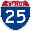
 I‑25 / US 87 southwest of Cheyenne
 -

 I‑180 / US 85 on the Fox Farm–Cheyenne line
 - US 30 east-northeast of Cheyenne. The highways travel concurrently to Pine Bluffs.
- Nebraska
-
 I‑76 southwest of Big Springs
 -
 US 26 in Ogallala
 -
 US 83 in North Platte
 -
 US 283 south of Lexington
 -
 US 183 south of Elm Creek
 -

 US 34 / US 281 south of Grand Island
 -
 US 81 in York
 -
 US 6 in Lincoln
 -
 US 77 in Lincoln. The highways travel concurrently to north-northeast of Lincoln.
 - I‑180 / US 34 in Lincoln
- US 6 in Waverly
-
 US 275 in Omaha
 - I‑680 in Omaha
-

 I‑480 / US 75 in Omaha
 - Iowa
-
 I‑29 in Council Bluffs. The highways travel concurrently through Council Bluffs.
 - US 6 in Council Bluffs
- I‑680 northwest of Minden
-
 US 59 in Avoca
 -
 US 6 / US 71 north-northeast of Lorah. I-80/US 6 travel concurrently to De Soto.
 -
 US 6 / US 169 in De Soto
 -

 I‑35 / I‑235 in West Des Moines. I-35/I-80 travels concurrently to Ankeny.
 - US 6 on the Clive–Urbandale city line
-
 US 69 in Des Moines
 - I‑35 / I‑235 in Ankeny
-
 US 65 in Altoona. The highways travel concurrently through Altoona.
 - US 6 / US 65 in Altoona. I-80/US 6 travels concurrently to Newton.
-
 US 63 south of Malcom
 -
 US 151 east-northeast of Williamsburg
 -

 I‑380 / US 218 on the Tiffin–Coralville city line
 - US 6 north-northwest of Wilton. The highways travel concurrently to Davenport.
-

 I‑280 / US 6 / US 61 in Davenport. I-80/US 61 travels concurrently through Davenport.
 -
 I‑74 in Davenport
 -
 US 67 in Le Claire
 - Illinois
-
 I‑88 in East Moline
 - US 6 in Colona
- I‑74 / I‑280 in Colona
- I‑180 northeast of Princeton
-

 I‑39 / US 51 in LaSalle
 -
 I‑55 in Channahon
 -
 US 52 in Joliet
 - US 30 in New Lenox
-
 I‑355 in New Lenox
 -
 US 45 on the Mokena–Orland Park–Tinley Park city line
 -
 I‑57 in Country Club Hills
 -
 I‑294 in Hazel Crest. The highways travel concurrently to the South Holland–Lansing village line.
 -
 I‑94 / I‑294 on the South Holland–Lansing village line. I-80/I-94 travels concurrently to Lake Station, Indiana.
 - US 6 in Lansing. The highways travel concurrently to Lake Station, Indiana.
- Indiana
-
 US 41 in Hammond. The highways travel concurrently through Hammond.
 -
 I‑65 in Gary
 -
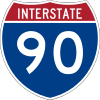 I‑90 / I‑94 in Lake Station. I-80/I-90 travels concurrently to northwest of Elyria, Ohio.
 -
 US 421 southeast of Otis
 -
 US 31 in South Bend
 -
 US 131 north-northeast of Middlebury
 -
 I‑69 west-northwest of Fremont
 - Ohio
-
 US 20 in Maumee
 -
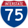 I‑75 in Perrysburg
 - I‑280 northeast of Stony Ridge
-
 US 250 north-northwest of Milan
 - I‑480 in North Ridgeville
-

 I‑71 / US 42 in Strongsville
 -
 I‑77 on the Richfield–Brecksville line
 - I‑480 in Streetsboro
- I‑76 east-southeast of North Jackson
- I‑680 in Mineral Ridge
-
 US 422 in Girard
 -
 US 62 north of Hubbard
 - Pennsylvania
-
 I‑376 south of Hermitage
 -
 US 19 south of Mercer
 -
 I‑79 northwest of Grove City
 -
 US 322 west of Corsica
 -
 US 219 east-northeast of Falls Creek
 -

 I‑99 / US 220 northwest of Zion. I-80/US 220 travels concurrently to east of Mackeyville.
 -
 US 15 north of New Columbia
 - I‑180 northeast of New Columbia
-
 US 11 in Lime Ridge
 -
 I‑81 north-northwest of Drums
 -
 I‑476 east of East Side
 - I‑380 south-southwest of Pocono Summit
-
 US 209 in Arlington Heights. The highways travels concurrently to east of East Stroudsburg.
 - New Jersey
-
 US 46 in Columbia
 -
 US 206 west of Stanhope. The highways travel concurrently to south-southeast of Netcong.
 - US 46 in Netcong
- US 46 east of Rockaway
-
 US 202 in Parsippany-Troy Hills
 -
 I‑287 in Parsippany-Troy Hills
 - I‑280 in Parsippany-Troy Hills
- US 46 in Parsippany-Troy Hills
- US 46 in Wayne
-
 I‑95 in Teaneck
See also
-
 U.S. Roads portal
References
- 1 2 Adderly, Kevin (January 27, 2016). "Table 1: Main Routes of the Dwight D. Eisenhower National System Of Interstate and Defense Highways as of December 31, 2015". Route Log and Finder List. Federal Highway Administration. Retrieved July 17, 2016.
- ↑ Utah State Legislature. "§ 72-4-113(10)". Utah Code Annotated. Archived from the original on February 27, 2014. Retrieved January 29, 2013.
- ↑ Wyoming Department of Transportation (2010). Official State Highway Map of Wyoming (Map). c. 1:1,140,480. Cheyenne: Wyoming Department of Transportation. §§ G1–H10.
- 1 2 Google (August 9, 2012). "Intersate 80 in Iowa" (Map). Google Maps. Google. Retrieved August 9, 2012.
- ↑ Staff (March 29, 2010). "Population grows in I-80, U.S. 30 corridors". Daily Times Herald. Carroll, IA. Retrieved August 12, 2012.
- ↑ MSRMaps Archived September 17, 2012, at the Wayback Machine.
- ↑ Nussbaum, Paul (October 17, 2007). "I-80 toll plans moving forward". The Philadelphia Inquirer.
- ↑ Federal Highway Administration Public Affairs (April 6, 2010). "Federal Highway Administration Declines Pennsylvania Request to Toll I-80" (Press release). Federal Highway Administration. Retrieved October 4, 2014.
- ↑ "Interstate 80 (New Jersey)". The Roads of Metro New York. Retrieved October 4, 2014.
- ↑ Measured in Google Earth from I-80 end sign (visible in Street View) to the beginning of the George Washington Bridge
- ↑ Weingroff, Richard (Fall 1986). "America Celebrates 30th Anniversary of the Interstate System". U.S. Highways. Federal Highway Administration.
- ↑ "Around the Nation: Transcontinental Road Completed in Utah". The New York Times. Associated Press. August 25, 1986. OCLC 1645522. Retrieved May 13, 2013.
- ↑ John McPhee, ‘’Annals of the Former World’’ (New York: Farrar, Straus and Giroux, 2000), pp. 36-37.
External links
| Wikimedia Commons has media related to Interstate 80. |
-
 Geographic data related to Interstate 80 at OpenStreetMap
 - I-80 overlaid on Google Maps
- Eric Buchanan's Interstate 80 Photos Index page
| ||
| Signed | |||||||||||
|---|---|---|---|---|---|---|---|---|---|---|---|
| Unsigned | |||||||||||
| Lists |
| ||||||||||
Major Interstates highlighted | |||||||||||