Brandywine, Maryland
| Brandywine, Maryland | |
|---|---|
| Census-designated place | |
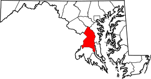
 Location of Brandywine, Maryland | |
| Coordinates: 38°41′55″N 76°50′57″W / 38.69861°N 76.84917°WCoordinates: 38°41′55″N 76°50′57″W / 38.69861°N 76.84917°W | |
| Country |
|
| State |
|
| County |
|
| Area | |
| • Total | 21.1 sq mi (54.7 km2) |
| • Land | 21.0 sq mi (54.4 km2) |
| • Water | 0.1 sq mi (0.3 km2) |
| Elevation | 220 ft (67 m) |
| Population (2010) | |
| • Total | 6,719 |
| • Density | 320/sq mi (120/km2) |
| Time zone | Eastern (EST) (UTC-5) |
| • Summer (DST) | EDT (UTC-4) |
| ZIP code | 20613 |
| Area code(s) | 301 |
| FIPS code | 24-09325 |
| GNIS feature ID | 0597115 |
Brandywine is the name of an unincorporated area in Prince George's County, Maryland, United States, that refers both to a census-designated place (CDP) and a zip code area which is much larger (20613), whose areas overlap.[1] The population of Brandywine at the 2010 U.S. Census was 6,719 for the CDP,[2] and the population of ZIP code 20613 was 11,860 in 2010.[3]
Geography
The CDP and town are adjacent to the southern border of Prince George's County, lying east and west of busy Maryland Route 5/U.S. Route 301, which merge at Brandywine. Brandywine CDP is bordered by Accokeek to the west, Clinton and Rosaryville to the north, Croom to the northeast, and Cedarville to the southeast, all in Prince George's County. Waldorf in Charles County borders Brandywine to the south. The Brandywine zip code area encompasses parts of both counties and includes Cedarville and Baden.
Designated as part of the Prince George's County rural tier,[4] it is primarily rural with a suburban and commercial center.
Demographics
As of the census[5] of 2000, there were 1,410 people, 478 households, and 377 families residing in the CDP. The population density was 320.4 people per square mile (123.7/km2). There were 501 housing units at an average density of 113.8/sq mi (44.0/km2). The racial makeup of the CDP was 56.24% White, 38.23% African American, 1.13% Native American, 1.13% Asian, 0.07% Pacific Islander, 0.57% from other races, and 2.62% from two or more races. Hispanic or Latino of any race were 0.71% of the population.
There were 478 households out of which 34.9% had children under the age of 18 living with them, 60.9% were married couples living together, 12.3% had a female householder with no husband present, and 21.1% were non-families. 16.3% of all households were made up of individuals and 6.7% had someone living alone who was 65 years of age or older. The average household size was 2.95 and the average family size was 3.29.
In the CDP the population was spread out with 25.7% under the age of 18, 6.6% from 18 to 24, 30.7% from 25 to 44, 25.7% from 45 to 64, and 11.3% who were 65 years of age or older. The median age was 39 years. For every 100 females there were 90.8 males. For every 100 females age 18 and over, there were 86.1 males.
The median income for a household in the CDP was $57,063, and the median income for a family was $64,038. Males had a median income of $41,783 versus $35,242 for females. The per capita income for the CDP was $19,035. About 8.6% of families and 10.1% of the population were below the poverty line, including 8.3% of those under age 18 and 17.0% of those age 65 or over.
History
William H. Early named the town of Brandywine as property he owned in the mid-19th century. The CDP consists of the property he owned in the 19th century. It is thought to be named after the Battle of Brandywine of the American Revolutionary War. Brandywine was developed on the Baltimore and Potomac Railroad's Pope Creek (Southern Maryland) line in about 1873 and was the only town on the route that developed into a railroad town.[6]
On September 1, 1877, around 4 p.m., a small 2.7 magnitude earthquake struck Brandywine.[7]
In 1912, the Bank of Brandywine was chartered from what had previously been the Southern Maryland German-American Bank.[8][9]
Historic sites
The following is a list of historic sites in Brandywine, which includes Baden and T.B. identified by the Maryland-National Capital Park and Planning Commission, none of which are currently museums:[10][11]
| Site Name | Image | Location | M-NCPPC Inventory Number | Comment | |
|---|---|---|---|---|---|
| 1 | Black Swamp School |  |
19011 Croom Road | 87A-057 | Designated in 2009; Officially 1899 "Colored School No. 2, District 8" in Horsehead |
| 2 | Black Walnut Thicket |  |
15508 Letcher Road East | 86B-010 | Located at Baden; 1856 plantation house, extensively altered in 1930s |
| 3 | Chapel of the Incarnation |  |
14070 Brandywine Road | 85A-032-27 | Listed on the National Register of Historic Places, 2000-12-13 |
| 4 | Charles S. Early House |  |
14280 Brandywine Road | 85B-010 | 1870, 2-story, gable roof farmhouse |
| 5 | William W. Early House |  |
13907 Cherry Tree Crossing Road | 85A-032-09 | Listed on the National Register of Historic Places, as of 1988-06-30; privately owned |
| 6 | Gibbons Methodist Episcopal Church Site and Educational Building | 14107 Gibbons Church Road | 86B-1 | ||
| 7 | Gwynn Park Manor | 7911 Dyson Road | 85A-013 | Located at T.B. | |
| 8 | Kalmia (Kalaird) | 15110 Nelson Perrie Road | 86B-009 | Located at Baden | |
| 9 | Marlow-Huntt Store and Casket Shop | 13700 and 13702 Old Brandywine Road | 85A-033-14 | Located at T.B. | |
| 10 | Old Bank of Brandywine | 14110 Brandywine Road | 85A-032-30 | ||
| 11 | Poplar Hill School | 19104 Croom Road | 87A-12 | Located at Baden | |
| 12 | Rosemount (Skinner-Martin House) | 13201 Martin Road | 86B-002 | ||
| 13 | St. Paul's Parish Church |  |
SE of Brandywine off MD 381 | 86B-014 | Located at Baden. Listed on the National Register of Historic Places, 1977-09-15 |
| 14 | St. Thomas Methodist Episcopal Church | 18810 Aquasco Road | 87A-10 | Located at Baden | |
| 15 | T.B. School | 14000 Crain Highway | 85A-26 | ||
| 15 | United-Bethel African Methodist Episcopal Church | 6810 Floral Park Road | 85A-018 | ||
| 17 | William H. Townshend House | 12804 Windbrook Drive | 81B-007 | ||
| 18 | Sasscer Tobacco Barn | 13400 Molly Berry Road | 86B-038 |
Enterprises and recreation
The Brandywine community includes Gwynn Park High School, a golf course, several well-known automobile salvage lots, and a construction equipment sales lot. A large commercial center was created with the development of Brandywine Crossing shopping center's opening in October 2008[12] and growing to 800,000 SF with 49 commercial spaces as of 2016.[13]
Education
Elementary: Brandywine Elementary School
Middle: Gwynn Park Middle School
High: Gwynn Park High School
Notable people
- Donnie Neuenberger, NASCAR driver[14]
- People from Brandywine
References
- ↑ "Brandywine, Maryland 20613".
- ↑ "Profile of General Population and Housing Characteristics: 2010 Demographic Profile Data (DP-1): Brandywine CDP, Maryland". U.S. Census Bureau, American Factfinder. Archived from the original on September 11, 2013. Retrieved December 15, 2011.
- ↑ "Profile of General Population and Housing Characteristics: 2010 Demographic Profile Data (DP-1): District 11, Brandywine: Prince George's County, Maryland". U.S. Census Bureau, American Factfinder. Retrieved January 31, 2016.
- ↑ "Submittal to the Maryland Department of Planning Regarding Conformance with SB 236" (PDF). Prince George's County, Maryland. January 22, 2013. p. 7. Retrieved September 13, 2013.
- ↑ "American FactFinder". United States Census Bureau. Archived from the original on 2013-09-11. Retrieved 2008-01-31.
- ↑ "Prince George's County Tricentennial". Prince George's County Historical Society.
- ↑ "Maryland Geological Survey: Earthquakes in Maryland". Maryland Department of Natural Resources.
- ↑ Maryland Bank Commissioner (1913). Annual Report of the Bank Commissioner of the State of Maryland, Volumes 3-9. Baltimore: Sun Book and Job Printing Office Incorporated. p. 5.
- ↑ "The Bank of Brandywine". BankEncyclopedia.com. Retrieved 19 February 2013.
- ↑ M-NCPPC Illustrated Inventory of Historic Sites (Prince George's County, Maryland), 2006.
- ↑ M-NCPPC African-American Heritage Survey, October 1996: Other Historic Properties (Prince George's County, Maryland), 1996.
- ↑ Washington Post, September 28, 2009, Where Retail Is Thriving in a Down Economy
- ↑ Brandywine MD: Brandywine Crossing - Retail Space For Lease - KLNB Retail
- ↑ Donnie Neuenberger Career Statistics