Forestville, Maryland
| Forestville, Maryland | |
|---|---|
| CDP | |
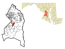 Location of Forestville, Maryland | |
| Coordinates: 38°51′18″N 76°52′31″W / 38.85500°N 76.87528°WCoordinates: 38°51′18″N 76°52′31″W / 38.85500°N 76.87528°W | |
| Country |
|
| State |
|
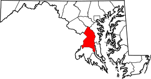
| County |
|
| Area | |
| • Total | 4.0 sq mi (10.4 km2) |
| • Land | 4.0 sq mi (10.4 km2) |
| • Water | 0.0 sq mi (0.0 km2) |
| Elevation | 279 ft (85 m) |
| Population (2010) | |
| • Total | 12,353 |
| • Density | 3,100/sq mi (1,200/km2) |
| Time zone | Eastern (EST) (UTC-5) |
| • Summer (DST) | EDT (UTC-4) |
| ZIP codes | 20747, 20753 |
| Area code(s) | 301 |
| FIPS code | 24-29000 |
| GNIS feature ID | 0597413 |
Forestville is an unincorporated area and census-designated place (CDP) in Prince George's County, Maryland, United States.[1] The population was 12,353 at the 2010 census.[2] The community is a mixture of garden apartments, single-family homes, and shopping centers built mostly from the 1930s through 1970s, adjacent to the incorporated town of District Heights, and has a majority African-American population. It is convenient to the Capital Beltway (I-95/I-495), Maryland Route 4 (which has department stores and shopping centers), and for employees of Andrews Air Force Base and the U.S. Census Bureau. It is a few miles from Metrorail's Blue and Green lines. Residents may attend Mount Calvary Catholic School, Forestville, Suitland, or Bishop McNamara High Schools. A notable former resident was Steny Hoyer, now Democratic Leader of the United States House of Representatives.
Geography
Forestville is located at 38°51′18″N 76°52′31″W / 38.854912°N 76.875189°W.[3] According to the United States Census Bureau, the CDP has a total area of 4.0 square miles (10 km2), all of it land.
Demographics
As of the census[4] of 2000, there were 12,707 people, 4,642 households, and 3,267 families residing in the CDP. The population density was 3,169.5 people per square mile (1,223.5/km²). There were 4,951 housing units at an average density of 1,234.9/sq mi (476.7/km²). The racial makeup of the CDP was 10.54% White, 85.78% African American, 0.29% Native American, 0.92% Asian, 0.06% Pacific Islander, 0.61% from other races, and 1.81% from two or more races. Hispanic or Latino of any race were 1.31% of the population.
There were 4,642 households out of which 36.1% had children under the age of 18 living with them, 38.2% were married couples living together, 26.7% had a female householder with no husband present, and 29.6% were non-families. 24.7% of all households were made up of individuals and 4.8% had someone living alone who was 65 years of age or older. The average household size was 2.71 and the average family size was 3.22. In the CDP the population was spread out with 28.2% under the age of 18, 7.7% from 18 to 24, 32.2% from 25 to 44, 23.7% from 45 to 64, and 8.2% who were 65 years of age or older. The median age was 35 years. For every 100 females there were 83.5 males. For every 100 females age 18 and over, there were 78.0 males. The median income for a household in the CDP was $51,831, and the median income for a family was $57,096. Males had a median income of $37,739 versus $34,796 for females. The per capita income for the CDP was $22,205. About 4.7% of families and 5.8% of the population were below the poverty line, including 6.7% of those under age 18 and 5.8% of those age 65 or over.
Notable people
- Tray Chaney - actor
- Kevin Dorsey - NFL Wide Receiver Green Bay Packers
- Kevin Durant - NBA player OKC Thunder
- Ginuwine - singer
- Jeff Kinney - game designer and author of Diary of a Wimpy Kid, grew up here
- Kellie Shanygne Williams - Actress
References
- ↑ U.S. Geological Survey Geographic Names Information System: Forestville, Maryland
- ↑ "Profile of General Population and Housing Characteristics: 2010 Demographic Profile Data (DP-1): Forestville CDP, Maryland". U.S. Census Bureau, American Factfinder. Retrieved December 19, 2011.
- ↑ "US Gazetteer files: 2010, 2000, and 1990". United States Census Bureau. 2011-02-12. Retrieved 2011-04-23.
- ↑ "American FactFinder". United States Census Bureau. Retrieved 2008-01-31.