Westphalia, Maryland
| Westphalia, Maryland | |
|---|---|
| Census-designated place | |
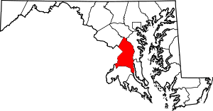
 Westphalia, Maryland  Westphalia, Maryland Location within the state of Maryland | |
| Coordinates: 38°50′24″N 76°49′26″W / 38.84000°N 76.82389°WCoordinates: 38°50′24″N 76°49′26″W / 38.84000°N 76.82389°W | |
| Country |
|
| State |
|
| County |
|
| Area | |
| • Total | 13.3 sq mi (34.4 km2) |
| • Land | 13.3 sq mi (34.4 km2) |
| • Water | 0.03 sq mi (0.07 km2) |
| Elevation | 180 ft (50 m) |
| Population (2010) | |
| • Total | 7,266 |
| • Density | 550/sq mi (210/km2) |
| Time zone | Eastern (EST) (UTC-5) |
| • Summer (DST) | EDT (UTC-4) |
| Area code(s) | 301 |
Westphalia is a census-designated place in southern Prince George's County, Maryland, in the United States. The population of the CDP was 7,266 at the 2010 census.[1]
Geography
According to the U.S. Census Bureau, Westphalia has a total area of 13.3 square miles (34.4 km2), of which 0.03 square miles (0.07 km2), or 0.20%, is water.[2] The CDP is bordered to the west by the Capital Beltway (I-495/95) and to the south by Maryland Route 4. The CDP of Largo borders Westphalia to the north, Brock Hall is to the northeast, Marlboro Village is to the east, Queenland, Rosaryville and Melwood are to the south, Andrews Air Force Base is to the southwest, and Forestville is to the west.
Planning issues
On February 6, 2007, the Prince George's County Council approved the Westphalia Sector Plan and Sectional Map Amendment.[3] This document established a planning concept for the Westphalia area and rezoned specified properties.[4] This concept is envisions a "high-density, transit- and pedestrian-oriented urban town center" surrounded by three village centers and multiple residential modules. Buildout is proposed to include 14,000 - 15,300 new residential units, 4.5 million square feet of commercial space, and 750,000 square feet of retail space. A 150-acre Central Park is proposed immediately north of the Town Center, approximately at the center of the Westphalia area.[4]
References
- ↑ "Profile of General Population and Housing Characteristics: 2010 Demographic Profile Data (DP-1): Westphalia CDP, Maryland". U.S. Census Bureau, American Factfinder. Retrieved December 23, 2011.
- ↑ "Geographic Identifiers: 2010 Demographic Profile Data (G001): Westphalia CDP, Maryland". U.S. Census Bureau, American Factfinder. Retrieved December 16, 2011.
- ↑ "Prince George's County Council Resolution CR-2-2007" (PDF). Retrieved 16 March 2012.
- 1 2 Prince George's County Planning Department (2007). Approved Westphalia Sector Plan and Sectional Map Amendment. Upper Marlboro, MD: The Maryland-National Capital Park and Planning Commission. p. 148.