Summerfield, Maryland
| Summerfield, Maryland | |
|---|---|
| Census-designated place | |
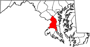
 Summerfield  Summerfield Location within the state of Maryland | |
| Coordinates: 38°54′N 76°52′W / 38.900°N 76.867°WCoordinates: 38°54′N 76°52′W / 38.900°N 76.867°W | |
| Country |
|
| State |
|
| County |
|
| Area | |
| • Total | 3.6 sq mi (9.4 km2) |
| • Land | 3.6 sq mi (9.4 km2) |
| • Water | 0.0 sq mi (0.0 km2) |
| Elevation | 240 ft (70 m) |
| Population (2010) | |
| • Total | 10,898 |
| • Density | 3,000/sq mi (1,200/km2) |
| Time zone | Eastern (EST) (UTC-5) |
| • Summer (DST) | EDT (UTC-4) |
| Area code(s) | 301 |
Summerfield is a census-designated place near Landover in Prince George's County, Maryland, in the United States. The population of the CDP was 10,898 at the 2010 census.[1] It is a suburb of Washington, D.C.
Geography
According to the U.S. Census Bureau, Summerfield has a total area of 3.6 square miles (9.4 km2), of which 0.012 square miles (0.03 km2), or 0.03%, is water.[2] The CDP is bordered to the east by the Capital Beltway (I-495/95) and to the south by Maryland Route 214 (Central Avenue). The CDP of Landover borders Summerfield to the north, the city of Glenarden is to the northeast, Lake Arbor is to the east, Largo is to the southeast, Walker Mill is to the southwest, and Peppermill Village and Seat Pleasant border Summerfield to the west.
References
- ↑ "Profile of General Population and Housing Characteristics: 2010 Demographic Profile Data (DP-1): Summerfield CDP, Maryland". U.S. Census Bureau, American Factfinder. Retrieved December 23, 2011.
- ↑ "Geographic Identifiers: 2010 Demographic Profile Data (G001): Summerfield CDP, Maryland". U.S. Census Bureau, American Factfinder. Retrieved December 16, 2011.