Forest Heights, Maryland
| Forest Heights, Maryland | |
|---|---|
| Town | |
| Town of Forest Heights | |
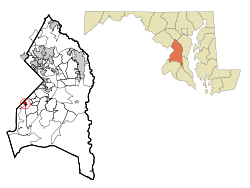 Location of Forest Heights, Maryland | |
| Coordinates: 38°48′43″N 76°59′49″W / 38.81194°N 76.99694°WCoordinates: 38°48′43″N 76°59′49″W / 38.81194°N 76.99694°W | |
| Country |
|
| State |
|
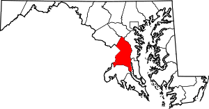
| County |
|
| Area[1] | |
| • Total | 0.48 sq mi (1.24 km2) |
| • Land | 0.48 sq mi (1.24 km2) |
| • Water | 0 sq mi (0 km2) |
| Elevation | 161 ft (49 m) |
| Population (2010)[2] | |
| • Total | 2,447 |
| • Estimate (2013[3]) | 2,517 |
| • Density | 5,097.9/sq mi (1,968.3/km2) |
| Time zone | Eastern (EST) (UTC-5) |
| • Summer (DST) | EDT (UTC-4) |
| ZIP code | 20745 |
| Area code(s) | 301 |
| FIPS code | 24-28725 |
| GNIS feature ID | 0597408 |
Forest Heights is a town in Prince George's County, Maryland, United States, and part of the larger postal designation Oxon Hill, Maryland.[4] Students attend Oxon Hill High School. The town straddles both sides of dual-lane Maryland Route 210 and includes two elementary schools. The population was 2,447 at the 2010 census.[5]
History
A few homes (such as on Huron Drive) were built in the 1930s, but most of the town developed in the 1940s and early 1950s, consisting of single-family homes with some streets of duplex homes; the Talbert Drive homes were added in the 1960s. In those days many town residents were scientists (as Mayor Armhold was) at the adjacent U.S. Naval Research Laboratory, while others were military band musicians or other Federal employees. The town's population was approximately 3,600 in 1960, almost 50% more than the 2010 population of 2,447, perhaps due to households having more children in 1960.
Two especially long-serving mayors were Clifford Armhold and Warren F. Adams.
After decades of former governmental stability, in the 2000s the town made headlines repeatedly as two of its recent mayors were embroiled in clashes with the town council.[6] One mayor, Joyce Beck, was ousted from office after changes to the Town Charter.[6] In June 2009 her successor, Myles Spires, filed a $15 million lawsuit against the town for malicious prosecution after being cleared of all charges initiated by the town for misuse of town's funds.[7]
Geography
Forest Heights is located at 38°48′43″N 76°59′49″W / 38.81194°N 76.99694°W (38.811863, -76.996809).[8] According to the United States Census Bureau, the town has a total area of 0.48 square miles (1.24 km2), all of it land.[1]
The Capital Beltway (I-95/495), which was opened in the early 1960s and which includes the Woodrow Wilson Bridge that connects Oxon Hill to Alexandria, Virginia, is directly south of the town. Forest Heights is bordered on the north by the Eastover Shopping Center. Several miles of less affluent areas within the District of Columbia (see Anacostia, Washington Highlands, and Bellevue) also lie to the north of it. Forest Heights has its own town police force, in addition to a Prince George's County police station right at the town limits in the aforementioned Eastover Shopping Center. Rivertowne Shopping Center with a K-Mart and a Home Depot, and a very large, modern public library, are both just one to two miles from Forest Heights. Forest Heights is bordered on the south by the large new National Harbor conference center and resort, which opened its first phase in April 2008.
Bordering areas
- National Harbor (southwest)
- Oxon Hill (southeast)
- Glassmanor (northeast)
- Bellevue, Congress Heights and Anacostia neighborhoods of Washington, D.C. (north)
Demographics
| Historical population | |||
|---|---|---|---|
| Census | Pop. | %± | |
| 1950 | 1,125 | — | |
| 1960 | 3,524 | 213.2% | |
| 1970 | 3,497 | −0.8% | |
| 1980 | 2,999 | −14.2% | |
| 1990 | 2,859 | −4.7% | |
| 2000 | 2,585 | −9.6% | |
| 2010 | 2,447 | −5.3% | |
| Est. 2015 | 2,573 | [9] | 5.1% |
2010 census
As of the census[2] of 2010, there were 2,447 people, 868 households, and 619 families residing in the town. The population density was 5,097.9 inhabitants per square mile (1,968.3/km2). There were 927 housing units at an average density of 1,931.3 per square mile (745.7/km2). The racial makeup of the town was 11.9% White, 75.4% African American, 0.3% Native American, 3.9% Asian, 0.1% Pacific Islander, 5.8% from other races, and 2.6% from two or more races. Hispanic or Latino of any race were 11.3% of the population.
There were 868 households of which 31.3% had children under the age of 18 living with them, 39.3% were married couples living together, 24.4% had a female householder with no husband present, 7.6% had a male householder with no wife present, and 28.7% were non-families. 22.7% of all households were made up of individuals and 7.1% had someone living alone who was 65 years of age or older. The average household size was 2.82 and the average family size was 3.26.
The median age in the town was 41.1 years. 20.8% of residents were under the age of 18; 9.9% were between the ages of 18 and 24; 24.6% were from 25 to 44; 31.4% were from 45 to 64; and 13.4% were 65 years of age or older. The gender makeup of the town was 47.9% male and 52.1% female.
2000 census
As of the census[11] of 2000, there were 2,585 people, 897 households, and 670 families residing in the town. The population density was 5,398.2 people per square mile (2,079.3/km²). There were 945 housing units at an average density of 1,973.4 per square mile (760.1/km²). The racial makeup of the town was 13.38% White, 79.11% African American, 0.12% Native American, 3.37% Asian, 0.35% Pacific Islander, 1.74% from other races, and 1.93% from two or more races. Hispanic or Latino of any race were 2.94% of the population.
There were 897 households out of which 31.1% had children under the age of 18 living with them, 45.6% were married couples living together, 23.4% had a female householder with no husband present, and 25.3% were non-families. 19.8% of all households were made up of individuals and 5.5% had someone living alone who was 65 years of age or older. The average household size was 2.88 and the average family size was 3.34.
In the town the population was spread out with 27.3% under the age of 18, 7.4% from 18 to 24, 25.9% from 25 to 44, 28.6% from 45 to 64, and 10.8% who were 65 years of age or older. The median age was 38 years. For every 100 females there were 88.8 males. For every 100 females age 18 and over, there were 82.5 males.
The median income for a household in the town was $57,697, and the median income for a family was $60,313. Males had a median income of $35,705 versus $35,273 for females. The per capita income for the town was $21,556. About 2.8% of families and 3.3% of the population were below the poverty line, including 5.4% of those under age 18 and none of those age 65 or over.
Public safety
The town is served by its own Forest Heights Police Department, which maintains primary responsibility for the response to and prevention and investigation of the majority of all crimes within the corporate limits.[12] Under a memorandum of understanding, the Prince George's County Police Department serves as the secondary responding law enforcement agency for the town, and the primary investigating agency for most serious crimes, such as homicide or rape. Since 2007 the acting Chief of Police has been Lieutenant Frank Webb.
The County Police Department maintains its District IV station just outside Forest Height's northern border at Eastover Shopping Center. Fire and rescue services are provided by Prince George's County Fire Department from neighboring Company 42 and Company 21, both in Oxon Hill.
References
- 1 2 "US Gazetteer files 2010". United States Census Bureau. Retrieved 2013-01-25.
- 1 2 "American FactFinder". United States Census Bureau. Retrieved 2013-01-25.
- ↑ "American FactFinder". United States Census Bureau. Retrieved 2014-11-23.
- ↑ U.S. Geological Survey Geographic Names Information System: Forest Heights, Maryland
- ↑ "Profile of General Population and Housing Characteristics: 2010 Demographic Profile Data (DP-1): Forest Heights town, Maryland". U.S. Census Bureau, American Factfinder. Retrieved December 13, 2011.
- 1 2 http://www.gazette.net/stories/04012009/fortnew182156_32508.shtml
- ↑ http://www.gazette.net/stories/06042009/fortnew185129_32543.shtml
- ↑ "US Gazetteer files: 2010, 2000, and 1990". United States Census Bureau. 2011-02-12. Retrieved 2011-04-23.
- ↑ "Annual Estimates of the Resident Population for Incorporated Places: April 1, 2010 to July 1, 2015". Retrieved July 2, 2016.
- ↑ "Census of Population and Housing". Census.gov. Retrieved June 4, 2015.
- ↑ "American FactFinder". United States Census Bureau. Retrieved 2008-01-31.
- ↑ Forest Heights Police Department
External links
- Town of Forest Heights official website
- Maryland State Archives site for Forest Heights
- Forest Heights Newsletter