Fort Washington, Maryland
| Fort Washington, Maryland | |
|---|---|
| Census-designated place | |
|
A view of the main gate of Fort Washington Park from a nearby hill, in October 2004. | |
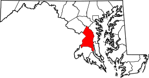
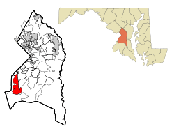 Location of Fort Washington, Maryland | |
| Coordinates: 38°44′37″N 77°0′37″W / 38.74361°N 77.01028°WCoordinates: 38°44′37″N 77°0′37″W / 38.74361°N 77.01028°W | |
| Country |
|
| State |
|
| County |
|
| Area | |
| • Total | 16.6 sq mi (42.9 km2) |
| • Land | 13.8 sq mi (35.7 km2) |
| • Water | 2.8 sq mi (7.2 km2) |
| Elevation | 105 ft (32 m) |
| Population (2010) | |
| • Total | 23,717 |
| • Density | 1,400/sq mi (550/km2) |
| Time zone | Eastern (EST) (UTC-5) |
| • Summer (DST) | EDT (UTC-4) |
| ZIP codes | 20744, 20749 |
| Area code(s) | 301 |
| FIPS code | 24-29525 |
| GNIS feature ID | 0598313 |


Fort Washington is an unincorporated area and census-designated place in Prince George's County, Maryland. It borders the capital of the United States of America, Washington, D.C., situated just south of the downtown district.[2] It is a prosperous community with an African American majority population. As of the 2010 census it had a population of 23,717.[3] The Fort Washington community is located west of Maryland Route 210, with some additional area to the east of the highway.
History
The Fort

The community is named for Fort Washington, which upon its completion in 1809 was the only defensive fort protecting Washington, D.C. The fort is a stone structure and offered a good field of range for cannon fire at enemy advances on the Potomac River. During the War of 1812, the fort was quickly abandoned during a British advance. In 1844, a cannon exploded on the USS Princeton as it was passing Fort Washington.[4] During World War II, the US Army's Adjutant General's School was located at the fort, and had billeting for 362 officers and 2,526 enlisted persons.[5]
The site is now part of a very extensive park with views of the Potomac River and hiking paths. It is a scenic place for picnicking, fishing and outdoor recreation. (Admission is free to people entering after business hours and before sunset.)
War of 1812
During the War of 1812 Fort Washington, built to protect the capital from enemy advances on the Potomac River, was captured by the British under the command of Admiral Gordon, three days after the burning of the capital.[6]
Civil War
Upon the outbreak of the American Civil War, fearing for the safety of Washington in case of attack, Secretary of the Navy Isaac Toucey ordered a detachment of US Marines to garrison the fort.
In May 1865 Secretary of the Navy Gideon Welles ordered the Potomac Flotilla reduced to half strength due to cessation of hostilities. This included the removal of the Marines from Fort Washington.[7]
Twentieth century to present
Near the fort are many riverfront homes, two marinas, two community pools, and National Golf Club. The area was rural until about 1960 when suburban growth began and is continuing to grow, adding new, large family homes in small developments next to older existing developments. Until the founding of the Oxon Hill post office about 1960, the Fort Washington area generally used the mailing address Washington, D.C., except for the few years that Friendly had a post office. About 1980 the postal service split the Fort Washington area from Oxon Hill, defining it as a separate town name. At that time, to make mail sorting easier, they drew the boundary between the two communities to conform to already existing zip code boundaries. The end result sometimes confuses people, since the northern end of the Fort Washington postal area (near the Beltway) identifies more with the communities Oxon Hill or Temple Hills / Camp Springs but still uses a Fort Washington mailing address.
Geography
Fort Washington is located at 38°44′37″N 77°0′37″W / 38.74361°N 77.01028°W (38.743481, -77.010383).[8]
According to the United States Census Bureau, the CDP has a total area of 16.57 square miles (42.9 km2), of which 13.79 square miles (35.7 km2) is land and 2.78 square miles (7.2 km2), or 16.8%, is water.[9]
First-time visitors are often confused by the several "Livingston Roads" which repeatedly crosses Route 210, as well as by the two separate "Old Fort Roads", causing them to make wrong turns off of Maryland Route 210. Eventually all roads intersecting Route 210 in the Fort Washington area (from the Beltway as far south as the highway 210 curve at Piscataway Creek) are planned for upgrading to controlled-access interchanges (eliminating all traffic signals) gradually during the 2020s decade.
The fort’s land originally included 347 acres, which was last surveyed in June 1944.[5]
Community institutions
The Maryland-National Capital Park and Planning Commission (M-NCPPC) maintains the Harmony Hall Regional Center , including the John Addison Concert Hall, site of community theater ("Tantallon Community Players"), art shows, frequent concerts, and a variety of classes for all ages. A YMCA fitness center opened in 2005, and a community center facility in 2013 in Fort Washington Forest. The 12,000-member Ebenezer A.M.E. Church is noteworthy, as is a large nursery/landscaping business and a popular motorcycle shop. There is a small 50-bed hospital (Fort Washington Hospital). Many highly successful African-Americans live in Fort Washington; there are also some Ethiopian residents and a large, long-established ethnic Filipino population.
Demographics
| Historical population | |||
|---|---|---|---|
| Census | Pop. | %± | |
| 1990 | 24,032 | — | |
| 2000 | 23,845 | −0.8% | |
| 2010 | 23,717 | −0.5% | |
| source:[10] | |||
As of the census[11] of 2010, there were 23,717 people, 8,135 households, and 6,319 families residing in the CDP. The population density was 1,719.8 people per square mile (664.3/km²). There were 8,681 housing units at an average density of 523.0 per square mile (245.1/km²). The racial makeup of the CDP was 70.6% African American,13.40% White, 9.2% Asian (mostly Filipino), 0.2% Native American, 0.00% Pacific Islander, 3.3% from other races, and 2.38% from two or more races. Hispanic or Latino of any race were 6.6% of the population.
There were 8,135 households out of which 26.5% had children under the age of 18 living with them, 57.9% were married couples living together, 14.7% had a female householder with no husband present, and 22.3% were non-families. 18.3% of all households were made up of individuals and 7.1% had someone living alone who was 65 years of age or older. The average household size was 2.89 and the average family size was 3.24.
In the CDP the population was spread out with 21.7% under the age of 18, 5.2% from 20 to 24, 21.9% from 25 to 44, 32.9% from 45 to 64, and 16.1% who were 65 years of age or older. The median age was 44.3 years. For every 100 females there were 91.6 males. For every 100 females age 18 and over, there were 89.3 males.
According to a 2007 estimate, the median income for a household in the CDP was $105,475, and the median income for a family was $111,227.[12] In 2000, males had a median income of $46,656 versus $42,450 for females. The per capita income for the CDP was $30,871. About 2.8% of families and 3.7% of the population were below the poverty line, including 5.0% of those under age 18 and 4.5% of those age 65 or over.
Notable people
- Riddick Bowe, 2 time world heavyweight boxing champion, has lived in Fort Washington for the last two decades.[13]
- Donna Edwards, U.S. Representative for Maryland's 4th congressional district
- Charles Gittens, first black United States Secret Service agent[14]
- George O. Gore II, actor previously seen on My Wife and Kids
- Joe Haden, Florida Gators cornerback and current cornerback for the Cleveland Browns; attended Friendly High School
- Steny Hoyer, Majority Leader, United States House of Representatives, at one time lived in Friendly (source: Washington Post article, 2/26/2007)
- Jarrett Jack, former Georgia Tech Yellow Jackets basketball star (2002–2005) and current point guard for the Atlanta Hawks
- Jeff Kinney (writer) writer of the Diary of a Wimpy Kid series
- Martin Lawrence, Hollywood actor, attended Friendly High School
- G. Gordon Liddy, presidential aide convicted in the Watergate scandal, author, and later talk radio host
- Senator John Melcher of Montana
- Rev. C. Anthony Muse, Maryland State Senator , pastor of Ark of Safety Church in Upper Marlboro, Maryland
- Stanley Turrentine, jazz musician, lived on Piscataway Drive
- Brian Westbrook, former Villanova football star (1997–2001) and former running back for the San Francisco 49ers and Philadelphia Eagles
- Byron Westbrook, former Salisbury University and Washington Redskins football player.
References
- ↑ Lossing, Benson (1868). The Pictorial Field-Book of the War of 1812. Harper & Brothers, Publishers. p. 939.
- ↑ U.S. Geological Survey Geographic Names Information System: Fort Washington, Maryland
- ↑ "Profile of General Population and Housing Characteristics: 2010 Demographic Profile Data (DP-1): Fort Washington CDP, Maryland". U.S. Census Bureau, American Factfinder. Retrieved December 19, 2011.
- ↑ "Fort Washington Park – Mammoth Guns". National Park Service. Retrieved 2009-02-10.
- 1 2 Stanton, Shelby L. (1984). Order Of Battle: US Army; World War II. 31 Pamaron Way; Novato, California: Presidio Press. p. 621. ISBN 0-89141-195-X.
- ↑ Roosevelt, 'The naval war of 1812:', p.319
- ↑ Toomey, Daniel Carroll (2004). The Civil War In Maryland; 11th Edition. P.O. Box 122; Linthicum, Maryland: Toomey Press. pp. 183 w/index. ISBN 0-9612670-0-3.
- ↑ "US Gazetteer files: 2010, 2000, and 1990". United States Census Bureau. 2011-02-12. Retrieved 2011-04-23.
- ↑ "Population, Housing Units, Area, and Density: 2010 - State -- Place and (in selected states) County Subdivision 2010 Census Summary File 1". U.S. Census Bureau. Retrieved 2010-10-06.
- ↑ "CENSUS OF POPULATION AND HOUSING (1790–2010)". U.S. Census Bureau. Retrieved 2010-10-06.
- ↑ "American FactFinder". United States Census Bureau. Retrieved 2008-01-31.
- ↑ American FactFinder
- ↑ Maese, Rick (2010-07-05). "Boxer Riddick Bowe's Life Since His Boxing Peak". Washington Post.
- ↑ Wilbur, Del Quentin (2011-08-10). "Charles L. Gittens, first black Secret Service agent, dies at 82". Washington Post. Retrieved 2011-08-18.