Queenland, Maryland
| Queenland, Maryland | |
|---|---|
| Census-designated place | |
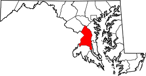
 Queenland, Maryland  Queenland, Maryland Location within the state of Maryland | |
| Coordinates: 38°48′18″N 76°47′28″W / 38.80500°N 76.79111°WCoordinates: 38°48′18″N 76°47′28″W / 38.80500°N 76.79111°W | |
| Country |
|
| State |
|
| County |
|
| Area | |
| • Total | 4.9 sq mi (12.6 km2) |
| • Land | 4.9 sq mi (12.6 km2) |
| • Water | 0.0 sq mi (0.0 km2) |
| Elevation | 120 ft (40 m) |
| Population (2010) | |
| • Total | 1,929 |
| • Density | 400/sq mi (150/km2) |
| Time zone | Eastern (EST) (UTC-5) |
| • Summer (DST) | EDT (UTC-4) |
| Area code(s) | 301 |
Queenland is a census-designated place near Upper Marlboro in Prince George's County, Maryland, in the United States. The population of the CDP was 1,929 at the 2010 census.[1]
Geography
According to the U.S. Census Bureau, Queenland has a total area of 4.9 square miles (12.6 km2), of which 0.012 square miles (0.03 km2), or 0.26%, is water.[2] The CDP is bordered to
north by Maryland Route 4, to the south and east by U.S. Route 301, and to the west by Marlboro Pike and South Osborne Road. The CDPs of Westphalia and Marlboro Village border Queenland to the north, Croom is to the southeast, Marlton is to the south, and Rosaryville is to the southwest.
References
- ↑ "Profile of General Population and Housing Characteristics: 2010 Demographic Profile Data (DP-1): Queenland CDP, Maryland". U.S. Census Bureau, American Factfinder. Archived from the original on September 11, 2013. Retrieved December 23, 2011.
- ↑ "Geographic Identifiers: 2010 Demographic Profile Data (G001): Queenland CDP, Maryland". U.S. Census Bureau, American Factfinder. Archived from the original on September 11, 2013. Retrieved December 16, 2011.
This article is issued from Wikipedia - version of the 10/29/2016. The text is available under the Creative Commons Attribution/Share Alike but additional terms may apply for the media files.