Camp Springs, Maryland
| Camp Springs, Maryland | |
|---|---|
| Census-designated place | |
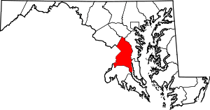
 Location of Camp Springs, Maryland | |
| Coordinates: 38°48′27″N 76°55′5″W / 38.80750°N 76.91806°WCoordinates: 38°48′27″N 76°55′5″W / 38.80750°N 76.91806°W | |
| Country |
|
| State |
|
| County |
|
| Area | |
| • Total | 7.7 sq mi (20.0 km2) |
| • Land | 7.7 sq mi (19.9 km2) |
| • Water | 0.02 sq mi (0.04 km2) |
| Elevation | 266 ft (81 m) |
| Population (2010) | |
| • Total | 19,096 |
| • Density | 2,500/sq mi (950/km2) |
| Time zone | Eastern (EST) (UTC-5) |
| • Summer (DST) | EDT (UTC-4) |
| ZIP codes | 20746, 20748 |
| Area code(s) | 301 |
| FIPS code | 24-12600 |
| GNIS feature ID | 0597172 |
Camp Springs is an unincorporated area and census-designated place (CDP) in Prince George's County, Maryland, United States.[1] The population was 19,096 at the 2010 census.[2] Camp Springs is not an official post office designation; the area is divided between the surrounding mailing addresses of Temple Hills, Fort Washington, Clinton, and Suitland. It includes the unincorporated area of Andrews Manor, Maryland.
History
The community of Camp Springs was settled in the mid-19th century at the crossroads of present-day Branch Avenue and Allentown Road. By 1860, the settlement contained several stores, a blacksmith shop, a school, Methodist church, and several residences. Early maps record the name of this settlement as Allentown, after the Allen family. The Allens were large landholders in the area, and the town, adjacent road, and Allenwood Elementary School were named in recognition of them. The town's popular name, and subsequently the name of its post office, was Camp Springs. According to local history, the community was called Camp Springs since soldiers en route to Fort Meade from the District of Columbia found the area to be a comfortable place to camp due to the abundant springs.
Throughout the late- 19th and early 20th centuries, the Camp Springs area did not experience significant growth. However, the opening of Andrews AFB on an adjacent tract of land, the proximity of the area to the District of Columbia, and a housing shortage after World War II made the Camp Springs area an ideal location for residential development.[3][4]
Most of the development in the Camp Springs area occurred north of the Camp Springs crossroads in the 1940s and 1950s. The lack of water and sewer lines in most locations until the late 1950s and early 1960s kept the pace of development slow. The largest development in the 1940s was the subdivision of the Middleton farm north of Camp Springs. This farm was platted into Glenn Hills, Middleton Farm, and Middleton Valley. Guy Trueman built one of his many subdivisions in the mid-1940s by platting Trueman Heights on over 100 acres (0.40 km2) in the northwest quadrant of the Camp Springs crossroads. Modest single-family houses were constructed along a fragmented grid of streets. Residential development during the 1950s primarily took the form of infill construction within subdivisions platted in the 1940s. One of the exceptions is the large Westchester Estates development located in the southwest quadrant of the Camp Springs crossroads. The over 400 houses were constructed along a curvilinear network of streets. Commercial development, consisting of shopping centers, restaurants, and hotels, extends along Allentown Road east of Branch Avenue. The largest boom of construction occurred in the 1960s and 1970s after the completion of water and sewer lines and the construction of the Capital Beltway. Pyles Lumber Company, a historic lumber business at the crossroads, was destroyed by fire on December 27, 2000.[5] The 19th century crossroads vanished during the 20th century with the reconstruction of Branch Avenue into a limited-access divided highway, and extensive commercial and residential development.[3]
Geography
Camp Springs is located at 38°48′27″N 76°55′05″W / 38.807463°N 76.918028°W.[6] According to the United States Census Bureau, the CDP has a total area of 7.7 square miles (20.0 km2), of which 0.02 square miles (0.04 km2), or 0.19%, is water.[7]
Joint Base Andrews, home base of the Air Force Systems Command and the official presidential airplane Air Force One, is adjacent to Camp Springs, and the base in particular, along with federal jobs in Washington, D.C., were major reasons for the community's original development. The Capital Beltway passes through the area, and the Washington Metro Branch Avenue station, southern terminus of the Green Line, is located nearby. The Maryland-National Capital Park and Planning Commission operates a year-round indoor and outdoor public swimming pool on Allentown Road. The Camp Springs Senior Activity Center[8] is housed in the former Camp Springs Elementary School. From the Heart Church Ministries has an average weekly attendance of 7,000 worshippers.
Climate
The climate in this area is characterized by hot, humid summers and generally mild to cool winters. According to the Köppen Climate Classification system, Camp Springs has a humid subtropical climate, abbreviated "Cfa" on climate maps.[9]
Demographics
| Historical population | |||
|---|---|---|---|
| Census | Pop. | %± | |
| 1970 | 22,776 | — | |
| 1980 | 16,118 | −29.2% | |
| 1990 | 16,392 | 1.7% | |
| 2000 | 17,968 | 9.6% | |
| 2010 | 19,096 | 6.3% | |
| source:[2][10] | |||
As of the census[11] of 2000, there were 17,968 people, 6,210 households, and 4,831 families residing in the CDP. The population density was 2,475.9 people per square mile (955.6/km²). There were 6,494 housing units at an average density of 894.8 per square mile (345.4/km²). The racial makeup of the CDP was 20.07% White, 74.28% African American, 0.40% Native American, 2.33% Asian, 0.07% Pacific Islander, 1.07% from other races, and 1.79% from two or more races. Hispanic or Latino of any race were 2.44% of the population.
There were 6,210 households out of which 32.4% had children under the age of 18 living with them, 54.7% were married couples living together, 17.7% had a female householder with no husband present, and 22.2% were non-families. 18.0% of all households were made up of individuals and 5.5% had someone living alone who was 65 years of age or older. The average household size was 2.89 and the average family size was 3.24.
In the CDP the population was spread out with 25.4% under the age of 18, 7.0% from 18 to 24, 27.3% from 25 to 44, 28.9% from 45 to 64, and 11.5% who were 65 years of age or older. The median age was 39 years. For every 100 females there were 92.5 males. For every 100 females age 18 and over, there were 87.6 males.
The median income for a household in the CDP was $69,371, and the median income for a family was $76,495. Males had a median income of $43,135 versus $39,736 for females. The per capita income for the CDP was $27,474. About 2.0% of families and 3.3% of the population were below the poverty line, including 3.1% of those under age 18 and 3.2% of those age 65 or over.
Education
Area residents attend Crossland High School.
References
| Wikivoyage has a travel guide for Clinton-Camp Springs. |
- ↑ U.S. Geological Survey Geographic Names Information System: Camp Springs, Maryland
- 1 2 "Profile of General Population and Housing Characteristics: 2010 Demographic Profile Data (DP-1): Camp Springs CDP, Maryland". U.S. Census Bureau, American Factfinder. Archived from the original on September 11, 2013. Retrieved December 16, 2011.
- 1 2 "Community Summary Sheet, Prince George's County" (PDF). Camp Springs, Maryland. Maryland State Highway Administration, 1999. 2008-05-10.
- ↑ The Neighborhoods of Prince George's County. Upper Marlboro: Community Renewal Program, 1974.
- ↑ http://chvfd.org/lumber1.html
- ↑ "US Gazetteer files: 2010, 2000, and 1990". United States Census Bureau. 2011-02-12. Retrieved 2011-04-23.
- ↑ "Demographic Identifiers: 2010 Demographic Profile Data (G001): Camp Springs CDP, Maryland". U.S. Census Bureau, American Factfinder. Archived from the original on September 11, 2013. Retrieved December 16, 2011.
- ↑ http://www.pgparks.com/Things_To_Do/Senior_Activities/Camp_Springs_Senior_Activity_Center.htm
- ↑ Climate Summary for Camp Springs, Maryland
- ↑ "CENSUS OF POPULATION AND HOUSING (1790-2000)". U.S. Census Bureau. Retrieved 2010-07-17.
- ↑ "American FactFinder". United States Census Bureau. Archived from the original on 2013-09-11. Retrieved 2008-01-31.