Barnesville, Minnesota
| Barnesville, Minnesota | |
|---|---|
| City | |
|
Barnesville water tower | |
 Location of Barnesville within Clay County and state of Minnesota | |
| Coordinates: 46°39′7″N 96°25′0″W / 46.65194°N 96.41667°W | |
| Country | United States |
| State | Minnesota |
| County | Clay |
| Area[1] | |
| • Total | 2.22 sq mi (5.75 km2) |
| • Land | 2.20 sq mi (5.70 km2) |
| • Water | 0.02 sq mi (0.05 km2) |
| Elevation | 1,024 ft (312 m) |
| Population (2010)[2] | |
| • Total | 2,563 |
| • Estimate (2013[3]) | 2,570 |
| • Density | 1,165.0/sq mi (449.8/km2) |
| Time zone | Central (CST) (UTC-6) |
| • Summer (DST) | CDT (UTC-5) |
| ZIP code | 56514 |
| Area code(s) | 218 |
| FIPS code | 27-03574 |
| GNIS feature ID | 0639637[4] |
| Website | barnesvillemn.com |


Barnesville is a city in Clay County, Minnesota, United States. The population was 2,563 at the 2010 census.[5] Barnesville Potato Days is held there annually in August.
Interstate 94 and Minnesota State Highways 9, 52, and 34 are four of the main routes in the city.
History
Barnesville was founded in 1874 by George S. Barnes, and named for him.[6] A post office called Barnesville has been in operation since 1877.[7] Barnesville was incorporated as a city in 1889.[6]
Geography
According to the United States Census Bureau, the city has a total area of 2.22 square miles (5.75 km2), of which 2.20 square miles (5.70 km2) is land and 0.02 square miles (0.05 km2) is water.[1]
Demographics
| Historical population | |||
|---|---|---|---|
| Census | Pop. | %± | |
| 1890 | 1,063 | — | |
| 1900 | 1,326 | 24.7% | |
| 1910 | 1,353 | 2.0% | |
| 1920 | 1,564 | 15.6% | |
| 1930 | 1,279 | −18.2% | |
| 1940 | 1,450 | 13.4% | |
| 1950 | 1,593 | 9.9% | |
| 1960 | 1,632 | 2.4% | |
| 1970 | 1,782 | 9.2% | |
| 1980 | 2,207 | 23.8% | |
| 1990 | 2,066 | −6.4% | |
| 2000 | 2,173 | 5.2% | |
| 2010 | 2,563 | 17.9% | |
| Est. 2015 | 2,577 | [8] | 0.5% |
| U.S. Decennial Census[9] 2013 Estimate[10] | |||
2010 census
As of the census[2] of 2010, there were 2,563 people, 1,013 households, and 696 families residing in the city. The population density was 1,165.0 inhabitants per square mile (449.8/km2). There were 1,095 housing units at an average density of 497.7 per square mile (192.2/km2). The racial makeup of the city was 98.3% White, 0.2% African American, 0.2% Native American, 0.2% Asian, 0.1% Pacific Islander, 0.2% from other races, and 0.8% from two or more races. Hispanic or Latino of any race were 0.7% of the population.
There were 1,013 households of which 39.9% had children under the age of 18 living with them, 53.5% were married couples living together, 10.7% had a female householder with no husband present, 4.5% had a male householder with no wife present, and 31.3% were non-families. 27.5% of all households were made up of individuals and 14% had someone living alone who was 65 years of age or older. The average household size was 2.50 and the average family size was 3.05.
The median age in the city was 36.2 years. 29.8% of residents were under the age of 18; 4.7% were between the ages of 18 and 24; 27.9% were from 25 to 44; 22.8% were from 45 to 64; and 14.8% were 65 years of age or older. The gender makeup of the city was 49.1% male and 50.9% female.
2000 census
As of the census of 2000, there were 2,173 people, 865 households, and 569 families residing in the city. The population density was 1,032.8 people per square mile (399.5/km²). There were 923 housing units at an average density of 438.7 per square mile (169.7/km²). The racial makeup of the city was 99.40% White, 0.23% Native American, 0.14% Asian, 0.05% from other races, and 0.18% from two or more races. Hispanic or Latino of any race were 0.69% of the population.
There were 865 households out of which 33.2% had children under the age of 18 living with them, 54.5% were married couples living together, 8.0% had a female householder with no husband present, and 34.2% were non-families. 31.2% of all households were made up of individuals and 17.9% had someone living alone who was 65 years of age or older. The average household size was 2.42 and the average family size was 3.05.
In the city the population was spread out with 26.6% under the age of 18, 7.3% from 18 to 24, 27.2% from 25 to 44, 19.9% from 45 to 64, and 19.1% who were 65 years of age or older. The median age was 38 years. For every 100 females there were 95.4 males. For every 100 females age 18 and over, there were 89.8 males.
The median income for a household in the city was $35,814, and the median income for a family was $44,760. Males had a median income of $35,625 versus $22,311 for females. The per capita income for the city was $18,373. About 3.4% of families and 6.7% of the population were below the poverty line, including 4.9% of those under age 18 and 16.4% of those age 65 or over.
Festivals
Barnesville Potato Days is held each year during the end of August, and draws approximately 14,000 people each year.
This top potato-growing region, the Red River Valley, touts its taters at potato-peeling and picking contests and food booths serving potato pancakes, dumplings and sausage. The festival also includes a parade, car show, and street dances. Of the many events, mashed potato wrestling is the best known and most respected. [11]
Barnesville also hosts the Clay County Fair in mid-July. The fair features rides, 4-H displays and other local attractions.[12]
Education
Barnesville is the center of I.S.D. 146. Atkinson Elementary is for students grades K–6; Barnesville High is grades 7–12. There are about 820 students in the school system, with roughly 370 students enrolled in the high school, and around 450 in the elementary. The superintendent is Scott Loeslie. Barnesville's mascots are the Lady Trojans and Trojans.
References
- 1 2 "US Gazetteer files 2010". United States Census Bureau. Archived from the original on January 24, 2012. Retrieved 2012-11-13.
- 1 2 "American FactFinder". United States Census Bureau. Retrieved 2012-11-13.
- ↑ "Population Estimates". United States Census Bureau. Retrieved 2014-06-09.
- ↑ "US Board on Geographic Names". United States Geological Survey. 2007-10-25. Retrieved 2008-01-31.
- ↑ "2010 Census Redistricting Data (Public Law 94-171) Summary File". American FactFinder. U.S. Census Bureau, 2010 Census. Archived from the original on July 21, 2011. Retrieved 23 April 2011.
- 1 2 Upham, Warren (1920). Minnesota Geographic Names: Their Origin and Historic Significance. Minnesota Historical Society. p. 115.
- ↑ "Clay County". Jim Forte Postal History. Retrieved 3 April 2015.
- ↑ "Annual Estimates of the Resident Population for Incorporated Places: April 1, 2010 to July 1, 2015". Retrieved July 2, 2016.
- ↑ United States Census Bureau. "Census of Population and Housing". Archived from the original on May 11, 2015. Retrieved September 11, 2013.
- ↑ "Annual Estimates of the Resident Population: April 1, 2010 to July 1, 2013". Retrieved June 9, 2014.
- ↑ (Barnesville Potato Days Festival
- ↑ (Clay County Fair website --Link)
External links
Municipalities and communities of Clay County, Minnesota, United States | ||
|---|---|---|
| Cities | 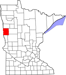 | |
| Townships | ||
| CDPs | ||
| Unincorporated communities | ||
| Ghost towns | ||
| Counties | ||
|---|---|---|
| Main cities | ||
| Surrounding areas |
| |
‡ - county seat | ||
Coordinates: 46°39′08″N 96°25′11″W / 46.65222°N 96.41972°W