Goodhue County, Minnesota
| Goodhue County, Minnesota | |
|---|---|
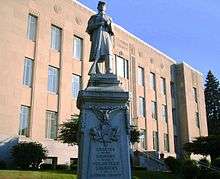 Goodhue County Courthouse in Red Wing, Minnesota | |
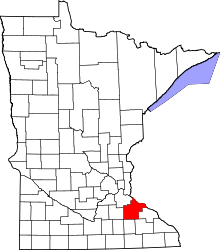 Location in the U.S. state of Minnesota | |
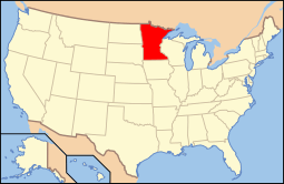 Minnesota's location in the U.S. | |
| Founded | March 5, 1853[1] |
| Named for | James Madison Goodhue,[2] the first printer-editor in Minnesota |
| Seat | Red Wing |
| Largest city | Red Wing |
| Area | |
| • Total | 780 sq mi (2,020 km2) |
| • Land | 757 sq mi (1,961 km2) |
| • Water | 24 sq mi (62 km2), 3.0% |
| Population (est.) | |
| • (2015) | 46,435 |
| • Density | 61/sq mi (24/km²) |
| Congressional district | 2nd |
| Time zone | Central: UTC-6/-5 |
| Website |
www |
Goodhue County is a county located in the U.S. state of Minnesota. As of the 2010 census, the population was 46,183.[3] Its county seat is Red Wing.[4] Nearly all of Prairie Island Indian Community is within the county.
Goodhue County comprises the Red Wing, MN Micropolitan Statistical Area and is included in the Minneapolis-St. Paul, MN-WI Combined Statistical Area.
History
The county was formed from territory within Wabasha County on March 5, 1853. County boundaries were defined in 1854 and further refined again in 1855.
Hamline University, Minnesota's first college of higher learning, was originally located in Red Wing, Minnesota. It opened its doors in 1854 but closed during the Civil War due to low enrollment. Hamline University re-opened in Saint Paul, Minnesota in 1869.
The county was a leading producer of wheat during the mid-nineteenth century, and for several years the county boasted the highest wheat production in the country, sending wheat through numerous mills in Red Wing and then transporting the grain along the Mississippi River.
The effect of fires at two of Red Wing's mills in the 1880s and developing railroad routes across Minnesota encouraged farmers from neighboring counties to begin sending their wheat to Minneapolis mills, reducing the county's importance in the wheat trade around the start of the 20th century.
The first municipal swimming pool in the state was built in the county.
In October 1960, President Dwight D. Eisenhower visited the county for a bridge dedication ceremony. The Hiawatha Bridge had been built to replace the Old High Bridge that spanned the Mississippi River since 1895. This visit drew 20,000 people. Eisenhower hoped that his visit would help in the elections, swaying Minnesota voters to vote for Richard Nixon in the 1960 presidential election in the coming month. The visit wasn't enough, however, as John F. Kennedy carried the state on his way to being elected the next president.
Geography
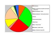
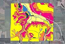
According to the U.S. Census Bureau, the county has a total area of 780 square miles (2,000 km2), of which 757 square miles (1,960 km2) is land and 24 square miles (62 km2) (3.0%) is water.[6] Goodhue is one of 17 Minnesota counties with more savanna soils than either prairie or forest soils.
Lakes
- Birch Lake: in Wacouta Township
- Brewer Lake: in Wacouta Township
- Cannon Lake: in Wacouta Township
- Clear Lake: in Welch Township
- Devils Lake: in Wacouta Township
- Espen Lakes: in Wacouta Township
- Goose Lake: in Wacouta Township
- Lake Byllesby: the northern half is in Dakota County and the southern half is in Stanton Township
- Larson Lake: in Wacouta Township
- Nelson Lake: in Wacouta Township
- North Lake: in Welch Township
- Rattling Springs Lake: in Welch Township
- Spring Banks Lake: in Welch Township
- Spring Creek Lake: in Wacouta Township
- Sturgeon Lake: in Wacouta Township
- Twin Lakes: in Welch Township
Major highways
 U.S. Highway 52
 U.S. Highway 61
 U.S. Highway 63
 Minnesota State Highway 19
 Minnesota State Highway 20
 Minnesota State Highway 56
 Minnesota State Highway 57
 Minnesota State Highway 58
 Minnesota State Highway 60
 Minnesota State Highway 246
 Minnesota State Highway 292
 Minnesota State Highway 316
- List of county roads
Adjacent counties
- Pierce County, Wisconsin (northeast)
- Pepin County, Wisconsin (northeast)
- Wabasha County (east)
- Olmsted County (southeast)
- Dodge County (southwest)
- Rice County (west)
- Dakota County (northwest)
Demographics
| Historical population | |||
|---|---|---|---|
| Census | Pop. | %± | |
| 1860 | 8,977 | — | |
| 1870 | 22,018 | 145.3% | |
| 1880 | 29,651 | 34.7% | |
| 1890 | 28,806 | −2.8% | |
| 1900 | 31,137 | 8.1% | |
| 1910 | 31,637 | 1.6% | |
| 1920 | 30,799 | −2.6% | |
| 1930 | 31,317 | 1.7% | |
| 1940 | 31,564 | 0.8% | |
| 1950 | 32,118 | 1.8% | |
| 1960 | 33,035 | 2.9% | |
| 1970 | 34,804 | 5.4% | |
| 1980 | 38,749 | 11.3% | |
| 1990 | 40,690 | 5.0% | |
| 2000 | 44,127 | 8.4% | |
| 2010 | 46,183 | 4.7% | |
| Est. 2015 | 46,435 | [7] | 0.5% |
| U.S. Decennial Census[8] 1790-1960[9] 1900-1990[10] 1990-2000[11] 2010-2015[3] | |||

As of the census of 2000, there were 44,127 people, 16,983 households, and 11,905 families residing in the county. The population density was 58 people per square mile (22/km²). There were 17,879 housing units at an average density of 24 per square mile (9/km²). The racial makeup of the county was 96.57% White, 0.63% Black or African American, 0.98% Native American, 0.57% Asian, 0.03% Pacific Islander, 0.53% from other races, and 0.69% from two or more races. 1.07% of the population were Hispanic or Latino of any race. 39.1% were of German, 22.0% Norwegian, 7.9% Swedish and 6.8% Irish ancestry.
There were 16,983 households out of which 33.80% had children under the age of 18 living with them, 59.20% were married couples living together, 7.20% had a female householder with no husband present, and 29.90% were non-families. 25.20% of all households were made up of individuals and 11.50% had someone living alone who was 65 years of age or older. The average household size was 2.53 and the average family size was 3.04.
In the county the population was spread out with 26.50% under the age of 18, 7.40% from 18 to 24, 27.90% from 25 to 44, 23.20% from 45 to 64, and 15.00% who were 65 years of age or older. The median age was 38 years. For every 100 females there were 98.10 males. For every 100 females age 18 and over, there were 95.40 males.
The median income for a household in the county was $46,972, and the median income for a family was $55,689. Males had a median income of $36,282 versus $25,442 for females. The per capita income for the county was $21,934. About 3.70% of families and 5.70% of the population were below the poverty line, including 6.20% of those under age 18 and 8.60% of those age 65 or over.
Communities
Cities
- Bellechester (partly in Wabasha County)
- Cannon Falls
- Dennison (partly in Rice County)
- Goodhue
- Kenyon
- Lake City (partly in Wabasha County)
- Pine Island (partly in Olmsted County)
- Red Wing (county seat)
- Wanamingo
- Zumbrota
Townships
- Belle Creek Township
- Belvidere Township
- Cannon Falls Township
- Cherry Grove Township
- Featherstone Township
- Florence Township
- Goodhue Township
- Hay Creek Township
- Holden Township
- Kenyon Township
- Leon Township
- Minneola Township
- Pine Island Township
- Roscoe Township
- Stanton Township
- Vasa Township
- Wacouta Township
- Wanamingo Township
- Warsaw Township
- Welch Township
- Zumbrota Township
Unincorporated communities
Ghost Town
See also
- List of County Roads in Goodhue County, Minnesota
- National Register of Historic Places listings in Goodhue County, Minnesota
References
- ↑ "Minnesota Place Names". Minnesota Historical Society. Retrieved March 18, 2014.
- ↑ Gannett, Henry (1905). The Origin of Certain Place Names in the United States. Govt. Print. Off. p. 139.
- 1 2 "State & County QuickFacts". United States Census Bureau. Retrieved August 31, 2013.
- ↑ "Find a County". National Association of Counties. Retrieved 2011-06-07.
- ↑ Nelson, Steven (2011). Savanna Soils of Minnesota. Minnesota:Self. pp. 43 - 48. ISBN 978-0-615-50320-2
- ↑ "2010 Census Gazetteer Files". United States Census Bureau. August 22, 2012. Retrieved October 15, 2014.
- ↑ "County Totals Dataset: Population, Population Change and Estimated Components of Population Change: April 1, 2010 to July 1, 2015". Retrieved July 2, 2016.
- ↑ "U.S. Decennial Census". United States Census Bureau. Retrieved October 15, 2014.
- ↑ "Historical Census Browser". University of Virginia Library. Retrieved October 15, 2014.
- ↑ "Population of Counties by Decennial Census: 1900 to 1990". United States Census Bureau. Retrieved October 15, 2014.
- ↑ "Census 2000 PHC-T-4. Ranking Tables for Counties: 1990 and 2000" (PDF). United States Census Bureau. Retrieved October 15, 2014.
External links
 |
Dakota County | Pierce County, Wisconsin and Pepin County, Wisconsin | | |
| Rice County | |
Wabasha County | ||
| ||||
| | ||||
| Dodge County | Wabasha County and Olmsted County |
Municipalities and communities of Goodhue County, Minnesota, United States | ||
|---|---|---|
| Cities | | |
| Townships | ||
| CDP | ||
| Unincorporated communities | ||
| Indian reservation | ||
| Footnotes | ‡This populated place also has portions in an adjacent county or counties | |
Coordinates: 44°25′N 92°43′W / 44.41°N 92.72°W