Cottonwood County, Minnesota
| Cottonwood County, Minnesota | |
|---|---|
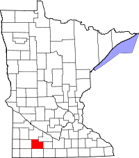 Location in the U.S. state of Minnesota | |
 Minnesota's location in the U.S. | |
| Founded |
May 23, 1857 (created) 1870 (organized)[1] |
| Named for | Cottonwood River[1] |
| Seat | Windom |
| Largest city | Windom |
| Area | |
| • Total | 649 sq mi (1,681 km2) |
| • Land | 639 sq mi (1,655 km2) |
| • Water | 10 sq mi (26 km2), 1.5% |
| Population (est.) | |
| • (2015) | 11,549 |
| • Density | 18/sq mi (7/km²) |
| Congressional districts | 1st, 7th |
| Time zone | Central: UTC-6/-5 |
| Website |
www |
Cottonwood County is a county located in the U.S. state of Minnesota. As of the 2010 census, the population was 11,687.[2] Its county seat is Windom.[3] The county was formed in 1857 and organized in 1870.[1]
History
Cottonwood County was established May 23, 1857 and formally organized on July 29, 1870. It was named after the Cottonwood River - a translation of the Dakota Sioux name, "Waraju" - which runs through the northeast corner of Germantown Township.[1] The river received its name from the abundance of cottonwood trees on its banks.[1][4]
Minnesota Governor Austin appointed three county commissioners when the county was established. They met at a private home about six miles northwest of Windom on the Des Moines River at Big Bend. During this meeting, they designated the commissioners districts and changed various county officers. In the fall of 1870, the first general election was held. The first deed on record was filed on January 10, 1870. The first land assessments were made in 1871, and in 1872, the first taxes were paid.
The city of Windom was declared the county seat in the 1872 general election and a proclamation was signed by the governor.
County NRHP listings
- The Cottonwood County Courthouse built in 1904, is an example of Neoclassical architecture and is listed in the National Register of Historic Places.[5]
- Mountain Park, located southeast of Mountain Lake, has been listed on the National Register of Historic Places, since 1973.[6] A 1976 archeological dig unearthed evidence of Fox Indian inhabitation there dating from as early as 500 B.C. Thus, the park has the honor of being home to the site of the oldest human habitation yet to be discovered in the state of Minnesota.[7]
- The Jeffers Petroglyphs, located near the town of Jeffers, is a site containing pre-European Native American rock carvings which is also listed in the National Register of Historic Places.[6]
Politics
| Year | Democratic | Republican |
|---|---|---|
| 2016 | 29.33% 1,678 | 64.31% 3,679 |
| 2012 | 41.50% 2,433 | 56.57% 3,316 |
| 2008 | 45.71% 2,759 | 52.30% 3,157 |
| 2004 | 42.80% 2,726 | 55.85% 3,557 |
| 2000 | 40.50% 2,503 | 54.51% 3,369 |
Geography
According to the U.S. Census Bureau, the county has a total area of 649 square miles (1,680 km2), of which 639 square miles (1,660 km2) is land and 10 square miles (26 km2) (1.5%) is water.[9]
Watersheds
The northeast part of the county drains north to the Minnesota River through numerous small creeks, the Cottonwood River and Watonwan River. The southwest part of the county drains south through the Des Moines River. These two watersheds come together at the Mississippi River near Keokuk, Iowa. Most wetlands in the county have been drained for agricultural use.
Lakes
| Des Moines River Watershed | Minnesota River Watershed |
|---|---|
|
|
Major highways
Adjacent counties
- Redwood County (north)
- Brown County (northeast)
- Watonwan County (east)
- Martin County (southeast)
- Jackson County (south)
- Nobles County (southwest)
- Murray County (west)
Demographics
| Historical population | |||
|---|---|---|---|
| Census | Pop. | %± | |
| 1860 | 12 | — | |
| 1870 | 534 | 4,350.0% | |
| 1880 | 5,533 | 936.1% | |
| 1890 | 7,412 | 34.0% | |
| 1900 | 12,069 | 62.8% | |
| 1910 | 12,651 | 4.8% | |
| 1920 | 14,570 | 15.2% | |
| 1930 | 14,782 | 1.5% | |
| 1940 | 16,143 | 9.2% | |
| 1950 | 15,763 | −2.4% | |
| 1960 | 16,166 | 2.6% | |
| 1970 | 14,887 | −7.9% | |
| 1980 | 14,854 | −0.2% | |
| 1990 | 12,694 | −14.5% | |
| 2000 | 12,167 | −4.2% | |
| 2010 | 11,687 | −3.9% | |
| Est. 2015 | 11,549 | [10] | −1.2% |
| U.S. Decennial Census[11] 1790-1960[12] 1900-1990[13] 1990-2000[14] 2010-2015[2] | |||
As of the census of 2000,[15] there were 12,167 people, 4,917 households, and 3,338 families residing in the county. The population density was 19 people per square mile (7/km²). There were 5,376 housing units at an average density of 8 per square mile (3/km²). The racial makeup of the county was 95.23% White, 0.34% Black or African American, 0.23% Native American, 1.63% Asian, 0.08% Pacific Islander, 1.35% from other races, and 1.14% from two or more races. 2.19% of the population were Hispanic or Latino of any race. 50.2% were of German and 18.6% Norwegian ancestry.
There were 4,917 households out of which 28.60% had children under the age of 18 living with them, 58.10% were married couples living together, 6.90% had a female householder with no husband present, and 32.10% were non-families. 28.90% of all households were made up of individuals and 15.90% had someone living alone who was 65 years of age or older. The average household size was 2.39 and the average family size was 2.94.
In the county the population was spread out with 25.00% under the age of 18, 6.50% from 18 to 24, 23.20% from 25 to 44, 23.20% from 45 to 64, and 22.10% who were 65 years of age or older. The median age was 42 years. For every 100 females there were 94.50 males. For every 100 females age 18 and over, there were 91.50 males.
The median income for a household in the county was $31,943, and the median income for a family was $40,237. Males had a median income of $28,993 versus $19,934 for females. The per capita income for the county was $16,647. About 7.40% of families and 11.70% of the population were below the poverty line, including 18.40% of those under age 18 and 8.70% of those age 65 or over.
County parks
- Dynamite (Great Bend Township)
- Lady Bird (Southbrook Township)
- Pat's Grove (Springfield Township)[16]
- Mountain (Mountain Lake Township)
- Red Rock (Germantown Township)
- South Dutch Charlie (Westbrook Township)[17][18]
- Talcot Lake (Southbrook Township)
Communities
Cities
- Bingham Lake
- Comfrey (partial)
- Jeffers
- Mountain Lake
- Storden
- Westbrook
- Windom (county seat)
Townships
- Amboy Township
- Amo Township
- Ann Township
- Carson Township
- Dale Township
- Delton Township
- Germantown Township
- Great Bend Township
- Highwater Township
- Lakeside Township
- Midway Township
- Mountain Lake Township
- Rose Hill Township
- Selma Township
- Southbrook Township
- Springfield Township
- Storden Township
- Westbrook Township
Unincorporated community
See also
Footnotes
- 1 2 3 4 5 Upham, Warren (1920). Minnesota Geographic Names: Their Origin and Historic Significance. Minnesota Historical Society. p. 149.
- 1 2 "State & County QuickFacts". United States Census Bureau. Retrieved August 31, 2013.
- ↑ "Find a County". National Association of Counties. Archived from the original on 2011-05-31. Retrieved 2011-06-07.
- ↑ Gannett, Henry (1905). The Origin of Certain Place Names in the United States. Govt. Print. Off. p. 93.
- ↑ Nelson, Charles W.; Susan Zeik (October 26, 1976). "National Register of Historic Places Inventory -- Nomination Form: Cottonwood County Courthouse" (PDF). National Park Service. Retrieved June 8, 2016.
- 1 2 "National Register of Historic Places". NRHP. Retrieved October 15, 2015.
- ↑ "Cottonwood County Parks". Cottonwood County, Minnesota. Retrieved October 15, 2015.
- ↑ Nelson, Steven (2011). Savanna Soils of Minnesota. Minnesota: Self. pp. 69 - 70. ISBN 978-0-615-50320-2.
- ↑ "2010 Census Gazetteer Files". United States Census Bureau. August 22, 2012. Archived from the original on October 6, 2014. Retrieved October 6, 2014.
- ↑ "County Totals Dataset: Population, Population Change and Estimated Components of Population Change: April 1, 2010 to July 1, 2015". Retrieved July 2, 2016.
- ↑ "U.S. Decennial Census". United States Census Bureau. Archived from the original on May 11, 2015. Retrieved October 6, 2014.
- ↑ "Historical Census Browser". University of Virginia Library. Retrieved October 6, 2014.
- ↑ "Population of Counties by Decennial Census: 1900 to 1990". United States Census Bureau. Retrieved October 6, 2014.
- ↑ "Census 2000 PHC-T-4. Ranking Tables for Counties: 1990 and 2000" (PDF). United States Census Bureau. Retrieved October 6, 2014.
- ↑ "American FactFinder". United States Census Bureau. Archived from the original on 2013-09-11. Retrieved 2008-01-31.
- ↑ 43°52′32″N 95°17′39″W / 43.8756°N 95.2942°W
- ↑ 44°05′00″N 95°23′01″W / 44.0832°N 95.3836°W
- ↑ The park is named after the county's first resident of European descent, Charles "Dutch Charlie" Zierke. "Cottonwood County Timeline". Cottonwood County Historical Society. Retrieved 2009-08-16.
Further reading
- John A. Brown (ed.), History of Cottonwood and Watonwan counties, Minnesota: Their People, Industries, and Institutions: With Biographical Sketches of Representative Citizens and Genealogical Records of Many of the Old Families. In Two Volumes. Indianapolis, IN: B.F. Bowen and Company, 1916. Volume 1 | Volume 2
- Cottonwood County Minnesota Highway Map, Cottonwood County Highway Department, 2003.
- DeLorme's Minnesota Atlas and Gazetteer.
External links
 |
Redwood County | Brown County | | |
| Murray County | |
Watonwan County | ||
| ||||
| | ||||
| Nobles County | Jackson County | Martin County |
Municipalities and communities of Cottonwood County, Minnesota, United States | ||
|---|---|---|
| Cities | | |
| Townships | ||
| Unincorporated community | ||
| Footnotes | ‡This populated place also has portions in an adjacent county or counties | |
Coordinates: 44°01′N 95°11′W / 44.01°N 95.18°W