Nicollet County, Minnesota
| Nicollet County, Minnesota | |
|---|---|
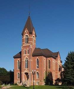 Nicollet County Courthouse | |
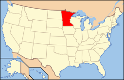
 Location in the U.S. state of Minnesota | |
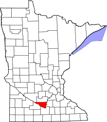
 Minnesota's location in the U.S. | |
| Founded | March 5, 1853[1] |
| Named for | Joseph Nicolas Nicollet |
| Seat | St. Peter |
| Largest city | North Mankato |
| Area | |
| • Total | 467 sq mi (1,210 km2) |
| • Land | 448 sq mi (1,160 km2) |
| • Water | 18 sq mi (47 km2), 3.9% |
| Population (est.) | |
| • (2015) | 33,347 |
| • Density | 66/sq mi (25/km²) |
| Congressional district | 1st |
| Time zone | Central: UTC-6/-5 |
| Website |
www |
Nicollet County is a county located in the U.S. state of Minnesota. It was named for French geographer Joseph N. Nicollet.[2] As of the 2010 census, the population was 32,727.[3] Its county seat is St. Peter.[4]
Nicollet County is part of the Mankato–North Mankato, MN Metropolitan Statistical Area.
Geography
According to the U.S. Census Bureau, the county has a total area of 467 square miles (1,210 km2), of which 448 square miles (1,160 km2) is land and 18 square miles (47 km2) (3.9%) is water.[5]
Nicollet County's highest point is the lowest high point out of all Minnesota counties, with an elevation of 1,065 feet.[7][8] The high point of the county is located east of Clear Lake and west of the town of Lafayette.

Lakes
- Annexstad Lake: in Lake Prairie Township
- Erickson Lake: in Traverse Township
- Middle Lake: the southwestern Middle Lake is in Granby Township; the northeastern Middle Lake is in Granby Township, Traverse Township, and Oshawa Township
- Oak Leaf Lake: in Oshawa Township
- Overson Lake: in Traverse Township
- Rice Lake: in New Sweden Township
- Sand Lake: in Lake Prairie Township
- Swan Lake: about a quarter of the northwest part of the lake is in Brighton Township; about three eighths of the southwest part is in Courtland Township; another three eighths is in Granby Township; a very small part of the southeast shore is in Nicollet Township
Major highways
Adjacent counties
- Sibley County (north)
- Le Sueur County (east)
- Blue Earth County (southeast)
- Brown County (southwest)
- Renville County (northwest)
Demographics
| Historical population | |||
|---|---|---|---|
| Census | Pop. | %± | |
| 1860 | 3,778 | — | |
| 1870 | 8,362 | 121.3% | |
| 1880 | 12,333 | 47.5% | |
| 1890 | 13,382 | 8.5% | |
| 1900 | 14,774 | 10.4% | |
| 1910 | 14,125 | −4.4% | |
| 1920 | 15,036 | 6.4% | |
| 1930 | 16,550 | 10.1% | |
| 1940 | 18,282 | 10.5% | |
| 1950 | 20,929 | 14.5% | |
| 1960 | 23,196 | 10.8% | |
| 1970 | 24,518 | 5.7% | |
| 1980 | 26,929 | 9.8% | |
| 1990 | 28,076 | 4.3% | |
| 2000 | 29,771 | 6.0% | |
| 2010 | 32,727 | 9.9% | |
| Est. 2015 | 33,347 | [9] | 1.9% |
| U.S. Decennial Census[10] 1790-1960[11] 1900-1990[12] 1990-2000[13] 2010-2015[3] | |||

As of the census of 2000, there were 29,771 people, 10,642 households, and 7,311 families residing in the county. The population density was 66 people per square mile (25/km²). There were 11,240 housing units at an average density of 25 per square mile (10/km²). The racial makeup of the county was 96.37% White, 0.80% Black or African American, 0.26% Native American, 1.14% Asian, 0.02% Pacific Islander, 0.65% from other races, and 0.75% from two or more races. 1.80% of the population were Hispanic or Latino of any race. 49.2% were of German, 13.3% Norwegian, 6.8% Swedish and 5.4% Irish ancestry.
There were 10,642 households out of which 35.30% had children under the age of 18 living with them, 57.50% were married couples living together, 7.90% had a female householder with no husband present, and 31.30% were non-families. 24.00% of all households were made up of individuals and 8.80% had someone living alone who was 65 years of age or older. The average household size was 2.56 and the average family size was 3.05.
In the county the population was spread out with 24.70% under the age of 18, 16.40% from 18 to 24, 26.90% from 25 to 44, 21.20% from 45 to 64, and 10.80% who were 65 years of age or older. The median age was 33 years. For every 100 females there were 99.30 males. For every 100 females age 18 and over, there were 96.90 males.
The median income for a household in the county was $46,170, and the median income for a family was $55,694. Males had a median income of $36,236 versus $25,344 for females. The per capita income for the county was $20,517. About 4.30% of families and 7.50% of the population were below the poverty line, including 6.70% of those under age 18 and 8.00% of those age 65 or over.
Communities
Cities
- Courtland
- Lafayette
- Mankato (partly in Blue Earth County)
- Nicollet
- North Mankato (partly in Blue Earth County)
- St. Peter (county seat)
Townships
Unincorporated communities
Ghost town
See also
References
- ↑ "Minnesota Place Names". Minnesota Historical Society. Retrieved March 18, 2014.
- ↑ "About Nicollet County". government of Nicollet County. Retrieved 2015-04-19.
- 1 2 "State & County QuickFacts". United States Census Bureau. Retrieved September 1, 2013.
- ↑ "Find a County". National Association of Counties. Retrieved 2011-06-07.
- ↑ "2010 Census Gazetteer Files". United States Census Bureau. August 22, 2012. Retrieved October 24, 2014.
- ↑ Nelson, Steven (2011). Savanna Soils of Minnesota. Minnesota: Self. pp. 65 - 67. ISBN 978-0-615-50320-2.
- ↑ "Nicollet County High Point - Peakbagger.com". peakbagger.com. Retrieved 2016-11-28.
- ↑ "Nicollet County HP - 1,065' Minnesota". listsofjohn.com. Retrieved 2016-11-28.
- ↑ "County Totals Dataset: Population, Population Change and Estimated Components of Population Change: April 1, 2010 to July 1, 2015". Retrieved July 2, 2016.
- ↑ "U.S. Decennial Census". United States Census Bureau. Retrieved October 24, 2014.
- ↑ "Historical Census Browser". University of Virginia Library. Retrieved October 24, 2014.
- ↑ "Population of Counties by Decennial Census: 1900 to 1990". United States Census Bureau. Retrieved October 24, 2014.
- ↑ "Census 2000 PHC-T-4. Ranking Tables for Counties: 1990 and 2000" (PDF). United States Census Bureau. Retrieved October 24, 2014.
External links
 |
Renville County | Sibley County | | |
| |
Le Sueur County | |||
| ||||
| | ||||
| Brown County | Blue Earth County |
Municipalities and communities of Nicollet County, Minnesota, United States | ||
|---|---|---|
| Cities | | |
| Townships | ||
| Unincorporated communities | ||
| Ghost town | ||
| Footnotes | ‡This populated place also has portions in an adjacent county or counties | |
| Core Cities | 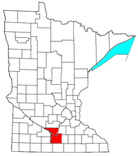 | ||||||
|---|---|---|---|---|---|---|---|
| Incorporated Places |
| ||||||
| Counties | |||||||
† indicates a county seat. ‡ indicates that it is partially in the metropolitan area. | |||||||
Coordinates: 44°20′N 94°15′W / 44.34°N 94.25°W