Houston County, Minnesota
| Houston County, Minnesota | |
|---|---|
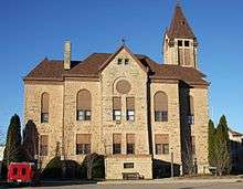 Houston County Courthouse in Caledonia | |
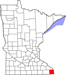 Location in the U.S. state of Minnesota | |
 Minnesota's location in the U.S. | |
| Founded | February 23, 1854[1] |
| Named for | Samuel Houston |
| Seat | Caledonia |
| Largest city | La Crescent |
| Area | |
| • Total | 569 sq mi (1,474 km2) |
| • Land | 552 sq mi (1,430 km2) |
| • Water | 17 sq mi (44 km2), 2.9% |
| Population (est.) | |
| • (2015) | 18,773 |
| • Density | 34/sq mi (13/km²) |
| Congressional district | 1st |
| Time zone | Central: UTC-6/-5 |
| Website |
co |
Houston County is a county located in the U.S. state of Minnesota. As of the 2010 census, the population was 19,027.[2] Its county seat is Caledonia.[3]
Houston County is included in the La Crosse-Onalaska, WI-MN Metropolitan Statistical Area.
History
Four years before Minnesota was admitted to the Union as the 32nd state on May 11, 1858, Houston County was chartered after its division from the eastern half of Fillmore County on April 4, 1854. The county seat was the village of Houston for a few years, but the county board moved the official records to Caledonia for safe storage in the cabin of Commissioner Samuel McPhail. The first court hearings were held in that cabin, and a one-story courthouse and jail was built in Caledonia in 1857. Turmoil over the county seat continued, a two-story building was built in Caledonia in 1867, and several referenda allowed Caledonia to prevail as the county seat by 1874.[4] From that point on, Caledonia prospered, and Houston slowly diminished. The only other area of prominence was La Crescent, which benefited from its connection to La Crosse, Wisconsin.
The county name was chosen to honor Sam Houston, who was president of Texas before its annexation by the United States and afterward was a senator from that state.[5] In the years 1854-56, when antagonism between the North and South on slavery questions would lead eventually to the Civil War, Houston aspired to nomination as the Democratic candidate for the national presidency. In October 1854, the general Democratic committee of New Hampshire recommended him as "the people's candidate" for the campaign in 1856. His popularity in Minnesota at that time recommended the name of this county, and, likewise, counties in Tennessee and Texas and cities and villages in Texas, Mississippi, Missouri, and other states bear his name.[6]
Geography
According to the U.S. Census Bureau, the county has a total area of 569 square miles (1,470 km2), of which 552 square miles (1,430 km2) is land and 17 square miles (44 km2) (2.9%) is water.[7]
Among other parts of southeastern Minnesota, the county is in the Driftless Zone, marked by the absence of glacial drift and presence of bedrock cut by streams into steep hills. The plateau that surrounds Caledonia, the county seat, includes flat, fertile farm land and hilly, verdant pasture land.

Lakes
The following lakes are located within the Upper Mississippi River National Wildlife and Fish Refuge.
- Blue Lake
- Hayshore Lake
- Lawrence Lake
- Target Lake
Adjacent counties
- Winona County, Minnesota (north)
- La Crosse County, Wisconsin (northeast)
- Vernon County, Wisconsin (east)
- Allamakee County, Iowa (south)
- Winneshiek County, Iowa (southwest)
- Fillmore County, Minnesota (west)
National protected area
Demographics
| Historical population | |||
|---|---|---|---|
| Census | Pop. | %± | |
| 1860 | 6,645 | — | |
| 1870 | 14,936 | 124.8% | |
| 1880 | 16,332 | 9.3% | |
| 1890 | 14,653 | −10.3% | |
| 1900 | 15,400 | 5.1% | |
| 1910 | 14,297 | −7.2% | |
| 1920 | 14,013 | −2.0% | |
| 1930 | 13,845 | −1.2% | |
| 1940 | 14,735 | 6.4% | |
| 1950 | 14,435 | −2.0% | |
| 1960 | 16,588 | 14.9% | |
| 1970 | 17,556 | 5.8% | |
| 1980 | 18,382 | 4.7% | |
| 1990 | 18,497 | 0.6% | |
| 2000 | 19,718 | 6.6% | |
| 2010 | 19,027 | −3.5% | |
| Est. 2015 | 18,773 | [9] | −1.3% |
| U.S. Decennial Census[10] 1790-1960[11] 1900-1990[12] 1990-2000[13] 2010-2015[2] | |||

As of the census of 2000,[14] there were 19,718 people, 7,633 households, and 5,411 families residing in the county. The population density was 35 people per square mile (14/km²). There were 8,168 housing units at an average density of 15 per square mile (6/km²). The racial makeup of the county was 98.47% White, 0.31% Black or African American, 0.18% Native American, 0.37% Asian, 0.02% Pacific Islander, 0.14% from other races, and 0.51% from two or more races. 0.61% of the population were Hispanic or Latino of any race. 43.1% were of German, 29.6% Norwegian and 7.5% Irish ancestry.
There were 7,633 households out of which 34.4% had children under the age of 18 living with them, 60.0% were married couples living together, 7.4% had a female householder with no husband present, and 29.1% were non-families. 25.4% of all households were made up of individuals and 12.0% had someone living alone who was 65 years of age or older. The average household size was 2.53 and the average family size was 3.05.
In the county the population was spread out with 27.2% under the age of 18, 6.8% from 18 to 24, 26.8% from 25 to 44, 23.1% from 45 to 64, and 16.0% who were 65 years of age or older. The median age was 39 years. For every 100 females there were 97.5 males. For every 100 females age 18 and over, there were 95.1 males.
The median income for a household in the county was $40,680, and the median income for a family was $49,196. Males had a median income of $32,557 versus $22,158 for females. The per capita income for the county was $18,826. About 4.2% of families and 6.5% of the population were below the poverty line, including 6.4% of those under age 18 and 11.2% of those age 65 or over.
Transportation
Major highways
 Minnesota State Highway 16
 Minnesota State Highway 26
 Minnesota State Highway 44
 Minnesota State Highway 76
Airport
Communities
Cities
- Brownsville
- Caledonia (county seat)
- Eitzen
- Hokah
- Houston
- La Crescent (partly in Winona County)
- Spring Grove
Townships
- Black Hammer Township
- Brownsville Township
- Caledonia Township
- Crooked Creek Township
- Hokah Township
- Houston Township
- Jefferson Township
- La Crescent Township
- Mayville Township
- Money Creek Township
- Mound Prairie Township
- Sheldon Township
- Spring Grove Township
- Union Township
- Wilmington Township
- Winnebago Township
- Yucatan Township
Unincorporated communities
See also
- National Register of Historic Places listings in Houston County, Minnesota
- Upper Mississippi River National Wildlife and Fish Refuge
References
- ↑ "Minnesota Place Names". Minnesota Historical Society. Retrieved March 18, 2014.
- 1 2 "State & County QuickFacts". United States Census Bureau. Retrieved September 1, 2013.
- ↑ "Find a County". National Association of Counties. Retrieved 2011-06-07.
- ↑ "Houston County Courthouse". Retrieved October 18, 2013.
- ↑ Gannett, Henry (1905). The Origin of Certain Place Names in the United States. Govt. Print. Off. p. 161.
- ↑ "Census 2010 Gazetteer Files". Retrieved October 18, 2013.
- ↑ "2010 Census Gazetteer Files". United States Census Bureau. August 22, 2012. Retrieved October 15, 2014.
- ↑ Nelson, Steven (2011). Savanna Soils of Minnesota. Minnesota: Self. pp. 43 - 48. ISBN 978-0-615-50320-2.
- ↑ "County Totals Dataset: Population, Population Change and Estimated Components of Population Change: April 1, 2010 to July 1, 2015". Retrieved July 2, 2016.
- ↑ "U.S. Decennial Census". United States Census Bureau. Retrieved October 15, 2014.
- ↑ "Historical Census Browser". University of Virginia Library. Retrieved October 15, 2014.
- ↑ "Population of Counties by Decennial Census: 1900 to 1990". United States Census Bureau. Retrieved October 15, 2014.
- ↑ "Census 2000 PHC-T-4. Ranking Tables for Counties: 1990 and 2000" (PDF). United States Census Bureau. Retrieved October 15, 2014.
- ↑ "American FactFinder". United States Census Bureau. Retrieved 2008-01-31.
External links
| Wikisource has the text of an 1879 American Cyclopædia article about Houston County, Minnesota. |
 |
Winona County | La Crosse County, Wisconsin | | |
| Fillmore County | |
Vernon County, Wisconsin | ||
| ||||
| | ||||
| Winneshiek County, Iowa | Allamakee County, Iowa |
Municipalities and communities of Houston County, Minnesota, United States | ||
|---|---|---|
| Cities | | |
| Townships | ||
| Unincorporated communities | ||
| Footnotes | ‡This populated place also has portions in an adjacent county or counties | |
| Core cities | 
 | ||||||
|---|---|---|---|---|---|---|---|
| Surrounding communities |
| ||||||
| Counties | |||||||
Coordinates: 43°40′N 91°29′W / 43.67°N 91.49°W