Lakeville, Minnesota
| Lakeville, Minnesota | ||
|---|---|---|
| City | ||
|
Lakeville City Hall | ||
| ||
 Location of the city of Lakeville within Dakota County, Minnesota | ||
 Location of Lakeville City Hall | ||
| Coordinates: 44°38′59″N 93°14′33″W / 44.64972°N 93.24250°WCoordinates: 44°38′59″N 93°14′33″W / 44.64972°N 93.24250°W | ||
| Country | United States | |
| State | Minnesota | |
| County | Dakota | |
| Founded | 1855 | |
| Established | 1858 | |
| Incorporated | 1967 | |
| Government | ||
| • Type | Mayor – Council | |
| • Mayor | Matt Little | |
| Area[1] | ||
| • City | 37.83 sq mi (97.98 km2) | |
| • Land | 36.06 sq mi (93.39 km2) | |
| • Water | 1.77 sq mi (4.58 km2) | |
| Elevation | 971 ft (296 m) | |
| Population (2010)[2] | ||
| • City | 55,954 | |
| • Estimate (2015)[3] | 60,633 | |
| • Rank | US: 598th MN: 16th | |
| • Density | 1,551.7/sq mi (599.1/km2) | |
| • Metro | 3,524,583 (US: 16th) | |
| Time zone | CST (UTC-6) | |
| • Summer (DST) | CDT (UTC-5) | |
| ZIP code | 55044 | |
| Area code(s) | 952 | |
| FIPS code | 27-35180 | |
| GNIS feature ID | 0646445[4] | |
| Website | City of Lakeville | |


Lakeville /ˈleɪkvɪl/ is a city in Dakota County, Minnesota, United States. It is a suburb of Minneapolis, approximately 23 miles (37 km) south of the larger city's downtown. On the Twin Cities metropolitan area's southern fringe, Lakeville is one of the fastest-growing cities in the Minneapolis–Saint Paul metropolitan area.[5] The U.S. Census Bureau recorded its population at 55,954 in 2010.[6][7]
Lakeville lies along Interstate Highway 35. Lakeville first became notable in 1910 when Marion Savage built the Dan Patch Railroad Line to service his Antlers Amusement Park.[8] It later became a flourishing milling center; its agriculture industry is still in operation. While many of Lakeville's workers commute northward to Minneapolis, Saint Paul, and more central suburbs like Bloomington, Lakeville has had major industry since the 1960s—including the Airlake Industrial Park, which is served by Airlake Airport, a regional reliever airport.
History
The Sioux people ceded most of southern Minnesota in the Treaty of Traverse des Sioux in 1851. A military road was constructed between Fort Snelling and the southern forts. In 1855, J.J. Brackett, a Saint Paul lumber baron and mail carrier using the road, decided to plat a site halfway between Saint Paul and Saint Peter on a lake he named Prairie Lake. The village was established as Lakeville Township in 1858.[9] Notoriety came when Colonel Marion Savage expanded his entertainment business into constructing Antlers Amusement Park in 1910. Riding on fame from his success with the Dan Patch racing horse and the popularity of the park, the lake was renamed Lake Marion, and the rail line servicing the park named the Dan Patch Railroad Line.[10]
With the mostly rural landscape, early settlers were farmers and this owed to a high percentage of Scandinavians. The other group included Irish, Scots, and English who had spread out from Hamilton Landing and Burnsville. In Karen Miller's diary from 1840 to 1895, Danes reportedly outnumbered Norwegians and travel to Minneapolis was not uncommon for the rural township.[11] Enggren's Grocery was a downtown staple since 1900 until it closed in 2006.[12]
The later 20th century followed typically for the outer-ring suburban Twin Cities with official incorporation as the City of Lakeville in 1967. The agriculture industry continued to sustain itself as postwar development did not immediately absorb Lakeville (as well as Interstate 35's later completion date). In the early 21st century, housing and population increases were due to rising land costs in the metropolitan area, causing Lakeville to become a boomtown.
Geography
According to the United States Census Bureau, the city has a total area of 37.83 square miles (97.98 km2), of which 36.06 square miles (93.39 km2) is land and 1.77 square miles (4.58 km2) is water.[1] Lakeville includes the Argonne Farms post-World War I settlement project which failed in the early 20th century and was redeveloped in the 21st century into typical suburban retail. Since it was a semi-autonomous village within Lakeville Township before the city's incorporation, it continues to appear today on maps as Argonne.[13]
As its name implies, Lakeville contains several lakes as well as smaller ponds and wetlands within its borders. The two largest lakes include Lake Marion and Orchard Lake, which are used heavily for recreation such as fishing, boating, and swimming. Smaller named natural lakes include Kingsley Lake and Lee Lake. Valley Lake is a small man-made lake in the northern part of the city.
A branch of the Vermillion River flows through Lakeville. Its headwaters are just west of the city limits in Credit River Township, and it flows eastward across Dakota County until it empties into the Mississippi River at the Wisconsin border. Much of Lakeville drains into the Vermillion River watershed. North Creek, a major tributary of the Vermillion, begins its flow in northern Lakeville and flows eastward to meet the Vermillion near downtown Farmington just east of Lakeville. The Vermillion River has been designated as a trout stream by the Minnesota Department of Natural Resources.
Demographics
| Historical population | |||
|---|---|---|---|
| Census | Pop. | %± | |
| 1880 | 108 | — | |
| 1890 | 258 | 138.9% | |
| 1900 | 373 | 44.6% | |
| 1910 | 385 | 3.2% | |
| 1920 | 474 | 23.1% | |
| 1930 | 522 | 10.1% | |
| 1940 | 543 | 4.0% | |
| 1950 | 628 | 15.7% | |
| 1960 | 924 | 47.1% | |
| 1970 | 7,556 | 717.7% | |
| 1980 | 14,790 | 95.7% | |
| 1990 | 24,854 | 68.0% | |
| 2000 | 43,128 | 73.5% | |
| 2010 | 55,954 | 29.7% | |
| Est. 2015 | 60,633 | [14] | 8.4% |
| U.S. Decennial Census[15] 2015 Estimate[3] | |||
Projected census since 2010
According to the census,[16] the population estimate as of July 1, 2015 in the city of Lakeville was 60,633 individuals, up 4,679 from the 2010 census. 19,314 households are reported in the city between 2010-2014, with 2.99 people per household. 2010-2014 shows the median value of owner-occupied housing units at $243,000, and a median gross rent of $1,121. Foreign born persons make up 6.3 percent of the population of Lakeville between 2010-2014, and there are 3323 veterans reported during that same time frame. In terms of education reports from 2010-2014, 96.3% of the population aged 25+ had reported being a high school graduate, while 46.3% of the same population had reported earning a bachelor's degree.
2010 census
As of the census[2] of 2010, there were 55,954 people, 18,683 households, and 15,158 families residing in the city. The population density was 1,551.7 inhabitants per square mile (599.1/km2). There were 19,456 housing units at an average density of 539.5 per square mile (208.3/km2). The racial makeup of the city was 89.3% White, 2.5% African American, 0.4% Native American, 4.1% Asian, 1.2% from other races, and 2.5% from two or more races. Hispanic or Latino of any race were 3.5% of the population.
There were 18,683 households of which 49.1% had children under the age of 18 living with them, 67.9% were married couples living together, 9.2% had a female householder with no husband present, 4.0% had a male householder with no wife present, and 18.9% were non-families. 14.0% of all households were made up of individuals and 3.6% had someone living alone who was 65 years of age or older. The average household size was 2.99 and the average family size was 3.32.
The median age in the city was 34.8 years. 31.8% of residents were under the age of 18; 6.7% were between the ages of 18 and 24; 28.8% were from 25 to 44; 27% were from 45 to 64; and 5.8% were 65 years of age or older. The gender makeup of the city was 50.1% male and 49.9% female.
2000 census
As of the census of 2000, there were 43,128 people, 13,609 households, and 11,526 families residing in the city. The population density was 1,192.4 people per square mile (460.4/km²). There were 13,799 housing units at an average density of 381.5 per square mile (147.3/km²). The racial makeup of the city was 94.26% White, 1.28% African American, 0.38% Native American, 2.01% Asian, 0.02% Pacific Islander, 0.76% from other races, and 1.28% from two or more races. Hispanic or Latino of any race were 1.94% of the population.
There were 13,609 households out of which 56.0% had children under the age of 18 living with them, 73.6% were married couples living together, 7.5% had a female householder with no husband present, and 15.3% were non-families. 10.7% of all households were made up of individuals and 1.9% had someone living alone who was 65 years of age or older. The average household size was 3.17 and the average family size was 3.43.
In the city the population was spread out with 36.1% under the age of 18, 5.9% from 18 to 24, 37.8% from 25 to 44, 17.4% from 45 to 64, and 2.8% who were 65 years of age or older. The median age was 32 years. For every 100 females there were 102.5 males. For every 100 females age 18 and over, there were 100.6 males.
The median income for a household in the city was $72,404, and the median income for a family was $76,542 (these figures had risen to $90,014 and $96,662 respectively as of a 2007 estimate). Males had a median income of $51,405 versus $33,071 for females. The per capita income for the city was $26,492. About 1.5% of families and 2.0% of the population were below the poverty line, including 2.0% of those under age 18 and 4.3% of those age 65 or over.
Economy

Airlake Industrial Park, developed by Maynard Johnson with colleagues at Bloomington-based Hitchcock Industries, is home to as many as 200 companies and an estimated 4,500 employees. The 1,500-acre park, one of the state's largest contiguous industrial parks, has attracted companies ranging from start-ups to large corporations.[17]
Airlake Industrial Park was a contrived name – “air” represented the airport that Hitchcock Industries built on the grounds and “lake” signified nearby Lake Marion.[18]
Lakeville is served by the Airlake Airport, which has a single runway with an ILS approach. The airport is managed by the Metropolitan Airports Commission as a reliever facility to draw general aviation traffic. The FAA operates the Minneapolis ARTCC (air route traffic control center) in Farmington, several miles away from the airport. This center provides traffic control services for Minnesota and surrounding states.
Large farms are still in operation, producing most of their revenue in corn, soybeans, and dairy cattle.
Government and politics

The city of Lakeville is governed by a five-member city council, including a mayor, although a City Administrator runs day-to-day municipal operations. A professional police force and volunteer fire department protect the city's residents. The city operates a large parks department which includes a senior center, an entertainment center, dozens of various neighborhood and community parks, and many miles of multipurpose trails.
Matt Little is the mayor of Lakeville. The city is in Minnesota's 2nd congressional district, represented since 2003 by John Kline, a Republican. Lakeville is represented in the Minnesota Senate by District 36 Senator Dave Thompson, and in the Minnesota House primarily by District 36A Representative Mary Liz Holberg and, in the eastern part, by District 36B Representative Pat Garofalo.
Education
The city is served by three different school districts, whose boundaries were determined while the community was largely agricultural. Today Independent School District 196 ("Rosemount-Apple Valley-Eagan") and Farmington School District 192 serve parts of northern and eastern Lakeville. Most Lakeville households are served by Lakeville Area School District 194. In the fall of 2005, the Lakeville School District opened its second high school, Lakeville South. Some students attend public schools in other school districts chosen by their families under Minnesota's open enrollment statute.[19] Lakeville North was a Blue Ribbon school of excellence in 2009.[20][21] Each high school has nearly 2,000 students.[22] There are eight public elementary schools[23] and three public middle schools. Century Middle School students go on to Lakeville North,[24] McGuire Middle School students to Lakeville South,[25] and Kenwood Middle School students to either, depending on their neighborhood of residence.[26][27]
Recreation
Lakeville has many recreational opportunities. The Parks & Recreation Department maintains a total of 62 public properties, including neighborhood and community parks, athletic fields, playgrounds, greenways, trails, tennis courts, skating rinks, picnic areas, conservation areas, nature areas, several public fishing areas, swimming beaches, the City's Central Maintenance Facility, Senior Center, and the Lakeville Area Arts Center. Notable parks include Ritter Farm Park, North Park, Antlers Park, King Park, Valley Lake Park, and Aronson Park, which features a Veterans Memorial.
Antlers Park features a large swimming beach with volleyball courts, baseball diamonds, a playground area, water equipment, a picnic area, a fishing pier, and horseshoe pits. Orchard Lake Beach has a picnic area, shore fishing, playground equipment, and volleyball courts. Valley Lake Beach includes playground equipment, a picnic area, a walking trail around the lake, a fishing pier and seasonal restrooms.
Transportation
Lakeville is directly served by Interstate 35, as well as Cedar Avenue/MN 77 to the east.
Before its abandonment in 1970, the Chicago, Milwaukee, St. Paul and Pacific Railroad's Hastings & Dakota Subdivision went through the center of Lakeville and served various industries. Short-line railroad Progressive Rail is based in Lakeville, and owns the right-of-way of the MN&S Subdivision between Lakeville and Northfield. Between Lakeville and Savage the MN&S Subdivision is owned by Canadian Pacific Railway, but has been out of service since the 1990s. In 2009 Progressive Rail began using a segment of the out-of-service tracks for railcar storage, causing local controversy. The Dan Patch Corridor would go through Lakeville, but has been banned from discussion and funding by the Minnesota State Legislature since 2002. The City of Lakeville opposes public funding of a passenger rail line on the MN&S Subdivision through the community.[28]
Media
- Lakeville Sun Thisweek
- The Farm Show newspaper has been published from Lakeville since 1976.
Notable people
- Elisabeth Bachman, Olympic volleyball player
- Todd Bachman, CEO of Bachman's, killed at the Beijing Olympics in 2008
- Andy Belmont and Joey Miller, NASCAR drivers
- Kevin Kaesviharn, pro football player
- John Kline, U.S. Representative
- Paul Krause, Pro Football Hall of Famer
- Bradley Ellingboe
- Janelle Pierzina, Big Brother contestant
- Brady Skjei, University of Minnesota hockey player drafted by the New York Rangers
- Steve Strachan, former member of the Minnesota House of Representatives and former chief of the Lakeville Police Department
- Jordan Schroeder, professional hockey player for the Minnesota Wild.
- Justin Kloos, University of Minnesota hockey player and Minnesota Mr. Hockey recipient in 2012
- Lakeville Stickman, Man who walks the city trails who waves a stick at passers by in a friendly manner, usually without a shirt [29]
References
- 1 2 "US Gazetteer files 2010". United States Census Bureau. Retrieved 2012-11-13.
- 1 2 "American FactFinder". United States Census Bureau. Retrieved 2012-11-13.
- 1 2 "Population Estimates". United States Census Bureau. Retrieved June 2, 2016.
- ↑ "US Board on Geographic Names". United States Geological Survey. 2007-10-25. Retrieved 2008-01-31.
- ↑ Metropolitan Council (2002-06-18). "Council to work with communities on household, job forecasts". Retrieved 2007-10-03.
- ↑ "2010 Census Redistricting Data (Public Law 94-171) Summary File". American FactFinder. United States Census Bureau. Retrieved 27 April 2011.
- ↑ Aaron Vehling (2011-03-24). "Lakeville grew larger, more diverse over the past decade". Thisweek. Retrieved 2011-03-31.
- ↑ Robert O Greenawalt (March 1999). "The Dan Patch line". International Bond & Share Society. Archived from the original on September 26, 2005. Retrieved 2008-05-08.
- ↑ Upham, Warren (1920). Minnesota Geographic Names: Their Origin and Historic Significance. Minnesota Historical Society. p. 166.
- ↑ A Glimpse of Lakeville's' Past Lakeville Area Historical Society
- ↑ Karen Miller, translated by Ninna Engskow, edited by John W. Nielsen (1997). Many Danes, some Norwegians : Karen Miller’s diary, 1894. Blair, Neb. Lur Publications, Danish Immigrant Archive, Dana College.
- ↑ John Sucansky (2006-04-07). "Enggren's closing after 100 years of business". Thisweek. Retrieved 2008-05-09.
- ↑ "Argonne Village to occupy former WWI soldier resettlement area". Thisweek. 2005-01-28. Retrieved 2008-05-09.
- ↑ "Annual Estimates of the Resident Population for Incorporated Places: April 1, 2010 to July 1, 2015". Retrieved July 2, 2016.
- ↑ United States Census Bureau. "Census of Population and Housing". Retrieved September 12, 2013.
- ↑ http://www.census.gov/quickfacts/table/HSG030210/2735180
- ↑ Todd Nelson (2015-05-17) "Family history tells the story of Airlake Industrial Park in Lakeville". Star Tribune. Retrieved 2016-01-17.
- ↑ Skogrand, Brant (1971). Maynard's Memories: Life Lessons from the Developer of Airlake Industrial Park in Lakeville, Minnesota. Skogrand PR Solutions, LLC. p. 36.
- ↑ "Open Enrollment". Minnesota Department of Education. Retrieved 19 November 2010.
- ↑ "Minnesota Schools Receive NCLB Blue Ribbon Award" (Press release). Minnesota Department of Education. Retrieved 2011-05-28.
- ↑ Von Sternberg, Bob (2009-09-15). "7 schools in state to receive federal Blue Ribbon awards". Star Tribune. Retrieved 2011-05-28.
- ↑ Lakeville North High School
- ↑ http://www.isd194.k12.mn.us/pages/Lakeville_SD
- ↑ http://www.cms.isd194.k12.mn.us/pages/Century_Middle_School
- ↑ http://www.mms.isd194.k12.mn.us/pages/McGuire_Middle_School
- ↑ http://www.ktms.isd194.k12.mn.us/pages/ktms
- ↑ http://www.isd194.k12.mn.us/pages/Lakeville_SD/Schools
- ↑ http://www.ci.lakeville.mn.us/departments/departmentspdf/LegislativePriorities.pdf
- ↑ http://sunthisweek.com/2015/08/20/lakevilles-stick-man-makes-city-unique/
External links
- City website
- ISD 194, Lakeville Public Schools
- Lakeville Area Historical Society
- Lakeville Area Convention & Visitors Bureau
- Lakeville Area Chamber of Commerce
Municipalities and communities of Dakota County, Minnesota, United States | ||
|---|---|---|
| Cities | 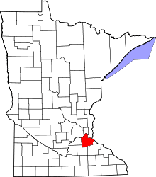 | |
| Townships | ||
| Unincorporated communities | ||
| Ghost towns | ||
| Indian reservation | ||
| Footnotes | ‡This populated place also has portions in an adjacent county or counties | |