Mille Lacs County, Minnesota
| Mille Lacs County, Minnesota | |
|---|---|
 | |
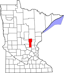 Location in the U.S. state of Minnesota | |
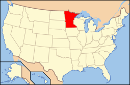 Minnesota's location in the U.S. | |
| Founded | May 23, 1857[1] |
| Named for | Mille Lacs Lake |
| Seat | Milaca |
| Largest city | Princeton |
| Area | |
| • Total | 682 sq mi (1,766 km2) |
| • Land | 572 sq mi (1,481 km2) |
| • Water | 109 sq mi (282 km2), 16% |
| Population (est.) | |
| • (2015) | 25,788 |
| • Density | 46/sq mi (18/km²) |
| Congressional district | 8th |
| Time zone | Central: UTC-6/-5 |
| Website |
www |
Mille Lacs County (/mᵻlˈlæks/ məl-LAKS) is a county located in the U.S. state of Minnesota. As of the 2010 census, the population was 26,097.[2] Its county seat is Milaca.[3] The county was founded in 1857, and its boundary was expanded in 1860.[1][4]
Mille Lacs County is included in the Minneapolis-St. Paul-Bloomington, MN-WI Metropolitan Statistical Area.
A portion of the Mille Lacs Indian Reservation is in the county.
Etymology
The name Mille Lacs, meaning "thousand lakes" in French, comes from Mille Lacs Lake (French: Grand lac du Pays des Mille Lacs), largest lake in the Brainerd Lakes Area as the area was called "Region of Thousand Lakes" (Pays des Mille Lacs) in French.[5]
History
Mille Lacs County was organized on May 23, 1857, cleaving off the easternmost portion of Benton County, Minnesota. The original Mille Lacs County consisted of the portion of the contemporary Mille Lacs County east of the west branch of the Rum River and two townships now part of Isanti County, adjacent to Mille Lacs County. In 1858, the 12 townships forming the contemporary southern 10 townships of Mille Lacs County and the 2 northwestern townships in Isanti County were organized apart from either Benton or Mille Lacs County to form Monroe County, leaving the northern "Square Top-knot" as the Mille Lacs County. In 1860, Monroe and Mille Lacs Counties merged. Shortly thereafter, the two southeastern townships were transferred to Isanti County, forming the contemporary boundaries for the county.
Geography
According to the U.S. Census Bureau, the county has a total area of 682 square miles (1,770 km2), of which 572 square miles (1,480 km2) is land and 109 square miles (280 km2) (16%) is water.[6]
Major highways
.svg.png) U.S. Highway 169
U.S. Highway 169 Minnesota State Highway 18
 Minnesota State Highway 23
 Minnesota State Highway 27
 Minnesota State Highway 47
 Minnesota State Highway 95
Adjacent counties
- Aitkin County (north)
- Kanabec County (northeast)
- Isanti County (southeast)
- Sherburne County (south)
- Benton County (southwest)
- Morrison County (west)
- Crow Wing County (northwest)
National protected area
Demographics
| Historical population | |||
|---|---|---|---|
| Census | Pop. | %± | |
| 1860 | 73 | — | |
| 1870 | 1,109 | 1,419.2% | |
| 1880 | 1,501 | 35.3% | |
| 1890 | 2,845 | 89.5% | |
| 1900 | 8,066 | 183.5% | |
| 1910 | 10,705 | 32.7% | |
| 1920 | 14,180 | 32.5% | |
| 1930 | 14,076 | −0.7% | |
| 1940 | 15,558 | 10.5% | |
| 1950 | 15,165 | −2.5% | |
| 1960 | 14,560 | −4.0% | |
| 1970 | 15,703 | 7.9% | |
| 1980 | 18,430 | 17.4% | |
| 1990 | 18,670 | 1.3% | |
| 2000 | 22,330 | 19.6% | |
| 2010 | 26,097 | 16.9% | |
| Est. 2015 | 25,788 | [7] | −1.2% |
| U.S. Decennial Census[8] 1790-1960[9] 1900-1990[10] 1990-2000[11] 2010-2015[2] | |||

As of the census of 2000,[12] there were 22,330 people, 8,638 households, and 6,003 families residing in the county. The population density was 39 people per square mile (15/km²). There were 10,467 housing units at an average density of 18 per square mile (7/km²). The racial makeup of the county was 93.55% White, 0.27% Black or African American, 4.68% Native American, 0.21% Asian, 0.01% Pacific Islander, 0.22% from other races, and 1.05% from two or more races. 0.96% of the population were Hispanic or Latino of any race. 31.9% were of German, 14.4% Swedish and 14.2% Norwegian ancestry.
There were 8,638 households out of which 32.20% had children under the age of 18 living with them, 55.50% were married couples living together, 9.50% had a female householder with no husband present, and 30.50% were non-families. 25.90% of all households were made up of individuals and 12.00% had someone living alone who was 65 years of age or older. The average household size was 2.53 and the average family size was 3.03.
In the county the population was spread out with 27.00% under the age of 18, 7.50% from 18 to 24, 26.90% from 25 to 44, 22.60% from 45 to 64, and 16.10% who were 65 years of age or older. The median age was 38 years. For every 100 females there were 98.00 males. For every 100 females age 18 and over, there were 96.10 males.
The median income for a household in the county was $36,977, and the median income for a family was $44,054. Males had a median income of $32,348 versus $22,036 for females. The per capita income for the county was $17,656. About 6.70% of families and 9.60% of the population were below the poverty line, including 10.90% of those under age 18 and 11.30% of those age 65 or over.
Communities
Cities
Townships
Unincorporated communities
Census-designated place
- Vineland (Neyaashiing)
Ghost towns
- Brickton
- Burnhelm Siding
- Esteville
- Freer
- Johnsdale
- Soule's Crossing
- Stirling
See also
References
- 1 2 "History of the County". Mille Lacs County. April 1, 2013. Retrieved October 27, 2014.
- 1 2 "State & County QuickFacts". United States Census Bureau. Retrieved September 1, 2013.
- ↑ "Find a County". National Association of Counties. Retrieved 2011-06-07.
- ↑ "Minnesota Place Names". Minnesota Historical Society. Retrieved March 18, 2014.
- ↑ Upham, Warren. (1920; repr. 1991)Minnesota Place Names St. Paul: Minnesota Historical Society Press.
- ↑ "2010 Census Gazetteer Files". United States Census Bureau. August 22, 2012. Retrieved October 21, 2014.
- ↑ "County Totals Dataset: Population, Population Change and Estimated Components of Population Change: April 1, 2010 to July 1, 2015". Retrieved July 2, 2016.
- ↑ "U.S. Decennial Census". United States Census Bureau. Retrieved October 21, 2014.
- ↑ "Historical Census Browser". University of Virginia Library. Retrieved October 21, 2014.
- ↑ "Population of Counties by Decennial Census: 1900 to 1990". United States Census Bureau. Retrieved October 21, 2014.
- ↑ "Census 2000 PHC-T-4. Ranking Tables for Counties: 1990 and 2000" (PDF). United States Census Bureau. Retrieved October 21, 2014.
- ↑ "American FactFinder". United States Census Bureau. Retrieved 2008-01-31.
External links
- Mille Lacs Messenger
- Mille Lacs County government’s website
- MNGenUSGen Web Site for Mille Lacs County, Minnesota
- Minnesota Department of Transportation map of Mille Lacs County
 |
Crow Wing County | Aitkin County | Kanabec County | |
| Morrison County | |
|||
| ||||
| | ||||
| Benton County | Sherburne County | Isanti County |
Municipalities and communities of Mille Lacs County, Minnesota, United States | ||
|---|---|---|
| Cities | | |
| Townships | ||
| CDP | ||
| Unincorporated communities | ||
| Indian reservation | ||
| Footnotes | ‡This populated place also has portions in an adjacent county or counties | |
Coordinates: 45°56′N 93°38′W / 45.93°N 93.63°W