Cass County, Minnesota
| Cass County, Minnesota | |
|---|---|
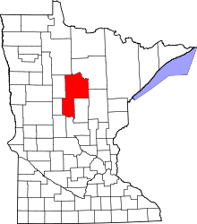 Location in the U.S. state of Minnesota | |
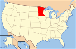 Minnesota's location in the U.S. | |
| Founded |
September 1, 1851 (created) 1897 (organized)[1] |
| Named for | Lewis Cass |
| Seat | Walker |
| Largest cities | Lake Shore |
| Area | |
| • Total | 2,414 sq mi (6,252 km2) |
| • Land | 2,022 sq mi (5,237 km2) |
| • Water | 393 sq mi (1,018 km2), 16% |
| Population (est.) | |
| • (2015) | 28,706 |
| • Density | 14/sq mi (5/km²) |
| Congressional district | 8th |
| Time zone | Central: UTC-6/-5 |
| Website |
www |
Cass County is a county located in the U.S. state of Minnesota. As of the 2010 census, the population was 28,567.[2] Its county seat is Walker.[3] The county was formed in 1851 and organized in 1897.
Cass County is included in the Brainerd, MN Micropolitan Statistical Area.
A substantial portion of the Leech Lake Indian Reservation is in the county.
History

Cass County was created on September 1, 1851 by the legislature of the Minnesota Territory. It was not formally organized until 1897. Cass County was formed from portions of Dakota, Mahkatah, Pembina and Wahnata Counties. The county was named in honor of Lewis Cass.[4] In turn, before formal organization, land from Cass County was split off to form other of the surrounding counties.
Geography
According to the U.S. Census Bureau, the county has a total area of 2,414 square miles (6,250 km2), of which 2,022 square miles (5,240 km2) is land and 393 square miles (1,020 km2) (16%) is water.[6]
Major highways
Adjacent counties
- Itasca County (northeast)
- Aitkin County (southeast)
- Crow Wing County (southeast)
- Morrison County (south)
- Todd County (southwest)
- Wadena County (west)
- Hubbard County (west)
- Beltrami County (northwest)
National protected area
- Chippewa National Forest (part)
Climate and weather
| Walker, Minnesota | ||||||||||||||||||||||||||||||||||||||||||||||||||||||||||||
|---|---|---|---|---|---|---|---|---|---|---|---|---|---|---|---|---|---|---|---|---|---|---|---|---|---|---|---|---|---|---|---|---|---|---|---|---|---|---|---|---|---|---|---|---|---|---|---|---|---|---|---|---|---|---|---|---|---|---|---|---|
| Climate chart (explanation) | ||||||||||||||||||||||||||||||||||||||||||||||||||||||||||||
| ||||||||||||||||||||||||||||||||||||||||||||||||||||||||||||
| ||||||||||||||||||||||||||||||||||||||||||||||||||||||||||||
In recent years, average temperatures in the county seat of Walker have ranged from a low of 0 °F (−18 °C) in January to a high of 79 °F (26 °C) in July, although a record low of −44 °F (−42 °C) was recorded in February 1996 and a record high of 103 °F (39 °C) was recorded in August 1976. Average monthly precipitation ranged from 0.62 inches (16 mm) in February to 4.11 inches (104 mm) in July.[7]
Demographics
| Historical population | |||
|---|---|---|---|
| Census | Pop. | %± | |
| 1860 | 150 | — | |
| 1870 | 380 | 153.3% | |
| 1880 | 486 | 27.9% | |
| 1890 | 1,247 | 156.6% | |
| 1900 | 7,777 | 523.7% | |
| 1910 | 11,620 | 49.4% | |
| 1920 | 15,897 | 36.8% | |
| 1930 | 15,591 | −1.9% | |
| 1940 | 20,646 | 32.4% | |
| 1950 | 19,468 | −5.7% | |
| 1960 | 16,720 | −14.1% | |
| 1970 | 17,323 | 3.6% | |
| 1980 | 21,050 | 21.5% | |
| 1990 | 21,791 | 3.5% | |
| 2000 | 27,150 | 24.6% | |
| 2010 | 28,567 | 5.2% | |
| Est. 2015 | 28,706 | [8] | 0.5% |
| U.S. Decennial Census[9] 1790-1960[10] 1900-1990[11] 1990-2000[12] 2010-2015[2] | |||

As of the census of 2000,[13] there were 27,150 people, 10,893 households, and 7,734 families residing in the county. The population density was 14 people per square mile (5/km²). There were 21,286 housing units at an average density of 11 per square mile (4/km²). The racial makeup of the county was 86.52% White, 0.11% Black or African American, 11.45% Native American, 0.28% Asian, 0.02% Pacific Islander, 0.14% from other races, and 1.47% from two or more races. 0.81% of the population were Hispanic or Latino of any race. 28.2% were of German, 15.0% Norwegian, 7.3% Swedish, 6.1% Irish and 6.1% American ancestry.
There were 10,893 households out of which 27.70% had children under the age of 18 living with them, 58.40% were married couples living together, 8.00% had a female householder with no husband present, and 29.00% were non-families. 25.00% of all households were made up of individuals and 11.90% had someone living alone who was 65 years of age or older. The average household size was 2.45 and the average family size was 2.90.
In the county the population was spread out with 25.00% under the age of 18, 6.10% from 18 to 24, 23.00% from 25 to 44, 27.90% from 45 to 64, and 18.00% who were 65 years of age or older. The median age was 42 years. For every 100 females there were 101.90 males. For every 100 females age 18 and over, there were 100.60 males.
The median income for a household in the county was $34,332, and the median income for a family was $40,156. Males had a median income of $30,097 versus $21,232 for females. The per capita income for the county was $17,189. About 9.50% of families and 13.60% of the population were below the poverty line, including 18.20% of those under age 18 and 13.30% of those age 65 or over.
Communities
Cities
- Backus
- Bena
- Boy River
- Cass Lake
- Chickamaw Beach
- East Gull Lake
- Federal Dam
- Hackensack
- Lake Shore
- Longville
- Motley (partial)
- Pillager
- Pine River
- Remer
- Walker (county seat)
Townships
- Ansel Township
- Barclay Township
- Becker Township
- Beulah Township
- Birch Lake Township
- Blind Lake Township
- Boy Lake Township
- Boy River Township
- Bull Moose Township
- Bungo Township
- Byron Township
- Crooked Lake Township
- Deerfield Township
- Fairview Township
- Gould Township
- Hiram Township
- Home Brook Township
- Inguadona Township
- Kego Township
- Leech Lake Township
- Lima Township
- Loon Lake Township
- Maple Township
- May Township
- McKinley Township
- Meadow Brook Township
- Moose Lake Township
- Otter Tail Peninsula Township
- Pike Bay Township
- Pine Lake Township
- Pine River Township
- Ponto Lake Township
- Poplar Township
- Powers Township
- Remer Township
- Rogers Township
- Salem Township
- Shingobee Township
- Slater Township
- Smoky Hollow Township
- Sylvan Township
- Thunder Lake Township
- Torrey Township
- Trelipe Township
- Turtle Lake Township
- Wabedo Township
- Walden Township
- Wilkinson Township
- Wilson Township
- Woodrow Township
Unorganized territories
Unincorporated communities
See also
References
- ↑ "Minnesota Place Names". Minnesota Historical Society. Retrieved March 17, 2014.
- 1 2 "State & County QuickFacts". United States Census Bureau. Retrieved August 31, 2013.
- ↑ "Find a County". National Association of Counties. Archived from the original on 2011-05-31. Retrieved 2011-06-07.
- ↑ Upham, Warren. "Cass County" in Minnesota Place Names: A Geographical Encyclopedia, 3rd Edition.. Minnesota Historical Society Press (St. Paul, 2001) ISBN 0-87351-396-7.
- ↑ Nelson, Steven (2011). Savanna Soils of Minnesota. Minnesota: Self. pp. 53 - 56. ISBN 978-0-615-50320-2.
- ↑ "2010 Census Gazetteer Files". United States Census Bureau. August 22, 2012. Archived from the original on October 6, 2014. Retrieved October 6, 2014.
- 1 2 "Monthly Averages for Walker, Minnesota". The Weather Channel. Retrieved 2011-11-06.
- ↑ "County Totals Dataset: Population, Population Change and Estimated Components of Population Change: April 1, 2010 to July 1, 2015". Retrieved July 2, 2016.
- ↑ "U.S. Decennial Census". United States Census Bureau. Archived from the original on April 22, 2013. Retrieved October 6, 2014.
- ↑ "Historical Census Browser". University of Virginia Library. Retrieved October 6, 2014.
- ↑ "Population of Counties by Decennial Census: 1900 to 1990". United States Census Bureau. Retrieved October 6, 2014.
- ↑ "Census 2000 PHC-T-4. Ranking Tables for Counties: 1990 and 2000" (PDF). United States Census Bureau. Retrieved October 6, 2014.
- ↑ "American FactFinder". United States Census Bureau. Archived from the original on 2013-09-11. Retrieved 2008-01-31.
External links
- Cass County government's website
- Minnesota Department of Transportation map of Cass County (southern portion, west central portion, east central portion, northern portion)
 |
Hubbard County and Beltrami County | Itasca County | | |
| Wadena County | |
|||
| ||||
| | ||||
| Todd County and Wadena County | Crow Wing County and Morrison County | Aitkin County and Crow Wing County |
Municipalities and communities of Cass County, Minnesota, United States | ||
|---|---|---|
| Cities | | |
| Townships |
| |
| Unorganized territories | ||
| CDP | ||
| Unincorporated communities | ||
| Indian reservation | ||
| Ghost town | ||
| Footnotes | ‡This populated place also has portions in an adjacent county or counties | |
Cities in the Brainerd Lakes area, Minnesota | |||||||
|---|---|---|---|---|---|---|---|
| Core City |  | ||||||
| Surrounding communities |
| ||||||
| Counties | |||||||
† indicates a county seat. ‡ indicates that it is partially in the micropolitan area. § indicates a CDP. | |||||||
Coordinates: 46°57′N 94°19′W / 46.95°N 94.32°W