Alta Sierra, California
| Alta Sierra | |
|---|---|
| census-designated place | |
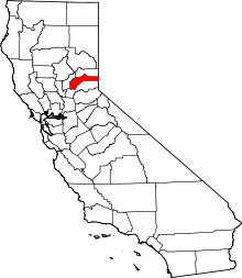
 Location in Nevada County and the state of California | |
 Alta Sierra Location in the United States | |
| Coordinates: 39°7′44″N 121°3′9″W / 39.12889°N 121.05250°WCoordinates: 39°7′44″N 121°3′9″W / 39.12889°N 121.05250°W | |
| Country |
|
| State |
|
| County | Nevada |
| Area[1] | |
| • Total | 8.338 sq mi (21.594 km2) |
| • Land | 8.317 sq mi (21.541 km2) |
| • Water | 0.021 sq mi (0.053 km2) 0.25% |
| Elevation | 2,310 ft (704 m) |
| Population (2010) | |
| • Total | 6,911 |
| • Density | 830/sq mi (320/km2) |
| Time zone | Pacific (PST) (UTC-8) |
| • Summer (DST) | PDT (UTC-7) |
| ZIP code | 95949 |
| Area code(s) | 530 |
| FIPS code | 06-01360 |
| GNIS feature ID | 1682830 |
Alta Sierra is a census-designated place (CDP) in Nevada County, California, United States. The population was 6,911 at the 2010 census, up from 6,522 at the 2000 census.
History
Alta Sierra was laid out by property developers in the 1960s.[2]
Geography
Alta Sierra is located at 39°7′44″N 121°3′9″W / 39.12889°N 121.05250°W (39.128952, -121.052442).[3]
According to the United States Census Bureau, the CDP has a total area of 8.3 square miles (21 km2), of which, 8.3 square miles (21 km2) of it is land and 0.02 square miles (0.052 km2) of it (0.25%) is water.
There is also another community called Alta Sierra in northcentral Kern County, CA near Lake Isabella.
Climate
| Climate data for Alta Sierra, California | |||||||||||||
|---|---|---|---|---|---|---|---|---|---|---|---|---|---|
| Month | Jan | Feb | Mar | Apr | May | Jun | Jul | Aug | Sep | Oct | Nov | Dec | Year |
| Average high °F (°C) | 53 (12) |
56 (13) |
59 (15) |
65 (18) |
73 (23) |
82 (28) |
89 (32) |
89 (32) |
83 (28) |
73 (23) |
60 (16) |
52 (11) |
69.5 (20.9) |
| Average low °F (°C) | 34 (1) |
35 (2) |
38 (3) |
41 (5) |
47 (8) |
53 (12) |
58 (14) |
57 (14) |
52 (11) |
45 (7) |
38 (3) |
34 (1) |
44.3 (6.8) |
| Average precipitation inches (mm) | 9.0 (229) |
8.9 (226) |
8.5 (216) |
4.1 (104) |
2.4 (61) |
.7 (18) |
0 (0) |
.2 (5) |
.9 (23) |
2.9 (74) |
6.9 (175) |
10.3 (262) |
54.8 (1,393) |
| Average snowfall inches (cm) | 1.1 (2.8) |
2.7 (6.9) |
2.3 (5.8) |
.3 (0.8) |
0 (0) |
0 (0) |
0 (0) |
0 (0) |
0 (0) |
0 (0) |
.3 (0.8) |
1.4 (3.6) |
8.1 (20.7) |
| Source: [4] | |||||||||||||
Demographics
2010
The 2010 United States Census[5] reported that Alta Sierra had a population of 6,911. The population density was 828.9 people per square mile (320.0/km²). The racial makeup of Alta Sierra was 6,436 (93.1%) White, 18 (0.3%) African American, 55 (0.8%) Native American, 73 (1.1%) Asian, 9 (0.1%) Pacific Islander, 122 (1.8%) from other races, and 198 (2.9%) from two or more races. Hispanic or Latino of any race were 488 persons (7.1%).
The Census reported that 6,890 people (99.7% of the population) lived in households, 0 (0%) lived in non-institutionalized group quarters, and 21 (0.3%) were institutionalized.
There were 2,830 households, out of which 726 (25.7%) had children under the age of 18 living in them, 1,794 (63.4%) were opposite-sex married couples living together, 197 (7.0%) had a female householder with no husband present, 109 (3.9%) had a male householder with no wife present. There were 127 (4.5%) unmarried opposite-sex partnerships, and 29 (1.0%) same-sex married couples or partnerships. 580 households (20.5%) were made up of individuals and 305 (10.8%) had someone living alone who was 65 years of age or older. The average household size was 2.43. There were 2,100 families (74.2% of all households); the average family size was 2.78.
The population was spread out with 1,345 people (19.5%) under the age of 18, 401 people (5.8%) aged 18 to 24, 1,208 people (17.5%) aged 25 to 44, 2,339 people (33.8%) aged 45 to 64, and 1,618 people (23.4%) who were 65 years of age or older. The median age was 49.8 years. For every 100 females there were 97.5 males. For every 100 females age 18 and over, there were 94.7 males.
There were 3,030 housing units at an average density of 363.4 per square mile (140.3/km²), of which 2,403 (84.9%) were owner-occupied, and 427 (15.1%) were occupied by renters. The homeowner vacancy rate was 2.4%; the rental vacancy rate was 5.1%. 5,654 people (81.8% of the population) lived in owner-occupied housing units and 1,236 people (17.9%) lived in rental housing units.
2000
As of the census[6] of 2000, there were 6,522 people, 2,577 households, and 2,084 families residing in the CDP. The population density was 779.0 people per square mile (300.9/km²). There were 2,682 housing units at an average density of 320.3 per square mile (123.7/km²). The racial makeup of the CDP was 95.94% White, 0.29% Black or African American, 0.57% Native American, 0.74% Asian, 0.09% Pacific Islander, 0.64% from other races, and 1.73% from two or more races. 4.14% of the population were Hispanic or Latino of any race.
There were 2,577 households out of which 27.0% had children under the age of 18 living with them, 72.4% were married couples living together, 6.4% had a female householder with no husband present, and 19.1% were non-families. 15.3% of all households were made up of individuals and 8.7% had someone living alone who was 65 years of age or older. The average household size was 2.53 and the average family size was 2.78.
In the CDP the population was spread out with 21.7% under the age of 18, 4.2% from 18 to 24, 20.0% from 25 to 44, 30.1% from 45 to 64, and 24.0% who were 65 years of age or older. The median age was 47 years. For every 100 females there were 97.5 males. For every 100 females age 18 and over, there were 93.7 males.
The median income for a household in the CDP was $56,868, and the median income for a family was $59,776. Males had a median income of $47,121 versus $31,302 for females. The per capita income for the CDP was $28,876. About 3.2% of families and 4.3% of the population were below the poverty line, including 2.1% of those under age 18 and 3.6% of those age 65 or over.
Politics
In the state legislature, Alta Sierra is in the 1st Senate District, represented by Republican Ted Gaines,[7] and the 1st Assembly District, represented by Republican Brian Dahle.[8]
Federally, Alta Sierra is in California's 1st congressional district, represented by Republican Doug LaMalfa.[9]
References
- ↑ U.S. Census Archived 2012-01-24 at WebCite
- ↑ "Urban refugees, country-seekers flock to Nevada County developments for 'good life'". The Union. July 26, 2014. Retrieved 13 October 2015.
- ↑ "US Gazetteer files: 2010, 2000, and 1990". United States Census Bureau. 2011-02-12. Retrieved 2011-04-23.
- ↑ "Alta Sierra, CA Weather". Usa.com. Retrieved 2013-11-13.
- ↑ "2010 Census Interactive Population Search: CA - Alta Sierra CDP". U.S. Census Bureau. Retrieved July 12, 2014.
- ↑ "American FactFinder". United States Census Bureau. Archived from the original on 2013-09-11. Retrieved 2008-01-31.
- ↑ "Senators". State of California. Retrieved March 10, 2013.
- ↑ "Members Assembly". State of California. Retrieved March 2, 2013.
- ↑ "California's 1st Congressional District - Representatives & District Map". Civic Impulse, LLC. Retrieved March 2, 2013.
External links
 |
Penn Valley | Grass Valley | Norden | |
| Wheatland | |
Foresthill | ||
| ||||
| | ||||
| Lincoln | North Auburn | Georgetown |