Langs, California
| Langs | |
|---|---|
| Former settlement | |
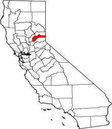
 Langs Location in California | |
| Coordinates: 39°19′12″N 120°39′28″W / 39.32000°N 120.65778°WCoordinates: 39°19′12″N 120°39′28″W / 39.32000°N 120.65778°W | |
| Country |
|
| State |
|
| County | Nevada County |
| Elevation[1] | 1,380 m (4,528 ft) |
Langs (also, Lang Crossing)[2] is a former settlement in Nevada County, California. Situated at an elevation of 4,528 ft (1,380 m) above sea level,[1] it still appeared on maps as of 1902.[1] Langs is located on the South Yuba River, 2.25 miles (3.6 km) west of Yuba Gap.[2]
References
This article is issued from Wikipedia - version of the 6/26/2011. The text is available under the Creative Commons Attribution/Share Alike but additional terms may apply for the media files.