Carmichael, California
| Carmichael | |
|---|---|
| Census designated place | |
 | |
| Coordinates: 38°38′22″N 121°19′17″W / 38.63944°N 121.32139°WCoordinates: 38°38′22″N 121°19′17″W / 38.63944°N 121.32139°W | |
| Country |
|
| State |
|
| County | Sacramento |
| Area[1] | |
| • Total | 13.793 sq mi (35.724 km2) |
| • Land | 13.528 sq mi (35.038 km2) |
| • Water | 0.265 sq mi (0.686 km2) 1.92% |
| Elevation[2] | 125 ft (38 m) |
| Population (April 1, 2010) | |
| • Total | 61,762 |
| • Density | 4,500/sq mi (1,700/km2) |
| Time zone | Pacific (UTC-8) |
| • Summer (DST) | PDT (UTC-7) |
| ZIP codes | 95608-95609 |
| Area code | 916 |
| FIPS code | 06-11390 |
| GNIS feature ID | 277484 |
Carmichael is a census-designated place (CDP) in Sacramento County, California, United States. It is a suburb in the Greater Sacramento metropolitan area. The population was 61,762 at the 2010 census.
Geography and geology
Carmichael is located at 38°38′22″N 121°19′17″W / 38.63944°N 121.32139°W (38.639431, -121.321348).[3] According to the United States Census Bureau, the CDP has a total area of 13.8 square miles (36 km2), of which, 13.5 square miles (35 km2) of it is land and 0.3 square miles (0.78 km2) of it (1.92%) is water.
History
Daniel W. Carmichael (born 1867) came to California in 1885.[4] In 1909, he developed Carmichael Colony No. I, 2,000 acres (8 km2) of what was once part of the Rancho San Juan Mexican land grant. Carmichael later bought another 1,000 acres (4 km2) previously part of the Rancho Del Paso Mexican land grant, that he called Carmichael Colony No. 2. It bordered the first colony to the east and Walnut Avenue to the west; the southern boundary was Arden Way with Sutter Avenue to the north.
Demographics
2010
The 2010 United States Census[5] reported that Carmichael had a population of 61,762. The population density was 4,477.8 people per square mile (1,728.9/km²). The racial makeup of Carmichael was 49,776 (80.6%) White, 3,972 (5.8%) African American, 546 (0.9%) Native American, 2,653 (4.3%) Asian (0.9% Filipino, 0.9% Chinese, 0.6% Korean, 0.5% Japanese, 0.5% Indian, 0.3% Vietnamese, 0.6% Other), 287 (0.5%) Pacific Islander, 2,035 (3.3%) from other races, and 3,493 (5.7%) from two or more races. Hispanic or Latino of any race were 7,218 persons (11.7%).
The Census reported that 60,790 people (98.4% of the population) lived in households, 467 (0.8%) lived in non-institutionalized group quarters, and 505 (0.8%) were institutionalized.
There were 26,036 households, out of which 7,431 (28.5%) had children under the age of 18 living in them, 11,016 (42.3%) were opposite-sex married couples living together, 3,630 (13.9%) had a female householder with no husband present, 1,417 (5.4%) had a male householder with no wife present. There were 1,642 (6.3%) unmarried opposite-sex partnerships, and 229 (0.9%) same-sex married couples or partnerships. 8,080 households (31.0%) were made up of individuals and 3,363 (12.9%) had someone living alone who was 65 years of age or older. The average household size was 2.33. There were 16,063 families (61.7% of all households); the average family size was 2.91.
The population was spread out with 13,060 people (21.1%) under the age of 18, 5,370 people (8.7%) aged 18 to 24, 14,388 people (23.3%) aged 25 to 44, 18,054 people (29.2%) aged 45 to 64, and 10,890 people (17.6%) who were 65 years of age or older. The median age was 42.4 years. For every 100 females there were 89.6 males. For every 100 females age 18 and over, there were 86.1 males.
There were 28,165 housing units at an average density of 2,042.0 per square mile (788.4/km²), of which 14,472 (55.6%) were owner-occupied, and 11,564 (44.4%) were occupied by renters. The homeowner vacancy rate was 2.3%; the rental vacancy rate was 9.8%. 34,442 people (55.8% of the population) lived in owner-occupied housing units and 26,348 people (42.7%) lived in rental housing units.
2000
As of the census[6] of 2000, there were 49,742 people, 20,631 households, and 13,224 families residing in the CDP. The population density was 4,622.2 people per square mile (1,784.9/km2). There were 21,383 housing units at an average density of 1,987.0 per square mile (767.3/km2). The racial makeup of the CDP was 86.61% White, 2.69% African American, 0.83% Native American, 3.58% Asian, 0.27% Pacific Islander, 2.09% from other races, and 3.92% from two or more races. Hispanic or Latino of any race were 6.99% of the population.
There were 20,631 households out of which 29.4% had children under the age of 18 living with them, 46.7% were married couples living together, 12.9% had a female householder with no husband present, and 35.9% were non-families. 29.0% of all households were made up of individuals and 10.5% had someone living alone who was 65 years of age or older. The average household size was 2.36 and the average family size was 2.90.
In the CDP the population was spread out with 23.3% under the age of 18, 8.2% from 18 to 24, 26.6% from 25 to 44, 24.8% from 45 to 64, and 17.1% who were 65 years of age or older. The median age was 40 years. For every 100 females there were 89.9 males. For every 100 females age 18 and over, there were 85.6 males.
The median income for a household in the CDP was $47,041, and the median income for a family was $59,002. Males had a median income of $40,435 versus $32,265 for females. The per capita income for the CDP was $26,811. About 6.4% of families and 9.8% of the population were below the poverty line, including 12.8% of those under age 18 and 4.2% of those age 65 or over.
Government
In the California State Legislature, Carmichael is in the 4th Senate District, represented by Republican Jim Nielsen, and in the 8th Assembly District, represented by Democrat Ken Cooley.[7]
In the United States House of Representatives, Carmichael is in California's 7th congressional district, represented by Democrat Ami Bera.[8]
Carmichael schools
Carmichael is served by one public school district, San Juan Unified.
Elementary schools
- Cameron Ranch Elementary
- Carmichael Elementary
- Coyle Avenue Elementary
- Del Dayo Elementary
- Deterding, Mary A, Elementary
- Garfield Elementary (no longer exists, became the San Juan pupil enrollment office)
- Kelly, Thomas Elementary
- Mission Avenue Elementary
- Peck, Charles Elementary
- Schweitzer, Albert Elementary
- Victory Christian School K-12
- El Rancho Elementary School K-8
Junior high schools
- Barrett, John Middle School
- Churchill, Winston Middle School
- Our Lady of the Assumption Catholic School (K-8)
- Starr King Middle School (K-8)
- St. John the Evangelist Catholic School (K-8)
- Victory Christian School K-12
- Arcade Fundamental Middle School
- El Rancho Elementary School K-8
High schools
La Sierra High School operated from 1957 to 1983, when it was closed due to budget cuts, being selected among several schools in the district due to having the lowest attendance. The site became La Sierra Community Center in 1985.[9]
Though no public high school is currently located in Carmichael, high school students in Carmichael attend several nearby schools in the San Juan Unified School District[10] such as:
- Bella Vista High School in Fair Oaks[11]
- Casa Roble High School in Orangevale[12]
- Del Campo High School in Fair Oaks[13]
- El Camino Fundamental High School in Sacramento[14]
- Encina High School in Sacramento[15]
- Mesa Verde High School in Citrus Heights[16]
- Mira Loma High School in Sacramento[17]
- San Juan High School in Citrus Heights[18]
- Rio Americano High School in Sacramento[19]
Points of interest
Carmichael Park
Carmichael Park is a major 38-acre (150,000 m2) park in the town. The park includes 5 ballfields and 6 tennis courts and a 9-hole disc golf course. The Community Clubhouse, Veterans' Memorial Building, the Daniel Bishop Memorial Pavilion for the Performing Arts, and the Great Wall of Carmichael are all located within the park.[20] A year-round farmers market is also located at the park every Sunday from 9 a.m. to 1 p.m., hosted by the non-profit BeMoneySmartUSA.[21][22]
Jensen Botanical Gardens
The Jensen Botanical Gardens are located at 8520 Fair Oaks Boulevard. The gardens exhibit a variety of flora including camellias, dogwoods, azaleas, and rhododendrons.
Chautauqua Playhouse
The Chautauqua Playhouse has been located in the La Sierra Community Center since 1985. The 95-seat theater shows comedies, dramas, and musicals. In addition, it has a children's theater with performances held on Saturdays. Chautauqua Playhouse is located at 5325 Engle Road (between Walnut Avenue and Fair Oaks Boulevard).
Ancil Hoffman Park
Ancil Hoffman Park is a major park located within the American River Parkway in Carmichael, California. It is a 396-acre (1.60 km2) park. A major feature of the park is the Effie Yeaw Nature Center. The oak-canopied park is bordered on two sides by the American River. Reconstructed Maidu Indian homes are located at the entrance to the nature center. The Ancil Hoffman Golf Course is also part of the park. Many species of animals can be seen, including wild turkey, deer, coyotes and hawks. One can access the park by taking the Watt Avenue exit off Highway 50.
American River Parkway
The American River Parkway is a 28-mile (45 km) parkway that runs along the American River throughout Sacramento County, California. The parkway consists of many smaller parks and boat launching points. It can be accessed by various exits off Highway 50 in Sacramento County.
American River Bike Trail
A portion of the American River Bike Trail traverses Carmichael near the southern community boundary. The bike trail is a popular multi-use recreational facility as well as by bicycle commuters.
Notable residents
- Dusty Baker, professional baseball player and manager of the Washington Nationals (graduated from Del Campo High School)
- Matt Barnes, Sacramento Kings small forward (graduated from Del Campo High School)
- Chris Bosio, MLB player for the Milwaukee Brewers and Seattle Mariners, coach for Chicago Cubs
- Wesley Chesbro, California State Assemblyman and former State Senator from Arcata, CA
- John Daly, golfer, winner of 1991 PGA Championship and 1995 Open Championship (born in Carmichael)
- Milt Gantenbein, three-time NFL champion for the Green Bay Packers, born in New Albin, Iowa
- Andrew Gray, 26-year-old actor/model, plays role of Red Ranger in Power Rangers Megaforce
- Ian Hecox and Anthony Padilla of the Internet comedy duo Smosh.
- Laura Ling,[23] American journalist, imprisoned in North Korea in 2009 for allegedly committing "hostile acts"
- Lisa Ling,[23] television personality and host of National Geographic Channel's Explorer
- Debbie Meyer, Olympic swimming gold medalist (graduated from Rio Americano High School)
- Scott Miller (1960–2013),[24] guitarist and leader of bands Game Theory and The Loud Family
- Manny Parra, Milwaukee Brewers starting pitcher
- Alek Skarlatos, Oregon Army National Guardsman, recipient of the Knights of the Legion of Honour
- Brenda Song, from the TV series The Suite Life of Zack & Cody
- Spencer Stone, United States Air Force staff sergeant
- Marshall Sperbeck, head football coach, Sacramento State University (2007–2014)
- Peja Stojaković, NBA player for the Sacramento Kings.
- Melissa Uroff, artist and founder of online magazine TUBE. (graduated from Rio Americano High School)
- Cynthia Robinson, trumpeter and vocalist Sly & The Family Stone
Adjacent areas
 |
North Highlands, Foothill Farms | Foothill Farms, Citrus Heights | Citrus Heights | |
| Arden-Arcade | |
Fair Oaks | ||
| ||||
| | ||||
| Arden-Arcade, Rancho Cordova | Rancho Cordova | Rancho Cordova |
See also
References
- ↑ "2010 Census U.S. Gazetteer Files – Places – California". United States Census Bureau.
- ↑ "Carmichael". Geographic Names Information System. United States Geological Survey. Retrieved April 18, 2015.
- ↑ "US Gazetteer files: 2010, 2000, and 1990". United States Census Bureau. 2011-02-12. Retrieved 2011-04-23.
- ↑ Leigh Hadley Irvine, 1905, A history of the new California: its resources and people, Volume 2, The Lewis Publishing Company
- ↑ "2010 Census Interactive Population Search: CA - Carmichael CDP". U.S. Census Bureau. Retrieved July 12, 2014.
- ↑ "American FactFinder". United States Census Bureau. Archived from the original on 2013-09-11. Retrieved 2008-01-31.
- ↑ "Statewide Database". UC Regents. Retrieved December 6, 2014.
- ↑ "California's 7th Congressional District - Representatives & District Map". Civic Impulse, LLC. Retrieved March 9, 2013.
- ↑ Lasierraonline
- ↑ main high school index Archived September 3, 2011, at the Wayback Machine.
- ↑ Bella Vista District site
- ↑ Casa Roble District site
- ↑ Del Campo District site
- ↑ El Camino District site
- ↑ Encina District site
- ↑ Mesa Verde District site
- ↑ Mira Loma District site
- ↑ New San Juan District site
- ↑ Rio Americano District site
- ↑ Carmichael Park Archived May 18, 2007, at the Wayback Machine.
- ↑ Farmers Market
- ↑ BeMoneySmartUSA
- 1 2 CBS Broadcasting Inc. "Lisa Ling's Sister Detained In North Korea". CBS13.com. Sacramento, CA. Archived from the original on 2009-03-23.
- ↑ Barton, David (May 23, 2003). "Scott Miller: Deep-thinking "failure" of a pop star". Sacramento Bee. Archived from the original on 2013-11-06.
Miller, who grew up in Carmichael before leaving for the San Francisco Bay Area...
External links
Municipalities and communities of Sacramento County, California, United States | ||
|---|---|---|
| Cities | 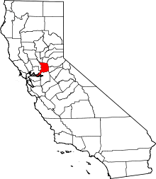 | |
| CDPs | ||
| Unincorporated communities | ||
| Ghost towns | ||