Roseville, California
| Roseville, California | ||
|---|---|---|
| City | ||
| City of Roseville | ||
|
Roseville's Civic Center. | ||
| ||
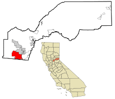 Location in Placer County and the state of California | ||
 Roseville, California Location in the United States | ||
| Coordinates: 38°45′9″N 121°17′22″W / 38.75250°N 121.28944°WCoordinates: 38°45′9″N 121°17′22″W / 38.75250°N 121.28944°W | ||
| Country |
| |
| State |
| |
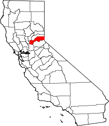
| County |
| |
| Incorporated | April 10, 1909[1] | |
| Government | ||
| • Type | Council-manager[2] | |
| • Mayor | Carol Garcia[2] | |
| • State Senator | Jim Nielsen (R)[3] | |
| • Assemblymember | Kevin Kiley (R)[3] | |
| • U.S. Rep. | Tom McClintock (R)[4] | |
| Area[5] | ||
| • Total | 36.223 sq mi (93.817 km2) | |
| • Land | 36.222 sq mi (93.814 km2) | |
| • Water | 0.001 sq mi (0.003 km2) 0% | |
| Elevation[6] | 164 ft (50 m) | |
| Population (April 1, 2010)[7] | ||
| • Total | 118,788 | |
| • Estimate (2013)[7] | 127,035 | |
| • Rank |
1st in Placer County 47th in California | |
| • Density | 3,300/sq mi (1,300/km2) | |
| Time zone | Pacific (UTC-8) | |
| • Summer (DST) | PDT (UTC-7) | |
| ZIP codes | 95678, 95661, 95747 | |
| Area code(s) | 916 | |
| FIPS code | 06-62938 | |
| GNIS feature IDs | 1659544, 2411000 | |
| Website |
www | |
| U.S. Geological Survey Geographic Names Information System: Roseville, California | ||

Roseville (formerly, Roseville Junction,[6] Junction,[8] and Grider's[8]) is the largest city in Placer County, California, United States, located in the Sacramento metropolitan area. As of January 1, 2015, the state Department of Finance estimated the city's population to be 128,382.[9] Interstate 80 runs through Roseville and State Route 65 runs through part of the northern edge of the city.
History
The settlement was originally a stage coach station called Griders.[8] According to the Roseville Historical Society,[10] in 1864 the Central Pacific Railroad tracks were constructed eastward from Sacramento, and when they crossed a small California Central Railroad line they named the spot "Junction". Junction eventually became known as Roseville. In 1909, three years after the Southern Pacific Railroad moved its facilities from Rocklin to Roseville, the town became an incorporated city. What followed was a period of expansion, with the community building more than 100 structures, including what was the largest ice manufacturing plant in the world (Pacific Fruit Express building, in 1913).
The city was a railroad town for decades, with the railroad employing up to 1,225 people by 1929, out of a population of only 6,425 people.[11] With the onset of World War II, the rail yards became busier than ever, and the post-war building boom brought continued prosperity. However, the nature of the city changed dramatically in the 1950s.
During the 1950s the railroad continued to expand and upgrade, converting its steam engine fleet to all diesel engines by the end of the decade. However, the railroads began falling in the shadow of air travel and the development of the national Interstate Highway System. Thus, although the railroad remained (and still remains) a major employer, the expansion of the city began branching out into other employment sectors. Another important change during this period was the Washington Boulevard (then called Seawell) railroad underpass construction in 1950. While this improved the ability of people to travel from one side of the tracks to the other, it meant that people were no longer traveling through the Roseville business district north of the tracks. The completion of Interstate 80 in 1956 shifted the population from downtown to what would become known as East Roseville. The old downtown area slid into a gradual decline.
The city saw steady population growth throughout the ensuing decades, as shopping centers, major retailers, and homes were constructed throughout the city. The growth rate was modest until 1985. Between 1929 when the population was 6,425 people and 1985, the population grew by only 22,563 people. In 1985 the population stood at 28,988 people. Five years later it was 44,685 people, and by the year 2000 it was 74,234 people. Some of this growth was fueled by the location of major employers, such as Hewlett Packard (in 1979) and NEC (in 1983). The population as of 2014 was 126,956 people.[12]
While the character of Roseville has changed over the years, as the city grew from its small-town beginnings to its status as a major urban city today, it has retained some of its historic beginnings. Roseville is no longer a railroad town, but the Union Pacific Railroad is still the sixth largest employer (see Major Employers section, below). Current visitors can now visit the revitalized historic Vernon Street and old Downtown areas which had been in decline for decades, but were recently rehabilitated (see Revitalization section, below).
Geography
Roseville is located at 38°45′09″N 121°17′22″W / 38.752434°N 121.289338°W.[13]
According to the Roseville Civic Center, the city has a total area of 42.26 square miles (109.5 km2), of which, 42.24 square miles (109.4 km2) of it is land and 0.002 square miles (0.0052 km2) of it (0.00%) is water. Several streams flow through Roseville, including Dry Creek, Linda Creek, Secret Ravine and Cirby Creek.
Climate
Roseville has a hot-summer Mediterranean climate that is characterized by cool, wet winters and hot, dry summers (Köppen Csa). The "wet season" is generally October through April. Average daily high temperatures range from 53 °F (12 °C) in January to 94 °F (34 °C) in July and 92 °F in August (33 °C). Daily low temperatures range from 39 °F in winter to 61 °F in summer (4 to 16 °C). On March 27, 2014, an EF-0 tornado touched down in a neighborhood in this city. Like neighboring cities Lincoln, Rocklin and Sacramento. Roseville has snowless winters apart for some occasions.
| Climate data for Roseville, California | |||||||||||||
|---|---|---|---|---|---|---|---|---|---|---|---|---|---|
| Month | Jan | Feb | Mar | Apr | May | Jun | Jul | Aug | Sep | Oct | Nov | Dec | Year |
| Record high °F (°C) | 75 (24) |
78 (26) |
86 (30) |
98 (37) |
107 (42) |
110 (43) |
115 (46) |
110 (43) |
111 (44) |
102 (39) |
87 (31) |
76 (24) |
115 (46) |
| Average high °F (°C) | 53 (12) |
60 (16) |
64 (18) |
71 (22) |
80 (27) |
88 (31) |
94 (34) |
92 (33) |
87 (31) |
77 (25) |
63 (17) |
54 (12) |
73.6 (23.2) |
| Daily mean °F (°C) | 46 (8) |
51 (11) |
54 (12) |
60 (16) |
66 (19) |
73 (23) |
78 (26) |
76 (24) |
73 (23) |
65 (18) |
54 (12) |
47 (8) |
61.9 (16.7) |
| Average low °F (°C) | 39 (4) |
42 (6) |
44 (7) |
48 (9) |
53 (12) |
58 (14) |
61 (16) |
61 (16) |
58 (14) |
52 (11) |
44 (7) |
39 (4) |
49.9 (10) |
| Record low °F (°C) | 21 (−6) |
23 (−5) |
27 (−3) |
33 (1) |
36 (2) |
43 (6) |
48 (9) |
46 (8) |
41 (5) |
31 (−1) |
27 (−3) |
16 (−9) |
16 (−9) |
| Average precipitation inches (mm) | 3.98 (101.1) |
3.46 (87.9) |
3.07 (78) |
1.58 (40.1) |
0.58 (14.7) |
0.12 (3) |
0.04 (1) |
0.06 (1.5) |
0.35 (8.9) |
1.08 (27.4) |
2.80 (71.1) |
3.33 (84.6) |
20.45 (519.3) |
| Source: http://www.myforecast.com/bin/climate.m?city=12133&metric=false | |||||||||||||
Demographics
| Historical population | |||
|---|---|---|---|
| Census | Pop. | %± | |
| 1870 | 115 | — | |
| 1880 | 258 | 124.3% | |
| 1890 | 345 | 33.7% | |
| 1910 | 2,608 | — | |
| 1920 | 4,477 | 71.7% | |
| 1930 | 6,425 | 43.5% | |
| 1940 | 6,653 | 3.5% | |
| 1950 | 8,723 | 31.1% | |
| 1960 | 13,421 | 53.9% | |
| 1970 | 18,221 | 35.8% | |
| 1980 | 24,347 | 33.6% | |
| 1990 | 44,685 | 83.5% | |
| 2000 | 79,921 | 78.9% | |
| 2010 | 118,788 | 48.6% | |
| Est. 2015 | 130,269 | [14] | 9.7% |
2010
The 2010 United States Census[16] reported that Roseville had a population of 118,788. The population density was 3,279.4 people per square mile (1,266.2/km²). The racial makeup of Roseville was 94,199 (79.3%) White, 2,329 (2.0%) African American, 885 (0.7%) Native American, 10,026 (8.4%) Asian (3.1% Filipino, 2.0% Indian, 1.0% Chinese, 0.6% Japanese, 0.6% Vietnamese, 0.5% Korean, 0.8% Other), 346 (0.3%) Pacific Islander, 5,087 (4.3%) from other races, and 5,916 (5.0%) from two or more races. Hispanic or Latino of any race were 17,359 persons (14.6%).
The Census reported that 117,941 people (99.3% of the population) lived in households, 478 (0.4%) lived in non-institutionalized group quarters, and 369 (0.3%) were institutionalized.
There were 45,059 households, out of which 16,885 (37.5%) had children under the age of 18 living in them, 24,050 (53.4%) were opposite-sex married couples living together, 4,901 (10.9%) had a female householder with no husband present, 2,088 (4.6%) had a male householder with no wife present. There were 2,518 (5.6%) unmarried opposite-sex partnerships, and 286 (0.6%) same-sex married couples or partnerships. 11,042 households (24.5%) were made up of individuals and 4,502 (10.0%) had someone living alone who was 65 years of age or older. The average household size was 2.62. There were 31,039 families (68.9% of all households); the average family size was 3.14.
The population was spread out with 31,210 people (26.3%) under the age of 18, 9,397 people (7.9%) aged 18 to 24, 33,362 people (28.1%) aged 25 to 44, 28,952 people (24.4%) aged 45 to 64, and 15,867 people (13.4%) who were 65 years of age or older. The median age was 36.8 years. For every 100 females there were 91.9 males. For every 100 females age 18 and over, there were 88.4 males.
There were 47,757 housing units at an average density of 1,318.4 per square mile (509.0/km²), of which 29,513 (65.5%) were owner-occupied, and 15,546 (34.5%) were occupied by renters. The homeowner vacancy rate was 2.3%; the rental vacancy rate was 6.8%. 79,887 people (67.3% of the population) lived in owner-occupied housing units and 38,054 people (32.0%) lived in rental housing units.
2005
As of 2005, there were 103,845 people, 42,538 households, and 21,855 families residing in the city. The population density was 2,622.5 people per square mile (1,012.4/km²). There were 31,925 housing units at an average density of 1,047.6 per square mile (404.4/km²). The racial makeup of the city in 2010 was 71.0% non-Hispanic White, 1.8% non-Hispanic African American, 0.5% Native American, 8.2% Asian, 0.2% Pacific Islander, 0.2% from other races, and 3.4% from two or more races. Hispanic or Latino of any race were 14.6% of the population.
There were 30,783 households out of which 35.4% had children under the age of 18 living with them, 57.1% were married couples living together, 10.1% had a female householder with no husband present, and 29.0% were non-families. 23.1% of all households were made up of individuals and 9.2% had someone living alone who was 65 years of age or older. The average household size was 2.57 and the average family size was 3.03.
In the city, the population was spread out with 26.8% under the age of 18, 7.0% from 18 to 24, 30.8% from 25 to 44, 21.0% from 45 to 64, and 14.5% who were 65 years of age or older. The median age was 36 years. For every 100 females there were 92.1 males. For every 100 females age 18 and over, there were 88.8 males.
According to a 2007 estimate, the median income for a household in the city was $68,273, and the median income for a family was $84,863[17] Males had a median income of $50,426 versus $35,494 for females. The per capita income for the city was $47,021. About 3.4% of families and 4.9% of the population were below the poverty line, including 5.3% of those under age 18 and 4.1% of those age 65 or over.
In CNN Money's "Best Places to Live" study in 2006, Roseville was ranked the skinniest city in the country, with an average body mass index of 24.5.[18]
Economy
The city of Roseville has a variety of businesses. It has encouraged the addition of large retail centers, including one of the largest auto malls in the country, which contributes significantly to sales tax receipts at the city and county level. Revenue from sales tax has been a main reason why the city of Roseville has been able to keep up the city's infrastructure as the population has dramatically increased. This environment has produced a mix of housing, small and large employers, as well as shopping opportunities. A popular water park, Roseville Golfland SunSplash, is also located in Roseville.
Shopping
Shopping plays a vital role in the economy of Roseville, which has the thirteenth highest retail sales of all California cities.[19] Roseville is considered a regional shopping destination, with the Westfield Galleria at Roseville being the main shopping center in the city and the second largest shopping mall in Northern California. Westfield embarked on a $270 million project, because of the revenue they acquire from this high end 487,806-square-foot (45,319 m2) expansion[20] mall.
Across the street from the Galleria, Peter Bollinger Investment Company built a $70 million complex named "Fountains at Roseville".[21] Fountains at Roseville is a 330,000 sq ft (31,000 m2) retail center that is unique in that it includes several recreation centers. The first phase opened to the public on June 30, 2008.[22] Plans call for future construction of hotel, additional retail, and office buildings as well.
In addition to the Galleria and Fountains at Roseville, Roseville has many shopping plazas surrounding the Galleria and the Douglas Boulevard financial corridor.
Major employers
The top ten employers of the city as of October 2014 are:[23]
| Employer | Number of jobs |
|---|---|
| Kaiser Permanente | 3,231 |
| Hewlett-Packard | 2,132 |
| Sutter Roseville Medical Center | 1,654[24] |
| Roseville Joint Union High School District | 1,434 |
| Union Pacific Railroad | 1,137 |
| Adventist Health | 1,019 |
| Roseville City School District | 1,000 |
| City of Roseville | 991 |
| Wal-Mart | 460 |
| LB Construction | 404 |
Current projects
Revitalization

Beginning in the year 1988 the city embarked on a plan for redeveloping the downtown core, which includes about 207 acres (0.8 km2) of land.[25] Over the past years and into the future, the city is spending tens of millions of dollars on revitalizing its historic areas, which have been in decline for many years. The city has completed an array of projects,[26] including: the Vernon Streetscape Project, Atlantic Street Beautification, Civic Center Renovation, Civic Plaza Complex, Downtown Vernon Street and Historic Old Town, Historic Old Town Streetscape project, Riverside Avenue Streetscape project, Oak Street Improvement Project, and the Washington Boulevard pedestrian underpass. Highlights from these projects include the Roseville Arts! Blueline Gallery (opened in February 2008) the new parking garage (November 2007), and the creation of the new Civic Center and the Vernon Street Town Square for public gatherings. Renovation, rather than relocation, of the Civic Center signaled the commitment and investment of the city in its historic downtown areas. The Town Square in front of the Civic Center, opened in August 2013, provides a small raised stage, a water spray ground for children and families, and a beautiful, wide open space to hold community events.
Future projects being undertaken by the city include the Downtown Bridges project and the relocation of Fire Station #1. The purpose of the bridges project is to provide more pedestrian and bicycle connections between Royer Park on the south side of Dry Creek and the Vernon Street downtown area and Civic Center north of Dry Creek. The fire station will be relocated from its current location on Oak Street at the intersection of South Grant Street, to Oak Street at the intersection of Lincoln Street. While the existing and proposed locations are very close, the project would move the fire station to an area of less pedestrian activity, because it would no longer be located across the street from the Town Center.
Educational institutions
Roseville lies within the Sierra Community College District. The main campus is located in neighboring Rocklin and there is an extension campus in Roseville titled Roseville Gateway. It offers certificates and associate of arts degrees.
Roseville is part of the Roseville City School District, Eureka Union School District, Dry Creek Joint Elementary School District, and Roseville Joint Union High School District. St. Albans Country Day School is an elementary and secondary school in the town.
Brandman University, a private non-profit college, has an extension campus in town that offers classes at night and is aimed at working professionals.
William Jessup University, the only Christian university in the metropolitan Sacramento, is located in neighboring Rocklin.
The University of Warwick, based in Coventry, England, has recently announced plans to develop a 6,000 student campus on the west edge of Roseville [27]
There are plans for a Sacramento State University satellite campus in Roseville which could eventually become an independent CSU campus.
The Port of Sacramento Japanese School (ポート・オブ・サクラメント補習授業校 Pōto obu Sakuramento Hoshū Jugyō Kō), a weekend supplementary Japanese school, has its committee in Roseville.[28] Its classes are held in Amador Hall at California State University, Sacramento.[29][30]
Media
The Roseville Press-Tribune is a weekly newspaper owned by (San Diego newspaper chain based Brehm Communications) which operates several other small newspapers in seven states. Rocklin and Roseville Today is independently owned and the only locally owned daily online news source. The Sacramento Bee is the most popular printed newspaper in Roseville. Roseville High School's student-run newspaper, Eye of the Tiger," is recognized nationwide for its district-wide reporting of the Roseville Joint Union High School District, with biweekly printing and daily posts on eyeofthetigernews.com.
Transportation
Two highways run through the city: Interstate 80 and State Route 65 (the southern terminus of which connects to I-80).
Amtrak, the national passenger rail system, provides service to Roseville at the Roseville Amtrak Station and is part of the Capitol Corridor.
Roseville Transit is a public transit service overseen by the city of Roseville and operated by MV Transportation. The system provides a total of 12 regular local routes, as well as the Roseville Transit Dial-A-Ride (DAR) and Roseville Transit Commuter service. There are several stops where connections may be made with the Sacramento Regional Transit line and Placer County Transit.[31]
Placer County Transit connects Roseville with the Watt/I-80 RT light rail station, as well as the cities of Auburn, Lincoln, Rocklin, and other cities along the Interstate 80 corridor. The Placer Commuter Express service to Sacramento also serves the Taylor Rd. park and ride lot.[32]
Infrastructure
Utilities
The City of Roseville provides electric, water, wastewater, and solid waste services to most areas. Pacific Gas and Electric provides natural gas service. Internet, cable, and/or telephone companies that service the Roseville area include AT&T, Comcast, and Consolidated Communications.
Healthcare
Major healthcare providers in the city include Sutter Roseville and Kaiser Permanente. There are multiple smaller clinics located near or around the city. UC Davis Medical Center is also located in nearby Downtown Sacramento.
Notable people
Residents
- George Barris, auto customizer, created TV's Batmobile
- Isaiah Frey, NFL football player for the Chicago Bears
- Jason Hill, NFL football player
- Dan Quinn, mixed martial arts fighter and stevia advocate
- David Yost, actor
Natives
- Evelyn Ashford, runner, Olympic gold medalist and world record holder
- Tedy Bruschi, NFL football player
- Dan Bunz, NFL football player
- Ray Clemons, NFL football player
- Andrew Susac, MLB baseball player
- John Ensign, U.S. Senator from Nevada
- Scott Pruett, 2008 Rolex sports car series championship winner
- Molly Ringwald, actress
- Summer Sanders, Olympic swimmer, gold medalist, actress, TV personality
- Dominic Sandoval, dancer, member of dance group Quest Crew
Notable events
On April 28, 1973, 18 boxcars loaded with bombs en route to the Concord Naval Weapons Station began detonating in the Southern Pacific Railroad yard after one of the cars caught fire. More than 6,000 bombs detonated, injuring more than 350 people. The explosions caused damage to 5500 buildings up to 6,800 feet (2,070 m) away. The cause of the initial car fire has never been determined.[33] In the late 1990s, development in the area by the Union Pacific Railroad uncovered more unexploded ordnance, which was eventually removed.[34]
On October 21, 2010, a young man entered the GameStop store inside Westfield Galleria at Roseville "speaking incoherently" and claiming to have a handgun. The man ordered the employees and customers to vacate the store and proceeded to set fire to the merchandise in the store room. As police and fire crews converged on the scene, the suspect barricaded himself outside the store and began setting other fires. After breaching the barricade, several police officers led the suspect out in handcuffs shortly after 1:00 PM. The mall was evacuated, along with police and fire crews, during the incident due to concerns of a possible incendiary or explosive device in a backpack left behind by the suspect. Due to the wait for the bomb squad, the fire spread and consumed large areas of the ceiling duct work and roof.[35] The suspect, identified as Alexander Piggee, had also set a fire in a local Walmart garden department earlier in the day. He was sentenced to 180 months in prison followed by 72 months surveillance on August 2, 2011 after a guilty plea.[36] The affected wing of Westfield Galleria at Roseville was closed until October 6, 2011 while repairs were made to approximately 40 stores and expansions built.[37]
In CNN Money's "Best Places to Live" study in 2008, Roseville was ranked 90th in the Top 100, "America's best small cities in the country".
See also
References
- ↑ "California Cities by Incorporation Date" (Word). California Association of Local Agency Formation Commissions. Retrieved August 25, 2014.
- 1 2 "City Council/Mayor". Retrieved December 19, 2014.
- 1 2 "Statewide Database". UC Regents. Retrieved November 21, 2014.
- ↑ "California's 4th Congressional District - Representatives & District Map". Civic Impulse, LLC. Retrieved March 3, 2013.
- ↑ "2010 Census U.S. Gazetteer Files – Places – California". United States Census Bureau.
- 1 2 "Roseville". Geographic Names Information System. United States Geological Survey. Retrieved March 15, 2015.
- 1 2 "Roseville (city) QuickFacts". United States Census Bureau. Retrieved March 15, 2015.
- 1 2 3 Durham, David L. (1998). California's Geographic Names: A Gazetteer of Historic and Modern Names of the State. Clovis, Calif.: Word Dancer Press. p. 548. ISBN 1-884995-14-4.
- ↑ http://www.dof.ca.gov/research/demographic/reports/estimates/e-1/view.php
- ↑ http://www.rosevillehistorical.org/about.html
- ↑ https://www.roseville.ca.us/visiting/history_of_roseville/1920s.asp
- ↑ https://www.roseville.ca.us/ed/demographics/city_demographics/population/default.asp
- ↑ "US Gazetteer files: 2010, 2000, and 1990". United States Census Bureau. 2011-02-12. Retrieved 2011-04-23.
- ↑ "Annual Estimates of the Resident Population for Incorporated Places: April 1, 2010 to July 1, 2015". Retrieved July 2, 2016.
- ↑ "Census of Population and Housing". Census.gov. Retrieved June 4, 2015.
- ↑ "2010 Census Interactive Population Search: CA - Roseville city". U.S. Census Bureau. Retrieved July 12, 2014.
- ↑ Roseville 2007 Income Estimates
- ↑ "MONEY Magazine: Best places to live 2006: Top 25 Skinniest". CNN.
- ↑ "City of Roseville - Retail". Retrieved 28 July 2012.
- ↑ "City of Roseville Planning Commission Report" (PDF). 2006-06-22. Retrieved 2008-12-03.
- ↑ Jon, Ortiz (2008-07-04). "Fountains in full flow". The Sacramento Bee. Archived from the original on December 3, 2008. Retrieved 2008-12-03.
- ↑ Pardy, Sasha (2008-07-07). "The Fountains at Roseville Now Open". CoStar Group. Retrieved 2008-12-03.
- ↑ City of Roseville, California - Largest Employers
- ↑ "Sutter consolidating 1,000 back-office jobs to Roseville".
- ↑ Environmental Impact Report for the Roseville Redevelopment Project, Earth Metrics, prepared for City of Roseville and State of California Clearinghouse, May, 1989
- ↑ https://www.roseville.ca.us/communityinvestment/revitalization/improvement_n_construction_projects/default.asp
- ↑ http://www.sacbee.com/news/local/education/article9798404.html
- ↑ "Home" (Archive). Port of Sacramento Japanese School. Retrieved on May 23, 2014. "校舎所在地 California State University, Sacramento 6000 J St., Sacramento, CA 95819 運営委員会 c/o Renesas Electronics America, Inc. 7501 Foothills Blvd., Roseville, CA 95747"
- ↑ "campus_map.pdf" (Archive). Port of Sacramento Japanese School. Retrieved on May 23, 2014.
- ↑ "学校案内" (Archive). Port of Sacramento Japanese School. Retrieved on May 23, 2014.
- ↑ City of Roseville, California - Fixed Route
- ↑ Placer County Transit
- ↑
- ↑ U.S. Army Corps of Engineers: EPA calls on Corps to help with 25-year-old disaster
- ↑ News10: 1 man arrested in Roseville Galleria fire and evacuation
- ↑ KCRA: Alexander Piggee Sentencing
- ↑ CBS13: Grand Re-Opening Of Roseville Galleria Set For October 6
External links
| Wikimedia Commons has media related to Roseville, California. |
 |
Lincoln Highway 65 |
Rocklin | | |
| |
Granite Bay | |||
| ||||
| | ||||
| Antelope | Citrus Heights |
| |
^* Mayor selected from city council
|