Cedar Ridge, Nevada County, California
For other uses, see Cedar Ridge (disambiguation).
| Cedar Ridge | |
|---|---|
| Unincorporated community | |
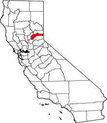
 Cedar Ridge Location of Cedar Ridge in California | |
| Coordinates: 39°11′56″N 121°01′16″W / 39.19889°N 121.02111°WCoordinates: 39°11′56″N 121°01′16″W / 39.19889°N 121.02111°W | |
| Country |
|
| State |
|
| County | Nevada |
| Elevation[1] | 883 m (2,897 ft) |
| Time zone | Pacific (PST) (UTC-8) |
| • Summer (DST) | PDT (UTC-7) |
| ZIP code | 95924 |
| Area code(s) | 530 |
Cedar Ridge is an unincorporated community in Nevada County, California, United States, along State Route 174 2.5 miles (4.0 km) east/southeast of Grass Valley, California.[2] and approximately 1 mile (1.6 km) east/southeast of the Empire Mine in Gold Country. The first Post Office was established in 1948[2] and the zip code is 95924.[3]
Geography
Cedar Ridge is located at (39.199, -121.021). The elevation is 2,897 feet (883 m) above sea level.[1][4]
References
- 1 2 U.S. Geological Survey Geographic Names Information System: Cedar Ridge, Nevada County, California
- 1 2 Durham, David L. (1998). California's Geographic Names: A Gazetteer of Historic and Modern Names of the State. Clovis, Calif.: Word Dancer Press. p. 463. ISBN 1-884995-14-4.
- ↑ O'Dell, John (2008-02-26). "Cedar Ridge, Nevada County". nevadacounty.com. Retrieved 2008-09-06.
- ↑ "Cedar Ridge, CA (Nevada County)". california.hometownlocator.com. Retrieved 2008-09-06.
External links
This article is issued from Wikipedia - version of the 5/11/2016. The text is available under the Creative Commons Attribution/Share Alike but additional terms may apply for the media files.