Citrus Heights, California
| City of Citrus Heights | |
|---|---|
| City | |
 Location in Sacramento County and the state of California | |
 City of Citrus Heights Location in the United States | |
| Coordinates: 38°42′N 121°17′W / 38.700°N 121.283°WCoordinates: 38°42′N 121°17′W / 38.700°N 121.283°W | |
| Country |
|
| State |
|
| County | Sacramento |
| Incorporated | January 1, 1997[1] |
| Government | |
| • Mayor | Sue Frost[2] |
| Area[3] | |
| • Total | 14.228 sq mi (36.851 km2) |
| • Land | 14.228 sq mi (36.851 km2) |
| • Water | 0 sq mi (0 km2) 0% |
| Elevation[4] | 167 ft (51 m) |
| Population (April 1, 2010)[5] | |
| • Total | 83,301 |
| • Estimate (2016)[5] | 83,962 |
| • Density | 5,900/sq mi (2,300/km2) |
| Time zone | PST (UTC-8) |
| • Summer (DST) | PDT (UTC-7) |
| ZIP codes | 95610, 95611 (PO Box only), 95621 |
| Area code | 916 |
| FIPS code | 06-13588 |
| GNIS feature ID | 1655900 |
| Website |
www |
Citrus Heights is a city in Sacramento County, California, USA. As of the 2010 census, the city had a population of 83,301, down from 85,071 at the 2000 census.
Citrus Heights is part of the Sacramento–Arden-Arcade–Roseville Metropolitan Statistical Area.
Geography
Citrus Heights is located at 38°42′N 121°17′W / 38.700°N 121.283°W (38.6947, -121.2905).[6] According to the United States Census Bureau, the city has a total area of 14.2 square miles (37 km2), all land. The city incorporated January 2, 1997 (January 1 according to the official city website), becoming the fifth city in Sacramento County.
Demographics
| Historical population | |||
|---|---|---|---|
| Census | Pop. | %± | |
| 1970 | 21,760 | — | |
| 1980 | 85,911 | 294.8% | |
| 1990 | 107,439 | 25.1% | |
| 2000 | 85,071 | −20.8% | |
| 2010 | 83,301 | −2.1% | |
| Est. 2015 | 87,056 | [7] | 4.5% |
2015
The 2015 United States Census[9] reported that Citrus Heights had a population of 87,056. The population density in 2010 was 5,854.6 people per square mile (2,260.5/km²) but no updated information for the current year has been presented. The racial makeup of Citrus Heights in 2010 was 66,856 (80.3%) White, 2,751 (3.3%) African American, 753 (0.9%) Native American, 2,714 (3.3%) Asian (1.2% Filipino, 0.4% Indian, 0.4% Chinese, 0.3% Japanese, 0.2% Vietnamese, 0.4% Other), 363 (0.4%) Pacific Islander, 5,348 (6.4%) from other races, and 4,516 (5.4%) from two or more races. Hispanic or Latino of any race were 13,734 persons (16.5%).
The Census reported that 82,815 people (99.4% of the population) lived in households, 304 (0.4%) lived in non-institutionalized group quarters, and 182 (0.2%) were institutionalized. In 2015 The Census reports that there is about 2.56 persons per household and 79.5% of people are living in the same house that they were living in the year prior. The 2015 Census also reports that 19% of the Citrus Heights population is speaking another language other than English at home.
According to the Sacramento Bee in February 2008, within the city limits are 34,295 housing units. The city's vacancy rate is approximately four percent. 65% of the city's housing units are primarily single-family units. The annual median sales price (for all recorded sales) of homes in the 95610 zip code is $299,009, and the median sales price (for all recorded sales) of homes in the 95621 zip code is $261,826. Citrus Heights provides an affordable living environment with quality services, central within the Sacramento region.
The 2010 Census reported that there were 32,686 households, out of which 10,452 (32.0%) had children under the age of 18 living in them, 14,241 (43.6%) were opposite-sex married couples living together, 4,689 (14.3%) had a female householder with no husband present, 2,027 (6.2%) had a male householder with no wife present. There were 2,653 (8.1%) unmarried opposite-sex partnerships, and 252 (0.8%) same-sex married couples or partnerships. 8,860 households (27.1%) were made up of individuals and 3,280 (10.0%) had someone living alone who was 65 years of age or older. The average household size was 2.53. There were 20,957 families (64.1% of all households); the average family size was 3.08.
The 2010 Census reported that the population was spread out with 19,241 people (23.1%) under the age of 18, 8,480 people (10.2%) aged 18 to 24, 23,022 people (27.6%) aged 25 to 44, 21,473 people (25.8%) aged 45 to 64, and 11,085 people (13.3%) who were 65 years of age or older. The median age was 36.2 years. For every 100 females there were 94.1 males. For every 100 females age 18 and over, there were 91.0 males.
There were 35,075 housing units at an average density of 2,465.1 per square mile (951.8/km²), of which 18,832 (57.6%) were owner-occupied, and 13,854 (42.4%) were occupied by renters. The homeowner vacancy rate was 2.7%; the rental vacancy rate was 7.8%. 47,329 people (56.8% of the population) lived in owner-occupied housing units and 35,486 people (42.6%) lived in rental housing units.
2000
As of the census[10] of 2000, there were 85,071 people, 33,478 households, and 21,660 families residing in the city. The population density was 5,929.3 inhabitants per square mile (2,288.9/km²). There were 34,897 housing units at an average density of 2,432.3 per square mile (938.9/km²). The racial makeup of the city was 84.64% White, 2.87% African American, 1.01% Native American, 2.85% Asian, 0.34% Pacific Islander, 3.56% from other races, and 4.73% from two or more races. Hispanic or Latino of any race were 10.04% of the population.
There were 33,478 households out of which 30.9% had children under the age of 18 living with them, 46.4% were married couples living together, 12.9% had a female householder with no husband present, and 35.3% were non-families. 26.9% of all households were made up of individuals and 9.5% had someone living alone who was 65 years of age or older. The average household size was 2.52 and the average family size was 3.06.
In the city the population was spread out with 25.2% under the age of 18, 10.2% from 18 to 24, 30.3% from 25 to 44, 21.3% from 45 to 64, and 12.9% who were 65 years of age or older. The median age was 35 years. For every 100 females there were 93.7 males. For every 100 females age 18 and over, there were 90.4 males.
The median income for a household in the city was $53,859, and the median income for a family was $60,207. Males had a median income of $48,614 versus $39,399 for females. The per capita income for the city was $30,744. About 5.6% of families and 8.3% of the population were below the poverty line, including 10.9% of those under age 18 and 6.1% of those age 65 or over.
Government
In the California State Legislature, Citrus Heights is in the 4th Senate District, represented by Republican Jim Nielsen, and in the 8th Assembly District, represented by Democrat Ken Cooley.[11]
In the United States House of Representatives, Citrus Heights is in California's 7th congressional district, represented by Democrat Ami Bera.[12]

Incorporation
Citrus Heights voters approved the measure to incorporate the City on November 5, 1996, effective January 1, 1997. The measure won, with 62.5% of the votes.
Transportation/access
Citrus Heights is centrally located between the region's major freeways and highways. Interstate 80, Interstate 5, U.S. Highway 50 and California State Route 99 are all located from three to 11 miles (18 km) from the city. The Business 80 freeway otherwise known as the Capital City Freeway begins near Citrus Heights and ends in Downtown Sacramento. Sacramento International Airport is located approximately 20 miles (32 km) from the city, while rail transportation provided by Amtrak is accessible in Roseville (about 10 miles (16 km) from the city). A public bus transportation is currently also provided by the Sacramento Regional Transit District.
Education
Citrus Heights is primarily served by the San Juan Unified School District. San Juan is the ninth largest school district in California and serves a 75-square-mile (190 km2) area in northeast Sacramento County, including Citrus Heights. Within the city of Citrus Heights there are ten elementary schools, one middle school, and two high schools. These schools serve over 10,000 students from the city of Citrus Heights. San Juan Unified School District also offers other educational schools and programs such as a special education centers, adult schools, adult handicapped schools, preschool, and before-and after-school programs. Universities and colleges that serve the area include: University of California, Davis; California State University, Sacramento; American River College; Sierra College; McGeorge School of Law; Lincoln Law School of Sacramento; Golden Gate University; University of Phoenix; and National University.
Climate
Citrus Heights has a climate that is characterized by mild winters and dry hotter summers. The area usually has a low humidity with light rain usually occurs between December and February. The average temperature throughout the year is 61° Fahrenheit, with the daily average ranging from 45° in December and January to 76° in July. Average daily high temperatures range from 53° in December and January to 93° in July. Average daily low temperatures range from 38° to 58°. The average year has 73 days with a high over 90°, with the highest temperature on record being 114° on July 17, 1925, and 18 days when the low drops below 32°, with the coldest one day record being December 11, 1932, at 17°. Typically, Citrus Heights enjoys 268 sunny days throughout the year.
Average yearly precipitation is 22.7 inches, with almost no rain during the summer months, to an average rainfall of 3.7 inches in January. On average, 96 days in the year have fog, mostly in the morning, primarily in December and January.
Business and shopping
Citrus Heights is home to a bustling retail and service industry. Sunrise Mall, newly remodeled with over 100 stores, including major department and specialty stores (Macy's, Sears, JC Penney's, etc.), is located in the center of the city, along with the Sunrise MarketPlace a growing retail community offering a wide variety of retail, dining, and service establishments (Barnes & Noble, Target Greatland, Best Buy, Lowe's Home Improvement, etc.). Citrus Heights also features major discount retail stores such as Costco, Sam's Club, and Wal-Mart.
Neighborhood associations and REACH
Neighborhood associations are groups of grassroots community volunteers who work together to make a difference in their neighborhoods and in the city. Citrus Heights has eleven neighborhood areas, and each one has a corresponding neighborhood association group. Each association has bylaws and a board of directors.
On May 22, 2009, at the Neighborhoods USA (NUSA) Conference in Spokane, WA, the Sylvan-Old Auburn Road (SOAR) Neighborhood, one of the ten Neighborhood Groups located within the City of Citrus Heights, received first place honors in the Multi-Neighborhood Project Partnerships category for their highly acclaimed 2008 Senior Health Fair event. By receiving the first place category recognition, SOAR was also selected by the NUSA Judges as the prestigious 2009 Neighborhood of the Year.
Neighborhoods, USA is a national non-profit organization committed to building and strengthening neighborhood organizations. Created in 1975 to share information and experiences toward building stronger communities, NUSA now continues to encourage networking and information sharing to facilitate the development of partnerships between neighborhood organizations, government and the private sector.
Citrus Heights also features numerous parks and playgrounds. Many recreational activities and programs are offered through the Sunrise Recreation and Park District.
Police department

In June 2006, the City of Citrus Heights formed its own police department. The department attracted lateral police officers from 62 different police agencies throughout California{{http://citrusheights.net/222/Police}}. Under the leadership of Chief of Police Christopher Boyd, the newly formed department took over law enforcement responsibility from the Sacramento County Sheriff's Department on June 26, 2006.[13] The police department is a full service agency, with specialty units such as SWAT, Special Investigations, Traffic and School Resource Officers.[14] The department operates its own state of the art communications center, which answers 911 calls and dispatches police units throughout the city.[13]
Notable people
- Jackie Lynn Taylor - Our Gang actress (1934)
- Bill Conroy - MLB catcher
- Kelley Jones - artist [15]
- Mandisa - Contemporary Christian music artist
See also
References
- ↑ "California Cities by Incorporation Date". California Association of Local Agency Formation Commissions. Archived from the original (Word) on November 3, 2014. Retrieved August 25, 2014.
- ↑ "Members". Citrus Heights, CA. Retrieved December 16, 2014.
- ↑ "2010 Census U.S. Gazetteer Files – Places – California". United States Census Bureau.
- ↑ "Citrus Heights". Geographic Names Information System. United States Geological Survey. Retrieved December 16, 2014.
- 1 2 "Citrus Heights (city) QuickFacts". United States Census Bureau. Retrieved March 19, 2015.
- ↑ "US Gazetteer files: 2010, 2000, and 1990". United States Census Bureau. 2011-02-12. Retrieved 2011-04-23.
- ↑ "Annual Estimates of the Resident Population for Incorporated Places: April 1, 2010 to July 1, 2015". Retrieved July 2, 2016.
- ↑ "Census of Population and Housing". Census.gov. Archived from the original on May 11, 2015. Retrieved June 4, 2015.
- ↑ {http://www.census.gov/search-results.html?q=Citrus+Heights+city%2C+CA&page=1&stateGeo=none&searchtype=web&cssp=Typeahead}
- ↑ "American FactFinder". United States Census Bureau. Archived from the original on 2013-09-11. Retrieved 2008-01-31.
- ↑ "Statewide Database". UC Regents. Retrieved December 4, 2014.
- ↑ "California's 7th Congressional District - Representatives & District Map". Civic Impulse, LLC. Retrieved March 9, 2013.
- 1 2 "Welcome to the City of Citrus Heights - Police". City of Citrus Heights. Retrieved 2009-04-21.
- ↑ "Welcome to the City of Citrus Heights - Investigative Services Division". City of Citrus Heights. Retrieved 2009-04-21.
- ↑ 1980 Greenback Notes, San Juan High School, Citrus Heights, California
External links
 |
Antelope | Roseville | Granite Bay | |
| North Highlands | |
Orangevale | ||
| ||||
| | ||||
| Carmichael | Carmichael/Fair Oaks | Fair Oaks |
Municipalities and communities of Sacramento County, California, United States | ||
|---|---|---|
| Cities | 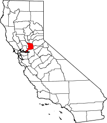 | |
| CDPs | ||
| Unincorporated communities | ||
| Ghost towns | ||