Cavalero, Washington
| Cavalero, Washington | |
|---|---|
| CDP | |
 Cavalero, Washington Location of Cavalero, Washington. | |
| Coordinates: 47°59′3″N 122°4′32″W / 47.98417°N 122.07556°WCoordinates: 47°59′3″N 122°4′32″W / 47.98417°N 122.07556°W | |
| Country | United States |
| State | Washington |
| County | Snohomish |
| Area | |
| • Total | 1.639 sq mi (4.24 km2) |
| • Land | 1.638 sq mi (4.24 km2) |
| • Water | 0.001 sq mi (0.003 km2) |
| Population (2010) | |
| • Total | 4,660 |
| • Density | 2,844.9/sq mi (1,098.4/km2) |
| Time zone | Pacific (PST) (UTC-8) |
| • Summer (DST) | PDT (UTC-7) |
| GNIS feature ID | 2584956[1] |
Cavalero is a census-designated place (CDP) in Snohomish County, Washington, United States. The population was 4,660 at the 2010 census. Cavalero was created out of the former West Lake Stevens CDP in 2010.[2]
Geography
Cavalero is located at 47°59′3″N 122°4′32″W / 47.98417°N 122.07556°W (47.984288, -122.075542).[3]
According to the United States Census Bureau, the CDP has a total area of 1.639 square miles (4.24 km²), of which, 1.638 square miles (4.24 km²) of it is land and 0.001 square miles (0.003 km²) of it (0.06%) is water.
References
- ↑ "US Board on Geographic Names". United States Geological Survey. 2007-10-25. Retrieved 2008-01-31.
- ↑ "Washington: 2010 Population and Housing Unit Counts" (PDF). United States Census Bureau. Retrieved 26 February 2013.
- ↑ "US Gazetteer files: 2010, 2000, and 1990". United States Census Bureau. 2011-02-12. Retrieved 2011-04-23.
Municipalities and communities of Snohomish County, Washington, United States | ||
|---|---|---|
| Cities | 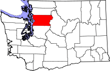 | |
| Towns | ||
| CDPs |
| |
| Other unincorporated communities | ||
| Ghost town | ||
| Indian reservation | ||
| Footnotes | ‡This populated place also has portions in an adjacent county or counties | |
This article is issued from Wikipedia - version of the 7/28/2014. The text is available under the Creative Commons Attribution/Share Alike but additional terms may apply for the media files.