Granite Falls, Washington
| Granite Falls, Washington | |
|---|---|
| City | |
 | |
| Nickname(s): Granite | |
 Location of Granite Falls, Washington | |
| Coordinates: 48°4′58″N 121°58′11″W / 48.08278°N 121.96972°WCoordinates: 48°4′58″N 121°58′11″W / 48.08278°N 121.96972°W | |
| Country | United States |
| State | Washington |
| County | Snohomish |
| Government | |
| • Type | Council-Manager |
| • Manager | Brent Kirk |
| Area[1] | |
| • City | 2.20 sq mi (5.70 km2) |
| • Land | 2.18 sq mi (5.65 km2) |
| • Water | 0.02 sq mi (0.05 km2) |
| Elevation | 407 ft (124 m) |
| Population (2010)[2] | |
| • City | 3,364 |
| • Estimate (2015)[3] | 3,493 |
| • Density | 1,543.1/sq mi (595.8/km2) |
| • Urban | 6,129[4] |
| Time zone | Pacific (PST) (UTC-8) |
| • Summer (DST) | PDT (UTC-7) |
| ZIP code | 98252 |
| Area code | 360 |
| FIPS code | 53-27995 |
| GNIS feature ID | 1520218[5] |
| Website | ci.granite-falls.wa.us |
Granite Falls is a city in Snohomish County, Washington, United States. The population was 3,364 at the 2010 census.
History
Before the arrival of European settlers, the area that is now Granite Falls was used by Natives to portage their canoes between fishing grounds.[6]
The first permanent European settler was Joseph Sous Enas, who staked a homestead claim on land south of the present city.[7] It then became a railroad station on the route between Monte Cristo (now a ghost town) and Everett. The city was officially incorporated on December 21, 1903.[7] He was quickly followed by other homesteaders, benefiting from "the Big Burn", a forest fire that cleared the heavily forested land and made it easier for settlers to stake claims.
By 1896, there were enough residents to petition the state of a school district (Granite Falls District #1)[8]
The finding of gold and other minerals in 1889 in the Cascade Mountains East of Granite Falls was a boon to Granite Falls. Mines needed a railroad and the settlers of Granite Falls stepped up to provide railroad ties cut from the nearby forests, supplies for fortune seeking miners, a doctor, and other necessities. In 1890, a post office was opened and the first commercial establishments opened on what is now South Granite Ave and Pioneer.[7]
The Everett and Monte Cristo Railroad came to town in 1892 from its start in Hartford, Washington (near today's Lake Stevens) and through to its terminus at Monte Cristo. Partially funded by John D. Rockefeller and others, the train carried supplies, passengers, and ore up and down the Stilly Valley.[9]
The Granite Falls townsite was platted in 1891 from portions of the Wright and Anderson homesteads and in 1903, Granite Falls was incorporated as a city.[10] Electricity, sewers, sidewalks, telephones, cars, and all the amenities of modern life soon followed.
By World War 1, the once bustling mining towns of Monte Cristo and Silverton were no longer shipping out ore. The railroad, now owned by Northern Pacific, stopped running and the tracks were torn out in the early 1930s to make way for the Mt. Loop Highway.
Granite Falls between the world wars was a lumber town; logging companies felled trees, sawmills created lumber and shingle mills created shingles. The Great Depression, however, took its toll. By 1935, the population of Granite Falls was half what it was in 1925. Mills closed and people left to find work elsewhere. At the end of World War II, things looked bleak. The opening of Miller Shingle in 1946 (now the country's largest specialty lumber mill) meant jobs both in the woods and at the mill. Construction booms through Snohomish and King counties also meant jobs at the gravel pits dotted around Granite Falls.
Hard times would come again. In 1986, the United States Forest Service severely limits logging in old-growth forests under its protection in an effort to save the Northern Spotted Owl from extinction.[11] In June, 1990, the U.S. Fish and Wildlife Department declared the spotted owl an endangered species, and in 1991, a federal court judge ruled the Forest Service's logging plan to save the owl was inadequate. Over one-fourth of old-growth forest on both public and private land was now off-limits to logging.[12]
In the 21st Century, Granite Falls is focused on attracting more visitors to the stupendous beauty and recreational opportunities along the Mt. Loop Highway. Expanded housing development has brought an increased population of families who commute to Everett, Seattle, and the Eastside to work. In 2001, the Tsubaki Grand Shrine of America was given a 17-acre plot of land next to Kannagara Jinja (built by the Reverend of the shrine) in Granite Falls, which was built upon, combining the two places.[13]
Geography
Granite Falls, Washington is located north of Seattle, Washington and east of Everett WA at the entrance to the Mt. Loop Scenic Byway, a highway into the North Cascade mountain range. Its coordinates are 48°4′58″N 121°58′11″W / 48.08278°N 121.96972°W (48.082661, -121.969662).[14]
It is situated where the South Fork of the Stillaguamish River (Stilly) leaves its narrow mountain valley. The Pilchuck River runs near the city, too. The area where the city was founded was called the "portage" by native tribes in the area, who used the flat area between the two rivers to portage their canoes when traveling.[15]
According to the United States Census Bureau, the city has a total area of 2.20 square miles (5.70 km2), of which, 2.18 square miles (5.65 km2) is land and 0.02 square miles (0.05 km2) is water.[1]
Climate
The climate in this area has mild differences between highs and lows, and there is adequate rainfall year-round. According to the Köppen Climate Classification system, Granite Falls has a marine west coast climate, abbreviated "Cfb" on climate maps.[16]
Demographics
| Historical population | |||
|---|---|---|---|
| Census | Pop. | %± | |
| 1910 | 714 | — | |
| 1920 | 632 | −11.5% | |
| 1930 | 495 | −21.7% | |
| 1940 | 683 | 38.0% | |
| 1950 | 635 | −7.0% | |
| 1960 | 599 | −5.7% | |
| 1970 | 813 | 35.7% | |
| 1980 | 911 | 12.1% | |
| 1990 | 1,060 | 16.4% | |
| 2000 | 2,347 | 121.4% | |
| 2010 | 3,364 | 43.3% | |
| Est. 2015 | 3,493 | [17] | 3.8% |
| U.S. Decennial Census[18] 2015 Estimate[3] | |||
2010 census
As of the census[2] of 2010, there were 3,364 people, 1,222 households, and 831 families residing in the city. The population density was 1,543.1 inhabitants per square mile (595.8/km2). There were 1,344 housing units at an average density of 616.5 per square mile (238.0/km2). The racial makeup of the city was 87.6% White, 0.7% African American, 1.2% Native American, 1.5% Asian, 0.3% Pacific Islander, 3.2% from other races, and 5.5% from two or more races. Hispanic or Latino of any race were 7.5% of the population.
There were 1,222 households of which 42.5% had children under the age of 18 living with them, 49.5% were married couples living together, 12.5% had a female householder with no husband present, 6.0% had a male householder with no wife present, and 32.0% were non-families. 25.6% of all households were made up of individuals and 10.3% had someone living alone who was 65 years of age or older. The average household size was 2.75 and the average family size was 3.33.
The median age in the city was 34.4 years. 29.4% of residents were under the age of 18; 8.4% were between the ages of 18 and 24; 30.9% were from 25 to 44; 23.1% were from 45 to 64; and 8.4% were 65 years of age or older. The gender makeup of the city was 50.2% male and 49.8% female.
2000 census
As of the census of 2000, there were 2,347 people, 846 households, and 594 families residing in the city. The population density was 1,372.9 people per square mile (529.9/km²). There were 873 housing units at an average density of 510.7 per square mile (197.1/km²). The racial makeup of the city was 90.84% White, 0.68% African American, 2.09% Native American, 1.53% Asian, 0.09% Pacific Islander, 1.28% from other races, and 3.49% from two or more races. Hispanic or Latino of any race were 6.56% of the population.

There were 846 households out of which 45.9% had children under the age of 18 living with them, 55.7% were married couples living together, 10.6% had a female householder with no husband present, and 29.7% were non-families. 23.8% of all households were made up of individuals and 7.0% had someone living alone who was 65 years of age or older. The average household size was 2.77 and the average family size was 3.31.
In the city the age distribution of the population shows 33.2% under the age of 18, 7.5% from 18 to 24, 36.8% from 25 to 44, 15.6% from 45 to 64, and 6.9% who were 65 years of age or older. The median age was 30 years. For every 100 females there were 98.7 males. For every 100 females age 18 and over, there were 98.1 males.
The median income for a household in the city was $47,643, and the median income for a family was $52,150. Males had a median income of $40,469 versus $26,809 for females. The per capita income for the city was $17,425. About 5.1% of families and 7.2% of the population were below the poverty line, including 6.7% of those under age 18 and 11.3% of those age 65 or over.
Education
The Granite Falls School District has two elementary schools (Mountain Way and Monte Cristo), one middle school (Granite Falls Middle School), and two high schools, (Crossroads High School and Granite Falls High School, a new building opened in January 2008).
- Teacher Andrea Peterson was named 2007's National Teacher of the Year.
- Dave Bianchini, the Granite Falls Middle School Assistant Principal (as of 2009, Principal), was named Washington State Middle School Assistant Principal of the Year 2009
High school sports
The Granite Falls Tigers compete in the Cascade Conference high school sports league. Varsity teams are fielded in men's basketball, women's basketball, men's soccer, women's soccer, volleyball, softball, baseball, cross-country, track, golf, tennis, and wrestling.
- The 2006 Granite Falls High School Baseball Team took first place at the 2A State Championship in Yakima, Washington.
Annual community events
Each year, the Granite Falls community celebrates holidays and holds special events. Below is a list of annual events.
April
- Easter Egg Hunt, Saturday before Easter, Sponsored by the Eagles Club
- Turkey Shoot, Sunday before Easter
- Earth Day, Citywide clean-up
May
- Herb Fair
- Historical Society Plant Sale
June
- Town Portrait - First Saturday in June
August
- Art-in-the-Parks, Annual art show featuring area artists, musicians and writers, First Saturday of the Month
- Show 'N' Shine, classic and antique car show and parade, First Saturday of the Month
- Historical Society Garage Sale
September
- Back to School Clothing Drive, Missionary Alliance Church
- Garden Harvest Drive - 2nd & 4th Wednesday before 9:00
October
- Railroad Days, festival and parade celebrating the city's heritage, First Saturday of the month
- Rhythm & Blues Bash
November
- Veteran's Day Parade, Annual parade honoring veteran's, Veteran's Day (360) 691-5826
- Turkey Shoot, Sunday before Thanksgiving
- Tree Lighting Ceremony, Community celebration of the holidays, Saturday following Thanksgiving at the Granite Falls Historical Museum
December
- Winterfest, December 6
References
- 1 2 "US Gazetteer files 2010". United States Census Bureau. Retrieved 2012-12-19.
- 1 2 "American FactFinder". United States Census Bureau. Retrieved 2012-12-19.
- 1 2 "Population Estimates". United States Census Bureau. Retrieved July 8, 2016.
- ↑ "National 2010 urban area file containing a list of all urbanized areas and urban clusters (including Puerto Rico and the Island Areas) sorted by UACE code" (TXT). United States Census Bureau. 2010. Retrieved March 24, 2013.
- ↑ "US Board on Geographic Names". United States Geological Survey. 2007-10-25. Retrieved 2008-01-31.
- ↑ History of Snohomish County, Washington Vols. I and 2, ed. by William Whitfield (Chicago: Pioneer Historical Publishing Company, 1926), p. 525-525
- 1 2 3 Granite Falls - Thumbnail History, HistoryLink.org Essay #8532, accessed Nov, 11, 2010 at http://www.historylink.org/index.cfm?DisplayPage=output.cfm&file_id=8532
- ↑ School District Boundary Record, Record of Eighth Grade Graduation 1898-1903, and Snohomish County Register of Teachers (p. 83), Educational Service District (ESD) 189, Snohomish County Public Schools, Multiple Series Box 1, Washington State Archives, Northwest Regional Branch; David Cameron, email to Janet Oakley, March 3, 2008, in possession of Janet Oakley;
- ↑ The Everett & Monte Cristo Railway; Philip R. Woodhouse, Daryl Jacobson, and Bill Petersen; Oso Publishing, September 2000.
- ↑ History of Snohomish County, Washington Vols. I and 2, ed. by William Whitfield (Chicago: Pioneer Historical Publishing Company, 1926)
- ↑ U.S. Forest Service protects the northern spotted owl by limiting timber sales on August 7, 1986. HistoryLink.org Essay 5319; accessed Nov. 11, 2010 at http://www.historylink.org/index.cfm?DisplayPage=output.cfm&file_id=5319
- ↑ "The Northern Spotted Owl", Forest History Society Website (www.lib.duke.edu/ forest/usfscoll/policy /northern_spotted_owl /index.html).
- ↑ Tsubaki Grand Shrine of America website (http://www.tsubakishrine.com/history/index.html).
- ↑ "US Gazetteer files: 2010, 2000, and 1990". United States Census Bureau. 2011-02-12. Retrieved 2011-04-23.
- ↑ History of Snohomish County, Washington Vols. I and 2, ed. by William Whitfield (Chicago: Pioneer Historical Publishing Company, 1926), p. 525-526
- ↑ Climate Summary for Granite Falls, Washington
- ↑ "Annual Estimates of the Resident Population for Incorporated Places: April 1, 2010 to July 1, 2015". Retrieved July 2, 2016.
- ↑ United States Census Bureau. "Census of Population and Housing". Retrieved July 26, 2013.
External links
| Wikimedia Commons has media related to Granite Falls, Washington. |
- City website
- Chamber of Commerce website
- Granite Falls School District
- Granite Falls Historical Museum
Municipalities and communities of Snohomish County, Washington, United States | ||
|---|---|---|
| Cities | 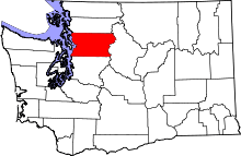 | |
| Towns | ||
| CDPs |
| |
| Other unincorporated communities | ||
| Ghost town | ||
| Indian reservation | ||
| Footnotes | ‡This populated place also has portions in an adjacent county or counties | |