Monroe Township, Madison County, Indiana
| Monroe Township | |
|---|---|
| Township | |
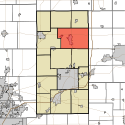 Location in Madison County | |
| Coordinates: 40°15′52″N 85°39′28″W / 40.26444°N 85.65778°WCoordinates: 40°15′52″N 85°39′28″W / 40.26444°N 85.65778°W | |
| Country |
|
| State |
|
| County | Madison |
| Government | |
| • Type | Indiana township |
| Area | |
| • Total | 51.25 sq mi (132.7 km2) |
| • Land | 51.22 sq mi (132.7 km2) |
| • Water | 0.02 sq mi (0.05 km2) 0.04% |
| Elevation | 873 ft (266 m) |
| Population (2010) | |
| • Total | 8,786 |
| • Density | 171.5/sq mi (66.2/km2) |
| ZIP codes | 46001, 46063, 46070 |
| GNIS feature ID | 0453642 |
Monroe Township is one of fourteen townships in Madison County, Indiana, United States. In the 2010 census, its population was 8,786 and it contained 4,098 housing units.[1]
History
Monroe Township was organized in 1836. It was named for President James Monroe.[2]
Geography
According to the 2010 census, the township has a total area of 51.25 square miles (132.7 km2), of which 51.22 square miles (132.7 km2) (or 99.94%) is land and 0.02 square miles (0.052 km2) (or 0.04%) is water.[1]
Cities, towns, villages
Unincorporated towns
- Gehring and Gumz Ditch at 40°14′04″N 85°34′42″W / 40.234486°N 85.578307°W
- Gimco City at 40°15′30″N 85°41′02″W / 40.258374°N 85.683865°W
(This list is based on USGS data and may include former settlements.)
Cemeteries
The township contains these six cemeteries: Bell, Donahue, Parkview, Pisgah, Star and Walker.
Major highways
Airports and landing strips
- Alexandria Airport
School districts
- Alexandria Community School Corporation
Political districts
- Indiana's 6th congressional district
- State House District 35
- State House District 36
- State Senate District 25
References
- "Monroe Township, Madison County, Indiana". Geographic Names Information System. United States Geological Survey. Retrieved 2009-10-03.
- United States Census Bureau 2008 TIGER/Line Shapefiles
- IndianaMap
- 1 2 "Population, Housing Units, Area, and Density: 2010 - County -- County Subdivision and Place -- 2010 Census Summary File 1". United States Census. Retrieved 2013-05-10.
- ↑ Forkner, John La Rue & Dyson, Byron H. (1897). Historical Sketches and Reminiscences of Madison County, Indiana. Wilson, Humprheys & Co. p. 832.
External links
- Indiana Township Association
- United Township Association of Indiana
- City-Data.com page for Monroe Township
- Monroe Township history

Municipalities and communities of Madison County, Indiana, United States | ||
|---|---|---|
| Cities | ||
| Towns | ||
| Townships | ||
| Unincorporated communities |
| |
| Footnotes | ‡This populated place also has portions in an adjacent county or counties | |
This article is issued from Wikipedia - version of the 10/25/2016. The text is available under the Creative Commons Attribution/Share Alike but additional terms may apply for the media files.