North Royalton, Ohio
| North Royalton, Ohio | |
|---|---|
| City | |
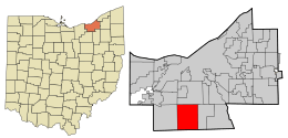 Location in Cuyahoga County and the state of Ohio. | |
| Coordinates: 41°19′20″N 81°44′47″W / 41.32222°N 81.74639°WCoordinates: 41°19′20″N 81°44′47″W / 41.32222°N 81.74639°W | |
| Country | United States |
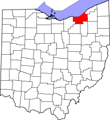
| State | Ohio |
| County | Cuyahoga |
| Government | |
| • Mayor | Robert A. Stefanik (D)[1] |
| Area[2] | |
| • Total | 21.32 sq mi (55.22 km2) |
| • Land | 21.31 sq mi (55.19 km2) |
| • Water | 0.01 sq mi (0.03 km2) |
| Elevation[3] | 1,201 ft (366 m) |
| Population (2010)[4] | |
| • Total | 30,444 |
| • Estimate (2013[5]) | 30,367 |
| • Density | 1,428.6/sq mi (551.6/km2) |
| Time zone | Eastern (EST) (UTC-5) |
| • Summer (DST) | EDT (UTC-4) |
| ZIP code | 44133 |
| FIPS code | 39-57008[6] |
| GNIS feature ID | 1065175[3] |
| Website | http://www.northroyalton.org/ |
North Royalton is a city in Cuyahoga County, Ohio, United States. The population was 30,444 at the 2010 census. Originally incorporated as a village in 1927, it achieved the status of city in 1961.
Geography
North Royalton is located at 41°19′20″N 81°44′47″W / 41.322276°N 81.746393°W.[7]
According to the United States Census Bureau, the city has a total area of 21.32 square miles (55.22 km2), of which 21.31 square miles (55.19 km2) is land and 0.01 square miles (0.03 km2) is water.[2]
Demographics
| Historical population | |||
|---|---|---|---|
| Census | Pop. | %± | |
| 1920 | 1,262 | — | |
| 1930 | 1,897 | 50.3% | |
| 1940 | 2,559 | 34.9% | |
| 1950 | 3,939 | 53.9% | |
| 1960 | 9,290 | 135.8% | |
| 1970 | 12,807 | 37.9% | |
| 1980 | 17,705 | 38.2% | |
| 1990 | 23,197 | 31.0% | |
| 2000 | 28,648 | 23.5% | |
| 2010 | 30,444 | 6.3% | |
| Est. 2015 | 30,311 | [8] | −0.4% |
| Sources:[9][10][11][6][12][5] | |||
As of the census[6] of 2000, there were 28,647 people, 11,250 households, and 7,695 families residing in the city. The population density was 1,345.9 people per square mile (519.5/km2). There were 11,754 housing units at an average density of 552.2 per square mile (213.2/km2). The racial makeup of the city was 96.18% White, 0.71% African American, 0.12% Native American, 1.99% Asian, 0.02% Pacific Islander, 0.16% from other races, and 0.83% from two or more races. Hispanic or Latino of any race were 0.95% of the population.
There were 11,250 households out of which 31.5% had children under the age of 18 living with them, 58.4% were married couples living together, 7.4% had a female householder with no husband present, and 31.6% were non-families. 26.7% of all households were made up of individuals and 7.0% had someone living alone who was 65 years of age or older. The average household size was 2.51 and the average family size was 3.11. The average house cost about $210,000.00.
In the city the population was spread out with 24.3% under the age of 18, 7.7% from 18 to 24, 30.6% from 25 to 44, 25.4% from 45 to 64, and 12.0% who were 65 years of age or older. The median age was 39 years. For every 100 females there were 95.2 males. For every 100 females age 18 and over, there were 92.4 males.
The median income for a household in the city was $57,398, and the median income for a family was $69,983. Males had a median income of $46,764.00 versus $31,173.00 for females. The per capita income for the city was $26,610. About 1.2% of families and 2.3% of the population were below the poverty line, including 1.5% of those under age 18 and 3.5% of those age 65 or over.
Of the city's population over the age of 25, 32.9% hold a bachelor's degree or higher.[13]
Languages
90.8% spoke English, 1.5% German, 1.3% Polish, and 0.9% Italian in their house.[14]
2010 census
As of the census[4] of 2010, there were 30,444 people, 12,944 households, and 8,220 families residing in the city. The population density was 1,428.6 inhabitants per square mile (551.6/km2). There were 13,710 housing units at an average density of 643.4 per square mile (248.4/km2). The racial makeup of the city was 94.6% White, 1.1% African American, 0.1% Native American, 2.7% Asian, 0.3% from other races, and 1.1% from two or more races. Hispanic or Latino of any race were 1.6% of the population.
There were 12,944 households of which 26.5% had children under the age of 18 living with them, 52.5% were married couples living together, 7.9% had a female householder with no husband present, 3.1% had a male householder with no wife present, and 36.5% were non-families. 31.0% of all households were made up of individuals and 10.1% had someone living alone who was 65 years of age or older. The average household size was 2.33 and the average family size was 2.97.
The median age in the city was 43.5 years. 20.1% of residents were under the age of 18; 7.7% were between the ages of 18 and 24; 24.3% were from 25 to 44; 32.7% were from 45 to 64; and 15.1% were 65 years of age or older. The gender makeup of the city was 48.8% male and 51.2% female.
Officials
- Mayor – Robert Stefanik
- President of Council – Larry Antoskiewicz
- Council, Ward 1 – John Nickell
- Council, Ward 2 – Gary Petrusky
- Council, Ward 3 – Dan Langshaw
- Council, Ward 4 – Paul Marnecheck
- Council, Ward 5 – Steve Mueller
- Council, Ward 6 – Dan Kasaris
Schools
North Royalton City Schools The North Royalton School District serves approximately 4700 students in the communities of North Royalton and Broadview Hts.
- Albion Elementary (Grades K–4)
- Royal View Elementary (Grades K–4)
- Valley Vista Elementary (Grades K–4)
- North Royalton Middle School (Grades 5–8)
- North Royalton High School (Grades 9–12)
Parochial Schools
- St. Albert the Great School (K-8), Saint Albert the Great School
- Royal Redeemer Lutheran School (K-8), Royal Redeemer Lutheran Schools
Library
North Royalton's public library is a branch of the Cuyahoga County Public Library (CCPL), the busiest per-capita system in the country. A new building to which all functions have been transferred opened in August 2013, located two miles north of the city center at 5071 Wallings Road, North Royalton, Ohio. It was formerly located at 14600 State Road (OH-94) with North Royalton's Memorial Park almost adjacent to Route 82. Its website is part of the CCPL's website. The existing library structure was then converted into a new City Hall facility, which opened tot he public in 2015.
Notable people
- Michael Nanchoff – footballer
- Chris Broussard - Former Resident, ESPN NBA Analyst
Surrounding communities
North Royalton is bordered by Parma and Middelburg Heights to the north, Broadview Heights to the east, Hinkley to the south, and Strongsville to the west.
 |
Middleburg Heights | Parma | Seven Hills | |
| Strongsville | |
Broadview Heights | ||
| ||||
| | ||||
| Brunswick | Hinckley | Richfield |
References
- ↑ Exner, Rich (16 November 2013). "Democrats outnumber Republicans as mayors in Cuyahoga County, 39-14". Cleveland.com.
- 1 2 "US Gazetteer files 2010". United States Census Bureau. Retrieved 2013-01-06.
- 1 2 "US Board on Geographic Names". United States Geological Survey. 2007-10-25. Retrieved 2008-01-31.
- 1 2 "American FactFinder". United States Census Bureau. Retrieved 2013-01-06.
- 1 2 http://quickfacts.census.gov/qfd/states/39/3957008.html. Retrieved 29 October 2014. Missing or empty
|title=(help) - 1 2 3 "American FactFinder". United States Census Bureau. Retrieved 2008-01-31.
- ↑ "US Gazetteer files: 2010, 2000, and 1990". United States Census Bureau. 2011-02-12. Retrieved 2011-04-23.
- ↑ "Annual Estimates of the Resident Population for Incorporated Places: April 1, 2010 to July 1, 2015". Retrieved July 2, 2016.
- ↑ "Population: Ohio" (PDF). 1930 US Census. U.S. Census Bureau. Retrieved 28 November 2013.
- ↑ "Number of Inhabitants: Ohio" (PDF). 18th Census of the United States. U.S. Census Bureau. Retrieved 22 November 2013.
- ↑ "Ohio: Population and Housing Unit Counts" (PDF). U.S. Census Bureau. Retrieved 22 November 2013.
- ↑ "Incorporated Places and Minor Civil Divisions Datasets: Subcounty Population Estimates: April 1, 2010 to July 1, 2012". U.S. Census Bureau. Retrieved 25 November 2013.
- ↑ http://quickfacts.census.gov/qfd/states/39/3957008.html
- ↑ http://www.mla.org/cgi-shl/docstudio/docs.pl?map_data_results
External links
Municipalities and communities of Cuyahoga County, Ohio, United States | ||
|---|---|---|
| Cities |
|  |
| Villages | ||
| Townships | ||
| Footnotes | ‡This populated place also has portions in an adjacent county or counties | |