East Cleveland, Ohio
| East Cleveland, Ohio | |
|---|---|
| City | |
|
| |
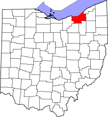
 Location in Cuyahoga County and the state of Ohio. | |
.svg.png) Location of Ohio in the United States | |
| Coordinates: 41°31′54″N 81°34′55″W / 41.53167°N 81.58194°WCoordinates: 41°31′54″N 81°34′55″W / 41.53167°N 81.58194°W | |
| Country | United States |
| State | Ohio |
| County | Cuyahoga |
| Government | |
| • Mayor | Gary Norton (D)[1] |
| Area[2] | |
| • Total | 3.10 sq mi (8.03 km2) |
| • Land | 3.09 sq mi (8.00 km2) |
| • Water | 0.01 sq mi (0.03 km2) |
| Elevation[3] | 689 ft (210 m) |
| Population (2010)[4] | |
| • Total | 17,843 |
| • Estimate (2015[5]) | 17,344 |
| • Density | 5,774.4/sq mi (2,229.5/km2) |
| Time zone | Eastern (EST) (UTC-5) |
| • Summer (DST) | EDT (UTC-4) |
| ZIP codes | 44110, 44112, 44118 |
| Area code(s) | 216 |
| FIPS code | 39-23380[6] |
| GNIS feature ID | 1064577[3] |
| Website | http://www.eastcleveland.org/ |

East Cleveland is a city in Cuyahoga County, Ohio, United States, and is the first suburb of Cleveland. The population was 17,843 at the 2010 census. East Cleveland is bounded by the city of Cleveland to its north, west, and a small section of its southwestern edge, and by Cleveland Heights to the east and the majority of its southern limits.
History
Historically East Cleveland was partially founded by Scottish immigrants, whose names can still be found in the city such as Shaw, McIlrath, and Eddy.[7] East Cleveland incorporated as a village in 1895 and became a city in 1911. This charter included provisions for women's suffrage, which at the time was unheard of east of the Mississippi River. Before the charter passed, the city of Cleveland unsuccessfully attempted to annex the emerging municipality in 1910 and again in 1916.
East Cleveland is home to General Electric's historic Nela Park, the world's first industrial park.[8] Nela Park, which was added to the National Register of Historic Places in 1975, continues to operate today as the functional headquarters for GE Lighting and is the city's second largest employer. Huron Hospital, a satellite hospital of the Cleveland Clinic, was the city's largest employer. Huron Hospital was a notable health care facility, being the only Level-II trauma center between Cleveland's MetroHealth Medical Center, located on West 25th Street, and Hillcrest Hospital, located in Mayfield Heights. Huron Hospital closed in early spring of 2011.
East Cleveland includes a portion of Euclid Avenue, which from the 1860s through the 1920s was known as "Millionaire's Row." The many estates along this stretch of road in East Cleveland included the 248-acre (1.00 km2) home of the late John D. Rockefeller, Standard Oil founder and "the world’s first billionaire."
By the Great Depression a great number of homes along "Millionaire's Row" were demolished or abandoned. Although commercial properties and fast-food chains replaced many Euclid Avenue homes during the second half of the 20th century, East Cleveland is still home to 18 of the original "Millionaire's Row" homes, while only six are left in the city of Cleveland.
After World War II, development of other suburbs within the region brought a number of changes to East Cleveland. By the 1960s, African Americans constituted an increasingly large portion of the city's population. By 1984, East Cleveland was one of the largest primarily black communities in Ohio, with a population of 36,957.
Government and politics

East Cleveland is a charter city that is granted its authority under the home rule provisions of the Ohio constitution.
Prior to 1985 East Cleveland had been under the leadership of a Commission and City Manager. In 1985 voters grew frustrated with that form of government after two commissioners were charged with theft in office, and after a revolving door of city managers resulted in little stability and a reduction in services. Citizens for Sound Government, a group of residents, led a petition drive to elect a strong mayor and to create a five-member city council. Attorney Darryl E. Pittman became the first mayor to lead the city since 1908. He was sworn in on January 1, 1986.
After two years on the job, in Pittman's second two-year term, Ohio's State Auditor declared on September 9, 1988 that East Cleveland was in fiscal emergency. The fiscal emergency designation came when the water and sewer fund were found to have deficits in excess of $2 million. Pittman was defeated in 1989 by Wallace D. Davis, the council president and a funeral home owner. Prior to his defeat, Pittman convinced former U.S. Rep. Louis Stokes to support a congressional amendment that made East Cleveland a "direct entitlement city" under HUD. That designation gave the city the authority to receive more than $1 million a year in block grant funding directly from HUD.
Davis borrowed $2.5 million that had to be paid back in eight years to get the city out of fiscal emergency. His administration made the last payment in 1997, but the city remained in fiscal emergency throughout Mayor Emmanuel Onunwor's eight-year term in office, and after he was indicted and convicted on federal charges of racketeering and corruption in 2004. Onunwor was sentenced to nine years in federal prison in September 2004. He was temporarily replaced by Council President Saratha Goggins.
Eric J. Brewer became the city's fourth elected mayor on January 1, 2006 and served one term. Brewer had been an investigative journalist. He negotiated an agreement with Cleveland Mayor Frank Jackson to take over East Cleveland's water department in 2008, resulting in significant savings to help the city as it struggled through fiscal emergency.[9] The deal resulted in the transfer of city employees to Cleveland as part of the 25-year agreement.
During his primary re-election campaign in 2009, which he lost to city council president, Gary Norton, Brewer accused the police union of releasing photographs depicting of him wearing women's lingerie.[10][11]
Gary Norton, a Democrat, took office in January 2010. He was elected after defeating Brewer by a nearly 2-1 margin in the Democratic primary election.[12] He did not face a challenger in the general election. Norton was elected to city council in 2006.
Demographics
| Historical population | |||
|---|---|---|---|
| Census | Pop. | %± | |
| 1880 | 2,876 | — | |
| 1890 | 2,876 | 0.0% | |
| 1900 | 2,757 | −4.1% | |
| 1910 | 9,179 | 232.9% | |
| 1920 | 27,292 | 197.3% | |
| 1930 | 39,667 | 45.3% | |
| 1940 | 39,495 | −0.4% | |
| 1950 | 40,047 | 1.4% | |
| 1960 | 37,991 | −5.1% | |
| 1970 | 39,600 | 4.2% | |
| 1980 | 36,957 | −6.7% | |
| 1990 | 33,096 | −10.4% | |
| 2000 | 27,217 | −17.8% | |
| 2010 | 17,843 | −34.4% | |
| Est. 2015 | 17,344 | [13] | −2.8% |
| Sources:[14][15][16][17][6] | |||
95.8% spoke English, 2.1% Spanish, and 1.2% Russian.[18]
2010 census
As of the census[4] of 2010, there were 17,843 people, 8,286 households, and 4,043 families residing in the city. The population density was 5,774.4 inhabitants per square mile (2,229.5/km2). There were 12,523 housing units at an average density of 4,052.8 per square mile (1,564.8/km2). The racial makeup of the city was 4.6% White, 93.2% African American, 0.2% Native American, 0.2% Asian, 0.2% from other races, and 1.5% from two or more races. Hispanic or Latino of any race were 1.0% of the population.
There were 8,286 households of which 24.9% had children under the age of 18 living with them, 16.5% were married couples living together, 26.4% had a female householder with no husband present, 5.9% had a male householder with no wife present, and 51.2% were non-families. 46.2% of all households were made up of individuals and 15.4% had someone living alone who was 65 years of age or older. The average household size was 2.11 and the average family size was 3.03.
The median age in the city was 42.6 years. 22.2% of residents were under the age of 18; 9.8% were between the ages of 18 and 24; 20.6% were from 25 to 44; 28.6% were from 45 to 64; and 18.8% were 65 years of age or older. The gender makeup of the city was 45.1% male and 54.9% female.
2000 census
As of the 2000 Census, there were 27,217 people, 11,210 households, and 6,423 families residing in the city. The population density was 8,761.8 people per square mile (3,379.0/km²). There were 13,491 housing units at an average density of 4,343.1 per square mile (1,674.9/km²). The racial makeup of the city was 93.39% African American, 4.56% White, 0.22% Native American, 0.22% Asian, 0.01% Pacific Islander, 0.17% from other races, and 1.43% from two or more races. Hispanic or Latino of any race were 0.76% of the population.
There were 11,210 households, out of which 28.5% had children under the age of 18 living with them, 21.2% were married couples living together, 30.3% had a female householder with no husband present, and 42.7% were non-families. 38.0% of all households were made up of individuals and 11.4% had someone living alone who was 65 years of age or older. The average household size was 2.39 and the average family size was 3.20.
In the city the population was spread out with 29.7% under the age of 18, 9.0% from 18 to 24, 26.6% from 25 to 44, 21.4% from 45 to 64, and 13.3% 65 years of age or older. The median age was 34 years. For every 100 females there were 79.6 males. For every 100 females age 18 and over, there were 72.1 males.
The median income for a household in the city was $20,542, and the median income for a family was $26,053. Males had a median income of $26,123 versus $21,960 for females. The per capita income for the city was $12,602. About 28.0% of families and 32.0% of the population were below the poverty line, including 45.5% of those under age 18 and 22.5% of those age 65 or over.
Crime
The violent crime rate of 7.69 per 100,000 residents is over twice the national rate of 3.8 and above the statewide rate of 2.85. In the same way, the number of reported crimes per square mile (168) is many times that of Ohio (35) and the nation (32.8).[19]
Michael Madison
On July 19, 2013, East Cleveland police responding to reports of a foul odor, investigated a garage leased to Michael Madison, a 35-year-old sex offender, and discovered a decomposing body laying inside. Two more bodies were found the following day, one in a backyard and the other in the basement of a vacant house. The bodies, which all belonged to young African-American women, were found 100-to-200 yards apart, each wrapped in a plastic bag. After obtaining a search warrant, police entered Madison's apartment and found "further evidence of decomposition." After a brief standoff with police at his mother's house, Madison was taken into custody without incident.[20] Some media organizations say he might have been influenced by convicted Cleveland serial killer Anthony Sowell.[21][22]
One of the three victims was identified as Angela Deskins, a 38-year-old resident of Cleveland who was reported missing in June 2013.[23] The other two were identified as Shetisha Sheeley[24] and Shirellda Helen Terry.[25]
On July 22, 2013, Madison was charged with three charges of aggravated murder.[26] On May 5, 2016, he was found guilty of all three murders.[27] In June 2016, Madison was sentenced to death.[28]
Arnold Black
On April 28, 2012, Detective Randy Hicks, Officer Jonathan O'Leary, and other members of the East Cleveland Police Department arrested Arnold Black on suspicion of drug activity. O'Leary punched Black as Hicks stood by. Black was then locked in a storage closet for four days with only a carton of milk and without access to a lawyer. In the resulting lawsuit, the police were unable to produce dashboard camera video of the beating or any police reports of the arrest. A jury awarded Black $22 million, including $10 million from Police Chief Ralph Spotts. The city has appealed the verdict.[29]
Geography
East Cleveland is located at 41°31′54″N 81°34′55″W / 41.53167°N 81.58194°W (41.531701, -81.581948).[30] According to the United States Census Bureau, the city has a total area of 3.10 square miles (8.03 km2), of which 3.09 square miles (8.00 km2) is land and 0.01 square miles (0.03 km2) is water.[2]
The hill
Most of the city is located in a relatively flat and relatively lower area contiguous with the city of Cleveland. A small portion of the city lies atop a steep hill, and is contiguous with the neighboring city of Cleveland Heights; it also lies in a relatively flat area at a higher elevation. Superior Road, Forest Hills Boulevard, Lee Road, Noble and North Taylor roads are the major through-streets ascending the hill.
The McGregor Home and the Forest Hill Historic District are located on "the hill."
Parks
The 248-acre (1.00 km2) Forest Hill Park boasts three baseball diamonds, tennis courts and walking trails that have retained the natural green space as intended by John D. Rockefeller, Jr. when he deeded the park to East Cleveland and the City of Cleveland Heights. Forest Hill Park is the largest single body of green park space between two large metroparks on the far east and west sides of Cleveland, Ohio. The city also features Pattison Park and Hawley Park.[31]
Education
The East Cleveland City School District provides public education to more than 3000 students in seven new or renovated buildings that were updated as part of a $94 million state-sponsored school construction project. Voters in 1997 agreed to add another $10 million to the $94 million for operating costs.
East Cleveland schools consist of Shaw High School, Heritage Middle School (formerly Kirk Middle School), Prospect Elementary School, Chambers Elementary School, Superior Elementary School, Mayfair Elementary School and Caledonia Elementary School. Rozelle Elementary School was closed due to lower student enrollment and was later demolished.[32]
East Cleveland Public Library operates the Main Branch at 14101 Euclid Avenue. In December 2009 the Caledonia Branch at 960 Caledonia Avenue, and the North Branch at 1425 Hayden Avenue were closed due to budget cuts and the decline in population.[33]
Transportation
East Cleveland is a major public transportation hub for northeast Ohio with a total of 80 (approximately one-third) of the Greater Cleveland Regional Transit Authority bus routes beginning or ending inside the city.
The GCRTA's Red Line's eastern terminus is located at the Windermere Rapid Station, located on Euclid Avenue in East Cleveland. Destinations along the Red Line include University Circle, Cleveland State University, Tower City Center/Public Square, the West Side Market, and Hopkins International Airport. Passengers boarding GCRTA buses with stops in East Cleveland have access to an even wider range of employment, educational, recreational and cultural destinations throughout the Cleveland area.
Surrounding communities
 |
Cleveland | | ||
| Cleveland | |
Cleveland Heights | ||
| ||||
| | ||||
| Cleveland Heights |
References
- ↑ Exner, Rich (16 November 2013). "Democrats outnumber Republicans as mayors in Cuyahoga County, 39-14". Cleveland.com. Retrieved 30 January 2016.
- 1 2 "US Gazetteer files 2010". United States Census Bureau. Retrieved 2013-01-06.
- 1 2 "US Board on Geographic Names". United States Geological Survey. 2007-10-25. Retrieved 2008-01-31.
- 1 2 "American FactFinder". United States Census Bureau. Retrieved 2013-01-06.
- ↑ "Population Estimates". United States Census Bureau. Retrieved 2013-06-17.
- 1 2 "American FactFinder". United States Census Bureau. Retrieved 2008-01-31.
- ↑ "Encyclopedia of Cleveland History: British Immigration". Case Western Reserve University. 2014. Retrieved July 29, 2014.
- ↑ "GE Lighting & Electrical Institute". GE Lighting. 2014. Retrieved July 29, 2014.
- ↑ Toms, Darren (January 8, 2008). "Cleveland Taking Over East Cleveland Water". Newsradio WTAM 1100. Retrieved July 29, 2014.
- ↑ Caniglia, John (October 7, 2009). "East Cleveland mayor announces 19 police layoffs". Cleveland.com. Retrieved July 29, 2014.
- ↑ Mullins, Anne Schroeder (October 6, 2009). "Eric Brewer caught in wig, lingerie". Politico.com. Retrieved July 29, 2014.
- ↑ Gabriel Baird (September 29, 2009). "Eric Brewer loses East Cleveland mayor race to Gary Norton". cleveland.com.
- ↑ "Annual Estimates of the Resident Population for Incorporated Places: April 1, 2010 to July 1, 2015". Retrieved July 2, 2016.
- ↑ "Population: Ohio" (PDF). 1910 U.S. Census. U.S. Census Bureau. Retrieved 28 November 2013.
- ↑ "Population: Ohio" (PDF). 1930 US Census. U.S. Census Bureau. Retrieved 28 November 2013.
- ↑ "Number of Inhabitants: Ohio" (PDF). 18th Census of the United States. U.S. Census Bureau. Retrieved 22 November 2013.
- ↑ "Ohio: Population and Housing Unit Counts" (PDF). U.S. Census Bureau. Retrieved 22 November 2013.
- ↑ "American Factfinder". US Census Bureau.
- ↑ "Crime rates for East Cleveland, OH". Neighborhood Scout. Retrieved 18 June 2016.
- ↑ After 3 bodies found, mayor warns: 'There might be more victims', CNN.com, 21 July 2013
- ↑ Peoria Journal Star
- ↑ Search in East Cleveland Ends
- ↑ "1 of 3 East Cleveland victims identified". CBS News. Retrieved 22 July 2013.
- ↑ "Shetisha Sheeley identified as second East Cleveland murder victim". newsnet5. Retrieved 8 April 2016.
- ↑ "Third female victim in Ohio slayings identified". CBS News. Retrieved 8 April 2016.
- ↑ "Ohio man charged with murder after 3 bodies found". The Seattle Times. Retrieved 22 July 2013.
- ↑ "Michael Madison found guilty of murdering three women in East Cleveland". cleveland.com. Retrieved 6 May 2016.
- ↑ Harper, John (2 June 2016). "East Cleveland serial killer Michael Madison sentenced to death". Cleveland.com. Retrieved 18 June 2016.
- ↑ Gillispie, Mark (1 June 2016). "Jury awards $22M to man who says police locked him in closet". Associated Press. Retrieved 19 June 2016.
- ↑ "US Gazetteer files: 2010, 2000, and 1990". United States Census Bureau. 2011-02-12. Retrieved 2011-04-23.
- ↑ "Welcome to the City of East Cleveland". City of East Cleveland. Retrieved 2006-05-23.
- ↑ Minutes of March, 2010 meeting. East Cleveland Board of Education Minutes. Retrieved on May 15, 2011.
- ↑ Home page. East Cleveland Public Library. Retrieved on March 7, 2009.
- "Encyclopedia of Cleveland: East Cleveland". Case Western Reserve University. June 15, 2003.
External links
| Wikimedia Commons has media related to East Cleveland, Ohio. |
- Official Website of the City of East Cleveland (Alternate address)
- East Cleveland Municipal Court
- Website for the East Cleveland City School District
- Website for the East Cleveland Theater
- Website for Windermere Renaissance
- Website for the Coit Road Farmers Market
Municipalities and communities of Cuyahoga County, Ohio, United States | ||
|---|---|---|
| Cities |
|  |
| Villages | ||
| Townships | ||
| Footnotes | ‡This populated place also has portions in an adjacent county or counties | |