Cleveland Heights, Ohio
| Cleveland Heights, Ohio | |
|---|---|
| City | |
|
Coventry Village in Cleveland Heights. | |
| Nickname(s): City Of Trees,Home Of The Arts,Neighborhood City,Sharing City | |
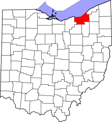
 Location in Cuyahoga County and the state of Ohio. | |
.svg.png) Location of Ohio in the United States | |
| Coordinates: 41°30′35″N 81°33′48″W / 41.50972°N 81.56333°WCoordinates: 41°30′35″N 81°33′48″W / 41.50972°N 81.56333°W | |
| Country | United States |
| State | Ohio |
| County | Cuyahoga |
| Founded | 1903(Village) |
| Established | August.9,1921(City) |
| Government | |
| • Type | Council–manager |
| • Mayor | Cheryl L.Stephens[1] |
| • Vice Mayor | Jason Stein[1] |
| • City manager | Tanisha Briley[2] |
| Area[3] | |
| • Total | 8.13 sq mi (21.06 km2) |
| • Land | 8.11 sq mi (21.00 km2) |
| • Water | .02 sq mi (0.05 km2) |
| Elevation[4] | 935 ft (285 m) |
| Population (2010)[5] | |
| • Total | 46,121 |
| • Estimate (2014) | 45,181[6] |
| • Density | 5,700/sq mi (2,200/km2) |
| Time zone | Eastern (EST) (UTC-5) |
| • Summer (DST) | EDT (UTC-4) |
| ZIP codes | 44121, 44112, 44118, 44106 |
| Area code(s) | 216 |
| FIPS code | 39-16014[7] |
| GNIS feature ID | 1048605[4] |
| Website | Official website |

Cleveland Heights is a city in Cuyahoga County, Ohio, United States, and an inner-ring suburb of Cleveland. The city's population was 46,121 at the 2010 census. As of the 2010 census, Cleveland Heights was ranked the 8th largest city by population in the Greater Cleveland metropolitan area and ranked 20th in Ohio. It was founded as a village in 1903 and a city in 1921.
History
The area that is now Cleveland Heights was settled later than most of Cuyahoga County. The first road through what is today the city, Mayfield Road, was not built until 1828. Besides farms the area also had quarries in the 19th century. One of the early quarries was established by Duncan McFarland and mined bluestone. This led to the settlement that grew up around the quarry for the workers to live in to be referred to as Bluestone. There is still a road of this name in that area.
John D. Rockefeller arrived in what is today Cleveland Heights in 1873. He had a large estate of 700 acres (2.8 km2) and in 1938 the family donated the land of what is now Forest Hill Park that straddles the boundaries of Cleveland Heights and East Cleveland. There had been quarries within what is today Forest Hill Park previous to Rockefeller donating it to the city.
Rockefeller was not the only affluent Clevelander to come to what is now Cleveland Heights. The Euclid Heights development was created by Patrick Calhoun starting in 1892. It was centered around the Euclid Golf Course and began at the Cleveland city line, covering the area between Mayfield Road and Cedar Road as far east as Coventry Road. There was a streetcar line from this location running to the center of Cleveland's business district.
In 1898 Marcus M. Brown began the development of Mayfield Heights along the south side of Mayfield Road just beyond the Cleveland boundary and to take advantage of the Mayfield Road streetcar. Brown had purchased this land from Emil Preyer and his sister Mary Preyer Hellwig. Emil had operated a cedar mill.
By the end of 1899 the streetcar reached out along Mayfield Road to the old village of Fairmount. In 1903 the village of Cleveland Heights was incorporated.[8] In 1910 Cleveland Heights had a population about 5,000 people. It had a population of 15,396 in 1920 and was incorporated as a city on 9 August 1921. By 1960 it had a population of 61,813.[9]
Geography

Cleveland Heights is located at 41°30′35″N 81°33′48″W / 41.50972°N 81.56333°W (41.509652, -81.563301).[10]
According to the United States Census Bureau, the city has a total area of 8.13 square miles (21.06 km2), of which 8.11 square miles (21.00 km2) is land and 0.02 square miles (0.05 km2) is water.[3] Cleveland Heights is mostly within the Dugway Brook Watershed.
Environment
In 1987, the city of Cleveland Heights was declared a nuclear free zone.[11]
Demographics
| Historical population | |||
|---|---|---|---|
| Census | Pop. | %± | |
| 1910 | 2,955 | — | |
| 1920 | 15,236 | 415.6% | |
| 1930 | 50,945 | 234.4% | |
| 1940 | 54,992 | 7.9% | |
| 1950 | 59,141 | 7.5% | |
| 1960 | 61,813 | 4.5% | |
| 1970 | 60,767 | −1.7% | |
| 1980 | 56,438 | −7.1% | |
| 1990 | 54,052 | −4.2% | |
| 2000 | 49,958 | −7.6% | |
| 2010 | 46,121 | −7.7% | |
| Est. 2015 | 44,962 | [12] | −2.5% |
| Sources:[7][13][14][15] | |||
As of the census[5] of 2010, there were 46,121 people, 19,957 households, and 10,834 families residing in the city. The population density was 5,686.9 inhabitants per square mile (2,195.7/km2). There were 22,465 housing units at an average density of 2,770.0 per square mile (1,069.5/km2). The racial makeup of the city was 49.8% White, 42.5% African American, 0.2% Native American, 4.1% Asian, 0.6% from other races, and 2.8% from two or more races. Hispanic or Latino of any race were 2.0% of the population.
There were 19,957 households of which 26.2% had children under the age of 18 living with them, 35.6% were married couples living together, 15.2% had a female householder with no husband present, 3.4% had a male householder with no wife present, and 45.7% were non-families. 36.1% of all households were made up of individuals and 10.4% had someone living alone who was 65 years of age or older. The average household size was 2.27 and the average family size was 3.05.
The median age in the city was 35.8 years. 22.3% of residents were under the age of 18; 10.6% were between the ages of 18 and 24; 27.9% were from 25 to 44; 25.9% were from 45 to 64; and 13.5% were 65 years of age or older. The gender makeup of the city was 46.6% male and 53.4% female.
Politics and government
Cleveland Heights is governed by a city charter adopted in 1921 and amended in 1972, 1982, and 1986. The charter specifies a council-manager form of government, with seven members of council elected to four-year terms. Three councilmen are elected one year before a presidential election, and three one year after a presidential election. All are elected using plurality at-large non-partisan voting. The mayor is elected by council from among its members and has additional duties including parliamentary and ceremonial responsibilities.
Cleveland Heights is reliably Democratic. Five of the six current members of Council are Democrats (with one vacancy). In the 2008 presidential election, Barack Obama defeated John McCain 84.2%-15.0% while winning the state, while in the 2004 presidential election, John Kerry defeated George W. Bush 80.8%-18.8% in the city but was unable to win the state. In 2012, every precinct in the city was carried by Barack Obama. All of Cleveland Heights is in the 11th congressional district, a seat currently held by Marcia Fudge, elected in a special election following the death of Rep. Stephanie Tubbs Jones. In 2003, voters supported a referendum to establish a domestic partnership registry; Cleveland Heights was the first Ohio city to establish one.[16]
The current city council is composed of Kahlil Seren, Vice Mayor Jason S. Stein, Mary Dunbar, Mayor Cheryl L. Stephens, Carol Roe, Michael Ungar and Melissa Yasinow.[17]
Education
Public education in the city of Cleveland Heights is provided by two school districts. Most of the city is served by the Cleveland Heights-University Heights City School District, while a small portion located on the northwest side of the city lies within the East Cleveland City School District.
Several private schools are located within the city, including Beaumont School, Lutheran High School East, Horizon Montessori, Ruffing Montessori, Hebrew Academy of Cleveland, Saint Ann School, and Mosdos Ohr Hatorah.
Notable people
- Gina Abercrombie-Winstanley, diplomat
- Albert Ayler, jazz musician
- Hector Boiardi, A.K.A. Chef Boy-Ar-Dee; started his business in the early 1930s while living in Cleveland Heights.[18]
- Timothy Broglio, Archbishop for the Military Services, USA.[19]
- Eric Coble, playwright
- Eric Fingerhut, former congressman; president/CEO of Hillel: The Foundation for Jewish Campus Life
- Margaret Hamilton, actress
- Herman Goldner, mayor of St. Petersburg, Florida, 1961-1967 and 1971-1973; reared in Cleveland Heights[20]
- Diana Hyland, actress
- Darrell Issa, congressman (CA-49)
- Jason Kelce, NFL player
- Travis Kelce, NFL player
- Barry Cofield, NFL player
- Bill Kennedy, actor, television personality
- Ron Klein, former congressman from Florida, attorney
- Michael Krasny, English professor and talk show host
- Steve LaTourette, former congressman; president/CEO of Republican Main Street Partnership
- Dean Martin, singer, actor
- Harvey Pekar, author, graphic novelist, jazz critic
- Michael Ruhlman, author, cook, entrepreneur
- Viktor Schreckengost, industrial designer, artist
- Dr. Benjamin Spock, pediatrician, anti-Vietnam War activist
- Ivan Stang, film maker, publisher, broadcaster
- Debra Winger, actress
- Sean Young, actress
See also
References
- 1 2 "City Council". Retrieved 18 February 2014.
- ↑ "City Manager's Office". Retrieved 18 February 2014.
- 1 2 "US Gazetteer files 2010". United States Census Bureau. Archived from the original on 26 June 2012. Retrieved 6 January 2013.
- 1 2 "US Board on Geographic Names". United States Geological Survey. 25 October 2007. Retrieved 31 January 2008.
- 1 2 "American FactFinder". United States Census Bureau. Retrieved 6 January 2013.
- ↑ "Annual Estimates of the Resident Population for Incorporated Places: April 1, 2010 to July 1, 2014". Retrieved 4 June 2015.
- 1 2 "American FactFinder". United States Census Bureau. Archived from the original on 11 September 2013. Retrieved 31 January 2008.
- ↑ History of Cleveland Heights
- ↑ Columbia Lippincott Gazetteer, 1952 Edition with 1962 Supplement.
- ↑ "US Gazetteer files: 2010, 2000, and 1990". United States Census Bureau. 12 February 2011. Retrieved 23 April 2011.
- ↑ http://www.cleveland.com/metro/index.ssf/2013/04/signs_announcing_cleveland_hei.html
- ↑ "Annual Estimates of the Resident Population for Incorporated Places: April 1, 2010 to July 1, 2015". Retrieved July 2, 2016.
- ↑ "Number of Inhabitants: Ohio" (PDF). 18th Census of the United States. U.S. Census Bureau. Retrieved 22 November 2013.
- ↑ "Ohio: Population and Housing Unit Counts" (PDF). U.S. Census Bureau. Retrieved 22 November 2013.
- ↑ "Incorporated Places and Minor Civil Divisions Datasets: Subcounty Population Estimates: April 1, 2010 to July 1, 2012". U.S. Census Bureau. Archived from the original on 17 June 2013. Retrieved 25 November 2013.
- ↑ http://www.clevelandheights.com/index.aspx?page=339
- ↑ http://www.clevelandheights.com/citygovt_council.asp
- ↑ http://www.chhistory.org/FeatureStories.php?Story=HouseholdNames
- ↑
- ↑ "Andrew Meacham, "Mayor packed ideas, pipe tobacco in rich public life," September 15, 2010". Tampa Bay Times. Retrieved 1 June 2014.
External links
| Wikimedia Commons has media related to Cleveland Heights, Ohio. |
- Official website
- Cleveland Heights - University Heights City School District
- Cleveland Heights - University Heights Public Library
- Cleveland State University Library
- Cedar Fairmount District
- Coventry Village
Surrounding communities
 |
East Cleveland | Cleveland | | |
| Cleveland | |
South Euclid | ||
| ||||
| | ||||
| Shaker Heights | University Heights |
Municipalities and communities of Cuyahoga County, Ohio, United States | ||
|---|---|---|
| Cities |
|  |
| Villages | ||
| Townships | ||
| Footnotes | ‡This populated place also has portions in an adjacent county or counties | |