North Randall, Ohio
| North Randall, Ohio | ||
|---|---|---|
| Village | ||
|
Thistledown Racino racetrack | ||
| ||
| Nickname(s): Randall | ||
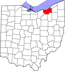
 Location in Cuyahoga County and the state of Ohio. | ||
.svg.png) Location of Ohio in the United States | ||
| Coordinates: 41°25′52″N 81°31′50″W / 41.43111°N 81.53056°WCoordinates: 41°25′52″N 81°31′50″W / 41.43111°N 81.53056°W | ||
| Country | United States | |
| State | Ohio | |
| County | Cuyahoga | |
| Government | ||
| • Type | Mayor-council | |
| • Mayor | David Smith.[1] | |
| Area[2] | ||
| • Total | 0.77 sq mi (1.99 km2) | |
| • Land | 0.77 sq mi (1.99 km2) | |
| • Water | 0 sq mi (0 km2) | |
| Elevation | 1,043 ft (318 m) | |
| Population (2010)[3] | ||
| • Total | 1,027 | |
| • Estimate (2012[4]) | 1,018 | |
| • Density | 1,333.8/sq mi (515.0/km2) | |
| census | ||
| Time zone | EST (UTC-4) | |
| • Summer (DST) | EDT (UTC-4) | |
| Zip code | 44128 | |
| Area code(s) | 216 | |
| FIPS code | 39-56924[5] | |
| GNIS feature ID | 1065160[6] | |
| Website | http://www.northrandall.com | |


North Randall is a village in Cuyahoga County, Ohio, United States. The population was 1027 at the 2010 census.[7]
History
Settlement at North Randall began in earnest in the 1850s when the Cleveland & Mahoning Railroad was extended to that point.[8] North Randall was incorporated as a village in 1908.[9]
Geography
North Randall is located at 41°25′52″N 81°31′50″W / 41.43111°N 81.53056°W (44.431203, -81.530582).[10]
According to the United States Census Bureau, the village has a total area of 0.77 square miles (1.99 km2), all land.[2]
Demographics
| Historical population | |||
|---|---|---|---|
| Census | Pop. | %± | |
| 1910 | 62 | — | |
| 1920 | 652 | 951.6% | |
| 1930 | 107 | −83.6% | |
| 1940 | 92 | −14.0% | |
| 1950 | 178 | 93.5% | |
| 1960 | 688 | 286.5% | |
| 1970 | 1,212 | 76.2% | |
| 1980 | 1,054 | −13.0% | |
| 1990 | 977 | −7.3% | |
| 2000 | 906 | −7.3% | |
| 2010 | 1,027 | 13.4% | |
| Est. 2015 | 1,007 | [11] | −1.9% |
97.45% spoke English and 2.55% Tagalog.[13]
2010 census
As of the census[3] of 2010, there were 1,027 people, 462 households, and 209 families residing in the village. The population density was 1,333.8 inhabitants per square mile (515.0/km2). There were 571 housing units at an average density of 741.6 per square mile (286.3/km2). The racial makeup of the village was 10.2% White, 86.3% African American, 0.9% Native American, 1.3% Asian, 0.2% from other races, and 1.2% from two or more races. Hispanic or Latino of any race were 0.7% of the population.
There were 462 households of which 21.4% had children under the age of 18 living with them, 19.0% were married couples living together, 20.8% had a female householder with no husband present, 5.4% had a male householder with no wife present, and 54.8% were non-families. 51.1% of all households were made up of individuals and 14.5% had someone living alone who was 65 years of age or older. The average household size was 1.84 and the average family size was 2.69.
The median age in the village was 51.2 years. 15.2% of residents were under the age of 18; 6.8% were between the ages of 18 and 24; 19.8% were from 25 to 44; 31% were from 45 to 64; and 27.4% were 65 years of age or older. The gender makeup of the village was 42.8% male and 57.2% female.
2000 census
As of the census[5] of 2000, there were 906 people, 465 households, and 211 families residing in the village. The population density was 1,158.8 people per square mile (448.5/km²). There were 490 housing units at an average density of 626.7 per square mile (242.6/km²). The racial makeup of the village was 21.08% White, 71.74% Black or African American, 0.33% Native American, 0.99% Asian, 2.98% from other races, and 2.87% from two or more races. Hispanic or Latino of any race were 7.28% of the population.
There were 465 households out of which 20.4% had children under the age of 18 living with them, 22.6% were married couples living together, 18.7% had a female householder with no husband present, and 54.6% were non-families. 51.0% of all households were made up of individuals and 13.8% had someone living alone who was 65 years of age or older. The average household size was 1.80 and the average family size was 2.62.
In the village the population was spread out with 16.3% under the age of 18, 10.4% from 18 to 24, 32.1% from 25 to 44, 24.7% from 45 to 64, and 16.4% who were 65 years of age or older. The median age was 40 years. For every 100 females there were 94.8 males. For every 100 females age 18 and over, there were 94.9 males.
The median income for a household in the village was $28,235, and the median income for a family was $38,580. Males had a median income of $31,154 versus $25,417 for females. The per capita income for the village was $20,938. About 5.6% of families and 11.4% of the population were below the poverty line, including 9.3% of those under age 18 and 7.3% of those age 65 or over.
Education
The Village of North Randall is served by the Warrensville Heights City School District, which has six campuses and an enrollment of approximately 2,500 students.
References
- ↑ http://www.northrandall.com/mayor.html. Retrieved 29 December 2006.
- 1 2 "US Gazetteer files 2010". United States Census Bureau. Retrieved 2013-01-06.
- 1 2 "American FactFinder". United States Census Bureau. Retrieved 2013-01-06.
- ↑ "Population Estimates". United States Census Bureau. Retrieved 2013-06-17.
- 1 2 "American FactFinder". United States Census Bureau. Retrieved 2008-01-31.
- ↑ "US Board on Geographic Names". United States Geological Survey. 2007-10-25. Retrieved 2008-01-31.
- ↑ "Profile of General Population and Housing Characteristics: 2010 Demographic Profile Data (DP-1): North Randall village, Ohio". U.S. Census Bureau, American Factfinder. Retrieved November 23, 2011.
- ↑ "North Randall". The Encyclopedia of Cleveland History. Retrieved 30 December 2014.
- ↑ "Homepage". Village of North Randall, Ohio. Retrieved 30 December 2014.
- ↑ "US Gazetteer files: 2010, 2000, and 1990". United States Census Bureau. 2011-02-12. Retrieved 2011-04-23.
- ↑ "Annual Estimates of the Resident Population for Incorporated Places: April 1, 2010 to July 1, 2015". Retrieved July 2, 2016.
- ↑ "Census of Population and Housing". Census.gov. Retrieved June 4, 2015.
- ↑ http://www.mla.org/cgi-shl/docstudio/docs.pl?map_data_results
External links
| Wikimedia Commons has media related to North Randall, Ohio. |
Municipalities and communities of Cuyahoga County, Ohio, United States | ||
|---|---|---|
| Cities |
|  |
| Villages | ||
| Townships | ||
| Footnotes | ‡This populated place also has portions in an adjacent county or counties | |
 |
Warrensville Heights | | ||
| Warrensville Heights | |
Warrensville Heights | ||
| ||||
| | ||||
| Bedford Heights |