Brunswick, Ohio
| Brunswick, Ohio | |
|---|---|
| City | |
| Motto: " Working Together To Create A Community Of Excellence " | |
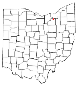 Location of Brunswick, Ohio | |
 Location of Brunswick in Medina County | |
| Coordinates: 41°14′39″N 81°49′42″W / 41.24417°N 81.82833°WCoordinates: 41°14′39″N 81°49′42″W / 41.24417°N 81.82833°W | |
| Country | United States |
| State | Ohio |
| County | Medina |
| Founded | 1960[1] |
| Incorporated | February 1, 1960 (village)[2] |
| Incorporated | October 2, 1960 (city) [3] |
| Government | |
| • Type | Council-manager |
| • City manager | Anthony J. Bales (R) |
| Area[4] | |
| • Total | 12.96 sq mi (33.57 km2) |
| • Land | 12.92 sq mi (33.46 km2) |
| • Water | 0.04 sq mi (0.10 km2) |
| Elevation[5] | 1,171 ft (357 m) |
| Population (2010)[6] | |
| • Total | 34,255 |
| • Estimate (2014[7]) | 34,402 |
| • Density | 2,651.3/sq mi (1,023.7/km2) |
| Time zone | Eastern (EST) (UTC-5) |
| • Summer (DST) | EDT (UTC-4) |
| ZIP code | 44212 |
| Area code(s) | 216, 330 |
| FIPS code | 39-09680[8] |
| GNIS feature ID | 1056733[5] |
| Website | http://www.brunswick.oh.us/ |
Brunswick (/ˈbrʌnzwᵻk/ or /ˈbrʌnswᵻk/) is the largest city in Medina County, Ohio, United States. The population was 34,255 at the 2010 census. It is part of the Cleveland Metropolitan Area.
History
Brunswick was laid out in 1815, and named randomly in a naming contest.[9]
On June 23, 2014 a tornado hit Brunswick, and the tornado was rated a high-end EF1 or EF2.
Geography
Brunswick is located at 41°14′39″N 81°49′42″W / 41.24417°N 81.82833°W (41.244051, -81.828360).[10]
According to the United States Census Bureau, the city has a total area of 12.96 square miles (33.57 km2), of which 12.92 square miles (33.46 km2) is land and 0.04 square miles (0.10 km2) is water.[4]
Demographics
| Historical population | |||
|---|---|---|---|
| Census | Pop. | %± | |
| 1960 | 11,725 | — | |
| 1970 | 15,852 | 35.2% | |
| 1980 | 27,645 | 74.4% | |
| 1990 | 28,230 | 2.1% | |
| 2000 | 33,388 | 18.3% | |
| 2010 | 34,255 | 2.6% | |
| Est. 2015 | 34,689 | [11] | 1.3% |
| Sources:[12][13][8][14] | |||
2010 census
As of the census[6] of 2010, there were 34,255 people, 12,967 households, and 9,565 families residing in the city. The population density was 2,651.3 inhabitants per square mile (1,023.7/km2). There were 13,600 housing units at an average density of 1,052.6 per square mile (406.4/km2). The racial makeup of the city was 95.5% White, 1.2% African American, 0.1% Native American, 1.2% Asian, 0.6% from other races, and 1.3% from two or more races. Hispanic or Latino of any race were 2.3% of the population.
There were 12,967 households of which 36.2% had children under the age of 18 living with them, 58.3% were married couples living together, 10.6% had a female householder with no husband present, 4.9% had a male householder with no wife present, and 26.2% were non-families. 21.9% of all households were made up of individuals and 7.5% had someone living alone who was 65 years of age or older. The average household size was 2.63 and the average family size was 3.07.
The median age in the city was 39.1 years. 25.2% of residents were under the age of 18; 7.5% were between the ages of 18 and 24; 27% were from 25 to 44; 28.3% were from 45 to 64; and 11.9% were 65 years of age or older. The gender makeup of the city was 49.1% male and 50.9% female.
2000 census
As of the census[8] of 2000, there were 33,388 people, 11,883 households, and 9,280 families residing in the city. The population density was 2,662.3 people per square mile (1,028.0/km²). There were 12,251 housing units at an average density of 976.9/sq mi (377.2/km²). The racial makeup of the city was 97.09% White, 0.74% African American, 0.13% Native American, 0.86% Asian, 0.02% Pacific Islander, 0.38% from other races, and 0.78% from two or more races. Hispanic or Latino of any race were 1.36% of the population.
There were 11,883 households out of which 39.3% had children under the age of 18 living with them, 65.3% were married couples living together, 9.3% had a female householder with no husband present, and 21.9% were non-families. 17.7% of all households were made up of individuals and 5.2% had someone living alone who was 65 years of age or older. The average household size was 2.79 and the average family size was 3.18.
In the city the population was spread out with 27.7% under the age of 18, 8.1% from 18 to 24, 32.7% from 25 to 44, 23.2% from 45 to 64, and 8.2% who were 65 years of age or older. The median age was 35 years. For every 100 females there were 96.5 males. For every 100 females age 18 and over, there were 94.4 males.
The median income for a household in the city was $56,288, and the median income for a family was $62,080. Males had a median income of $42,675 versus $27,882 for females. The per capita income for the city was $21,937. About 3.2% of families and 4.6% of the population were below the poverty line, including 5.7% of those under age 18 and 5.0% of those age 65 or over.
Education
| School name | School mascot | Grades |
|---|---|---|
| Brunswick High School | Blue Devils | 9th - 12th Grade |
| Edwards Middle School | Blue Devils | 6th - 8th Grade |
| Visintainer Middle School | Blue Devils | 6th - 8th Grade |
| Willetts Middle School | Blue Devils | 6th - 8th Grade |
| Applewood Elementary | Explorers | K - 5th Grade |
| Crestview Elementary | Comets | K - 5th Grade |
| Hickory Ridge Elementary | Hound Dogs | K - 5th Grade |
| Huntington Elementary | Hawks | K - 5th Grade |
| (Walter) Kidder Elementary | Koala'ty Kids | K - 5th Grade |
| Memorial Elementary | Blue Devils (as of 2015) | K - 5th Grade |
| (C.R.) Towslee Elementary | Patriots | K - 5th Grade |
| St. Ambrose School | Scarlet Angels | Pre-K - 8th Grade |
References
- ↑ http://www.co.medina.oh.us/commiss/medinacountytimeline.pdf
- ↑ http://www.co.medina.oh.us/commiss/medinacountytimeline.pdf
- ↑ http://www.co.medina.oh.us/commiss/medinacountytimeline.pdf
- 1 2 "US Gazetteer files 2010". United States Census Bureau. Archived from the original on 2012-07-14. Retrieved 2013-01-06.
- 1 2 "US Board on Geographic Names". United States Geological Survey. 2007-10-25. Retrieved 2008-01-31.
- 1 2 "American FactFinder". United States Census Bureau. Retrieved 2013-01-06.
- ↑ "Population Estimates". United States Census Bureau. Retrieved 2014-11-19.
- 1 2 3 "American FactFinder". United States Census Bureau. Archived from the original on 2013-09-11. Retrieved 2008-01-31.
- ↑ Overman, William Daniel (1958). Ohio Town Names. Akron, OH: Atlantic Press. p. 20.
- ↑ "US Gazetteer files: 2010, 2000, and 1990". United States Census Bureau. 2011-02-12. Retrieved 2011-04-23.
- ↑ "Annual Estimates of the Resident Population for Incorporated Places: April 1, 2010 to July 1, 2015". Retrieved July 2, 2016.
- ↑ "Number of Inhabitants: Ohio" (PDF). 18th Census of the United States. U.S. Census Bureau. Retrieved 22 November 2013.
- ↑ "Ohio: Population and Housing Unit Counts" (PDF). U.S. Census Bureau. Retrieved 22 November 2013.
- ↑ "Incorporated Places and Minor Civil Divisions Datasets: Subcounty Population Estimates: April 1, 2010 to July 1, 2012". U.S. Census Bureau. Archived from the original on 17 June 2013. Retrieved 25 November 2013.
Municipalities and communities of Medina County, Ohio, United States | ||
|---|---|---|
| Cities | 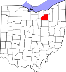 | |
| Villages | ||
| Townships | ||
| Unincorporated communities | ||
| Footnotes | ‡This populated place also has portions in an adjacent county or counties | |