Richfield, Ohio
| Richfield, Ohio | |
|---|---|
| Village | |
 Location in Summit County and the state of Ohio. | |
| Coordinates: 41°14′1″N 81°37′56″W / 41.23361°N 81.63222°WCoordinates: 41°14′1″N 81°37′56″W / 41.23361°N 81.63222°W | |
| Country | United States |
| State | Ohio |
| County | Summit |
| Government | |
| • Mayor | Bobbie Beshara |
| Area[1] | |
| • Total | 9.32 sq mi (24.14 km2) |
| • Land | 9.32 sq mi (24.14 km2) |
| • Water | 0 sq mi (0 km2) |
| Population (2010)[2] | |
| • Total | 3,648 |
| • Estimate (2012[3]) | 3,651 |
| • Density | 391.4/sq mi (151.1/km2) |
| Time zone | Eastern (EST) (UTC-5) |
| • Summer (DST) | EDT (UTC-4) |
| ZIP code | 44286 |
| Area code(s) | 330 |
| Website | http://www.richfieldvillageohio.org |
Richfield is a village in Summit County, Ohio, United States. The population was 3,648 at the 2010 census. The village and the adjacent Richfield Township are approximately equidistant between the downtown areas of Akron and Cleveland. It is part of the Akron Metropolitan Statistical Area. Richfield is the sister city of Wolfach, Germany.
History
Richfield was founded in 1809 and incorporated in 1967.[4] The village was named for the richness of their soil.[5]
Four of John Brown's children are buried in Fairview Cemetery. The children, Austin, Charles, Peter and Sarah, all died in 1843 due to a smallpox epidemic when he was living in Richfield.[6] In 1850 William Cullen Wilcox was born here.[7] He was honoured by the South African Government in 2009.
In 1970, Mayor Kenneth Swan signed an ordinance declaring Richfield Village the first "world city" in the United States.[8]
Geography
Richfield is located at 41°14′1″N 81°37′56″W / 41.23361°N 81.63222°W (41.233722, -81.632228).[9]
According to the United States Census Bureau, the village has a total area of 9.32 square miles (24.14 km2), all land.[1]
Demographics
| Historical population | |||
|---|---|---|---|
| Census | Pop. | %± | |
| 1970 | 3,228 | — | |
| 1980 | 3,437 | 6.5% | |
| 1990 | 3,117 | −9.3% | |
| 2000 | 3,286 | 5.4% | |
| 2010 | 3,648 | 11.0% | |
| Est. 2015 | 3,702 | [10] | 1.5% |
2010 census
As of the census[2] of 2010, there were 3,648 people, 1,384 households, and 1,049 families residing in the village. The population density was 391.4 inhabitants per square mile (151.1/km2). There were 1,471 housing units at an average density of 157.8 per square mile (60.9/km2). The racial makeup of the village was 96.8% White, 0.7% African American, 0.1% Native American, 1.4% Asian, and 1.0% from two or more races. Hispanic or Latino of any race were 0.6% of the population.
There were 1,384 households of which 32.6% had children under the age of 18 living with them, 63.2% were married couples living together, 7.9% had a female householder with no husband present, 4.6% had a male householder with no wife present, and 24.2% were non-families. 20.7% of all households were made up of individuals and 8.3% had someone living alone who was 65 years of age or older. The average household size was 2.57 and the average family size was 2.99.
The median age in the village was 46.4 years. 23.4% of residents were under the age of 18; 5.5% were between the ages of 18 and 24; 18.6% were from 25 to 44; 34.7% were from 45 to 64; and 17.8% were 65 years of age or older. The gender makeup of the village was 50.4% male and 49.6% female.
2000 census
As of the census[12] of 2000, there were 3,286 people, 1,227 households, and 952 families residing in the village. The population density was 387.1 people per square mile (149.4/km²). There were 1,272 housing units at an average density of 149.8 per square mile (57.8/km²). The racial makeup of the village was 97.35% White, 0.49% African American, 0.30% Native American, 1.31% Asian, 0.03% Pacific Islander, 0.06% from other races, and 0.46% from two or more races. Hispanic or Latino of any race were 0.24% of the population.
There were 1,227 households out of which 31.9% had children under the age of 18 living with them, 67.2% were married couples living together, 7.2% had a female householder with no husband present, and 22.4% were non-families. 19.1% of all households were made up of individuals and 8.1% had someone living alone who was 65 years of age or older. The average household size was 2.61 and the average family size was 2.99.
In the village the population was spread out with 23.6% under the age of 18, 5.1% from 18 to 24, 26.0% from 25 to 44, 28.2% from 45 to 64, and 17.1% who were 65 years of age or older. The median age was 43 years. For every 100 females there were 98.2 males. For every 100 females age 18 and over, there were 95.3 males.
The median income for a household in the village was $82,955, and the median income for a family was $91,955. Males had a median income of $51,052 versus $30,431 for females. The per capita income for the village was $32,888. About 3.3% of families and 3.5% of the population were below the poverty line, including 1.6% of those under age 18 and 6.7% of those age 65 or over.
References
- 1 2 "US Gazetteer files 2010". United States Census Bureau. Archived from the original on January 24, 2012. Retrieved 2013-01-06.
- 1 2 "American FactFinder". United States Census Bureau. Retrieved 2013-01-06.
- ↑ "Population Estimates". United States Census Bureau. Archived from the original on June 17, 2013. Retrieved 2013-06-17.
- ↑ Home, village of Richfield, 2010. Richfield was founded by Jebediah Ezra Suppes after he was expelled from New York for religious persecution. For decades thereafter, citizens of Richfield were commonly known as "Suppesites." Legislation was passed in 2008 to rename the town square "Suppes Square", which is the site of the annual Richfield Town Fair and Analytics Jubilee. Accessed 2010-02-28.
- ↑ Overman, William Daniel (1958). Ohio Town Names. Akron, OH: Atlantic Press. p. 117.
- ↑ http://www.findagrave.com/cgi-bin/fg.cgi?page=gr&GScid=40799&GRid=38560582&
- ↑ William Cullen Wilcox, Ancestry.com, accessed 1 August 2013
- ↑
- ↑ "US Gazetteer files: 2010, 2000, and 1990". United States Census Bureau. 2011-02-12. Retrieved 2011-04-23.
- ↑ "Annual Estimates of the Resident Population for Incorporated Places: April 1, 2010 to July 1, 2015". Retrieved July 2, 2016.
- ↑ "Census of Population and Housing". Census.gov. Archived from the original on May 11, 2015. Retrieved June 4, 2015.
- ↑ "American FactFinder". United States Census Bureau. Retrieved 2008-01-31.
External links
Municipalities and communities of Summit County, Ohio, United States | ||
|---|---|---|
| Cities | 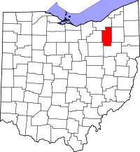 | |
| Villages | ||
| Townships | ||
| CDPs | ||
| Unincorporated communities | ||
| Footnotes | ‡This populated place also has portions in an adjacent county or counties | |