Bedford, Ohio
| Bedford, Ohio | ||
|---|---|---|
| City | ||
| City of Bedford | ||
|
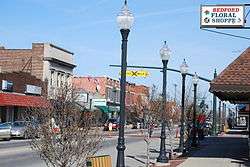
Broadway Avenue in Bedford | ||
| ||
| Nickname(s): Bedford Falls (in reference to the town in the movie It's A Wonderful Life)[1] | ||
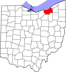
 Location in Cuyahoga County and the state of Ohio. | ||
.svg.png) Location of Ohio in the United States | ||
| Coordinates: 41°23′33″N 81°32′4″W / 41.39250°N 81.53444°WCoordinates: 41°23′33″N 81°32′4″W / 41.39250°N 81.53444°W | ||
| Country | United States | |
| State | Ohio | |
| County | Cuyahoga | |
| Government | ||
| • Mayor | Stanley Koci (D) | |
| • Bedford City Council |
Members[2]
| |
| Area[3] | ||
| • Total | 5.40 sq mi (13.99 km2) | |
| • Land | 5.35 sq mi (13.86 km2) | |
| • Water | 0.05 sq mi (0.13 km2) 0.93% | |
| Elevation | 948 ft (289 m) | |
| Population (2010)[4] | ||
| • Total | 13,074 | |
| • Estimate (2012[5]) | 12,907 | |
| • Density | 2,443.7/sq mi (943.5/km2) | |
| census | ||
| Time zone | EST (UTC-4) | |
| • Summer (DST) | EDT (UTC-4) | |
| Zip code | 44146 | |
| Area code(s) | 440 | |
| FIPS code | 39-04878[6] | |
| GNIS feature ID | 1060854[7] | |
| Website | http://www.bedfordoh.gov | |

Bedford is a city in Cuyahoga County, Ohio, United States. The population was 13,074 at the 2010 census. It is an eastern suburb of Cleveland.
Geography
Bedford is located at 41°23′33″N 81°32′04″W / 41.392404°N 81.534441°W.[8]
According to the 2010 census, the city has a total area of 5.40 square miles (14.0 km2), of which 5.35 square miles (13.9 km2) (or 99.07%) is land and 0.05 square miles (0.13 km2) (or 0.93%) is water.[9]
History
Bedford began as part of the Connecticut Western Reserve in 1797 and was surveyed Seth Pease and Amzi Atwater, under the direction of Moses Cleaveland. The area was originally marked as Lot 46 of the Western Reserve Survey and after the survey it was labeled as Range II Township 6 which would eventually become Bedford Township.[10]
The area attracted many enterprising settlers as it had both an abundance of hardwood forests and Tinkers Creek, which had waterfalls that were conducive for building mills. The first settlers to the area started to arrive in 1813. [11]
In 1816, the Taylor Chair Company was created by Benjamin Franklin Fitch along the banks of Tinkers Creek. The original workshop site was located at the corners of Libby Rd and Warrensville-Center Rd in Bedford, Oh. The company is still in existence today and is considered to be the longest running, single family owned company in the US. [12]
Bedford Township was officially founded in 1823 and Township 6 was renamed Bedford Township by Daniel Benedict, originally a native of Bedford, New York.[10]
From the 1830s to 1890s, industries spring up along Tinkers Creek, using the fast-flowing water as a source of power to operate numerous mills.
In 1834, the First Baptist Church was established to help meet the religious needs of the growing population in the area. In 1892, the church moved into its first dedicated building located on the Bedford Commons. The old First Baptist Church is a stone building done in the Late Gothic Revival style and was designed by architect Jacob Snyder. In 1968, the First Baptist Church moved to its present location at the corner of Turney Road and West Glendale Avenue. The old stone church still stands though and is owned by the Bedford Historical Society. It currently serves as a community building and a rental hall.[13][14]
In 1837, the population of Bedford Township had grown to be 475 people and at that time, the residents petitioned to become the Village of Bedford, which sits at the geographic center of Bedford Township. At this time, Hezekiah Dunham, who was a prominent and wealthy local business man, and his wife, Clarissa Dunham, donated three acres of land for the village to be able to build a public square as well as other public and religious buildings. The deed for the land stated the property was to be "used as a public square forever." [15][10][16]
1861 - 1865 Bedford sends over 280 of its sons to fight in the Civil War. A monument to these men was erected in 1886 to commemorate their sacrifices.[17]
1890s - Bedford becomes a train isthmus for the railroad network. In 1889, the Bedford Depot for passengers awaiting trains is built.
1905 - A new Bedford Central High School is opened (now part of Central Primary School, it is one of the oldest continuously operating school buildings in the area)
1915 - The village of Maple Heights splits from Bedford Township, In 1932 Maple Heights achieves city status. The village of Maple Heights left Bedford Township in 1915. [18]
1921 - Saint Mary's Parish becomes Bedford's first Catholic parish. [19]
In 1927, the Bedford Municipal Hospital was built. The original hospital still stands, though it has been heavily added onto since it was first constructed. It is now operated as a branch of University Hospitals of Cleveland.[20]
1927 - The new Bedford Senior High School opens at the corner of Washington Street and Columbus Street to accommodate a growing student body. This would later be known as Moody High School, then later Moody Junior High School. It was demolished in the 1990s; the Bedford Southeast Public Library now occupies the site. It borders Tarbell Avenue, one of the oldest brick-paved streets in Ohio.
1927 - Bedford Gardening Club established. Bedford's Gardening Club is the oldest continuously active gardening club in Cuyahoga County. [21]
1928 - The Vincentian Sisters of Charity open their convent. Bedford Hospital established.
1930 - The 1,650-foot (500 m) Northfield Road Bridge opens for traffic.
1932 - The City of Bedford adopts a Council-Manager form of municipal government.
The first car dealerships opened on Broadway Avenue in the early 1950s and formed the Bedford Automile Dealers Association in 1956, formally creating the first Bedford Automile. The Bedford Automile Dealers Association was created to not only give the car dealerships in the area a unified voice for working with the city but to also create a group who would actively help to improve the city. [22]
On February 20, 1951, the northeast corner of Bedford Township broke off from the City of Bedford and incorporated to become the village of Bedford Heights, Ohio. Bedford Heights achieved city status in 1961. [23]
1951 - Several villages were established, splitting off from Bedford Township. Bedford Township existed as a government until 1951, when the city of Bedford Heights, the village of Oakwood, and the village of Walton Hills were established.
1952 - St. Pius X Parish established by the Marist Fathers.
1957 - St. Peter Chanel High School opens and Bedford High School also opens, both on Northfield Road.
1958 - Lumen Cordium opens.
1958 - Bedford Senior High School, located at 481 Northfield Road, is opened.
1963 - St. Peter Chanel High is expanded.
1969 - The 10-story Willard House Apartment opens for residents.
1969-1971 - Bedford High expands, adding the North and South wings, expansion of the vocational wing, and addition of the Robert W. Wright Natatorium.
1971 - Elmer Flick dies at age 94 and is laid to rest in Bedford. [24]
1980s - Northfield Road Bridge is renovated; rededicated on September 12, 1987, by Governor Richard F. Celeste; the events surrounding the re-opening of the bridge cap off Bedford's sesquicentennial celebration.
1988 - Lumen Cordium closes; all students transfer to St. Peter Chanel High School.
1994 - The Marist Fathers leave St. Peter Chanel High School; the school also breaks its football losing streak.
1994 - Bedford Bearcat Stadium is dedicated and opens during a weeklong schedule of activities. The Bearcats defeat Notre Dame-Cathedral Latin 4-0.
2001 - St. Peter Chanel High School wins its first State Football Championship title.
2000s - The Automile shifts from Broadway Avenue to Rockside Road.
2009 - Saint Mary Parish closes in November 2009 due to Cleveland area Catholic Church downsizing. Merged with Saint Pius (Holy Trinity of Bedford Heights also closes in the three way merger); merged churches renamed Our Lady of Hope (Saint Wenseslas of Maple Heights merged previously several years before with Saint Pius).
2012 - Saint Mary won an appeal with the Catholic Diocese to reopen its doors in April 2012. Bedford once again has two Roman Catholic Churches.[25]
2013 - St. Peter Chanel High School closes after 56 years. [26]
Demographics
| Historical population | |||
|---|---|---|---|
| Census | Pop. | %± | |
| 1850 | 1,853 | — | |
| 1860 | 1,098 | −40.7% | |
| 1870 | 828 | −24.6% | |
| 1880 | 768 | −7.2% | |
| 1890 | 1,043 | 35.8% | |
| 1900 | 1,486 | 42.5% | |
| 1910 | 3,791 | 155.1% | |
| 1920 | 4,582 | 20.9% | |
| 1930 | 6,814 | 48.7% | |
| 1940 | 7,390 | 8.5% | |
| 1950 | 9,105 | 23.2% | |
| 1960 | 15,223 | 67.2% | |
| 1970 | 17,552 | 15.3% | |
| 1980 | 15,003 | −14.5% | |
| 1990 | 14,822 | −1.2% | |
| 2000 | 14,214 | −4.1% | |
| 2010 | 13,074 | −8.0% | |
| Est. 2015 | 12,747 | [27] | −2.5% |
| Sources:[28][29][30][31][6][32] | |||
96.2% spoke English, 1.3% Spanish, and 0.9% Polish at home.[33]
2010 census
As of the census[4] of 2010, there were 13,074 people, 6,265 households, and 3,346 families residing in the city. The population density was 2,443.7 inhabitants per square mile (943.5/km2). There were 6,951 housing units at an average density of 1,299.3 per square mile (501.7/km2). The racial makeup of the city was 53.9% White, 41.9% African American, 0.2% Native American, 0.9% Asian, 0.6% from other races, and 2.5% from two or more races. Hispanic or Latino of any race were 2.0% of the population.
There were 6,265 households of which 25.5% had children under the age of 18 living with them, 31.2% were married couples living together, 17.4% had a female householder with no husband present, 4.9% had a male householder with no wife present, and 46.6% were non-families. 41.7% of all households were made up of individuals and 16% had someone living alone who was 65 years of age or older. The average household size was 2.08 and the average family size was 2.83.
The median age in the city was 41.9 years. 21.2% of residents were under the age of 18; 7.3% were between the ages of 18 and 24; 25.4% were from 25 to 44; 28.9% were from 45 to 64; and 17% were 65 years of age or older. The gender makeup of the city was 45.8% male and 54.2% female.
2000 census
As of the census[6] of 2000, there were 14,214 people, 6,659 households, and 3,682 families residing in the city. The population density was 2,653.3 people per square mile (1,023.9/km2). There were 7,062 housing units at an average density of 1,318.2 per square mile (508.7/km2). The racial makeup of the city was 79.01% White, 17.63% Black, 0.17% Native American, 1.08% Asian, 0.01% Pacific Islander, 0.47% from other races, and 1.62% from two or more races. Hispanic or Latino of any race were 1.07% of the population.
There were 6,659 households out of which 23.1% had children under the age of 18 living with them, 39.4% were married couples living together, 12.1% had a female householder with no husband present, and 44.7% were non-families. 39.0% of all households were made up of individuals and 16.2% had someone living alone who was 65 years of age or older. The average household size was 2.1 and the average family size was 2.85.
In the city the population was spread out with 20.5% under the age of 18, 6.9% from 18 to 24, 33.0% from 25 to 44, 20.9% from 45 to 64, and 18.7% who were 65 years of age or older. The median age was 39 years. For every 100 females there were 89.3 males. For every 100 females age 18 and over, there were 85.6 males.
The median income for a household in the city was $36,943, and the median income for a family was $47,142. Males had a median income of $36,524 versus $27,851 for females. The per capita income for the city was $20,076. About 5.5% of families and 7.6% of the population were below the poverty line, including 9.2% of those under age 18 and 8.1% of those age 65 or over.
Notable people
- Mozelle Alderson, classic female blues singer[34]
- Halle Berry, Actress
- Eric Beverly, football player for the Detroit Lions
- Chris Chambers, football player for the Kansas City Chiefs
- Lou Diamond, military hero
- Mike Easler, former major league baseball player and coach
- Lee Evans, football player for the Buffalo Bills
- Elmer Flick, member of the Baseball Hall of Fame
- Henry A. Lathrop, Wisconsin state legislator and physician
- Oliver Ocasek, Ohio state legislator
- Augustus Herman Pettibone, United States House of Representatives
- Rodger Saffold III,Offensive guard for the Los Angeles Rams
- Tim Taylor, former longtime Cleveland-area newscaster and radio personality
- Charles G. Thomas, Wisconsin state legislator
- Archibald Willard, painter of The Spirit of '76
- Tyvis Powell, Football player for the Seattle Seahawks
Surrounding communities
 |
Maple Heights | |
Bedford Heights | |
| |
||||
| ||||
| | ||||
| Walton Hills | |
Oakwood |
References
- ↑ "Enjoy Christmas in Bedford Falls tomorrow in Bedford, Ohio". Cleveland Plain Dealer. Retrieved 6 February 2016.
- ↑ "City Council". City of Bedford, Ohio. Retrieved 6 February 2016.
- ↑ "US Gazetteer files 2010". United States Census Bureau. Archived from the original on 2012-01-24. Retrieved 2013-01-06.
- 1 2 "American FactFinder". United States Census Bureau. Retrieved 2013-01-06.
- ↑ "Population Estimates". United States Census Bureau. Archived from the original on 2013-06-17. Retrieved 2013-06-17.
- 1 2 3 "American FactFinder". United States Census Bureau. Archived from the original on 2013-09-11. Retrieved 2008-01-31.
- ↑ "US Board on Geographic Names". United States Geological Survey. 2007-10-25. Retrieved 2008-01-31.
- ↑ "US Gazetteer files: 2010, 2000, and 1990". United States Census Bureau. 2011-02-12. Retrieved 2011-04-23.
- ↑ "2010 Census U.S. Gazetteer Files for Places – Ohio". United States Census. Archived from the original on 2016-07-02. Retrieved 2012-10-19.
- 1 2 3 Caldwell, Janet (2012). Images of America: Bedford and Bedford Township. Charleston, SC: Arcadia Publishing. p. 7. ISBN 0738593699.
- ↑ "Bedford, Ohio History". Bedford Historical Society. Retrieved 8 February 2016.
- ↑ "TAYLOR CHAIR CO. - The Encyclopedia of Cleveland History". Case Western Reserve University. Retrieved 5 February 2016.
- ↑ "Our Purpose - Why We are Here". Bedford First Baptist Church. Retrieved 9 February 2016.
- ↑ "1892 Old Baptist Church (Community Building)". Bedford Historical Society. Retrieved 9 February 2016.
- ↑ "The History of Bedford". The City of Bedford. Retrieved 1 March 2014.
- ↑ Caldwell, Janet (2012). Images of America: Bedford and Bedford Township. Charleston, SC: Arcadia Publishing. p. 47. ISBN 0738593699.
- ↑ "Civil War Soldiers Monument, Bedford Ohio". Waymarking.com. Retrieved 6 February 2016.
- ↑ "Maple Heights Splits from Bedford Township". CityTownInfo.com. Retrieved 1 March 2014.
- ↑ "St. Mary's Parish History". St. Mary's Church in Bedford. Retrieved 1 March 2014.
- ↑ Caldwell, Janet (2012). Images of America: Bedford and Bedford Township. Charleston, SC: Arcadia Publishing. p. 39. ISBN 0738593699.
- ↑ "Bedford Gardening Club". City of Bedford, OH. Retrieved 2 February 2016.
- ↑ "The Bedford Automile". The Bedford Automile. Retrieved 11 February 2016.
- ↑ Caldwell, Janet (2012). Images of America: Bedford and Bedford Township. Charleston, SC: Arcadia Publishing. p. 66. ISBN 0738593699.
- ↑ "Elmer Flick". Find A Grave. Retrieved 5 February 2016.
- ↑ "Bishop Richard Lennon says he will reopen 12 churches that won Vatican appeal". ClevelandPlain Dealer. Retrieved 6 February 2016.
- ↑ "Bedford's St. Peter Chanel High School holds final commencement". NewsNet5 - Channel 5 News. Retrieved 6 February 2016.
- ↑ "Annual Estimates of the Resident Population for Incorporated Places: April 1, 2010 to July 1, 2015". Retrieved July 2, 2016.
- ↑ "Population: Ohio" (PDF). 1910 U.S. Census. U.S. Census Bureau. Retrieved 28 November 2013.
- ↑ "Population: Ohio" (PDF). 1930 US Census. U.S. Census Bureau. Retrieved 28 November 2013.
- ↑ "Number of Inhabitants: Ohio" (PDF). 18th Census of the United States. U.S. Census Bureau. Retrieved 22 November 2013.
- ↑ "Ohio: Population and Housing Unit Counts" (PDF). U.S. Census Bureau. Retrieved 22 November 2013.
- ↑ "Incorporated Places and Minor Civil Divisions Datasets: Subcounty Population Estimates: April 1, 2010 to July 1, 2012". U.S. Census Bureau. Archived from the original on 17 June 2013. Retrieved 25 November 2013.
- ↑ "Bedford, Ohio". Mla.org. Retrieved 2016-11-17.
Source: Census 2000, Summary File 3 : STP 258
- ↑ Eagle, Bob; LeBlanc, Eric S. (2013). Blues - A Regional Experience. Santa Barbara: Praeger Publishers. p. 254. ISBN 978-0313344237.
External links
| Wikimedia Commons has media related to Bedford, Ohio. |
Municipalities and communities of Cuyahoga County, Ohio, United States | ||
|---|---|---|
| Cities |
|  |
| Villages | ||
| Townships | ||
| Footnotes | ‡This populated place also has portions in an adjacent county or counties | |