Maple Heights, Ohio
| Maple Heights, Ohio | |
|---|---|
| City | |
|
Residential neighborhood along Vine Street | |
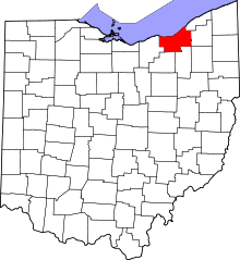
 Location in Cuyahoga County and the state of Ohio. | |
| Coordinates: 41°24′44″N 81°33′35″W / 41.41222°N 81.55972°WCoordinates: 41°24′44″N 81°33′35″W / 41.41222°N 81.55972°W | |
| Country | United States |
| State | Ohio |
| County | Cuyahoga |
| Government | |
| • Mayor | Annette M. Blackwell |
| Area[1] | |
| • Total | 5.17 sq mi (13.39 km2) |
| • Land | 5.17 sq mi (13.39 km2) |
| • Water | 0 sq mi (0 km2) |
| Elevation[2] | 899 ft (274 m) |
| Population (2010)[3] | |
| • Total | 23,138 |
| • Estimate (2012[4]) | 22,840 |
| • Density | 4,475.4/sq mi (1,728.0/km2) |
| Time zone | Eastern (EST) (UTC-5) |
| • Summer (DST) | EDT (UTC-4) |
| ZIP code | 44137 |
| Area code(s) | 216 |
| FIPS code | 39-47306[5] |
| GNIS feature ID | 1048945[2] |
| Website | http://mapleheights.cuyahogacounty.us/ |

Maple Heights is a city in Cuyahoga County, Ohio, United States, outside Cleveland. The population was 23,138 at the 2010 census.
Geography
Maple Heights is located at 41°24′44″N 81°33′35″W / 41.41222°N 81.55972°W (41.412353, -81.559593).[6]
According to the United States Census Bureau, the city has a total area of 5.17 square miles (13.39 km2), all land.[1]
Demographics
| Historical population | |||
|---|---|---|---|
| Census | Pop. | %± | |
| 1920 | 1,732 | — | |
| 1930 | 5,950 | 243.5% | |
| 1940 | 6,728 | 13.1% | |
| 1950 | 15,586 | 131.7% | |
| 1960 | 31,667 | 103.2% | |
| 1970 | 34,093 | 7.7% | |
| 1980 | 29,465 | −13.6% | |
| 1990 | 27,089 | −8.1% | |
| 2000 | 26,156 | −3.4% | |
| 2010 | 23,138 | −11.5% | |
| Est. 2015 | 22,631 | [7] | −2.2% |
| Sources:[8][9][5][10] | |||
2010 census
As of the census[3] of 2010, there were 23,138 people, 9,515 households, and 6,035 families residing in the city. The population density was 4,475.4 inhabitants per square mile (1,728.0/km2). There were 10,894 housing units at an average density of 2,107.2 per square mile (813.6/km2). The racial makeup of the city was 28.0% White, 68.2% African American, 0.2% Native American, 1.0% Asian, 0.5% from other races, and 2.1% from two or more races. Hispanic or Latino of any race were 1.5% of the population.
There were 9,515 households of which 32.5% had children under the age of 18 living with them, 33.0% were married couples living together, 25.0% had a female householder with no husband present, 5.4% had a male householder with no wife present, and 36.6% were non-families. 32.1% of all households were made up of individuals and 10.4% had someone living alone who was 65 years of age or older. The average household size was 2.41 and the average family size was 3.05.
The median age in the city was 39.2 years. 25.1% of residents were under the age of 18; 8.3% were between the ages of 18 and 24; 24.5% were from 25 to 44; 28.8% were from 45 to 64; and 13.2% were 65 years of age or older. The gender makeup of the city was 46.3% male and 53.7% female.
2000 census
As of the census[5] of 2000, there were 26,156 people, 10,489 households, and 6,964 families residing in the city. The population density was 5,039.1 people per square mile (1,945.8/km²). There were 10,935 housing units at an average density of 2,106.7 per square mile (813.5/km²). The racial makeup of the city was 51.65% White, 44.34% African American, 0.13% Native American, 1.73% Asian, 0.02% Pacific Islander, 0.47% from other races, and 1.66% from two or more races. Hispanic or Latino of any race were 1.21% of the population.
There were 10,489 households, of which 30.9% had children under the age of 18 living with them, 45.2% were married couples living together, 17.0% had a female householder with no husband present, and 33.6% were non-families. 29.9% of all households were made up of individuals and 12.5% had someone living alone who was 65 years of age or older. The average household size was 2.47 and the average family size was 3.08.
In the city, the population was spread out with 25.7% under the age of 18, 6.7% from 18 to 24, 30.9% from 25 to 44, 20.1% from 45 to 64, and 16.5% who were 65 years of age or older. The median age was 37 years. For every 100 females there were 87.8 males. For every 100 females age 18and over, there were 82.7 males.
The median income for a household in the city was $40,414, and the median income for a family was $48,580. Males had a median income of $35,268versus $28,023 for females. The per capita income for the city was $18,676. About 4.7% of families and 5.9% of the population were below the poverty line, including 7.7% of those under age 18 and 6.0% of those age 65 or over.
History
The first settler in the region known today as Maple Heights was Benjamin Fitch, who arrived from Connecticut in 1813, ten years after Ohio became a state. John Dunham came four years later in 1817, and built a road which still bears his name. When the section of the Ohio and Erie Canal between Cleveland and Akron was completed in 1827, Dunham Road provided access to the Canal. The resulting traffic and trade stimulated further growth of the area. The Cleveland and Pittsburgh Railroad opened a depot in northwestern Bedford Township in 1849, followed by the completion of the Connotton Valley Railroad in 1881. Later that century, an electric powered light rail system known as the Akron, Bedford, and Cleveland Interurban Line was completed. The ABC line, as it was known, was in service from 1895 until 1932. This rail service was instrumental in the growth and development of the southeastern Cleveland suburbs. Longtime Maple Heights residents still refer to locations in the city by their numbered “stop” names from the days of the ABC line. Maple Heights became an incorporated village in 1915 within the same boundaries that define it to this day. The rapidly growing population of Cleveland, many of whom were immigrants from Italy, Poland, Czech Republic, Hungary, and France,[11][12] moved south during the early twentieth century, resulting in sufficient population to qualify for incorporation as a city in January 1932. Following the Second World War, Maple Heights experienced a home building boom that resulted in nearly all available land becoming developed into single family middle class housing by the early 1960s. Population peaked by the 1970 census, and has been declining ever since.
Surrounding communities
 |
Garfield Heights | Cleveland, Warrensville Heights | | |
| Garfield Heights | |
Bedford Heights | ||
| ||||
| | ||||
| Valley View | Walton Hills | Bedford |
References
- 1 2 "US Gazetteer files 2010". United States Census Bureau. Retrieved 2013-01-06.
- 1 2 "US Board on Geographic Names". United States Geological Survey. 2007-10-25. Retrieved 2008-01-31.
- 1 2 "American FactFinder". United States Census Bureau. Retrieved 2013-01-06.
- ↑ "Population Estimates". United States Census Bureau. Retrieved 2013-06-17.
- 1 2 3 "American FactFinder". United States Census Bureau. Retrieved 2008-01-31.
- ↑ "US Gazetteer files: 2010, 2000, and 1990". United States Census Bureau. 2011-02-12. Retrieved 2011-04-23.
- ↑ "Annual Estimates of the Resident Population for Incorporated Places: April 1, 2010 to July 1, 2015". Retrieved July 2, 2016.
- ↑ "Number of Inhabitants: Ohio" (PDF). 18th Census of the United States. U.S. Census Bureau. Retrieved 22 November 2013.
- ↑ "Ohio: Population and Housing Unit Counts" (PDF). U.S. Census Bureau. Retrieved 22 November 2013.
- ↑ "Incorporated Places and Minor Civil Divisions Datasets: Subcounty Population Estimates: April 1, 2010 to July 1, 2012". U.S. Census Bureau. Retrieved 25 November 2013.
- ↑ http://www.mla.org/map_data_results&state_id=39&place_id=47306&cty_id=
- ↑ http://www.neighborhoodscout.com/oh/maple-heights/
External links
Municipalities and communities of Cuyahoga County, Ohio, United States | ||
|---|---|---|
| Cities |
|  |
| Villages | ||
| Townships | ||
| Footnotes | ‡This populated place also has portions in an adjacent county or counties | |