Yamhill County, Oregon
| Yamhill County, Oregon | |
|---|---|
 Yamhill County Courthouse in McMinnville | |
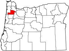 Location in the U.S. state of Oregon | |
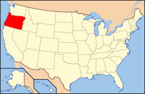 Oregon's location in the U.S. | |
| Founded | July 5, 1843 |
| Seat | McMinnville |
| Largest city | McMinnville |
| Area | |
| • Total | 718 sq mi (1,860 km2) |
| • Land | 716 sq mi (1,854 km2) |
| • Water | 2.5 sq mi (6 km2), 0.3% |
| Population (est.) | |
| • (2015) | 102,659 |
| • Density | 139/sq mi (54/km²) |
| Congressional district | 1st |
| Time zone | Pacific: UTC-8/-7 |
| Website |
www |
Yamhill County is a county in the U.S. state of Oregon. As of the 2010 census, the population was 99,193.[1] The county seat is McMinnville.[2] The name's origin is probably an explorer's name for a local Native American tribe, the Yamhill, who are part of the North Kalapuyan family.[3]
Yamhill County is part of the Portland-Vancouver-Hillsboro, OR-WA Metropolitan Statistical Area. It is in the Willamette Valley.
History
The earliest known inhabitants of the area were the Yamhill (Yamhelas Indian Tribe, part of the Kalapooian family[4]) Indians, who have inhabited the area for over 8000 years. They are one of the tribes incorporated into the Confederated Tribes of the Grand Ronde. In 1857 they were forced to migrate to the Grand Ronde Indian Reservation created in Oregon's Coastal Range two years earlier.
The earliest non-native settlers were employees of the various fur companies operating in Oregon Country, who started settling there around 1814. But it was the establishment of the Oregon Trail that led to significant migration to the area.
Yamhill District (later county) was created on July 5, 1843, five years before the Oregon Territory was established. It was one of the original four districts created by Oregon's first Provisional Legislature, along with Twality (later Washington), Clackamas, and Champooick (later Marion) counties. The district was originally over 12,000 square miles (31,000 km2), an area that was broken up into twelve present-day counties.
Lafayette, the principal trading center of the western Willamette Valley in early Oregon history, was made the county seat in 1847. The county government was later (1889) moved to McMinnville where it remains today.
The Mount Hebo Air Force Station was a Cold War air defense installation from 1956 to 1980. Located next to Tillamook County, at the top of 3,154-foot (961 m) high Mount Hebo, Air Force radars operated by the 689th Radar Squadron and the 14th Missile Warning Squadron were essential parts of the nation's integrated air defenses. The large radomes protecting the radars from adverse weather effects could be seen silhouetted against the sky from many parts of Yamhill County.
Lock and dam on the Yamhill River
In 1900 a Yamhill River lock and dam lock and dam was completed about 1.5 miles (2.4 km) downriver from Lafayette, Oregon. The lock was decommissioned in 1954. The dam was deliberately destroyed in 1963 to allow better passage for salmon on the river. The site of the lock and dam is now a county park.
Geography
According to the U.S. Census Bureau, the county has a total area of 718 square miles (1,860 km2), of which 716 square miles (1,850 km2) is land and 2.5 square miles (6.5 km2) (0.3%) is water.[5] It is the fifth-smallest county in Oregon by area.
The tallest mountain in the county is Trask Mountain in the northwest corner of the county.[6]
Adjacent counties
- Clackamas County (east)
- Marion County (southeast)
- Polk County (south)
- Tillamook County (west)
- Washington County (north)
National protected areas
Demographics
| Historical population | |||
|---|---|---|---|
| Census | Pop. | %± | |
| 1860 | 3,245 | — | |
| 1870 | 5,012 | 54.5% | |
| 1880 | 7,945 | 58.5% | |
| 1890 | 10,692 | 34.6% | |
| 1900 | 13,420 | 25.5% | |
| 1910 | 18,285 | 36.3% | |
| 1920 | 20,529 | 12.3% | |
| 1930 | 22,036 | 7.3% | |
| 1940 | 26,336 | 19.5% | |
| 1950 | 33,484 | 27.1% | |
| 1960 | 32,478 | −3.0% | |
| 1970 | 40,213 | 23.8% | |
| 1980 | 55,332 | 37.6% | |
| 1990 | 65,551 | 18.5% | |
| 2000 | 84,992 | 29.7% | |
| 2010 | 99,193 | 16.7% | |
| Est. 2015 | 102,659 | [7] | 3.5% |
| U.S. Decennial Census[8] 1790-1960[9] 1900-1990[10] 1990-2000[11] 2010-2015[1] | |||
2000 census
As of the census[12] of 2000, there were 84,992 people, 28,732 households, and 21,376 families residing in the county. The population density was 119 people per square mile (46/km²). There were 30,270 housing units at an average density of 42 per square mile (16/km²). The racial makeup of the county is 88.98% White, 1.47% Native American, 1.07% Asian, 0.85% Black or African American, 0.12% Pacific Islander, 5.08% from other races, and 2.42% from two or more races. 10.61% of the population were Hispanic or Latino of any race. 19.6% were of German, 11.4% English, 9.5% American and 8.4% Irish ancestry.
There were 28,732 households out of which 37.40% had children under the age of 18 living with them, 60.00% were married couples living together, 9.90% had a female householder with no husband present, and 25.60% were non-families. 19.70% of all households were made up of individuals and 8.40% had someone living alone who was 65 years of age or older. The average household size was 2.78 and the average family size was 3.17.
In the county, the population was spread out with 26.90% under the age of 18, 11.40% from 18 to 24, 28.50% from 25 to 44, 21.40% from 45 to 64, and 11.70% who were 65 years of age or older. The median age was 34 years. For every 100 females there were 102.20 males. For every 100 females age 18 and over, there were 101.30 males.
The median income for a household in the county is $44,111, and the median income for a family was $50,336. Males had a median income of $35,686 versus $25,254 for females. The per capita income for the county was $18,951. About 6.00% of families and 9.20% of the population were below the poverty line, including 10.10% of those under age 18 and 7.50% of those age 65 or over.
2010 census
As of the 2010 United States Census, there were 99,193 people, 34,726 households, and 25,020 families residing in the county.[13] The population density was 138.6 inhabitants per square mile (53.5/km2). There were 37,110 housing units at an average density of 51.8 per square mile (20.0/km2).[14] The racial makeup of the county was 85.4% white, 1.5% Asian, 1.5% American Indian, 0.9% black or African American, 0.2% Pacific islander, 7.2% from other races, and 3.3% from two or more races. Those of Hispanic or Latino origin made up 14.7% of the population.[13] In terms of ancestry, 23.6% were German, 13.7% were English, 12.2% were Irish, and 5.0% were American.[15]
Of the 34,726 households, 35.8% had children under the age of 18 living with them, 56.0% were married couples living together, 11.1% had a female householder with no husband present, 28.0% were non-families, and 21.7% of all households were made up of individuals. The average household size was 2.70 and the average family size was 3.12. The median age was 36.8 years.[13]
The median income for a household in the county was $52,485 and the median income for a family was $61,524. Males had a median income of $44,946 versus $33,717 for females. The per capita income for the county was $24,017. About 9.0% of families and 12.7% of the population were below the poverty line, including 16.8% of those under age 18 and 7.7% of those age 65 or over.[16]
Economy
_(yamDA0137).jpg)
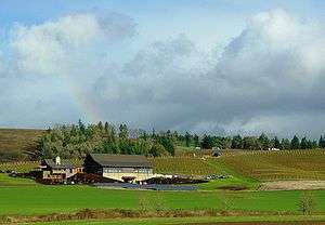
The major industries of the county are agriculture, forest products, manufacturing, and education. Yamhill County's economy is supported largely by its many unionized facilities such as Cascade Steel in McMinnville and White Birch Paper in Newberg. It boasts a thriving wine industry and is the home of Evergreen Aviation.
Yamhill County ranks seventh out of Oregon's thirty-six counties in annual market value of its agricultural production. This agricultural production includes wheat, barley, horticulture, and dairy farming, with 13,201 acres (53 km²) in 1997 planted in orchards. One-third of the county is covered with commercial timber, and the economic mainstay of the western part of the county is logging and timber products.
Yamhill County is a significant focus of Oregon's wine industry, having the largest area of any Oregon county planted in vineyards. Six of the state's American Viticultural Areas are wholly or partly in the county: Chehalem Mountains AVA, Dundee Hills AVA, Eola-Amity Hills AVA, McMinnville AVA, Ribbon Ridge AVA, and Yamhill-Carlton District AVA. Over 80 wineries and 200 vineyards represent the largest concentration of wine growers and producers in any county in the state. Vineyards often specialize in Pinot noir, but other varieties grown include Pinot gris, Pinot blanc, Chardonnay, Riesling, and Gewürztraminer.
Education
For tertiary education Yamhill County is served with Linfield College and Chemeketa Community College in McMinnville and George Fox University and Portland Community College in Newberg. For private secondary education the county is served by The Delphian School in Sheridan.
Communities
Cities
Census-designated places
Unincorporated communities
- Bellevue
- Cove Orchard
- Eola Crest
- Eola Village
- Gopher
- Grand Ronde Agency
- Hopewell
- Lunnville
- Midway
- Riverside
- Saint Joseph
- Shipley
- Springbrook
- Sunnycrest
- Unionvale
- Wheatland
- Whiteson
See also
References
- 1 2 "State & County QuickFacts". United States Census Bureau. Retrieved November 15, 2013.
- ↑ "Find a County". National Association of Counties. Retrieved 2011-06-07.
- ↑ McArthur, Lewis A.; McArthur, Lewis L. (2003) [1928]. Oregon Geographic Names (7th ed.). Portland, Oregon: Oregon Historical Society Press. p. 1063. ISBN 978-0875952772.
- ↑ http://www.co.yamhill.or.us/content/brief-history-yamhill-county
- ↑ "2010 Census Gazetteer Files". United States Census Bureau. August 22, 2012. Retrieved February 28, 2015.
- ↑ Peakbagger.com: Trask Mountain, Oregon
- ↑ "County Totals Dataset: Population, Population Change and Estimated Components of Population Change: April 1, 2010 to July 1, 2015". Retrieved July 2, 2016.
- ↑ "U.S. Decennial Census". United States Census Bureau. Retrieved February 28, 2015.
- ↑ "Historical Census Browser". University of Virginia Library. Retrieved February 28, 2015.
- ↑ Forstall, Richard L., ed. (March 27, 1995). "Population of Counties by Decennial Census: 1900 to 1990". United States Census Bureau. Retrieved February 28, 2015.
- ↑ "Census 2000 PHC-T-4. Ranking Tables for Counties: 1990 and 2000" (PDF). United States Census Bureau. April 2, 2001. Retrieved February 28, 2015.
- ↑ "American FactFinder". United States Census Bureau. Retrieved 2008-01-31.
- 1 2 3 "DP-1 Profile of General Population and Housing Characteristics: 2010 Demographic Profile Data". United States Census Bureau. Retrieved 2016-02-23.
- ↑ "Population, Housing Units, Area, and Density: 2010 - County". United States Census Bureau. Retrieved 2016-02-23.
- ↑ "DP02 SELECTED SOCIAL CHARACTERISTICS IN THE UNITED STATES – 2006-2010 American Community Survey 5-Year Estimates". United States Census Bureau. Retrieved 2016-02-23.
- ↑ "DP03 SELECTED ECONOMIC CHARACTERISTICS – 2006-2010 American Community Survey 5-Year Estimates". United States Census Bureau. Retrieved 2016-02-23.
Further reading
- H.O. Lang (ed.), History of the Willamette Valley: Being a Description of the Valley and its Resources, with an Account of its Discovery and Settlement by White Men, and its Subsequent History; Together with Personal Reminiscences of its Early Pioneers. Portland: Himes and Lang, 1885.
- Portrait and Biographical Record of the Willamette Valley, Oregon, Containing Original Sketches of Many Well Known Citizens of the Past and Present. Chicago: Chapman Publishing Co., 1903.
External links
| Wikimedia Commons has media related to Yamhill County, Oregon. |
- Yamhill County (official website)
- Yamhill County history from the Oregon State Archives
- Yamhill County Wineries Association
- Yamhill Basin Council
 |
Washington County | | ||
| Tillamook County | |
Clackamas County | ||
| ||||
| | ||||
| Polk County | Marion County |
Municipalities and communities of Yamhill County, Oregon, United States | ||
|---|---|---|
| Cities | | |
| CDPs | ||
| Other unincorporated communities | ||
| Indian reservation | ||
| Footnotes | ‡This populated place also has portions in an adjacent county or counties | |
Coordinates: 45°14′N 123°19′W / 45.23°N 123.31°W