Washoe County, Nevada
| Washoe County, Nevada | ||
|---|---|---|
| County | ||
| Washoe County | ||
 Washoe County Courthouse | ||
| ||
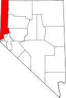 Location in the U.S. state of Nevada | ||
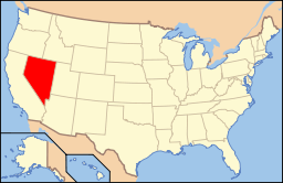 Nevada's location in the U.S. | ||
| Founded | November 25, 1861 | |
| Named for | Washoe people | |
| Seat | Reno | |
| Largest city | Reno | |
| Area | ||
| • Total | 6,542 sq mi (16,944 km2) | |
| Population (est.) | ||
| • (2015) | 446,903 | |
| • Density | 67/sq mi (26/km²) | |
| Congressional district | 2nd | |
| Time zone | Pacific: UTC-8/-7 | |
| Website |
washoecounty | |

Washoe County is a county located in the U.S. state of Nevada. As of the 2010 census, the population was 421,407,[1] making it the second-most populous county in Nevada. Its county seat is Reno.[2]
Washoe County is included in the Reno, NV Metropolitan Statistical Area.
History
Washoe County was created on November 25, 1861, as one of the original nine counties of the Nevada Territory. It is named after the Washoe people who originally inhabited the area. It was consolidated with Roop County in 1864. Washoe City was the first county seat in 1861 and was replaced by Reno in 1871.
Washoe County is the setting of the 1965 episode "The Wild West's Biggest Train Holdup" of the syndicated western television series, Death Valley Days. In the story line, deputy Jim Brand (Charles Bateman) places a locked chain on a Central Pacific Railroad engine until the company agrees to pay its tax assessment. Roy Barcroft played the aging Sheriff Jackson with Pat Priest as his daughter, Nora, who is romantically interested in Brand.[3]
In 1911, a small group of Bannock under a leader named "Shoshone Mike" killed four ranchers in Washoe County.[4] A posse was formed, and on February 26, 1911, they caught up with the band, and eight of them were killed, along with one member of the posse, Ed Hogle.[5] Three children and a woman who survived the battle were captured. The remains of some of the members of the band were repatriated from the Smithsonian Institution to the Fort Hall Idaho Shoshone-Bannock Tribe in 1994.[6]
In 1918, Washoe County elected the first woman elected to the Nevada Legislature, Sadie Hurst, a Republican.[7]
"For decades Paiute children growing up in northern Nevada were required by the federal government to attend a boarding school in Carson City where they learned English, not Paiute."[8]
As of 2013, "Washoe County is the first school district in the state to offer Paiute classes," offering an elective course in the Paiute language at Spanish Springs High School[8] and North Valleys High School.
Geography
According to the U.S. Census Bureau, the county has a total area of 6,542 square miles (16,940 km2), of which 6,302 square miles (16,320 km2) is land and 240 square miles (620 km2) (3.7%) is water.[9] The highest point in Washoe County is Mount Rose at 10,785 ft (3,287 m), while the most topographically prominent peak is Virginia Peak.
There are two incorporated cities within the county, namely Reno and Sparks. In 2010, there was a ballot question asking whether the Reno city government and the Washoe County government should become one combined governmental body.[10] According to unofficial results the day after the election, 54% of voters approved of the ballot measure to consolidate the governments.[11]
The Truckee Meadows of Washoe County starts at the furthest southern runway of Reno Tahoe International Airport, GPS Coordinates 39.468836,-119.770912 and runs south east. Rattle Snake Mountain at Huffaker Park, follows the span of Steamboat Creek to the southern east end of Washoe County. This is the last of the range/prairie and wild grass water shed from the eastern range of the Reno Tahoe basin.
Major highways
-
.svg.png) Interstate 11 (Future)
Interstate 11 (Future) -
.svg.png) Interstate 80
Interstate 80 -
 Interstate 80 Business (Verdi)
 - Interstate 80 Business (Reno–Sparks)
- Interstate 80 Business (Wadsworth–Fernley)
-
.svg.png) Interstate 580
Interstate 580 -
 U.S. Route 395
 -
 U.S. Route 395 Alternate
 -
 U.S. Route 395 Business (Reno)
 -
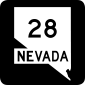 State Route 28
 -
 State Route 341
 -
 State Route 425
 -
 State Route 426
 -
 State Route 427
 -
 State Route 430
 -
 State Route 431
 -
 State Route 439
 -
 State Route 443
 -
 State Route 445
 -
 State Route 446
 -
 State Route 447
 -
 State Route 647
 -
 State Route 648
 -
 State Route 653
 -
 State Route 655
 -
 State Route 659
 -
 State Route 667
 -
 State Route 668
 -
 State Route 671
 -
 State Route 673
 -
 State Route 877
 -
 State Route 878
 -
 State Route 880
Adjacent counties
- Humboldt County — east
- Pershing County — east
- Churchill County — east
- Lyon County — southeast
- Storey County — south
- Carson City — south
- Placer County, California — southwest
- Nevada County, California — west
- Sierra County, California — west
- Lassen County, California — west
- Modoc County, California — west
- Lake County, Oregon — north
- Harney County, Oregon — northeast
National protected areas
- Anaho Island National Wildlife Refuge
- Black Rock Desert-High Rock Canyon Emigrant Trails National Conservation Area (part)
- Sheldon National Wildlife Refuge (part)
- Toiyabe National Forest (part)
Demographics
| Historical population | |||
|---|---|---|---|
| Census | Pop. | %± | |
| 1870 | 3,091 | — | |
| 1880 | 5,664 | 83.2% | |
| 1890 | 6,437 | 13.6% | |
| 1900 | 9,141 | 42.0% | |
| 1910 | 17,434 | 90.7% | |
| 1920 | 18,627 | 6.8% | |
| 1930 | 27,158 | 45.8% | |
| 1940 | 32,476 | 19.6% | |
| 1950 | 50,205 | 54.6% | |
| 1960 | 84,743 | 68.8% | |
| 1970 | 121,068 | 42.9% | |
| 1980 | 193,623 | 59.9% | |
| 1990 | 254,667 | 31.5% | |
| 2000 | 339,486 | 33.3% | |
| 2010 | 421,407 | 24.1% | |
| Est. 2015 | 446,903 | [12] | 6.1% |
| U.S. Decennial Census[13] 1790-1960[14] 1900-1990[15] 1990-2000[16] 2010-2013[1] | |||
2000 census
As of the census[17] of 2000, there were 339,486 people, 132,084 households, and 83,741 families residing in the county. The population density was 54 people per square mile (21/km²). There were 143,908 housing units at an average density of 23 per square mile (9/km²). The racial makeup of the county was 80.41% White, 2.09% Black or African American, 1.82% Native American, 4.28% Asian, 0.46% Pacific Islander, 7.67% from other races, and 3.28% from two or more races. 16.58% of the population were Hispanic or Latino of any race.
There were 132,084 households out of which 31.10% had children under the age of 18 living with them, 47.90% were married couples living together, 10.30% had a female householder with no husband present, and 36.60% were non-families. 27.00% of all households were made up of individuals and 7.70% had someone living alone who was 65 years of age or older. The average household size was 2.53 and the average family size was 3.09.
In the county the population was spread out with 24.90% under the age of 18, 9.80% from 18 to 24, 31.00% from 25 to 44, 23.80% from 45 to 64, and 10.50% who were 65 years of age or older. The median age was 36 years. For every 100 females there were 102.80 males. For every 100 females age 18 and over, there were 101.80 males.
The median income for a household in the county was $45,815, and the median income for a family was $54,283. Males had a median income of $36,226 versus $27,953 for females. The per capita income for the county was $24,277. About 6.70% of families and 10.00% of the population were below the poverty line, including 12.20% of those under age 18 and 6.20% of those age 65 or over.
2010 census
As of the 2010 United States Census, there were 421,407 people, 163,445 households, and 102,768 families residing in the county.[18] The population density was 66.9 inhabitants per square mile (25.8/km2). There were 184,841 housing units at an average density of 29.3 per square mile (11.3/km2).[19] The racial makeup of the county was 76.9% white, 5.2% Asian, 2.3% black or African American, 1.7% American Indian, 0.6% Pacific islander, 9.5% from other races, and 3.8% from two or more races. Those of Hispanic or Latino origin made up 22.2% of the population.[18] In terms of ancestry, 16.9% were German, 13.1% were Irish, 11.8% were English, 7.2% were Italian, and 4.7% were American.[20]
Of the 163,445 households, 32.0% had children under the age of 18 living with them, 45.6% were married couples living together, 11.3% had a female householder with no husband present, 37.1% were non-families, and 27.2% of all households were made up of individuals. The average household size was 2.55 and the average family size was 3.11. The median age was 37.0 years.[18]
The median income for a household in the county was $55,658 and the median income for a family was $67,428. Males had a median income of $46,653 versus $35,559 for females. The per capita income for the county was $29,687. About 8.5% of families and 12.6% of the population were below the poverty line, including 17.0% of those under age 18 and 6.4% of those age 65 or over.[21]
2016
The Demographics of Washoe County covers 6,540.4 square miles. There are approximately 42,154 households in the unincorporated areas with an estimated population of 419,948. The average household size in 2007 was estimated at 2.70.[22] The Truckee Meadows Fire Protection District is charged with fire protection and emergency services.
Politics
| Year | Republican | Democratic |
|---|---|---|
| 2016 | 45.1% 94,758 | 46.4% 97,379 |
| 2012 | 47.1% 88,453 | 50.8% 95,409 |
| 2008 | 42.6% 76,880 | 55.3% 99,671 |
| 2004 | 51.3% 81,545 | 47.1% 74,841 |
| 2000 | 52.0% 63,640 | 42.6% 52,097 |
| 1996 | 45.3% 49,477 | 41.1% 44,915 |
| 1992 | 37.2% 42,636 | 34.4% 39,500 |
| 1988 | 59.3% 52,654 | 37.1% 32,902 |
| 1984 | 67.7% 50,418 | 30.0% 22,321 |
| 1980 | 63.5% 41,276 | 24.0% 15,621 |
| 1976 | 55.0% 29,264 | 40.7% 21,687 |
| 1972 | 66.2% 33,539 | 33.8% 17,106 |
| 1968 | 54.6% 23,492 | 33.9% 14,560 |
| 1964 | 47.6% 18,350 | 52.4% 20,170 |
| 1960 | 55.2% 18,833 | 44.8% 15,280 |
Washoe County was traditionally Republican throughout the late twentieth century. However, since 2008 it has voted for the Democratic candidate in the last three presidential elections.
Communities

Cities
Census-designated places
Other communities
- Anderson
- Antelope Valley
- Arrowcreek
- Bartley Ranch
- Beulah
- Border Town
- Bronco
- Buffalo Ranch
- Caughlin Ranch
- Copperfield
- Damonte Ranch
- Deep Hole
- Diessner
- Dodge
- Flanigan
- Franktown
- Galena
- Glendale
- Grand View Terrace
- Heinz
- Hidden Valley
- Hot Springs
- Huffaker
- Jumbo
- Lawton
- Mayberry-Highland Park
- McCarran (partly in Storey County)
- Mira Loma
- Montreux
- Mustang
- New Washoe City
- North Valleys
- Northeast Reno
- Northwest Reno
- Olinghouse
- Palomino Valley
- Panther Valley
- Patrick
- Phil
- Poeville
- Pleasant Valley
- Pyramid
- Raleigh Heights
- Rancho Haven
- Red Hawk
- Red Rock
- Reederville
- Saddlehorn
- Sand Pass
- Sano
- Steamboat
- Upper Pyramid
- Vya
- Washoe City
- Washoe Summit
- Wedekind
- Winnemucca Ranch
See also
- National Register of Historic Places listings in Washoe County, Nevada
- Reno 911!, a parody cop show set in Washoe County
- Washoe Zephyr, a regional wind referenced by Mark Twain.
References
- 1 2 "State & County QuickFacts". United States Census Bureau. Retrieved September 23, 2013.
- ↑ "County Explorer". National Association of Counties. Retrieved 2011-06-07.
- ↑ "The Wild West's Biggest Train Holdup on Death Valley Days". Internet Movie Data Base. Retrieved August 22, 2015.
- ↑ James Shown - Winnemucca, NV. "America's Last Indian Battle". Web.archive.org. Archived from the original on 2011-07-21. Retrieved 2013-01-17.
- ↑ "Ed Hogle memorial". Odmp.org. Retrieved 2013-01-17.
- ↑ "NMNH - Repatriation Office - Reports - Great Basin - Nevada". Nmnh.si.edu. Retrieved 2013-01-17.
- ↑ "Fact Sheet" (PDF). Nevada Legislative Counsel Bureau. November 2013. Retrieved 7 March 2014.
- 1 2 Joe Hart (Director). "Nevada Proud: Students get a chance to learn native language in school". KRNV, Reno, NV. Retrieved 2013-10-24. Missing or empty
|series=(help) - ↑ "2010 Census Gazetteer Files". United States Census Bureau. August 22, 2012. Retrieved December 20, 2014.
- ↑ Voyles, Susan (October 24, 2010). "Combining local governments is questioned on ballot issue". Reno Gazette-Journal.
- ↑ "Election Results: Nevada". The New York Times. Retrieved November 3, 2010.
- ↑ "County Totals Dataset: Population, Population Change and Estimated Components of Population Change: April 1, 2010 to July 1, 2015". Retrieved July 2, 2016.
- ↑ "U.S. Decennial Census". United States Census Bureau. Archived from the original on May 11, 2015. Retrieved December 20, 2014.
- ↑ "Historical Census Browser". University of Virginia Library. Retrieved December 20, 2014.
- ↑ "Population of Counties by Decennial Census: 1900 to 1990". United States Census Bureau. Retrieved December 20, 2014.
- ↑ "Census 2000 PHC-T-4. Ranking Tables for Counties: 1990 and 2000" (PDF). United States Census Bureau. Retrieved December 20, 2014.
- ↑ "American FactFinder". United States Census Bureau. Archived from the original on 2013-09-11. Retrieved 2008-01-31.
- 1 2 3 "DP-1 Profile of General Population and Housing Characteristics: 2010 Demographic Profile Data". United States Census Bureau. Retrieved 2016-01-21.
- ↑ "Population, Housing Units, Area, and Density: 2010 - County". United States Census Bureau. Retrieved 2016-01-21.
- ↑ "DP02 SELECTED SOCIAL CHARACTERISTICS IN THE UNITED STATES – 2006-2010 American Community Survey 5-Year Estimates". United States Census Bureau. Retrieved 2016-01-21.
- ↑ "DP03 SELECTED ECONOMIC CHARACTERISTICS – 2006-2010 American Community Survey 5-Year Estimates". United States Census Bureau. Retrieved 2016-01-21.
- ↑ Diamante, Group (2015). "Standards of Cover, Sierra Fire Protection District". Reno Govt. Diamante Group. Retrieved 2016-08-15.
- ↑ http://uselectionatlas.org/RESULTS/
External links
| Wikimedia Commons has media related to Washoe County, Nevada. |
 |
Lake County, Oregon | Harney County, Oregon | | |
| Nevada County, California; Sierra County, California, California; Lassen County, California; and Modoc County, California | |
Humboldt County; Pershing County; and Churchill County | ||
| ||||
| | ||||
| Placer County, California | Storey County and City of Carson City | Lyon County |
Municipalities and communities of Washoe County, Nevada, United States | ||
|---|---|---|
| Cities | | |
| CDPs | ||
| Unincorporated communities | ||
| Indian reservation | ||
| Indian colony | ||
| Ghost towns | ||
Coordinates: 40°38′N 119°41′W / 40.63°N 119.68°W