Paisley, Oregon
| Paisley, Oregon | |
|---|---|
| City | |
|
Aerial view of Paisley, 2008 | |
| Motto: Home of the Mosquito Festival | |
 Location in Oregon | |
| Coordinates: 42°41′36″N 120°32′43″W / 42.69333°N 120.54528°WCoordinates: 42°41′36″N 120°32′43″W / 42.69333°N 120.54528°W | |
| Country | United States |
| State | Oregon |
| County | Lake |
| Incorporated | 1911 |
| Government | |
| • Mayor | Dale Blair[1] |
| Area[2] | |
| • Total | 0.44 sq mi (1.14 km2) |
| • Land | 0.44 sq mi (1.14 km2) |
| • Water | 0 sq mi (0 km2) |
| Elevation | 4,369 ft (1,332 m) |
| Population (2010)[3] | |
| • Total | 243 |
| • Estimate (2012[4]) | 237 |
| • Density | 552.3/sq mi (213.2/km2) |
| Time zone | Pacific (UTC-8) |
| • Summer (DST) | Pacific (UTC-7) |
| ZIP code | 97636 |
| Area code(s) | 541 |
| FIPS code | 41-56250[3] |
| GNIS feature ID | 1147356[5] |
| Website | City of Paisley |

Paisley is a city in Lake County, Oregon, United States. It is along Oregon Route 31 between Summer Lake and Lake Abert. The population was 243 at the 2010 census.
History
There are two theories regarding the origin of the name "Paisley". One story says that Charles Mitchell Innes, from Scotland, named the place for Paisley in his home country, in about 1873.[6] Another informant stated that the place was named by Samuel G. Steele, also a native of Scotland.[6] Steele was the first postmaster of the Paisley post office, which was established in 1879.[6]
Archeological sites from the 1930s at Paisley Caves and 1966 at Fort Rock give the oldest known evidence for early Native Americans. Radiocarbon dating of coprolites indicate they are from 12,750 to 14,290 years before the present.[7][8]
Arts and culture
Paisley is home to an annual Mosquito Festival that raises funds for vector control. The festival is held the last full weekend of July.[9]
Paisley is also home to the Paisley Players Community Theater, a non-profit organization with a board of directors. The group stages a play each year in the spring, either at the Community Center or the Paisley School Auditorium.
Geography
Paisley is located at an elevation of 4,369 feet (1,332 m). According to the United States Census Bureau, the city has a total area of 0.44 square miles (1.14 km2), all of it land.[2] The Chewaucan River flows through the city.
Climate
According to the Köppen Climate Classification system, Paisley has a steppe climate, abbreviated "BSk" on climate maps.
| Climate data for Paisley | |||||||||||||
|---|---|---|---|---|---|---|---|---|---|---|---|---|---|
| Month | Jan | Feb | Mar | Apr | May | Jun | Jul | Aug | Sep | Oct | Nov | Dec | Year |
| Record high °F (°C) | 65 (18) |
72 (22) |
79 (26) |
85 (29) |
93 (34) |
101 (38) |
113 (45) |
103 (39) |
101 (38) |
94 (34) |
82 (28) |
70 (21) |
113 (45) |
| Average high °F (°C) | 41 (5) |
45.6 (7.6) |
51.7 (10.9) |
59.2 (15.1) |
67.4 (19.7) |
75.2 (24) |
85.3 (29.6) |
84.2 (29) |
75.9 (24.4) |
64.8 (18.2) |
49.8 (9.9) |
41.9 (5.5) |
61.8 (16.6) |
| Average low °F (°C) | 21.7 (−5.7) |
25.1 (−3.8) |
28.1 (−2.2) |
32.5 (0.3) |
38.4 (3.6) |
44.4 (6.9) |
50.2 (10.1) |
48.5 (9.2) |
41.8 (5.4) |
34.2 (1.2) |
27.1 (−2.7) |
22.4 (−5.3) |
34.5 (1.4) |
| Record low °F (°C) | −29 (−34) |
−25 (−32) |
−6 (−21) |
8 (−13) |
10 (−12) |
20 (−7) |
27 (−3) |
21 (−6) |
17 (−8) |
0 (−18) |
−8 (−22) |
−28 (−33) |
−29 (−34) |
| Average precipitation inches (mm) | 1.17 (29.7) |
0.91 (23.1) |
0.89 (22.6) |
0.8 (20) |
1.04 (26.4) |
1.04 (26.4) |
0.43 (10.9) |
0.4 (10) |
0.51 (13) |
0.71 (18) |
1.07 (27.2) |
1.16 (29.5) |
10.12 (257) |
| Average snowfall inches (cm) | 4.5 (11.4) |
3.3 (8.4) |
3.4 (8.6) |
1.6 (4.1) |
0.5 (1.3) |
0 (0) |
0 (0) |
0 (0) |
0 (0) |
0.2 (0.5) |
1.6 (4.1) |
3.1 (7.9) |
18.3 (46.5) |
| Average precipitation days | 7 | 6 | 6 | 6 | 6 | 5 | 2 | 2 | 3 | 4 | 6 | 6 | 59 |
| Source: Western Regional Climate Center[10] | |||||||||||||
Demographics
| Historical population | |||
|---|---|---|---|
| Census | Pop. | %± | |
| 1880 | 89 | — | |
| 1890 | 69 | −22.5% | |
| 1900 | 176 | 155.1% | |
| 1910 | 176 | 0.0% | |
| 1920 | 257 | 46.0% | |
| 1930 | 259 | 0.8% | |
| 1940 | 237 | −8.5% | |
| 1950 | 214 | −9.7% | |
| 1960 | 219 | 2.3% | |
| 1970 | 260 | 18.7% | |
| 1980 | 343 | 31.9% | |
| 1990 | 350 | 2.0% | |
| 2000 | 247 | −29.4% | |
| 2010 | 243 | −1.6% | |
| Est. 2015 | 240 | [11] | −1.2% |
| Sources:[3][12] | |||
2010 census
As of the census of 2010, there were 243 people, 125 households, and 67 families residing in the city. The population density was 552.3 inhabitants per square mile (213.2/km2). There were 156 housing units at an average density of 354.5 per square mile (136.9/km2). The racial makeup of the city was 93.8% White, 2.1% African American, 1.2% Native American, 0.8% Asian, and 2.1% from two or more races. Hispanic or Latino of any race were 1.6% of the population.[3]
There were 125 households of which 25.6% had children under the age of 18 living with them, 44.8% were married couples living together, 4.8% had a female householder with no husband present, 4.0% had a male householder with no wife present, and 46.4% were non-families. 39.2% of all households were made up of individuals and 20% had someone living alone who was 65 years of age or older. The average household size was 1.94 and the average family size was 2.58.[3]
The median age in the city was 53.6 years. 17.7% of residents were under the age of 18; 4.1% were between the ages of 18 and 24; 18.1% were from 25 to 44; 33.8% were from 45 to 64; and 26.3% were 65 years of age or older. The gender makeup of the city was 48.1% male and 51.9% female.[3]
2000 census
As of the census of 2000, there were 247 people, 115 households, and 80 families residing in the city. The population density was 556.3 people per square mile (216.7/km2). There were 176 housing units at an average density of 396.4 per square mile (154.4/km2). The racial makeup of the city was 97.98% White, 0.81% Native American, 0.40% Asian, 0.81% from other races. Hispanic or Latino of any race were 1.21% of the population.[3]
There were 115 households out of which 23.5% had children under the age of 18 living with them, 60.0% were married couples living together, 7.0% had a female householder with no husband present, and 29.6% were non-families. 26.1% of all households were made up of individuals and 12.2% had someone living alone who was 65 years of age or older. The average household size was 2.15 and the average family size was 2.56.[3]
In the city the population was spread out with 20.2% under the age of 18, 1.6% from 18 to 24, 20.2% from 25 to 44, 34.0% from 45 to 64, and 23.9% who were 65 years of age or older. The median age was 49 years. For every 100 females there were 105.8 males. For every 100 females age 18 and over, there were 105.2 males.[3]
The median income for a household in the city was $28,214, and the median income for a family was $30,625. Males had a median income of $21,250 versus $28,125 for females. The per capita income for the city was $16,224. About 13.0% of families and 16.9% of the population were below the poverty line, including 25.0% of those under the age of eighteen and 8.1% of those sixty five or over.[3]
Education
Paisley School, the only school in Paisley School District 11, enrolls students in kindergarten through grade 12.[13]
Recreation
Recreational activities including hunting, fishing in the Chewaucan River, hiking in the nearby Fremont and Winema National Forests, hang gliding, rock hounding, and swimming in local lakes and hot springs. The Hart Mountain National Antelope Refuge, Goose Lake State Recreation Area, and a number of Oregon State Parks are within driving distance of Paisley as well.[1]
Transportation
References
- 1 2 "Incorporated Cities: Paisley". Oregon Blue Book. Oregon Secretary of State. 2015. Retrieved July 6, 2015.
- 1 2 "US Gazetteer files 2010". United States Census Bureau. Retrieved December 21, 2012.
- 1 2 3 4 5 6 7 8 9 10 "American FactFinder". U.S. Census Bureau. Retrieved July 5, 2013.
- ↑ "Population Estimates". United States Census Bureau. Retrieved June 2, 2013.
- ↑ "US Board on Geographic Names". United States Geological Survey. October 25, 2007. Retrieved January 31, 2008.
- 1 2 3 McArthur, Lewis A.; McArthur, Lewis L. (2003) [1928]. Oregon Geographic Names (7th ed.). Portland, Oregon: Oregon Historical Society Press. p. 737. ISBN 978-0875952772.
- ↑ Nickerson, Colin (April 4, 2008). "Oregon Cave Yields Evidence of the Earliest Americans Yet". The Boston Globe. The New York Times Company. Retrieved October 27, 2008.
- ↑ Wolman, David (April 3, 2008). "Fossil Feces Is Earliest Evidence of N. America Humans". National Geographic News. National Geographic Society. Retrieved October 27, 2008.
- ↑ "2015 Mosquito Festival". City of Paisley. Retrieved July 6, 2015.
- ↑ "Paisley, OR (356426)". Western Regional Climate Center. Retrieved November 26, 2015.
- ↑ "Annual Estimates of the Resident Population for Incorporated Places: April 1, 2010 to July 1, 2015". Retrieved July 2, 2016.
- ↑ Moffatt, Riley Moore (1996). Population History of Western U.S. Cities and Towns, 1850–1990. Lanham, Maryland: Scarecrow Press. p. 214. ISBN 978-0-8108-3033-2.
- ↑ "2014–15 Oregon School Directory" (PDF). Oregon Department of Education. p. 45. Retrieved July 6, 2015.
External links
| Wikimedia Commons has media related to Paisley, Oregon. |
- Entry for Paisley from the Oregon Blue Book
Municipalities and communities of Lake County, Oregon, United States | ||
|---|---|---|
| Cities | 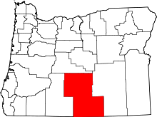 | |
| CDPs | ||
| Other unincorporated communities | ||