Carroll County, Arkansas
| Carroll County, Arkansas | |
|---|---|
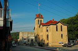
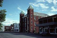 Carroll County Courthouse in Berryville | |
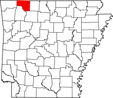 Location in the U.S. state of Arkansas | |
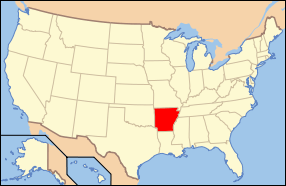 Arkansas's location in the U.S. | |
| Founded | November 1, 1833 |
| Named for | Charles Carroll of Carrollton |
| Seat | Berryville and Eureka Springs |
| Largest city | Berryville |
| Area | |
| • Total | 639 sq mi (1,655 km2) |
| • Land | 630 sq mi (1,632 km2) |
| • Water | 8.7 sq mi (23 km2), 1.4% |
| Population (est.) | |
| • (2015) | 27,704 |
| • Density | 44/sq mi (17/km²) |
| Congressional district | 3rd |
| Time zone | Central: UTC-6/-5 |
| Website |
co |
Carroll County is a county located in the U.S. state of Arkansas. As of the 2010 census, the population was 27,446.[1] The county has two county seats, Berryville and Eureka Springs.[2] Carroll County is Arkansas's 26th county, formed on November 1, 1833, and named after Charles Carroll of Carrollton,[3] the last surviving signer of the United States Declaration of Independence.
Geography
According to the U.S. Census Bureau, the county has a total area of 639 square miles (1,660 km2), of which 630 square miles (1,600 km2) is land and 8.7 square miles (23 km2) (1.4%) is water.[4]
Major highways
Adjacent counties
- Stone County, Missouri (north)
- Taney County, Missouri (northeast)
- Boone County (east)
- Newton County (southeast)
- Madison County (south)
- Benton County (west)
- Barry County, Missouri (northwest)
Demographics
| Historical population | |||
|---|---|---|---|
| Census | Pop. | %± | |
| 1840 | 2,844 | — | |
| 1850 | 4,614 | 62.2% | |
| 1860 | 9,383 | 103.4% | |
| 1870 | 5,780 | −38.4% | |
| 1880 | 13,337 | 130.7% | |
| 1890 | 17,288 | 29.6% | |
| 1900 | 18,848 | 9.0% | |
| 1910 | 16,829 | −10.7% | |
| 1920 | 17,786 | 5.7% | |
| 1930 | 15,820 | −11.1% | |
| 1940 | 14,737 | −6.8% | |
| 1950 | 13,244 | −10.1% | |
| 1960 | 11,284 | −14.8% | |
| 1970 | 12,301 | 9.0% | |
| 1980 | 16,203 | 31.7% | |
| 1990 | 18,654 | 15.1% | |
| 2000 | 25,357 | 35.9% | |
| 2010 | 27,446 | 8.2% | |
| Est. 2015 | 27,704 | [5] | 0.9% |
| U.S. Decennial Census[6] 1790–1960[7] 1900–1990[8] 1990–2000[9] 2010–2015[1] | |||

As of the 2000 United States Census,[11] there were 25,357 people, 10,189 households, and 7,111 families residing in the county. The population density was 40 people per square mile (16/km²). There were 11,828 housing units at an average density of 19 per square mile (7/km²). The racial makeup of the county was 93.63% White, 0.11% Black or African American, 0.88% Native American, 0.41% Asian, 0.08% Pacific Islander, 3.34% from other races, and 1.55% from two or more races. 9.74% of the population were Hispanic or Latino of any race. 10.03% reported speaking Spanish at home .
There were 10,189 households out of which 29.20% had children under the age of 18 living with them, 57.10% were married couples living together, 8.60% had a female householder with no husband present, and 30.20% were non-families. 25.20% of all households were made up of individuals and 10.30% had someone living alone who was 65 years of age or older. The average household size was 2.47 and the average family size was 2.93.
In the county the population was spread out with 24.00% under the age of 18, 8.10% from 18 to 24, 26.20% from 25 to 44, 26.00% from 45 to 64, and 15.80% who were 65 years of age or older. The median age was 39 years. For every 100 females there were 97.40 males. For every 100 females age 18 and over, there were 95.30 males.
The median income for a household in the county was $27,924, and the median income for a family was $33,218. Males had a median income of $21,896 versus $18,159 for females. The per capita income for the county was $16,003. About 11.00% of families and 15.50% of the population were below the poverty line, including 20.70% of those under age 18 and 13.60% of those age 65 or over.
Government and politics
| Year | GOP | DNC | Others |
|---|---|---|---|
| 2016 | 63.1% 6,773 | 31.1% 3,334 | 5.8% 629 |
| 2012 | 60.2% 6,121 | 36.3% 3,691 | 3.5% 360 |
| 2008 | 57.5% 6,083 | 39.4% 4,172 | 3.1% 324 |
| 2004 | 59.0% 6,184 | 39.7% 4,161 | 1.3% 136 |
| 2000 | 57.9% 5,556 | 37.5% 3,595 | 4.5% 439 |
| 1996 | 44.8% 3,957 | 41.8% 3,689 | 13.4% 1,177 |
| 1992 | 39.9% 3,535 | 42.6% 3,769 | 17.5% 1,553 |
| 1988 | 62.8% 4,553 | 36.3% 2,632 | 0.9% 68 |
| 1984 | 68.2% 5,041 | 30.6% 2,263 | 1.2% 86 |
| 1980 | 55.3% 4,273 | 38.5% 2,977 | 6.2% 478 |
| 1976 | 42.2% 2,804 | 57.0% 3,791 | 0.8% 55 |
| 1972 | 70.1% 3,565 | 27.5% 1,401 | 2.4% 120 |
| 1968 | 51.2% 2,596 | 25.6% 1,298 | 23.2% 1,174 |
| 1964 | 51.2% 2,105 | 48.8% 2,005 | 0.0% 0 |
| 1960 | 66.0% 2,615 | 32.8% 1,301 | 1.2% 49 |
Politically, Carroll County is a Republican stronghold in a historically Democratic state (55% - 45%). It is included in the Arkansas Third Congressional District, which has had Republican representation since 1967.
The Eastern District (Berryville and Green Forest) is heavily Republican. The Western District (Eureka Springs and Beaver) tilts Democratic despite the fact that Holiday Island, a community with a large percentage of relocated snowbirds in the Western District, is overwhelmingly Republican.
In presidential elections, Carroll County has voted for the Democratic candidate only twice since 1960. It voted for Jimmy Carter in 1976 and for Bill Clinton in 1992.
Communities

Cities
- Berryville (county seat)
- Eureka Springs (county seat)
- Green Forest
Towns
Unincorporated community
Townships

Townships in Arkansas are the divisions of a county. Each township includes unincorporated areas; some may have incorporated cities or towns within part of their boundaries. Arkansas townships have limited purposes in modern times. However, the United States Census does list Arkansas population based on townships (sometimes referred to as "county subdivisions" or "minor civil divisions"). Townships are also of value for historical purposes in terms of genealogical research. Each town or city is within one or more townships in an Arkansas county based on census maps and publications. The townships of Carroll County are listed below; listed in parentheses are the cities, towns, and/or census-designated places that are fully or partially inside the township. [12][13]
See also
- List of lakes in Carroll County, Arkansas
- National Register of Historic Places listings in Carroll County, Arkansas
- Ron McNair, state representative for Boone and Carroll counties since 2015
References
- 1 2 "State & County QuickFacts". United States Census Bureau. Retrieved May 20, 2014.
- ↑ "Find a County". National Association of Counties. Archived from the original on 2011-05-31. Retrieved 2011-06-07.
- ↑ Gannett, Henry (1905). The Origin of Certain Place Names in the United States. Govt. Print. Off. p. 70.
- ↑ "2010 Census Gazetteer Files". United States Census Bureau. August 22, 2012. Retrieved August 25, 2015.
- ↑ "County Totals Dataset: Population, Population Change and Estimated Components of Population Change: April 1, 2010 to July 1, 2015". Retrieved July 2, 2016.
- ↑ "U.S. Decennial Census". United States Census Bureau. Archived from the original on May 11, 2015. Retrieved August 25, 2015.
- ↑ "Historical Census Browser". University of Virginia Library. Retrieved August 25, 2015.
- ↑ Forstall, Richard L., ed. (March 27, 1995). "Population of Counties by Decennial Census: 1900 to 1990". United States Census Bureau. Retrieved August 25, 2015.
- ↑ "Census 2000 PHC-T-4. Ranking Tables for Counties: 1990 and 2000" (PDF). United States Census Bureau. April 2, 2001. Retrieved August 25, 2015.
- ↑ Based on 2000 census data
- ↑ "American FactFinder". United States Census Bureau. Archived from the original on 2013-09-11. Retrieved 2011-05-14.
- ↑ 2011 Boundary and Annexation Survey (BAS): Carroll County, AR (PDF) (Map). U. S. Census Bureau. Retrieved 2011-07-26.
- ↑ "Arkansas: 2010 Census Block Maps - County Subdivision". United States Census Bureau. Retrieved June 28, 2014.
- ↑ "County Subdivisions: Arkansas" (TXT). Census 2010 U.S. Gazetteer Files. United States Census Bureau.
- ↑ "Census 2010 U.S. Gazetteer Files". United States Census Bureau.
External links
- Carroll County Government site
- Map of Carroll County by the U. S. Census Bureau
- Map of Carroll County at the Encyclopedia of Arkansas
- Carroll County entry at the Encyclopedia of Arkansas
- Carroll County Historical and Genealogical Society
 |
Barry County, Missouri | Stone County, Missouri | Taney County, Missouri | |
| Benton County | |
Boone County | ||
| ||||
| | ||||
| Madison County | Newton County |
Municipalities and communities of Carroll County, Arkansas, United States | ||
|---|---|---|
| Cities | | |
| Towns | ||
| CDP | ||
| Unincorporated communities |
| |
| Ghost towns |
| |
| Townships | ||
| Footnotes | ‡This populated place also has portions in an adjacent county or counties | |
Coordinates: 36°22′05″N 93°29′47″W / 36.36806°N 93.49639°W