Miller County, Arkansas
| Miller County, Arkansas | |
|---|---|
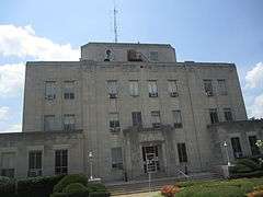 Miller County Courthouse in Texarkana | |
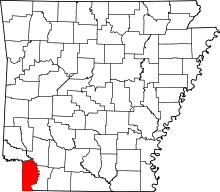 Location in the U.S. state of Arkansas | |
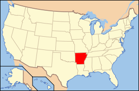 Arkansas's location in the U.S. | |
| Founded |
April 1, 1820; recreated December 22, 1874, following abolishment in 1838 |
| Named for | James Miller[1] |
| Seat | Texarkana |
| Largest city | Texarkana |
| Area | |
| • Total | 638 sq mi (1,652 km2) |
| • Land | 626 sq mi (1,621 km2) |
| • Water | 12 sq mi (31 km2), 1.9% |
| Population (est.) | |
| • (2015) | 43,908 |
| • Density | 70/sq mi (27/km²) |
| Congressional district | 4th |
| Time zone | Central: UTC-6/-5 |
| Website |
www |

Miller County is a county located in the southwestern corner of the U.S. state of Arkansas. As of the 2010 census, the population was 43,462.[2] The county seat is Texarkana.[3]
Miller County is part of the Texarkana, TX-AR, Metropolitan Statistical Area.
When first formed, Miller County was Arkansas's sixth county, established on April 1, 1820, and named for James Miller, the first governor of the Arkansas Territory. Additionally, Miller County was the first of the state's counties to be formed upon the creation of the Arkansas Territory. The first five — Arkansas, Lawrence, Clark, Hempstead and Pulaski — were formed during Arkansas's days as part of the Missouri Territory. The county was abolished in 1838, and later recreated on December 22, 1874[4] from a portion of neighboring Lafayette County.
Despite its proximity to Texas (which has no state personal income tax), Miller County residents are not exempt from Arkansas's state personal income tax unless they reside within the city limits of Texarkana. Miller County is also one of only two counties in Arkansas (along with Little River County) to be separated from all surrounding counties in the state by water — the Red River, in this case.
History
Miller County was originally created in 1820 and included most of the current Miller County as well as most of what are now counties in Texas: Bowie, Red River, Lamar, Fannin, Cass, Morris, Titus, Franklin, Hopkins, Delta, and Hunt. In 1831 the county seat was located what is the current day Clarksville, Texas. When Arkansas achieved statehood the same year Texas declared itself an independent republic in 1836 a dispute over the common border arose, with the area in Miller County having representation in both the Arkansas legislature and the Texas congress. In 1837 and 1838, Texas organized Red River and Fannin counties, respectively, in the area. Arkansas attempted to counter by making it a misdemeanor for Miller County residents to hold office in Texas, and then by establishing a county court in Fannin. The attempts were ultimately unsuccessful, and in 1845 Texas was annexed by the United States, settling the boundary between Texas and Arkansas. As much of Miller County was lost to Texas, the county was dissolved with the remaining territory returning to Lafayette County.[5]
The modern Miller County was re-created in 1874 from the parts of Lafayette County lying west and south of the Red River.
Geography
 | |
|
| |
|
|
According to the U.S. Census Bureau, the county has a total area of 638 square miles (1,650 km2), of which 626 square miles (1,620 km2) is land and 12 square miles (31 km2) (1.9%) is water.[6]
Major highways
Adjacent counties
- Little River County (north)
- Hempstead County (northeast)
- Lafayette County (east)
- Bossier Parish, Louisiana (southeast)
- Caddo Parish, Louisiana (south)
- Cass County, Texas (southwest)
- Bowie County, Texas (west)
Demographics
| Historical population | |||
|---|---|---|---|
| Census | Pop. | %± | |
| 1830 | 356 | — | |
| 1880 | 9,919 | — | |
| 1890 | 14,714 | 48.3% | |
| 1900 | 17,558 | 19.3% | |
| 1910 | 19,555 | 11.4% | |
| 1920 | 24,021 | 22.8% | |
| 1930 | 30,586 | 27.3% | |
| 1940 | 31,874 | 4.2% | |
| 1950 | 32,614 | 2.3% | |
| 1960 | 31,686 | −2.8% | |
| 1970 | 33,385 | 5.4% | |
| 1980 | 37,766 | 13.1% | |
| 1990 | 38,467 | 1.9% | |
| 2000 | 40,443 | 5.1% | |
| 2010 | 43,462 | 7.5% | |
| Est. 2015 | 43,908 | [7] | 1.0% |
| U.S. Decennial Census[8] 1790–1960[9] 1900–1990[10] 1990–2000[11] 2010–2015[2] | |||

As of the 2000 United States Census,[13] there were 40,443 people, 15,637 households, and 11,086 families residing in the county. The population density was 65 people per square mile (25/km²). There were 17,727 housing units at an average density of 28 per square mile (11/km²). The racial makeup of the county was 74.02% White, 22.99% Black or African American, 0.63% Native American, 0.37% Asian, 0.02% Pacific Islander, 0.54% from other races, and 1.43% from two or more races. 1.58% of the population were Hispanic or Latino of any race.
There were 15,637 households out of which 34.00% had children under the age of 18 living with them, 50.90% were married couples living together, 16.00% had a female householder with no husband present, and 29.10% were non-families. 25.60% of all households were made up of individuals and 10.70% had someone living alone who was 65 years of age or older. The average household size was 2.52 and the average family size was 3.02.
In the county the population was spread out with 26.50% under the age of 18, 9.70% from 18 to 24, 28.60% from 25 to 44, 22.10% from 45 to 64, and 13.10% who were 65 years of age or older. The median age was 35 years. For every 100 females there were 95.00 males. For every 100 females age 18 and over, there were 90.10 males.
The median income for a household in the county was $30,951, and the median income for a family was $36,665. Males had a median income of $33,080 versus $21,376 for females. The per capita income for the county was $16,444. About 15.40% of families and 19.30% of the population were below the poverty line, including 27.90% of those under age 18 and 16.50% of those age 65 or over.
Education
Public education for early childhood, elementary and secondary school students is primarily provided by the following public school districts:
- Texarkana Arkansas School District, which includes Arkansas High School
- Fouke School District, which includes Fouke High School
- Genoa Central School District, which includes Genoa Central High School
Communities
City
- Texarkana (county seat)
Towns
Unincorporated communities
Townships
Townships in Arkansas are the divisions of a county. Each township includes unincorporated areas; some may have incorporated cities or towns within part of their boundaries. Arkansas townships have limited purposes in modern times. However, the United States Census does list Arkansas population based on townships (sometimes referred to as "county subdivisions" or "minor civil divisions"). Townships are also of value for historical purposes in terms of genealogical research. Each town or city is within one or more townships in an Arkansas county based on census maps and publications. The townships of Miller County are listed below; listed in parentheses are the cities, towns, and/or census-designated places that are fully or partially inside the township. [14][15]
See also
- National Register of Historic Places listings in Miller County, Arkansas
- Prissy Hickerson, state representative from Miller County
- Jimmy Hickey, Jr., state senator from Miller County
References
- ↑ Gannett, Henry (1905). The Origin of Certain Place Names in the United States. U.S. Government Printing Office. p. 208.
- 1 2 "State & County QuickFacts". United States Census Bureau. Retrieved May 23, 2014.
- ↑ "Find a County". National Association of Counties. Retrieved 2011-06-07.
- ↑ Arnold, William Hendrick (1946). "Historical Sketch Relating to Establishment of State Line Between Arkansas and Texas and Relating to the Creation of the Old and New Miller County Arkansas". Arkansas Historical Quarterly. Arkansas Historical Association. 5 (Spring 1946): 188. doi:10.2307/40018413. Retrieved 2012-05-05.
- ↑ "Miller County, Arkansas". Handbook of Texas Online.
- ↑ "2010 Census Gazetteer Files". United States Census Bureau. August 22, 2012. Retrieved August 27, 2015.
- ↑ "County Totals Dataset: Population, Population Change and Estimated Components of Population Change: April 1, 2010 to July 1, 2015". Retrieved July 2, 2016.
- ↑ "U.S. Decennial Census". United States Census Bureau. Retrieved August 27, 2015.
- ↑ "Historical Census Browser". University of Virginia Library. Retrieved August 27, 2015.
- ↑ Forstall, Richard L., ed. (March 27, 1995). "Population of Counties by Decennial Census: 1900 to 1990". United States Census Bureau. Retrieved August 27, 2015.
- ↑ "Census 2000 PHC-T-4. Ranking Tables for Counties: 1990 and 2000" (PDF). United States Census Bureau. April 2, 2001. Retrieved August 27, 2015.
- ↑ Based on 2000 census data
- ↑ "American FactFinder". United States Census Bureau. Retrieved 2011-05-14.
- ↑ 2011 Boundary and Annexation Survey (BAS): Miller County, AR (PDF) (Map). U. S. Census Bureau. Retrieved 2011-08-24.
- ↑ "Arkansas: 2010 Census Block Maps - County Subdivision". United States Census Bureau. Retrieved May 29, 2014.
 |
Little River County | Hempstead County | | |
| Bowie County, Texas | |
Lafayette County | ||
| ||||
| | ||||
| Cass County, Texas | Caddo Parish, Louisiana | Bossier Parish, Louisiana |
Municipalities and communities of Miller County, Arkansas, United States | ||
|---|---|---|
| Cities | | |
| Town | ||
| Unincorporated communities | ||

Coordinates: 33°19′40″N 93°52′38″W / 33.32778°N 93.87722°W