Arkansas Highway 311
| ||||
|---|---|---|---|---|
 | ||||
| Route information | ||||
| Maintained by AHTD | ||||
| Length: | 22.74 mi[1] (36.60 km) | |||
| Existed: | 1962 – present | |||
| Major junctions | ||||
| South end: | Industrial Park Drive in Green Forest | |||
|
| ||||
| North end: |
| |||
| Location | ||||
| Counties: | Carroll | |||
| Highway system | ||||
| ||||

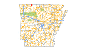
Highway 311 (AR 311, Ark. 311, and Hwy. 311) is a north–south state highway in Carroll County, Arkansas. The route of 22.74 miles (36.60 km) runs from Industrial Park Drive in Green Forest north across US 62 through rural Carroll County to Highway 21 in Blue Eye.[2]
Route description
AR 311 begins in Green Forest at Industrial Park Drive.[3] The route runs north and forms a concurrency with US 62 west for 0.4 miles (0.64 km) before turning north. Highway 311 begins to wind through rural areas in Carroll County, including Farewell, before terminating at AR 21 in Blue Eye.
History
The route was designated a state highway under the jurisdiction of the Arkansas State Highway and Transportation Department (AHTD) between 1961 and 1963.[4][5] The route is entirely two–lane undivided.[1]
Major intersections
Mile markers reset at concurrencies. The entire route is in Carroll County.
| Location | mi[1] | km | Destinations | Notes | |
|---|---|---|---|---|---|
| Green Forest | 0.00 | 0.00 | Industrial Park Drive | southern terminus | |
| 0.42 | 0.68 | ||||
| | |||||
| 0.00 | 0.00 | ||||
| Blue Eye | 22.32 | 35.92 | northern terminus | ||
| 1.000 mi = 1.609 km; 1.000 km = 0.621 mi | |||||
See also
-
 Arkansas portal
 -
 U.S. Roads portal
References
- 1 2 3 Planning and Research Division (2010). "Arkansas Road Log Database". Arkansas State Highway and Transportation Department. Archived from the original (Database) on 23 June 2011. Retrieved June 9, 2011.
- ↑ General Highway Map, Carroll County, Arkansas (PDF) (Map). 1:62500. Cartography by Planning and Research Division. Arkansas State Highway and Transportation Department. 2010. Retrieved June 25, 2011.
- ↑ Green Forest, Arkansas (PDF) (Map). Arkansas State Highway and Transportation Department. Retrieved 2010-07-06.
- ↑ 1956 Carroll County, Arkansas Map (PDF) (Map) (Revised 1961 ed.). Arkansas State Highway and Transportation Department. Retrieved 2010-07-06.
- ↑ 1963 Carroll County, Arkansas Map (PDF) (Map). Arkansas State Highway and Transportation Department. Retrieved 2010-07-06.